Walk c371 Esk Pike and Bow Fell (Bowfell) from The Old Dungeon Ghyll, Great Langdale
This 9 mile, Grade 7 (Hard), easy-to-follow, hand-crafted walk, complete with GPS Waypoints, starts at Great Langdale & will take about 6¾ hrs to complete.
   |
Vital Statistics:
| Length: | 9mls (14.5km) |
| Ascent: | 3,459ft (1,054m) |
| Time: | 6¾hrs |
| Grade: |  |

Route outline for walk c371:
Great Langdale - Old Dungeon Ghyll - The Cumbria Way - Mickleden Beck - Mickleden (Langdale) - Rossett Beck - Rossett Pike - Angle Tarn (Langdale) - Esk Hause - Esk Pike - Ore Gap - Bow Fell (Bowfell) (North Top) - Bow Fell (Bowfell) - Bowfell Buttress - Cambridge Crag - Flat Crag - Climbers' Traverse (optional) - Three Tarns - Earing Crag - White Stones - The Band - Oxendale - Stool End Farm - The Old Dungeon Ghyll - Great Langdale
Peaks, Summits and Tops reached on this walk:
 3 English Mountains |
 3 Wainwrights |
 4 English Nuttalls |
 0 English Deweys |
 0 Wainwright Outlying Fells |
 0 Marilyns |
 0 Bridgets |
Peak Bagging Statistics for this walk:
The highest point of this walk is Bow Fell (Bowfell) at 902m (2960ft). Bow Fell (Bowfell) is classified as an English Mountain (Hewitt) (8th highest in England, 24th highest in England & Wales) and a Wainwright (No. 6).
Bow Fell (Bowfell) is also known as an English Nuttall (10th highest in England, 27th highest in England & Wales).
Completing this walk will also take you to the top of Esk Pike at 885m (2904ft). Esk Pike is classified as an English Mountain (Hewitt) (13th highest in England, 33rd highest in England & Wales) and a Wainwright (No. 11).
Esk Pike is also known as an English Nuttall (16th highest in England, 38th highest in England & Wales).
You will also reach the summit of Bow Fell (Bowfell) (North Top) at 866m (2841ft). Bow Fell (Bowfell) (North Top) is also known as an English Nuttall (20th highest in England, 45th highest in England & Wales).
Along the way you will also bag and tick-off:
- Rossett Pike at 651m (2136ft). Rossett Pike is classified as an English Mountain (Hewitt) (143rd highest in England, 246th highest in England & Wales), a Wainwright (No. 115) and an English Nuttall (191st highest in England, 329th highest in England & Wales).
National Trails & Long Paths included on this walk:
Part of this walk follows a section of The Cumbria Way, a 112km (70 miles) linear footpath connecting Ulverston in Cumbria, England with Carlisle in Cumbria, England. The Cumbria Way is waymarked by named posts. For more walks that include a section of this trail see The Cumbria Way.
You can find this walk and other nearby walks on these unique Interactive Walk Planning Maps:
(worth a look if you're new to go4awalk.com & have never seen one of these before.)
1:25,000 scale OS Explorer Map (orange/yellow covers):
1:50,000 scale OS Landranger Maps (pink/magenta covers):
Some Photos and Pictures from Walk c371 Esk Pike and Bow Fell (Bowfell) from The Old Dungeon Ghyll, Great Langdale
In no particular order . . .
Three Tarns (or two tarns and a puddle) with Shelter Crags, Gunson Knott and Crinkle Crags beyond from Bow Fell (Bowfell)
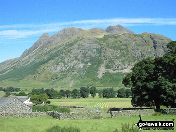

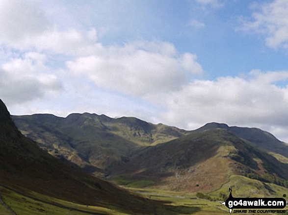
Crinkle Crags (South Top), Crinkle Crags (Long Top), Crinkle Crags (Gunson Knott), Shelter Crags, Shelter Crags, (North Top), The Band , Bow Fell (Bowfell) and Bow Fell (Bowfell) (North Top) from Stool End, Great Langdale

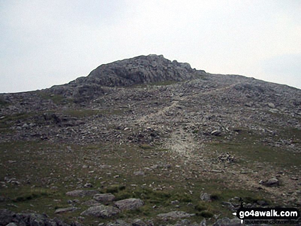
The Scafell Massif - Slight Side, Sca Fell, Symonds Knott, Mickledore, Scafell Pike and Ill Crag - from the summit of Bow Fell (Bowfell)

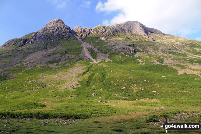
The Langdale Pikes - Pike of Stickle (left) and Loft Crag (centre right) from The Band

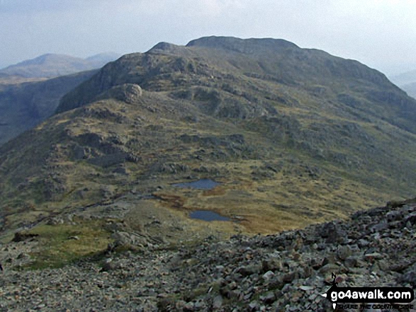
Rossett Pike summit ridge with The Langdale Pikes in the distance and Great Langdale far below
Send us your photographs and pictures from your walks and hikes
We would love to see your photographs and pictures from walk c371 Esk Pike and Bow Fell (Bowfell) from The Old Dungeon Ghyll, Great Langdale. Send them in to us as email attachments (configured for any computer) along with your name and where the picture was taken to:
and we shall do our best to publish them.
(Guide Resolution = 300dpi. At least = 660 pixels (wide) x 440 pixels (high).)

You can also submit photos from walk c371 Esk Pike and Bow Fell (Bowfell) from The Old Dungeon Ghyll, Great Langdale via our Facebook Page.
NB. Please indicate where each photo was taken.

To contribute to go4awalk.com or to contact us about anything at all - see Talk To Us.
For help see Help.
go4awalk.com and go4awalk.co.uk are registered trademarks of TMDH Limited.
Copyright © 2000-2026 TMDH Limited. All rights reserved.
Copyright Terms & Conditions Privacy Statement
A - Z Walks Home Log On/Accounts Photo Gallery Walk Ideas and Collections Fell Facts Hill Skills Walking Questions and Answers Your Stories News Competitions Product Reviews/Gear Tests Walking Gear Guides Peaks and Mountains Peak Bagging Find New Walking Friends Camping GPS Waypoints for Walking Contents Walk Search Talk To Us go4awalk.com Help Free Example Walks Newsletter


