Fifteen easy to follow campsite walks from Limefitt Park, Troutbeck, The Lake District, Cumbria, England

To reach Limefitt Park, Troutbeck, in-car SatNav users should select the Latitude/Longitude (Lat Lon) screen and enter:

Lat = N54.42021 and Lon = W2.90274 or postcode: LA23 1PA

Get directions to Limefitt Park in Troutbeck

Scroll down the list of walks below & click on each walk title (in blue) to locate it on the map above.


Walk 1 Walking Bootprint Icon

Walk c161 Winster Valley from Winster Church, nr Windermere

Easy walking in a lovely valley

Download GPS Waypoint Data for walk c161
Download GPX Waypoint Data for walk c161
Download Map and Route Details for walk c161

Vital Statistics:

Length:7 miles (11 km)
Ascent:1,218ft (371m)
Time:3.75hrs
Grade:Grade 3 Walking Easy
Walk 2 Walking Bootprint Icon

Walk c185 School Knott and The Dales Way from Ings

Easy walking on clear paths

Download GPS Waypoint Data for walk c185
Download GPX Waypoint Data for walk c185
Download Map and Route Details for walk c185

Vital Statistics:

Length:6 miles (9.5 km)
Ascent:531ft (246m)
Time:2½ hrs
Grade:Grade 3 Walking Easy
Walk 3 Walking Bootprint Icon

Walk c104 Orrest Head and Troutbeck from Windermere

A gentle stroll to fine views

Download GPS Waypoint Data for walk c104
Download GPX Waypoint Data for walk c104
Download Map and Route Details for walk c104

Vital Statistics:

Length:7.25 miles (11.5 km)
Ascent:1,247ft (380m)
Time:3.75hrs
Grade:Grade 4 Walking Moderate
Walk 4 Walking Bootprint Icon

Walk c255 Orrest Head and School Knott from Windermere

A gentle stroll to fine views

Download GPS Waypoint Data for walk c255
Download GPX Waypoint Data for walk c255
Download Map and Route Details for walk c255

Vital Statistics:

Length:7.5 miles (12 km)
Ascent:787ft (240m)
Time:3½ hrs
Grade:Grade 4 Walking Moderate
Walk 5 Walking Bootprint Icon

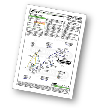
Walk c349 Sour Howes and Sallows from Troutbeck

Two less well known (& quieter) 'Wainwrights'

Download GPS Waypoint Data for walk c349
Download GPX Waypoint Data for walk c349
Download Map and Route Details for walk c349

Vital Statistics:

Length:5.5 miles (8.5 km)
Ascent:1,582ft (482m)
Time:3.75hrs
Grade:Grade 4 Walking Moderate
Walk 6 Walking Bootprint Icon

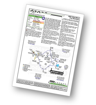
Walk c480 Hollow Moor (Green Quarter) from Kentmere

Wild walk across open fell

Download GPS Waypoint Data for walk c480
Download GPX Waypoint Data for walk c480
Download Map and Route Details for walk c480

Vital Statistics:

Length:5.75 miles (9 km)
Ascent:1,260ft (384m)
Time:3½ hrs
Grade:Grade 4 Walking Moderate
Walk 7 Walking Bootprint Icon

Walk sy102 Pike Lowe from Langsett Reservoir

Download GPS Waypoint Data for walk sy102
Download GPX Waypoint Data for walk sy102
Download Map and Route Details for walk sy102

Vital Statistics:

Length:7.5 miles (12 km)
Ascent:1,118ft (360m)
Time:4 hrs
Grade:Grade 4 Walking Moderate
Walk 8 Walking Bootprint Icon

Walk c131 Latterbarrow and Claife Heights (High Blind How) from Far Sawrey

Lake shore and former forest paths with one steep ascent

Download GPS Waypoint Data for walk c131
Download GPX Waypoint Data for walk c131
Download Map and Route Details for walk c131

Vital Statistics:

Length:8.5 miles (13.5 km)
Ascent:1,644ft (501m)
Time:4.75hrs
Grade:Grade 5 Walking Moderate
Walk 9 Walking Bootprint Icon

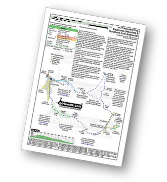
Walk c177 Baystones and Wansfell Pike from Ambleside

Popular Ambleside 'quickie'

Download GPS Waypoint Data for walk c177
Download GPX Waypoint Data for walk c177
Download Map and Route Details for walk c177

Vital Statistics:

Length:6 miles (9.5 km)
Ascent:2,192ft (668m)
Time:5 hrs
Grade:Grade 5 Walking Moderate
Walk 10 Walking Bootprint Icon

Walk c316 Troutbeck Tongue from Troutbeck

Magnificent views

Download GPS Waypoint Data for walk c316
Download GPX Waypoint Data for walk c316
Download Map and Route Details for walk c316

Vital Statistics:

Length:8.25 miles (13 km)
Ascent:1,421ft (433m)
Time:4½ hrs
Grade:Grade 5 Walking Moderate
Walk 11 Walking Bootprint Icon

Walk c449 Sour Howes and Sallows from Kentmere

Two less well known (& quieter) 'Wainwrights'.

Download GPS Waypoint Data for walk c449
Download GPX Waypoint Data for walk c449
Download Map and Route Details for walk c449

Vital Statistics:

Length:7.5 miles (12 km)
Ascent:1,216ft (462m)
Time:4.25hrs
Grade:Grade 5 Walking Moderate
Walk 12 Walking Bootprint Icon

Walk c257 The Kentmere Skyline from Kentmere

A classic lakeland horseshoe walk

Download GPS Waypoint Data for walk c257
Download GPX Waypoint Data for walk c257
Download Map and Route Details for walk c257

Vital Statistics:

Length:11.5 miles (18.5 km)
Ascent:3,378ft (1,030m)
Time:7½ hrs
Grade:Grade 7 Walking Hard
Walk 13 Walking Bootprint Icon

Walk c332 The Hagg Gill Round from Troutbeck

Superb ridge walk with wonderful views

Download GPS Waypoint Data for walk c332
Download GPX Waypoint Data for walk c332
Download Map and Route Details for walk c332

Vital Statistics:

Length:11 miles (17.5 km)
Ascent:3,410ft (1,039m)
Time:7½ hrs
Grade:Grade 7 Walking Hard
Walk 14 Walking Bootprint Icon

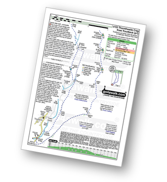
Walk c153 Thornthwaite Crag from Troutbeck

Superb ridge walk - unmissable

Download GPS Waypoint Data for walk c153
Download GPX Waypoint Data for walk c153
Download Map and Route Details for walk c153

Vital Statistics:

Length:12.25 miles (19.5 km)
Ascent:4,194ft (1,278m)
Time:8.75hrs
Grade:Grade 8 Walking Hard
Walk 15 Walking Bootprint Icon

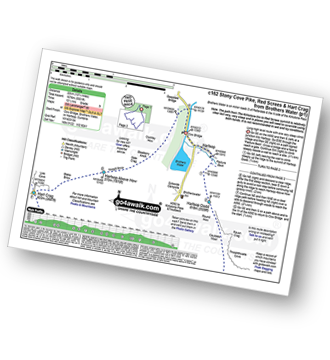
Walk c162 Stony Cove Pike (Caudale Moor), Red Screes and Hart Crag from Brothers Water

Long high level route with one very steep climb

Download GPS Waypoint Data for walk c162
Download GPX Waypoint Data for walk c162
Download Map and Route Details for walk c162

Vital Statistics:

Length:13.75 miles (22 km)
Ascent:5,501ft (1,676m)
Time:10½ hrs
Grade:Grade 9 Walking Very Hard

Do not miss our pick of the Best Walks in the UK


Follow go4awalk.com on Twitter Follow go4awalk.com on Facebook


Home


Find new Friends to go walking with

Walk all 214 Wainwrights in just 59 Walks. Download GPS Waypoints - Great Walks you must not miss!

Walk The Yorkshire Three Peaks Challenge Walk - All the Latest Route Information, GPS Waypoints and Split Times to keep you on Schedule

Walk The British Three Peaks Challenge Walk - All the Latest Route Information and GPS Waypoints

See our pick of The Best Walks in The Lake District - Great Walks you must not miss!

Walk our pick of the Best Lake District Ridge Walks - Great Walks you must not miss!

Walk our pick of the Best Lake District Walks to do in the rain - Great Walks you must not miss!

Walk our pick of The Best Walks in Snowdonia - Great Walks you must not miss!

Walk our pick of The Best Ridge Walks in Wales - Walks you must not miss!

Walk our pick of The Best Walks in The Brecon Beacons - Great Walks you must not miss!

Walk our pick of The Best Walks in The Yorkshire Dales - Walks you must not miss!

Walk our pick of The Best Walks in The Peak District - Walks you must not miss!

Walk our pick of The Best Walks in The Forest of Bowland - Walks you must not miss!

Walk our pick of The Best Walks in Shropshire - Walks you must not miss!

Walk our pick of The Best Walks in Cheshire - Walks you must not miss!

Walk our pick of The Best Walks in Lancashire - Walks you must not miss!

Not sure where to walk next? Try Peak Bagging - Great Walks you must not miss!

Not sure where to walk next? Walk part of a National Trail - Great Walks you must not miss!

Walks with Downloadable and Uploadable GPS Waypoint Data

Walking Kit and Gear Tested by Walkers

Full Site Search
Do not miss our pick of the Best Walks in Britain