Peak Bagging The Lake District Far Eastern Fells
The Lake District Far Eastern Fells are enclosed by:
- Ullswater to the North West
- The Kirkstone Pass and Ambleside to the West
- an imaginary line from Ambleside through Troutbeck, Kentmere and Sadgill to the Eastern tip of Haweswater Reservoir and then North to Pooley Bridge
To see interactive maps and list of walks in the area see Walks in the Lake District Far Eastern Fells.
The Mountains, Peaks, Tops and Hills of The Far Eastern Fells
There are 53 'tops' to walk up, bag and conquer, the highest point is High Street and the area includes:
 The summit of High Street
Photo: William Ringwood
| 36 |  |
Wainwrights |
| 18 |  |
Mountains (aka Hewitts) |
| 6 |  |
Deweys |
| 23 |  |
Nuttalls |
| 7 | |
Wainwright Outlying Fells |
| 5 |  |
Marilyns |
| 4 |  |
Hills (aka Bridgets) and |
| 4 |  |
Mountains, Tops, Peaks or Hills with a Trig Point on or near the top |
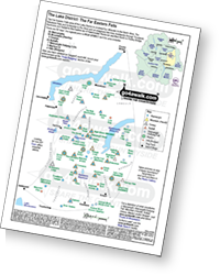 Downloadable Peak Baggers' Map detailing The Far Eastern Fells area of The Lake District
See these 53 Mountains, Peaks, Tops and Hills
- On a Downloadable PDF you can Print or Save to your Phone#
- On a special Wainwright Baggers' Downloadable PDF you can Print or Save to your Phone showing which routes complete these 36 Wainwrights in just 8 Walks#
# Whether you print a copy or download it to your phone, this Peak Baggers' Map will prove incredibly useful if you want to know what's what when you are up in the mountains and cannot get a phone signal.
On Interactive Google Maps and Lists
- On an Interactive Google Map with a list of tops below it.
- On a Detailed List in:
Alphabetical Order | Height Order - On one page with 'yet-to-be-bagged' listed 1st
& then 'already-bagged' tops listed 2nd in:
Alphabetical Order | Height Order - On one page with 'already-bagged' tops listed 1st
& then 'yet-to-be-bagged' tops listed 2nd in:
Alphabetical Order | Height Order