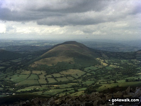
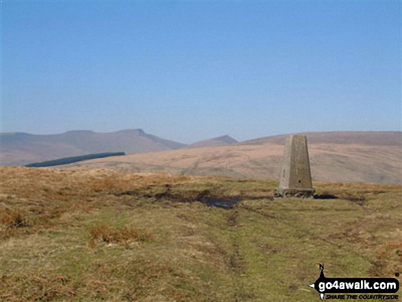
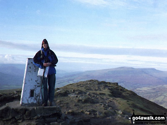
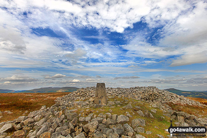
All the Mountains, Peaks, Tops and Hills in Bannau Brycheiniog (The Brecon Beacons National Park), Wales as a detailed list

Bannau Brycheiniog (The Brecon Beacons National Park) is located in South Wales covering part of the counties of Blaenau Gwent, Caerphilly, Carmarthenshire, Merthyr Tydfil, Monmouthshire, Powys, Rhondda Cynon Taf and Torfaen.


If you count only the Deweys there are 21 tops to climb, bag & conquer and the highest point is Mynydd Troed at 609m (1,999ft).


Wainwright
0/0
Wainwrights
Hewitt
23/0
Welsh
Mountains
Dewey
21/0
Welsh
Deweys
nuttall
34/0
Welsh
Nuttalls
Wainwright Outlying Fell
0/0
Wainwright
Outlying Fells
marilyn
18/0
Welsh
Marilyns
Bridget
39/0
Welsh
Bridgets
Trig Point
47/0
Trig
Points


To see all Mountains, Peaks, Tops and Hills displayed in different ways - see the options in the left-hand column and towards the bottom of this page.


LOG ON and RELOAD this page to show which Mountains, Peaks, Tops and Hills you have already climbed, bagged & conquered [. . . more]


See this list in: Alphabetical Order‡ | Height Order
To reverse the order select the link again.


Mountain, Peak, Top or Hill:

Bagged


1. Allt Forgan

513m (1,684ft)


Got a good photo of
Allt Forgan?

Send it in and we'll publish it here.

Photo
Submission
Details

  • Dewey (199th in Wales, 353rd in England & Wales)
  • N.B. The summit of Allt Forgan is on private land.


    We hope to have walks that climb & bag Allt Forgan very soon

    Google Maps Icon
    See the location of Allt Forgan and walks up it on a google Map

    Allt Forgan is on interactive maps:

  • OS Explorer (Orange Covers): OL12
  • OS Landranger (Pink Covers): 160

  • Allt Forgan is on Peak Bagging Map and Hill Tick List:


    2. Blorenge (Blorens)

    561m (1,841ft)

  • Dewey (68th in Wales, 121st in England & Wales)
  • OS Trig Point

  • We hope to have walks that climb & bag Blorenge (Blorens) very soon

    Google Maps Icon
    See the location of Blorenge (Blorens) and walks up it on a google Map

    Blorenge (Blorens) is on interactive maps:

  • OS Explorer (Orange Covers): OL13
  • OS Landranger (Pink Covers): 161

  • Blorenge (Blorens) is on Peak Bagging Map and Hill Tick List:


    3. Bryn (Waun Rydd)

    562m (1,844ft)


    Got a good photo of
    Bryn (Waun Rydd)?

    Send it in and we'll publish it here.

    Photo
    Submission
    Details

  • Dewey (66th in Wales, 117th in England & Wales)

  • To walk, climb & bag Bryn (Waun Rydd) use either of these easy to follow walks:

    Google Maps Icon
    See the location of Bryn (Waun Rydd) and walks up it on a google Map

    Bryn (Waun Rydd) is on interactive maps:

  • OS Explorer (Orange Covers): OL12
  • OS Landranger (Pink Covers): 160

  • Bryn (Waun Rydd) is on Peak Bagging Map and Hill Tick List:


    4. Bryniau Gleision (Talybont Reservoir)

    538m (1,766ft)


    Got a good photo of
    Bryniau Gleision (Talybont Reservoir)?

    Send it in and we'll publish it here.

    Photo
    Submission
    Details

  • Dewey (124th in Wales, 221st in England & Wales)

  • To walk, climb & bag Bryniau Gleision (Talybont Reservoir) use this easy to follow walk:

    Google Maps Icon
    See the location of Bryniau Gleision (Talybont Reservoir) and walks up it on a google Map

    Bryniau Gleision (Talybont Reservoir) is on interactive maps:

  • OS Explorer (Orange Covers): OL12
  • OS Landranger (Pink Covers): 160

  • Bryniau Gleision (Talybont Reservoir) is on Peak Bagging Map and Hill Tick List:


    5. Carn Pen-rhiw-ddu

    534m (1,752ft)


    Got a good photo of
    Carn Pen-rhiw-ddu?

    Send it in and we'll publish it here.

    Photo
    Submission
    Details

  • Dewey (140th in Wales, 246th in England & Wales)

  • We hope to have walks that climb & bag Carn Pen-rhiw-ddu very soon

    Google Maps Icon
    See the location of Carn Pen-rhiw-ddu and walks up it on a google Map

    Carn Pen-rhiw-ddu is on interactive maps:

  • OS Explorer (Orange Covers): OL12
  • OS Landranger (Pink Covers): 160

  • Carn Pen-rhiw-ddu is on Peak Bagging Map and Hill Tick List:


    6. Carreg Cadno

    538m (1,765ft)


    Got a good photo of
    Carreg Cadno?

    Send it in and we'll publish it here.

    Photo
    Submission
    Details

  • Dewey (128th in Wales, 226th in England & Wales)

  • To walk, climb & bag Carreg Cadno use this easy to follow walk:

    Google Maps Icon
    See the location of Carreg Cadno and walks up it on a google Map

    Carreg Cadno is on interactive maps:

  • OS Explorer (Orange Covers): OL12
  • OS Landranger (Pink Covers): 160

  • Carreg Cadno is on Peak Bagging Map and Hill Tick List:


    7. Carreg Goch

    558m (1,831ft)


    Got a good photo of
    Carreg Goch?

    Send it in and we'll publish it here.

    Photo
    Submission
    Details

  • Dewey (74th in Wales, 130th in England & Wales)

  • We hope to have walks that climb & bag Carreg Goch very soon

    Google Maps Icon
    See the location of Carreg Goch and walks up it on a google Map

    Carreg Goch is on interactive maps:

  • OS Explorer (Orange Covers): OL12
  • OS Landranger (Pink Covers): 160

  • Carreg Goch is on Peak Bagging Map and Hill Tick List:


    8. Cefn y Cylchau

    556m (1,825ft)


    Got a good photo of
    Cefn y Cylchau?

    Send it in and we'll publish it here.

    Photo
    Submission
    Details

  • Dewey (77th in Wales, 137th in England & Wales)

  • We hope to have walks that climb & bag Cefn y Cylchau very soon

    Google Maps Icon
    See the location of Cefn y Cylchau and walks up it on a google Map

    Cefn y Cylchau is on interactive maps:

  • OS Explorer (Orange Covers): OL12
  • OS Landranger (Pink Covers): 160

  • Cefn y Cylchau is on Peak Bagging Map and Hill Tick List:


    9. Disgwylfa (Waun Fignen Felen)

    544m (1,785ft)


    Got a good photo of
    Disgwylfa (Waun Fignen Felen)?

    Send it in and we'll publish it here.

    Photo
    Submission
    Details

  • Dewey (112th in Wales, 200th in England & Wales)

  • We hope to have walks that climb & bag Disgwylfa (Waun Fignen Felen) very soon

    Google Maps Icon
    See the location of Disgwylfa (Waun Fignen Felen) and walks up it on a google Map

    Disgwylfa (Waun Fignen Felen) is on interactive maps:

  • OS Explorer (Orange Covers): OL12
  • OS Landranger (Pink Covers): 160

  • Disgwylfa (Waun Fignen Felen) is on Peak Bagging Map and Hill Tick List:


    10. Foel Fraith

    602m (1,975ft)


    Got a good photo of
    Foel Fraith?

    Send it in and we'll publish it here.

    Photo
    Submission
    Details

  • Dewey (12th in Wales, 21st in England & Wales)

  • We hope to have walks that climb & bag Foel Fraith very soon

    Google Maps Icon
    See the location of Foel Fraith and walks up it on a google Map

    Foel Fraith is on interactive maps:

  • OS Explorer (Orange Covers): OL12
  • OS Landranger (Pink Covers): 160

  • Foel Fraith is on Peak Bagging Map and Hill Tick List:


    11. Hatterrall Hill

    531m (1,742ft)


    Got a good photo of
    Hatterrall Hill?

    Send it in and we'll publish it here.

    Photo
    Submission
    Details

  • Dewey (149th in Wales, 262nd in England & Wales)

  • We hope to have walks that climb & bag Hatterrall Hill very soon

    Google Maps Icon
    See the location of Hatterrall Hill and walks up it on a google Map

    Hatterrall Hill is on interactive maps:

  • OS Explorer (Orange Covers): OL13
  • OS Landranger (Pink Covers): 161

  • Hatterrall Hill is on Peak Bagging Map and Hill Tick List:


    12. Moel Feity

    591m (1,939ft)


    Got a good photo of
    Moel Feity?

    Send it in and we'll publish it here.

    Photo
    Submission
    Details

  • Dewey (27th in Wales, 45th in England & Wales)

  • We hope to have walks that climb & bag Moel Feity very soon

    Google Maps Icon
    See the location of Moel Feity and walks up it on a google Map

    Moel Feity is on interactive maps:

  • OS Explorer (Orange Covers): OL12
  • OS Landranger (Pink Covers): 160

  • Moel Feity is on Peak Bagging Map and Hill Tick List:


    13. Mynydd Llangorse

    515m (1,690ft)


    Got a good photo of
    Mynydd Llangorse?

    Send it in and we'll publish it here.

    Photo
    Submission
    Details

  • Dewey (194th in Wales, 344th in England & Wales)
  • Marilyn (80th in Wales, 951st in GB)
  • OS Trig Point

  • We hope to have walks that climb & bag Mynydd Llangorse very soon

    Google Maps Icon
    See the location of Mynydd Llangorse and walks up it on a google Map

    Mynydd Llangorse is on interactive maps:

  • OS Explorer (Orange Covers): OL13
  • OS Landranger (Pink Covers): 161

  • Mynydd Llangorse is on Peak Bagging Map and Hill Tick List:


    14. Mynydd Llangynidr

    557m (1,828ft)


    Got a good photo of
    Mynydd Llangynidr?

    Send it in and we'll publish it here.

    Photo
    Submission
    Details

  • Dewey (76th in Wales, 135th in England & Wales)

  • We hope to have walks that climb & bag Mynydd Llangynidr very soon

    Google Maps Icon
    See the location of Mynydd Llangynidr and walks up it on a google Map

    Mynydd Llangynidr is on interactive maps:

  • OS Explorer (Orange Covers): OL13
  • OS Landranger (Pink Covers): 161

  • Mynydd Llangynidr is on Peak Bagging Map and Hill Tick List:


    15. Mynydd Troed

    609m (1,999ft)

  • Dewey (1st in Wales, 1st in England & Wales)
  • Marilyn (55th in Wales, 753rd in GB)
  • OS Trig Point

  • To walk, climb & bag Mynydd Troed use this easy to follow walk:

    Google Maps Icon
    See the location of Mynydd Troed and walks up it on a google Map

    Mynydd Troed is on interactive maps:

  • OS Explorer (Orange Covers): OL13
  • OS Landranger (Pink Covers): 161

  • Mynydd Troed is on Peak Bagging Map and Hill Tick List:


    16. Pant y Creigiau

    565m (1,854ft)

  • Dewey (59th in Wales, 106th in England & Wales)
  • OS Trig Point

  • To walk, climb & bag Pant y Creigiau use any of these easy to follow walks:

    Google Maps Icon
    See the location of Pant y Creigiau and walks up it on a google Map

    Pant y Creigiau is on interactive maps:

  • OS Explorer (Orange Covers): OL12
  • OS Landranger (Pink Covers): 160

  • Pant y Creigiau is on Peak Bagging Map and Hill Tick List:


    17. Sugar Loaf (Y Fal)

    596m (1,956ft)

  • Dewey (18th in Wales, 31st in England & Wales)
  • Marilyn (57th in Wales, 776th in GB)
  • OS Trig Point

  • We hope to have walks that climb & bag Sugar Loaf (Y Fal) very soon

    Google Maps Icon
    See the location of Sugar Loaf (Y Fal) and walks up it on a google Map

    Sugar Loaf (Y Fal) is on interactive maps:

  • OS Explorer (Orange Covers): OL13
  • OS Landranger (Pink Covers): 161

  • Sugar Loaf (Y Fal) is on Peak Bagging Map and Hill Tick List:


    18. Tor y Foel

    551m (1,808ft)

  • Dewey (88th in Wales, 156th in England & Wales)
  • Marilyn (68th in Wales, 871st in GB)

  • We hope to have walks that climb & bag Tor y Foel very soon

    Google Maps Icon
    See the location of Tor y Foel and walks up it on a google Map

    Tor y Foel is on interactive maps:

  • OS Explorer (Orange Covers): OL13
  • OS Landranger (Pink Covers): 161

  • Tor y Foel is on Peak Bagging Map and Hill Tick List:


    19. Twr Pen-cyrn (Mynydd Llangattwg)

    529m (1,736ft)

  • Dewey (151st in Wales, 266th in England & Wales)
  • OS Trig Point

  • We hope to have walks that climb & bag Twr Pen-cyrn (Mynydd Llangattwg) very soon

    Google Maps Icon
    See the location of Twr Pen-cyrn (Mynydd Llangattwg) and walks up it on a google Map

    Twr Pen-cyrn (Mynydd Llangattwg) is on interactive maps:

  • OS Explorer (Orange Covers): OL13
  • OS Landranger (Pink Covers): 161

  • Twr Pen-cyrn (Mynydd Llangattwg) is on Peak Bagging Map and Hill Tick List:


    20. Waun Leuci (Cefn Cul)

    562m (1,844ft)


    Got a good photo of
    Waun Leuci (Cefn Cul)?

    Send it in and we'll publish it here.

    Photo
    Submission
    Details

  • Dewey (67th in Wales, 118th in England & Wales)

  • We hope to have walks that climb & bag Waun Leuci (Cefn Cul) very soon

    Google Maps Icon
    See the location of Waun Leuci (Cefn Cul) and walks up it on a google Map

    Waun Leuci (Cefn Cul) is on interactive maps:

  • OS Explorer (Orange Covers): OL12
  • OS Landranger (Pink Covers): 160

  • Waun Leuci (Cefn Cul) is on Peak Bagging Map and Hill Tick List:


    21. Yr Allt (Forest Fawr)

    604m (1,982ft)

  • Dewey (9th in Wales, 14th in England & Wales)

  • To walk, climb & bag Yr Allt (Forest Fawr) use this easy to follow walk:

    Google Maps Icon
    See the location of Yr Allt (Forest Fawr) and walks up it on a google Map

    Yr Allt (Forest Fawr) is on interactive maps:

  • OS Explorer (Orange Covers): OL12
  • OS Landranger (Pink Covers): 160

  • Yr Allt (Forest Fawr) is on Peak Bagging Map and Hill Tick List:


    View all 100 Mountains, Peaks, Tops and Hills in The Brecon Beacons National Park:


    Is there a Mountain, Peak, Top or Hill missing from the above google map or list?

    Let us know an we will add it to our database.


    Do not miss our pick of the Best Walks in Britain


    Follow go4awalk.com on Twitter Follow go4awalk.com on Facebook


    Home


    Find new Friends to go walking with

    Walk all 214 Wainwrights in just 59 Walks. Download GPS Waypoints - Great Walks you must not miss!

    Walk The Yorkshire Three Peaks Challenge Walk - All the Latest Route Information, GPS Waypoints and Split Times to keep you on Schedule

    Walk The British Three Peaks Challenge Walk - All the Latest Route Information and GPS Waypoints

    See our pick of The Best Walks in The Lake District - Great Walks you must not miss!

    Walk our pick of the Best Lake District Ridge Walks - Great Walks you must not miss!

    Walk our pick of the Best Lake District Walks to do in the rain - Great Walks you must not miss!

    Walk our pick of The Best Walks in Snowdonia - Great Walks you must not miss!

    Walk our pick of The Best Ridge Walks in Wales - Walks you must not miss!

    Walk our pick of The Best Walks in The Brecon Beacons - Great Walks you must not miss!

    Walk our pick of The Best Walks in The Yorkshire Dales - Walks you must not miss!

    Walk our pick of The Best Walks in The Peak District - Walks you must not miss!

    Walk our pick of The Best Walks in The Forest of Bowland - Walks you must not miss!

    Walk our pick of The Best Walks in Shropshire - Walks you must not miss!

    Walk our pick of The Best Walks in Cheshire - Walks you must not miss!

    Walk our pick of The Best Walks in Lancashire - Walks you must not miss!

    Not sure where to walk next? Try Peak Bagging - Great Walks you must not miss!

    Not sure where to walk next? Walk part of a National Trail - Great Walks you must not miss!

    Walks with Downloadable and Uploadable GPS Waypoint Data

    Walking Kit and Gear Tested by Walkers

    Full Site Search