Walk c279 The Oxendale Horseshoe from The Old Dungeon Ghyll, Great Langdale
This 10 mile, Grade 7 (Hard), easy-to-follow, hand-crafted walk, complete with GPS Waypoints, starts at Great Langdale & will take about 7½ hrs to complete.
   |
Vital Statistics:
| Length: | 10mls (16km) |
| Ascent: | 4,007ft (1,221m) |
| Time: | 7½hrs |
| Grade: |  |

Route outline for walk c279:
Great Langdale - The Old Dungeon Ghyll - Wall End Farm - Redacre Gill - Wrynose Fell - Pike of Blisco (Pike O' Blisco) - Red Tarn (Langdale) - Cold Pike - Cold Pike (West Top) - Cold Pike (Far West Top) - Great Knott - Little Stand - Great Knott - Crinkle Crags (South Top) - Crinkle Crags (Long Top) - Crinkle Crags (Gunson Knott) - Shelter Crags - Shelter Crags - (North Top) - Three Tarns - Earing Crag - White Stones - The Band - Oxendale - Stool End Farm - The Old Dungeon Ghyll - Great Langdale
Peaks, Summits and Tops reached on this walk:
 5 English Mountains |
 3 Wainwrights |
 9 English Nuttalls |
 0 English Deweys |
 0 Wainwright Outlying Fells |
 1 Marilyn |
 0 Bridgets |
Peak Bagging Statistics for this walk:
The highest point of this walk is Crinkle Crags (Long Top) at 859m (2819ft). Crinkle Crags (Long Top) is classified as an English Mountain (Hewitt) (20th highest in England, 43rd highest in England & Wales) and a Wainwright (No. 17).
Crinkle Crags (Long Top) is also known as an English Nuttall (24th highest in England, 50th highest in England & Wales).
Completing this walk will also take you to the top of Crinkle Crags (South Top) at 834m (2737ft). Crinkle Crags (South Top) is classified as an English Mountain (Hewitt) (30th highest in England, 56th highest in England & Wales)
Crinkle Crags (South Top) is also known as an English Nuttall (36th highest in England, 65th highest in England & Wales).
You will also reach the summit of Shelter Crags at 815m (2675ft). Shelter Crags is classified as an English Mountain (Hewitt) (35th highest in England, 66th highest in England & Wales)
Shelter Crags is also known as an English Nuttall (42nd highest in England, 79th highest in England & Wales).
Along the way you will also bag and tick-off:
- Little Stand at 740m (2429ft). Little Stand is known as an English Nuttall (91st highest in England, 158th highest in England & Wales).
- Pike of Blisco (Pike o' Blisco) at 705m (2314ft). Pike of Blisco (Pike o' Blisco) is classified as an English Mountain (Hewitt) (101st England, 167th highest in England & Wales), a Wainwright (No. 86), an English Nuttall (126th highest in England, 210th highest in England & Wales) and an English Marilyn (30th England, 580th highest in the UK).
- Cold Pike at 700m (2297ft). Cold Pike is classified as an English Mountain (Hewitt) (106th highest in England, 174th highest in England & Wales), a Wainwright (No. 88) and an English Nuttall (133rd highest in England, 219th highest in England & Wales).
- Great Knott at 695m (2281ft). Great Knott is known as an English Nuttall (140th highest in England, 229th highest in England & Wales).
- Cold Pike (West Top) at 683m (2242ft). Cold Pike (West Top) is known as an English Nuttall (150th highest in England, 252nd highest in England & Wales).
- Cold Pike (Far West Top) at 670m (2199ft). Cold Pike (Far West Top) is known as an English Nuttall (170th highest in England, 285th highest in England & Wales).
You can find this walk and other nearby walks on these unique Interactive Walk Planning Maps:
(worth a look if you're new to go4awalk.com & have never seen one of these before.)
1:25,000 scale OS Explorer Map (orange/yellow covers):
1:50,000 scale OS Landranger Maps (pink/magenta covers):
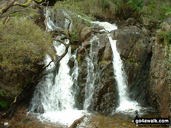
Some Photos and Pictures from Walk c279 The Oxendale Horseshoe from The Old Dungeon Ghyll, Great Langdale
In no particular order . . .


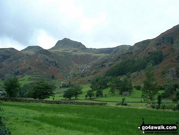
The Langdale Pikes - Pike of Stickle (left) and Loft Crag (centre right) from The Band
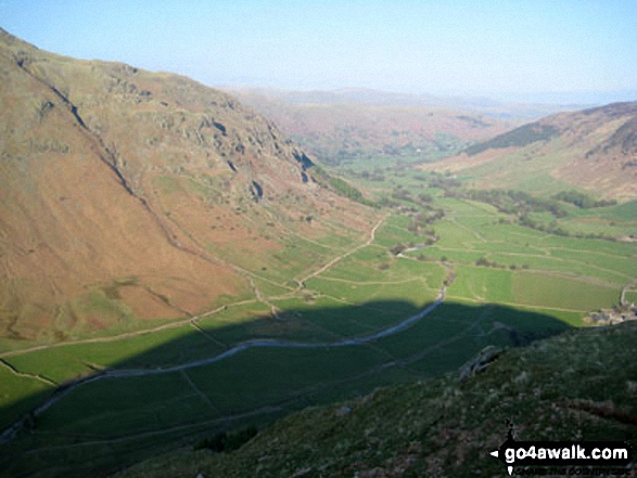

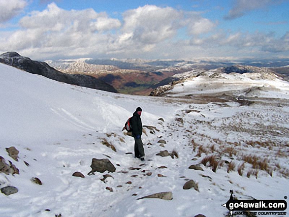
Heading for The Band from the Three Tarns col between Crinkle Crags and Bow Fell (Bowfell)
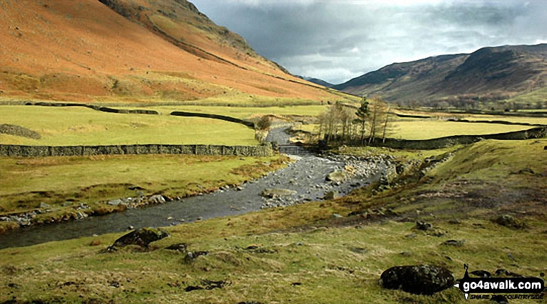
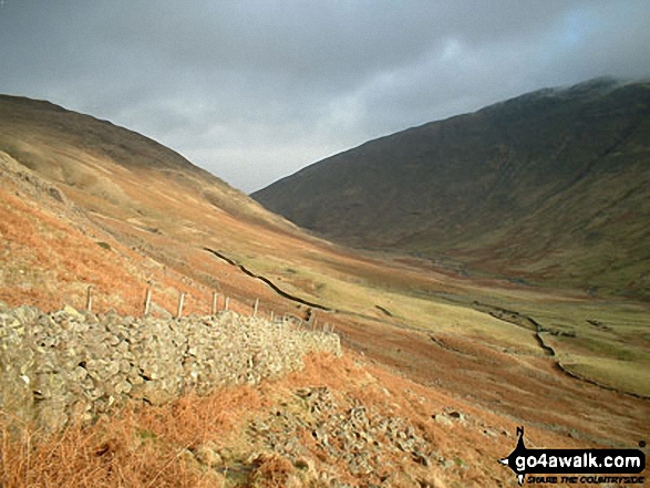
Mickelden Beck flowing through Great Langdale with the lowers slopes of the Landale pikes (left) and Side Pike (right)
Send us your photographs and pictures from your walks and hikes
We would love to see your photographs and pictures from walk c279 The Oxendale Horseshoe from The Old Dungeon Ghyll, Great Langdale. Send them in to us as email attachments (configured for any computer) along with your name and where the picture was taken to:
and we shall do our best to publish them.
(Guide Resolution = 300dpi. At least = 660 pixels (wide) x 440 pixels (high).)

You can also submit photos from walk c279 The Oxendale Horseshoe from The Old Dungeon Ghyll, Great Langdale via our Facebook Page.
NB. Please indicate where each photo was taken.

To contribute to go4awalk.com or to contact us about anything at all - see Talk To Us.
For help see Help.
go4awalk.com and go4awalk.co.uk are registered trademarks of TMDH Limited.
Copyright © 2000-2026 TMDH Limited. All rights reserved.
Copyright Terms & Conditions Privacy Statement
A - Z Walks Home Log On/Accounts Photo Gallery Walk Ideas and Collections Fell Facts Hill Skills Walking Questions and Answers Your Stories News Competitions Product Reviews/Gear Tests Walking Gear Guides Peaks and Mountains Peak Bagging Find New Walking Friends Camping GPS Waypoints for Walking Contents Walk Search Talk To Us go4awalk.com Help Free Example Walks Newsletter


