Walk c160 Pillar from Gatesgarth, Buttermere
This 10¼ mile, Grade 8 (Hard), easy-to-follow, hand-crafted walk, complete with GPS Waypoints, starts at Buttermere & will take about 8½ hrs to complete.
   |
Vital Statistics:
| Length: | 10¼mls (16.5km) |
| Ascent: | 4,611ft (1,405m) |
| Time: | 8½hrs |
| Grade: |  |

Route outline for walk c160:
Buttermere - Gatesgarth - Peggy's Bridge - Scarth Gap Pass - Scarth Gap - Black Sail Hut (Youth Hostel) - Black Sail Pass - Looking Stead (Pillar) - High Level Route - Robinson's Cairn - Pillar - Wind Gap - Black Crag (Pillar) - High Beck - Ennerdale - Scarth Gap Pass - Peggy's Bridge - Gatescarth - Buttermere
Peaks, Summits and Tops reached on this walk:
 2 English Mountains |
 1 Wainwright |
 3 English Nuttalls |
 0 English Deweys |
 0 Wainwright Outlying Fells |
 1 Marilyn |
 0 Bridgets |
Peak Bagging Statistics for this walk:
The highest point of this walk is Pillar at 892m (2928ft). Pillar is classified as an English Mountain (Hewitt) (11th highest in England, 29th highest in England & Wales) and a Wainwright (No. 8).
Pillar is also known as an English Nuttall (13th highest in England, 33rd highest in England & Wales) and an English Marilyn (6th highest in England, 249th highest in the UK).
The summit of Pillar is marked by an Ordnance Survey Trig Point.
Completing this walk will also take you to the top of Black Crag (Pillar) at 828m (2717ft). Black Crag (Pillar) is classified as an English Mountain (Hewitt) (31st highest in England, 60th highest in England & Wales)
Black Crag (Pillar) is also known as an English Nuttall (37th highest in England, 69th highest in England & Wales).
You will also reach the summit of Looking Stead (Pillar) at 627m (2058ft). Looking Stead (Pillar) is also known as an English Nuttall (220th highest in England, 383rd highest in England & Wales).
You can find this walk and other nearby walks on these unique Interactive Walk Planning Maps:
(worth a look if you're new to go4awalk.com & have never seen one of these before.)
1:25,000 scale OS Explorer Map (orange/yellow covers):
1:50,000 scale OS Landranger Map (pink/magenta covers):
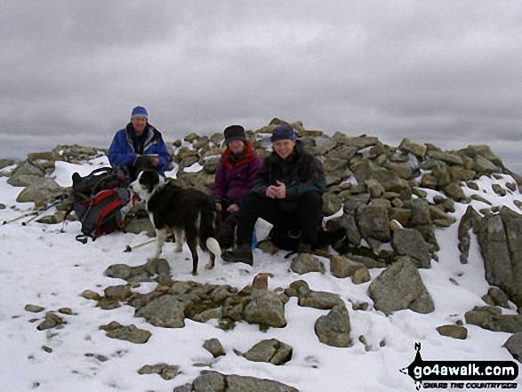
Some Photos and Pictures from Walk c160 Pillar from Gatesgarth, Buttermere
In no particular order . . .

Buttermere Lake with High Snockrigg beyond from near High Wax Knott above Peggy's Bridge (on the way to Hay Stacks)
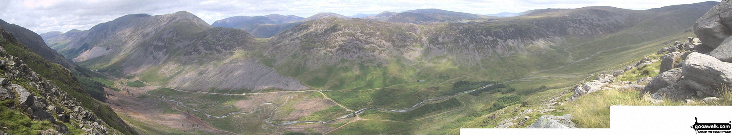
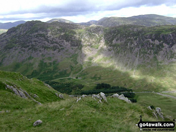
The view north from Looking Stead (Pillar) featuring Ennerdale with Red Pike (Buttermere), High Stile, High Crag, Seat, Scarth Gap, Hay Stacks (Haystacks) and Brandreth (far right)
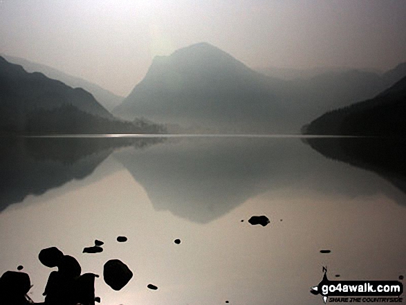
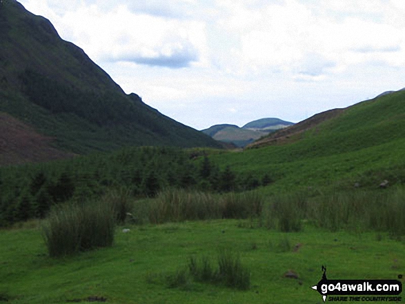
Hay Stacks (Haystacks) above Ennerdale (featuring Black Sail Hut Youth Hostel) from Black Sail Pass


. . . load all 112 walk photos from Walk c160 Pillar from Gatesgarth, Buttermere
Send us your photographs and pictures from your walks and hikes
We would love to see your photographs and pictures from walk c160 Pillar from Gatesgarth, Buttermere. Send them in to us as email attachments (configured for any computer) along with your name and where the picture was taken to:
and we shall do our best to publish them.
(Guide Resolution = 300dpi. At least = 660 pixels (wide) x 440 pixels (high).)

You can also submit photos from walk c160 Pillar from Gatesgarth, Buttermere via our Facebook Page.
NB. Please indicate where each photo was taken.

To contribute to go4awalk.com or to contact us about anything at all - see Talk To Us.
For help see Help.
go4awalk.com and go4awalk.co.uk are registered trademarks of TMDH Limited.
Copyright © 2000-2026 TMDH Limited. All rights reserved.
Copyright Terms & Conditions Privacy Statement
A - Z Walks Home Log On/Accounts Photo Gallery Walk Ideas and Collections Fell Facts Hill Skills Walking Questions and Answers Your Stories News Competitions Product Reviews/Gear Tests Walking Gear Guides Peaks and Mountains Peak Bagging Find New Walking Friends Camping GPS Waypoints for Walking Contents Walk Search Talk To Us go4awalk.com Help Free Example Walks Newsletter


