UK Postcode WV4 - The 30 nearest easy-to-follow, circular walk route maps to you
The thirty nearest easy-to-follow, circular walk route maps to you in UK Postcode WV4 in Walk Grade Order
The UK cities, towns and villages in West Midlands, England that have WV4 in their UK Postcode include:
• Ettingshall • Lower Penn • Penn •
Not familiar with the area around WV4?
See these 30 nearest walks to UK Postcode WV4 on a google map
   |
Vital Statistics:
| Length: | 5.25 miles (8.5 km) |
| Ascent: | 532ft (162m) |
| Time: | 2½ hrs |
| Grade: |  |
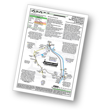
Route Summary:
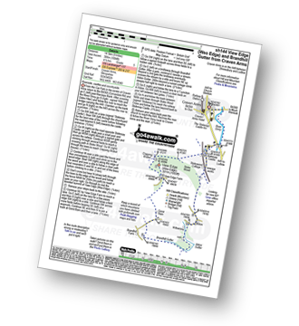
Eardington - Dinney Barn - The Jack Mytton Way - Chelmarsh Reservoir - Chelmarsh - Hampton - The Jack Mytton Way - The Severn Valley Railway - Hampton Loade - The Hampton Loade Ferry - The River Severn - The Severn Way - Eardington
|
Vital Statistics:
| Length: | 9.5 miles (15.5 km) |
| Ascent: | 1,132ft (345m) |
| Time: | 4.75hrs |
| Grade: |  |
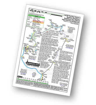
Route Summary:
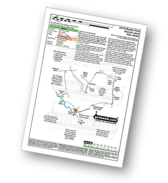
Bridgnorth - The River Severn - Quatford - Stanmore Country Park - Hoccum - Roughton - Burcote House - River Worfe - Soudley Rocks - Rindleford - Batch House - Fenn Gate - Woodside - High Rock - Caves - The Hermitage - Hermitage Hill Coppice - Bridgnorth
|
Vital Statistics:
| Length: | 10 miles (16 km) |
| Ascent: | 722ft (220m) |
| Time: | 4.25hrs |
| Grade: |  |

Route Summary:
Bridgnorth - Lower Town - River Severn - The Severn Way - Apley Forge - Nordley - Astley Abbots - Cross Lane Head - High Town - Bridgnorth - Lower Town - Bridgnorth
|
Vital Statistics:
| Length: | 3.75 miles (6 km) |
| Ascent: | 1,004ft (306m) |
| Time: | 2½ hrs |
| Grade: | |

Route Summary:
Buckatree Farm Reservoir - Wrekin Cottage - The Shropshire Way - Hell Gate - Heaven Gate - The Wrekin - Little Hill - Needle's Eye - Wenlocks Wood - Buckatree Farm Reservoir
|
Vital Statistics:
| Length: | 6.5 miles (10.5 km) |
| Ascent: | 1,152ft (351m) |
| Time: | 3½ hrs |
| Grade: | |

Route Summary:
Cleobury North - Stanbroughs Wood - Brown Clee Hill (Abdon Burf) - The Shropshire Way - Sandy Nap - Monkeys Fold - Green Lea - Brown Clee Hill (Clee Burf) - Chapelwod Farm - Wallermoore Wood - Harewood - Cleobury North
|
Vital Statistics:
| Length: | 4 miles (6.5 km) |
| Ascent: | 1,011ft (308m) |
| Time: | 2½ hrs |
| Grade: | |

Route Summary:
Dhustone - The Shropshire Way - Nine Spring Farm - Titterstone Incline - Titterstone Clee Hill - Hullabaloo House - Titterstone - Benson' Brook - Woodlands - Greenacres - Dhustone
|
Vital Statistics:
| Length: | 4 miles (6.5 km) |
| Ascent: | 712ft (217m) |
| Time: | 2.25hrs |
| Grade: | |

|
Vital Statistics:
| Length: | 8.5 miles (13.5 km) |
| Ascent: | 1,791ft (546m) |
| Time: | 5 hrs |
| Grade: | |
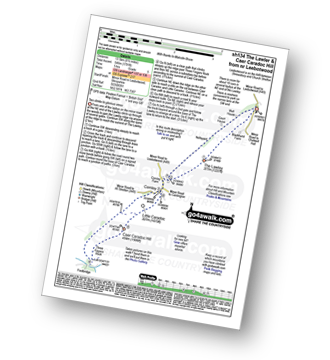
Route Summary:
Leebotwood - The Lawley - Comley - Caer Caradoc Hill - Three Fingers Rock - Comley - Leebotwood
|
Vital Statistics:
| Length: | 4.75 miles (7.5 km) |
| Ascent: | 295ft (90m) |
| Time: | 2 hrs |
| Grade: |  |

Route Summary:
Uffington - Haughmond Hill (Forest Commisison) - The Hollies - Haughmond Abbey - Abbey Wood - Haughmond Farm - New Coppice - Haughmond Hill (Forest Commisison) - Uffington
|
Vital Statistics:
| Length: | 5 miles (8 km) |
| Ascent: | 161ft (49m) |
| Time: | 2 hrs |
| Grade: |  |
Route Summary:
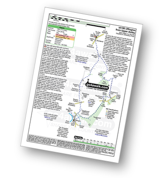
Upper Astley - The Shropshire Way - Wheatley Farm - Sunderton Farm - Sundorne Farm - Sundorne Castle Farm - Shrewsbury Rugby Club - New Coppice - Colin's Rough - Wheatley Farm - Upper Astley
|
Vital Statistics:
| Length: | 7.5 miles (12 km) |
| Ascent: | 361ft (110m) |
| Time: | 3 hrs |
| Grade: | |
Route Summary:
Upper Astley - The Shropshire Way - Wheatley Farm - Sunderton Farm - Sundorne Farm - Sundorne Castle Farm - The River Severn - Uffington - Haughmond Hill (Forest Commisison) - The Hollies - Haughmond Abbey - Abbey Wood - Haughmond Farm - New Coppice - Colins Rough - Wheatley Farm - Upper Astley
|
Vital Statistics:
| Length: | 6.25 miles (10 km) |
| Ascent: | 295ft (90m) |
| Time: | 2½ hrs |
| Grade: | |
Route Summary:
Stanton Upon Hine Heath - The Shropshire Way - River Roden - Harcourt Mill - Paperbank Mill - Hardcourt Farm - The Woodlands - Booley - Old Shop Farm - Quarry Coppice - Megan's Coppice - Hine Heath - Hine Heath Farm - Upper Blakeley Farm - Blakeley Stud - Blakeleyhill - Stanton Upon Hine Heath
|
Vital Statistics:
| Length: | 3.5 miles (5.5 km) |
| Ascent: | 289ft (88m) |
| Time: | 1.75hrs |
| Grade: | |

Route Summary:
Conkers Discovery Centre - Swadlincote - Conkers Waterside - Ashby Woulds Heritage Trail - Donisthorpe - Donisthorpe Woodland Park - Ashby De La Zouch Canal - Moira Lock - Moira Furnace Museum - Moira - Sarah's Wood - Conkers Waterside - Conkers Discovery Centre - Swadlincote.
|
Vital Statistics:
| Length: | 7 miles (11 km) |
| Ascent: | 1,214ft (370m) |
| Time: | 3.75hrs |
| Grade: | |

Route Summary:
Church Stretton - Three Fingers Rock - Caer Caradoc Hill - Little Caradoc - Comley - Church Stretton
|
Vital Statistics:
| Length: | 5.25 miles (8.5 km) |
| Ascent: | 945ft (288m) |
| Time: | 3 hrs |
| Grade: | |
Route Summary:
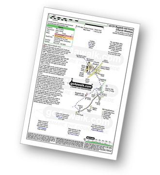
Church Stretton - The Jack Mytton Way - Snatchfield Farm - Clemcroft - Ragleth Hill - Ragdon Manor - Church Stretton
Not familiar with the area around WV4?
See these 30 nearest walks to UK Postcode WV4 on a google map
|
Vital Statistics:
| Length: | 5.75 miles (9 km) |
| Ascent: | 1,027ft (313m) |
| Time: | 3.25hrs |
| Grade: | |
Route Summary:
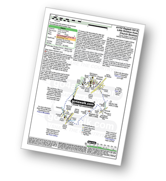
Church Stretton - The Jack Mytton Way - Snatchfield Farm - Clemcroft - Ragleth Hill - Little Stretton - Church Stretton
|
Vital Statistics:
| Length: | 10.25 miles (16.5 km) |
| Ascent: | 2,435ft (742m) |
| Time: | 6.25hrs |
| Grade: |  |

Route Summary:
Church Stretton - The Jack Mytton Way - Snatchfield Farm - Clemcroft - Ragleth Hill - Ragdon Manor - Gaerstones Farm - Caer Caradoc Hill - Little Caradoc - Church Stretton
|
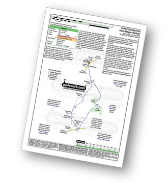
Vital Statistics:
| Length: | 8.75 miles (14 km) |
| Ascent: | 1,387ft (423m) |
| Time: | 4.75hrs |
| Grade: | |
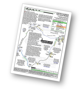
Route Summary:
Church Stretton - Town Brook - The Jack Mytton Way - The Long Mynd - Pole Bank (Long Mynd) - Midland Gliding Club - Minton Bach - Minton - Little Stretton - Chruch Stretton.
|
Vital Statistics:
| Length: | 9 miles (14.5 km) |
| Ascent: | 797ft (243m) |
| Time: | 4.25hrs |
| Grade: | |

Route Summary:
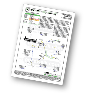
Corbet Wood - Grinshill - Clive - Grumpy - Myddle - The Marches Way - Webscott - Newton on the Hill - Yorton - Clive - Grinshill - The Shropshire Way - Corbet Wood - Grinshill
|
Vital Statistics:
| Length: | 5.25 miles (8.5 km) |
| Ascent: | 459ft (140m) |
| Time: | 2½ hrs |
| Grade: | |

|
Vital Statistics:
| Length: | 6.25 miles (10 km) |
| Ascent: | 558ft (170m) |
| Time: | 2.75hrs |
| Grade: | |

Route Summary:
Corbet Wood - Clive - Witterage Green - Newton On The Hill - Yorton - Grinshill - Corbet Wood
|
Vital Statistics:
| Length: | 6 miles (9.5 km) |
| Ascent: | 351ft (107m) |
| Time: | 2½ hrs |
| Grade: | |
Route Summary:
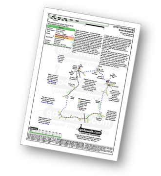
Grinshill - The Marches Way - Yorton Villa Farm - Yorton House Farm - Yorton Heath - Sansaw Heath - Sheepcotes - Sansaw Business Park - The Shropshire Way - Grinshill
|
Vital Statistics:
| Length: | 5 miles (8 km) |
| Ascent: | 542ft (165m) |
| Time: | 2½ hrs |
| Grade: | |
Route Summary:
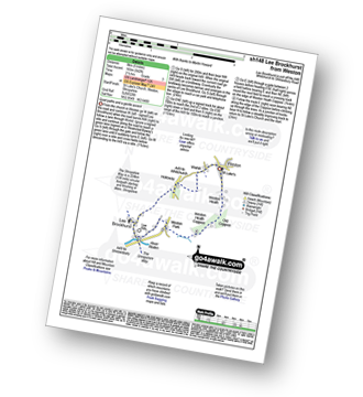
Weston - Wixhill - Lee Brockhurst - The Shropshire Way - Weston Heath Coppice - Weston Heath - Weston
|
Vital Statistics:
| Length: | 7 miles (11 km) |
| Ascent: | 880ft (268m) |
| Time: | 3½ hrs |
| Grade: | |
Route Summary:
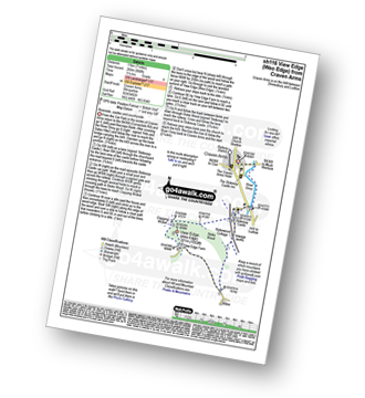
Craven Arms - River Onny - Hills and Dales Hike - Stokesay Castle - Clapping Wicket - View Edge (Weo Edge) - Aldon - Stokesay Castle - River Onny - Craven Arms
|
Vital Statistics:
| Length: | 10.25 miles (16.5 km) |
| Ascent: | 1,526ft (465m) |
| Time: | 5.25hrs |
| Grade: | |

Route Summary:
Craven Arms - Ireland Cottage - Hills and Dales Hike - Lower Dinchope - Hanging Wood - Wenlock Edge - Callow Hill (Little Stretton) - Flounders Folly - Frizland Coppice - Westhope - Wenlock Edge - Alcaton Common - Strefford Wood - Halford - Craven Arms
|
Vital Statistics:
| Length: | 9 miles (14.5 km) |
| Ascent: | 1,004ft (306m) |
| Time: | 4½ hrs |
| Grade: | |
Route Summary:
Craven Arms - River Onny - Hills and Dales Hike - Stokesay Castle - Clapping Wicket - View Edge (Weo Edge) - Gorst Barn - Brandhill Gutter - Aldon Gutter - Aldon - Stokesay Castle - River Onny - Craven Arms
|
Vital Statistics:
| Length: | 6.5 miles (10.5 km) |
| Ascent: | 853ft (260m) |
| Time: | 3.25hrs |
| Grade: | |

Route Summary:
Craven Arms - River Onny - Halford - Ireland Cottage - Hills and Dales Hike - Lower Dinchope - Hanging Wood - Callowhill Plantation - Wenlock Edge - Callow Hill (Little Stretton) - Flounders Folly - Frizland Coppice - Moorwood Farm - Strefford Wood - Berrymill Wood - Halford - Craven Arms
|
Vital Statistics:
| Length: | 7 miles (11 km) |
| Ascent: | 151ft (46m) |
| Time: | 2.75hrs |
| Grade: | |

Route Summary:
Stratford-upon-Avon - Tramway - River Stour - Clifford Chambers - The Greenway - River Avon - Stratford-upon-Avon
|
Vital Statistics:
| Length: | 7.75 miles (12.5 km) |
| Ascent: | 1,083ft (330m) |
| Time: | 4 hrs |
| Grade: | |
Route Summary:
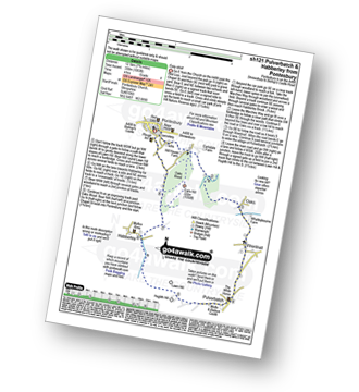
Pontesbury - Oaks Wood - The Marches Way - Oaks - Wrentnall - Pulverbatch - Habberley - Pontesbury
|
Vital Statistics:
| Length: | 5.5 miles (9 km) |
| Ascent: | 295ft (90m) |
| Time: | 2½ hrs |
| Grade: | |
Route Summary:
Myddle - Myddle Hill - Grumpy - Hill Farm - Newton on the Hill - Webscott - The Hollins - Myddle
Not familiar with the area around WV4?
See these 30 nearest walks to UK Postcode WV4 on a google map


