Walk sh201 The River Severn and Nordley from Bridgnorth

This 10 mile, Grade 4 (Moderate), easy-to-follow, hand-crafted walk, complete with GPS Waypoints, starts at Bridgnorth & will take about 4¼ hrs to complete.

Download Walk PDF Icon
Download GPX Track Icon
Download GPS Waypoints Icon

Vital Statistics:

Length:10mls (16km)
Ascent:722ft (220m)
Time:4¼hrs
Grade:Walk Grade 4_23_with_text.png Icon

Route outline for walk sh201:

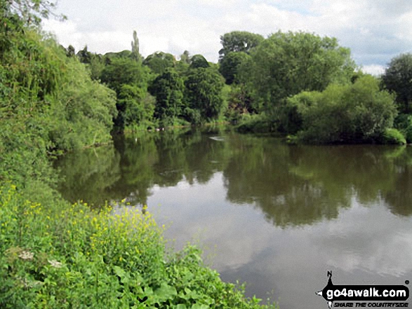
Bridgnorth  -  Lower Town  -  River Severn  -  The Severn Way  -  Apley Forge  -  Nordley  -  Astley Abbots  -  Cross Lane Head  -  High Town  -  Bridgnorth  -  Lower Town  -  Bridgnorth

Peaks, Summits and Tops reached on this walk:

Hewitt Icon
0
English
Mountains
Wainwright Icon
0
Wainwrights
English Nuttall Icon
0
English
Nuttalls
Dewey Icon
0
English
Deweys
Wainwright Outlying Fell Icon
0
Wainwright
Outlying Fells
Marilyn Icon
0
Marilyns
Bridget Icon
0
Bridgets

National Trails & Long Paths included on this walk:

Part of this walk follows a section of The Severn Way, a 338km (210 miles) linear footpath connecting Pen Pumlumon Fawr (Plynlimon) in Ceredigion, Wales with Bristol in Bristol, England. The Severn Way is waymarked by a Severn Trow logo and named posts. For more walks that include a section of this trail see The Severn Way.


You can find this walk and other nearby walks on these unique Interactive Walk Planning Maps:

(worth a look if you're new to go4awalk.com & have never seen one of these before.)


1:25,000 scale OS Explorer Map (orange/yellow covers):

OS Explorer 218 Kidderminster & Wyre Forest


1:50,000 scale OS Landranger Map (pink/magenta covers):

OS Landranger 138 Kidderminster & Wyre Forest


Some Photos and Pictures from Walk sh201 The River Severn and Nordley from Bridgnorth

In no particular order . . .

The River Severn at Quatford

The River Severn at Quatford

Photo: Barry Knox (7)


Send us your photographs and pictures from your walks and hikes

Send them in to us as email attachments (configured for any computer) along with your name/username and where the picture was taken to:

and we shall do our best to publish them.

(Guide Resolution = 300dpi. At least = 660 pixels (wide) x 440 pixels (high).)

Facebook Logo

You can also submit photos via our Facebook Page.

NB. Please indicate where each photo was taken so we can match it to a walk route.


Do not miss our pick of the Best Walks in Britain


If you would grow great and stately, you must try to walk sedately - Robert Louis Stevenson: 1850-1894
Follow go4awalk.com on Twitter Follow go4awalk.com on Facebook


Find new Friends to go walking with

Walk all 214 Wainwrights in just 59 Walks. Download GPS Waypoints - Great Walks you must not miss!

Walk The Yorkshire Three Peaks Challenge Walk - All the Latest Route Information, GPS Waypoints and Split Times to keep you on Schedule

Walk The British Three Peaks Challenge Walk - All the Latest Route Information and GPS Waypoints

See our pick of The Best Walks in The Lake District - Great Walks you must not miss!

Walk our pick of the Best Lake District Ridge Walks - Great Walks you must not miss!

Walk our pick of the Best Lake District Walks to do in the rain - Great Walks you must not miss!

Walk our pick of The Best Walks in Snowdonia - Great Walks you must not miss!

Walk our pick of The Best Ridge Walks in Wales - Walks you must not miss!

Walk our pick of The Best Walks in The Brecon Beacons - Great Walks you must not miss!

Walk our pick of The Best Walks in The Yorkshire Dales - Walks you must not miss!

Walk our pick of The Best Walks in The Peak District - Walks you must not miss!

Walk our pick of The Best Walks in The Forest of Bowland - Walks you must not miss!

Walk our pick of The Best Walks in Shropshire - Walks you must not miss!

Walk our pick of The Best Walks in Cheshire - Walks you must not miss!

Walk our pick of The Best Walks in Lancashire - Walks you must not miss!

Not sure where to walk next? Try Peak Bagging - Great Walks you must not miss!

Not sure where to walk next? Walk part of a National Trail - Great Walks you must not miss!

Walks with Downloadable and Uploadable GPS Waypoint Data

Walking Kit and Gear Tested by Walkers

Full Site Search