UK Postcode SY21 - The 30 nearest easy-to-follow, circular walk route maps to you
The thirty nearest easy-to-follow, circular walk route maps to you in UK Postcode SY21 in Walk Grade Order
The UK cities, towns and villages in Powys, Wales that have SY21 in their UK Postcode include:
• Aberriw • Brooks • Buttington • Castle Caereinion • Dolanog • Dolwen • Foel • Forden • Four Crosses • Fron • Garreg Bank • Garthmyl • Groes-lwyd • Guilsfield • Heniarth • Hope • Kingswood • Leighton • Llanerfyl • Llanfair Caereinion • Llangadfan • Llanllugan • Llwydiarth • Llwynderw • Manafon • Marton • Melin-y-grug • Middletown • Nant-y-dugoed • Pant-y-ffridd • Pentre'r beirdd • Pen-y-bont • Pool Quay • Trelystan • Trewern • Vaynor Park • Welshpool •
Not familiar with the area around SY21?
See these 30 nearest walks to UK Postcode SY21 on a google map
   |
Vital Statistics:
| Length: | 3.25 miles (5 km) |
| Ascent: | 479ft (146m) |
| Time: | 1.75hrs |
| Grade: |  |
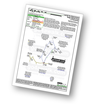
Route Summary:
Stiperstones Car Park - Gatten Plantation - The Shropshire Way - Shepherd's Rock - Devil's Chair - Stiperstones (Manstone Rock) - Stiperstones Car Park
|
Vital Statistics:
| Length: | 7.75 miles (12.5 km) |
| Ascent: | 1,355ft (413m) |
| Time: | 4.25hrs |
| Grade: |  |
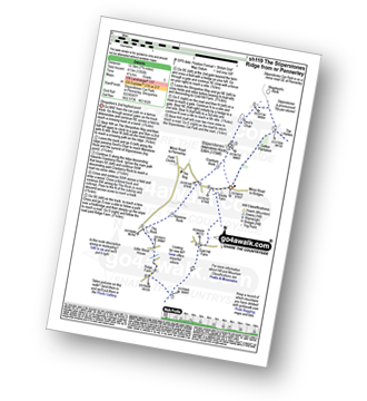
Route Summary:
Stiperstones Car Park - Gatten Plantation - The Shropshire Way - Shepherd's Rock - Devil's Chair - Stiperstones (Manstone Rock) - Nipstone Rock - The Rock - Ridge - Cold Hill Farm - Stiperstones Car Park
|
Vital Statistics:
| Length: | 5.25 miles (8.5 km) |
| Ascent: | 876ft (267m) |
| Time: | 3 hrs |
| Grade: |  |

Route Summary:
Stiperstones Car Park - The Shropshire Way - Nipstone Rock - The Rock - Ridge - Cold Hill Farm - Stiperstones Car Park
|
Vital Statistics:
| Length: | 7.75 miles (12.5 km) |
| Ascent: | 1,083ft (330m) |
| Time: | 4 hrs |
| Grade: |  |
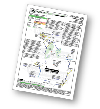
Route Summary:
Pontesbury - Oaks Wood - The Marches Way - Oaks - Wrentnall - Pulverbatch - Habberley - Pontesbury
|
Vital Statistics:
| Length: | 9.5 miles (15 km) |
| Ascent: | 2,632ft (802m) |
| Time: | 6 hrs |
| Grade: |  |

Route Summary:
Tyn-y-ffridd - Cwm Maen Gwynedd - Mynydd Tarw - Foel Wen (South Top) - Foel Wen - Tomle - Bwlch Maen Gwynedd - Craig Berwyn - Cadair Berwyn - Cadair Berwyn (North Top) - Moel Sych - Moel Yr Ewig - Godor (North Top) - Godor - Tyn-y-ffridd
|
Vital Statistics:
| Length: | 6 miles (9.5 km) |
| Ascent: | 2,530ft (771m) |
| Time: | 4.75hrs |
| Grade: | |

Route Summary:
Pistyll Rhaeadr Waterfall - Tan-y-pistyll - Nant y Llyn - LLyn Lluncaws - Cadair Berwyn - Cadair Berwyn (North Top) - Moel Sych - Trum Felen - Afon Disgynfa - Pistyll Rhaeadr - Tan-y-pistyll.
|
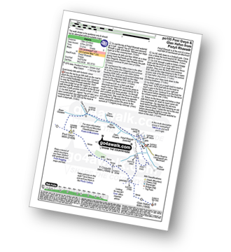
Vital Statistics:
| Length: | 12.75 miles (20.5 km) |
| Ascent: | 3,180ft (969m) |
| Time: | 7.75hrs |
| Grade: |  |

Route Summary:
Pistyll Rhaeadr Waterfall - Tan-y-pistyll - Nant y Llyn - LLyn Lluncaws - Cadair Berwyn - Cadair Berwyn (North Top) - Moel Sych - Ceulan Myheryn - Post Gwyn - Y Clogydd - Glan Hafon (Y Garn) - Afon Yr Ast - Pistyll Rhaeadr - Tan-y-pistyll.
|
Vital Statistics:
| Length: | 8.25 miles (13 km) |
| Ascent: | 2,215ft (675m) |
| Time: | 5.25hrs |
| Grade: | |
Route Summary:
Pistyll Rhaeadr Waterfall - Tan-y-pistyll - Nant y Llyn - Afon Disgynfa - Cwm Rhiwiau - Cwm Yr Eithin - Blaen Gaswen - Post Gwyn - Y Clogydd - Glan Hafon (Y Garn) - Afon Yr Ast - Pistyll Rhaeadr - Tan-y-pistyll.
|
Vital Statistics:
| Length: | 8.75 miles (14 km) |
| Ascent: | 1,387ft (423m) |
| Time: | 4.75hrs |
| Grade: | |
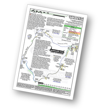
Route Summary:
Church Stretton - Town Brook - The Jack Mytton Way - The Long Mynd - Pole Bank (Long Mynd) - Midland Gliding Club - Minton Bach - Minton - Little Stretton - Chruch Stretton.
|
Vital Statistics:
| Length: | 5.75 miles (9 km) |
| Ascent: | 1,027ft (313m) |
| Time: | 3.25hrs |
| Grade: | |
Route Summary:
Church Stretton - The Jack Mytton Way - Snatchfield Farm - Clemcroft - Ragleth Hill - Little Stretton - Church Stretton
|
Vital Statistics:
| Length: | 10.25 miles (16.5 km) |
| Ascent: | 2,435ft (742m) |
| Time: | 6.25hrs |
| Grade: | |

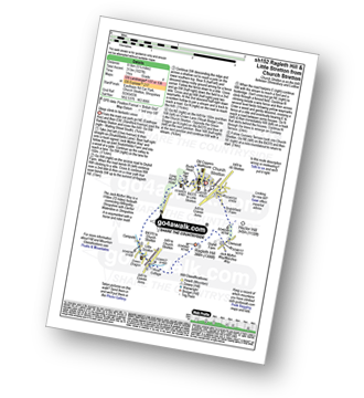
Route Summary:
Church Stretton - The Jack Mytton Way - Snatchfield Farm - Clemcroft - Ragleth Hill - Ragdon Manor - Gaerstones Farm - Caer Caradoc Hill - Little Caradoc - Church Stretton
|
Vital Statistics:
| Length: | 7 miles (11 km) |
| Ascent: | 1,214ft (370m) |
| Time: | 3.75hrs |
| Grade: | |

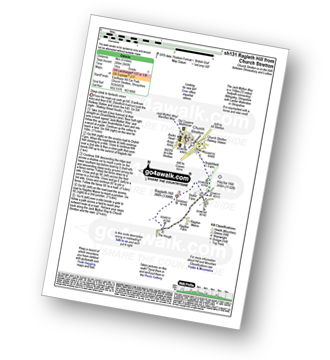
Route Summary:
Church Stretton - Three Fingers Rock - Caer Caradoc Hill - Little Caradoc - Comley - Church Stretton
|
Vital Statistics:
| Length: | 5.25 miles (8.5 km) |
| Ascent: | 945ft (288m) |
| Time: | 3 hrs |
| Grade: | |
Route Summary:
Church Stretton - The Jack Mytton Way - Snatchfield Farm - Clemcroft - Ragleth Hill - Ragdon Manor - Church Stretton
|
Vital Statistics:
| Length: | 7.75 miles (12.5 km) |
| Ascent: | 1,661ft (506m) |
| Time: | 4½ hrs |
| Grade: | |

Route Summary:
Cwm Pennant - Ffridd Ddu - Bryniau Gleision - Cwm Sian Llwyd - Foel Cwm-Sian Llwyd - Trwyn Swch - Nant Llwyn-gwerh - Nant Ceunant-bach - Milltir Gerrig - Nant Cwm Pydew - Blaen-y-cwm - Cwm Pennant
|
Vital Statistics:
| Length: | 4.75 miles (7.5 km) |
| Ascent: | 916ft (279m) |
| Time: | 2.75hrs |
| Grade: | |
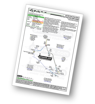
Route Summary:
Cwm Sian Llwyd - Foel Cwm-Sian Llwyd - Trwyn Swch - Nant Llwyn-gwerh - Nant Ceunant-bach - Milltir Gerrig - Pont Cwm Pydew - Nant Cwm Pydew - Cwm Sian Llwyd
Not familiar with the area around SY21?
See these 30 nearest walks to UK Postcode SY21 on a google map
|
Vital Statistics:
| Length: | 11 miles (17.5 km) |
| Ascent: | 2,839ft (865m) |
| Time: | 6.75hrs |
| Grade: | |

Route Summary:
Bwlch y Groes - Gwaun Yr Hen-Luest - Clipiau-Duon - Llechwedd Du (Arans) - Afon Twrch - Foel Rhudd - Esgeiriau Gwynion - Bwlch Sirddyn - Foel Hafod-fynydd - Creiglyn Dyfi - Llaethnant - Ceunant y Briddell - Pen y Craig - Natn Llewlyn-goch - Blaen-pennant - Afon Rhiwlech - Foel y Groes - Moel y Cerrig Duon - Bwlch y Groes
|
Vital Statistics:
| Length: | 8.5 miles (13.5 km) |
| Ascent: | 1,791ft (546m) |
| Time: | 5 hrs |
| Grade: | |
Route Summary:
Leebotwood - The Lawley - Comley - Caer Caradoc Hill - Three Fingers Rock - Comley - Leebotwood
|
Vital Statistics:
| Length: | 4 miles (6.5 km) |
| Ascent: | 712ft (217m) |
| Time: | 2.25hrs |
| Grade: | |

|
Vital Statistics:
| Length: | 5.5 miles (9 km) |
| Ascent: | 295ft (90m) |
| Time: | 2½ hrs |
| Grade: | |
Route Summary:
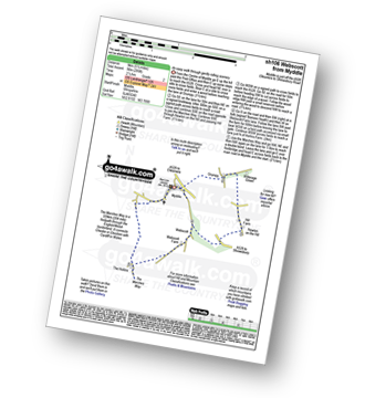
Myddle - Myddle Hill - Grumpy - Hill Farm - Newton on the Hill - Webscott - The Hollins - Myddle
|
Vital Statistics:
| Length: | 4.75 miles (7.5 km) |
| Ascent: | 1,628ft (496m) |
| Time: | 3½ hrs |
| Grade: | |

Route Summary:
Hirnant Pass - Foel Goch (Berwyns) - Trum y Gwrgedd - Trum y Gwragedd - Foel y Geifr (Berwyns) - Pen y Cerrig - Hirnant Pass
|
Vital Statistics:
| Length: | 10.5 miles (17 km) |
| Ascent: | 2,081ft (634m) |
| Time: | 6 hrs |
| Grade: | |

Route Summary:
Hirnant Pass - Pen y Cerrig - Pen y Boncyn Trefeilw - Stac Rhos - Cefn Gwyntog - Foel Cedig - Cyrniau Nod - Y Groes Fagl - Pennllyn Forest - Ystrad-y-groes - Hirnant Pass
|
Vital Statistics:
| Length: | 12.75 miles (20.5 km) |
| Ascent: | 2,763ft (842m) |
| Time: | 7½ hrs |
| Grade: | |

Route Summary:
Hirnant Pass - Foel Goch (Berwyns) - Trum y Gwrgedd - Trum y Gwragedd - Foel y Geifr (Berwyns) - Pen y Cerrig Duon - Pen y Boncyn Trefeilw - Stac Rhos - Cefn Gwyntog - Foel Cedig - Cyrniau Nod - Y Groes Fagl - Pennllyn Forest - Ystrad-y-groes - Hirnant Pass
|
Vital Statistics:
| Length: | 9 miles (14.5 km) |
| Ascent: | 420ft (128m) |
| Time: | 3.75hrs |
| Grade: | |
Route Summary:
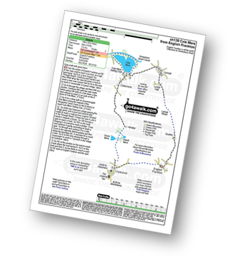
Cockshutt - English Frankton - Quaikin - Lyneal Wood - Lyneal Hall - River Roden - Lyneal - Cole Mere - Colemere - Whattal Farm - Whattal Moss - Seat Mere - Crose Mere - Lloyd's Wood - Crosemere House - Cockshutt,.
|
Vital Statistics:
| Length: | 9 miles (14.5 km) |
| Ascent: | 1,004ft (306m) |
| Time: | 4½ hrs |
| Grade: | |
Route Summary:
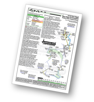
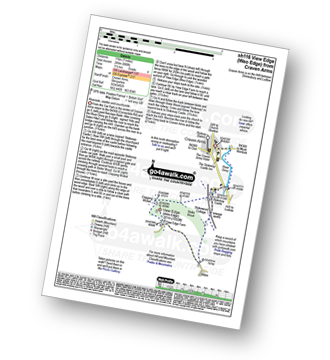
Craven Arms - River Onny - Hills and Dales Hike - Stokesay Castle - Clapping Wicket - View Edge (Weo Edge) - Gorst Barn - Brandhill Gutter - Aldon Gutter - Aldon - Stokesay Castle - River Onny - Craven Arms
|
Vital Statistics:
| Length: | 6.5 miles (10.5 km) |
| Ascent: | 853ft (260m) |
| Time: | 3.25hrs |
| Grade: | |

Route Summary:
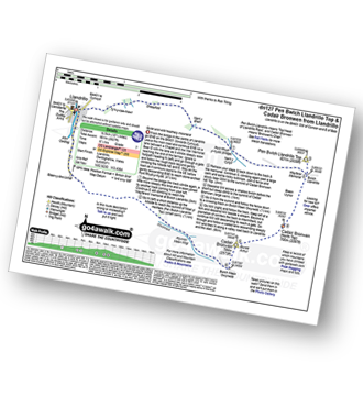
Craven Arms - River Onny - Halford - Ireland Cottage - Hills and Dales Hike - Lower Dinchope - Hanging Wood - Callowhill Plantation - Wenlock Edge - Callow Hill (Little Stretton) - Flounders Folly - Frizland Coppice - Moorwood Farm - Strefford Wood - Berrymill Wood - Halford - Craven Arms
|
Vital Statistics:
| Length: | 7 miles (11 km) |
| Ascent: | 880ft (268m) |
| Time: | 3½ hrs |
| Grade: | |
Route Summary:
Craven Arms - River Onny - Hills and Dales Hike - Stokesay Castle - Clapping Wicket - View Edge (Weo Edge) - Aldon - Stokesay Castle - River Onny - Craven Arms
|
Vital Statistics:
| Length: | 10.25 miles (16.5 km) |
| Ascent: | 1,526ft (465m) |
| Time: | 5.25hrs |
| Grade: | |

Route Summary:
Craven Arms - Ireland Cottage - Hills and Dales Hike - Lower Dinchope - Hanging Wood - Wenlock Edge - Callow Hill (Little Stretton) - Flounders Folly - Frizland Coppice - Westhope - Wenlock Edge - Alcaton Common - Strefford Wood - Halford - Craven Arms
|
Vital Statistics:
| Length: | 16.25 miles (26 km) |
| Ascent: | 3,213ft (979m) |
| Time: | 9 hrs |
| Grade: |  |

Route Summary:
Llandrillo - Pont Rhyd-yr-hydd - Bwlch Llandrillo Wayfarer Memorial - Pen Bwlch Llandrillo Top - Bronwen (North Top) - Cadair Bronwen - Bwlch Maen Gwynedd - Craig Berwyn - Cadair Berwyn - Cadair Berwyn (North Top) - Moel Sych - Ceulan Myheryn - Milltir Gerrig - Blaen-y-cwm - Llandrillo
|
Vital Statistics:
| Length: | 10.25 miles (16.5 km) |
| Ascent: | 2,627ft (801m) |
| Time: | 6½ hrs |
| Grade: | |
Route Summary:
Llandrillo - Pont Rhyd-yr-hydd - Bwlch Llandrillo Wayfarer Memorial - Pen Bwlch Llandrillo Top - Cadair Bronwen (North Top) - Cadair Bronwen - Bwlch Maen Gwynedd - Ffordd Gan Elin - Llandrillo
|
Vital Statistics:
| Length: | 4.75 miles (7.5 km) |
| Ascent: | 295ft (90m) |
| Time: | 2 hrs |
| Grade: | |

Route Summary:
Uffington - Haughmond Hill (Forest Commisison) - The Hollies - Haughmond Abbey - Abbey Wood - Haughmond Farm - New Coppice - Haughmond Hill (Forest Commisison) - Uffington
Not familiar with the area around SY21?
See these 30 nearest walks to UK Postcode SY21 on a google map


