UK Postcode ST19 - The 30 nearest easy-to-follow, circular walk route maps to you
The thirty nearest easy-to-follow, circular walk route maps to you in UK Postcode ST19 in Walk Grade Order
The UK cities, towns and villages in Staffordshire, England that have ST19 in their UK Postcode include:
• Bickford • Bishop's Wood • Brewood • Gailey • Horsebrook • Kiddemore Green • Lapley • Mitton • Penkridge • Stretton • Wheaton Aston • Whiston •
Not familiar with the area around ST19?
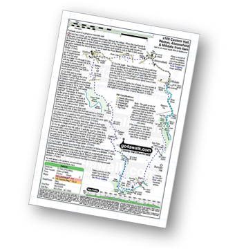
See these 30 nearest walks to UK Postcode ST19 on a google map
   |
Vital Statistics:
| Length: | 9.5 miles (15.5 km) |
| Ascent: | 1,132ft (345m) |
| Time: | 4.75hrs |
| Grade: |  |
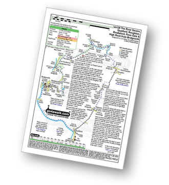
Route Summary:
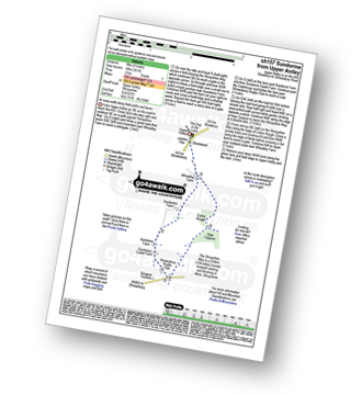
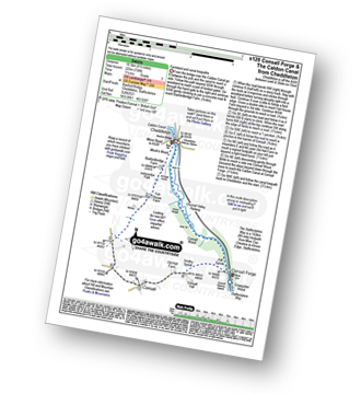
Bridgnorth - The River Severn - Quatford - Stanmore Country Park - Hoccum - Roughton - Burcote House - River Worfe - Soudley Rocks - Rindleford - Batch House - Fenn Gate - Woodside - High Rock - Caves - The Hermitage - Hermitage Hill Coppice - Bridgnorth
|
Vital Statistics:
| Length: | 10 miles (16 km) |
| Ascent: | 722ft (220m) |
| Time: | 4.25hrs |
| Grade: |  |

Route Summary:
Bridgnorth - Lower Town - River Severn - The Severn Way - Apley Forge - Nordley - Astley Abbots - Cross Lane Head - High Town - Bridgnorth - Lower Town - Bridgnorth
|
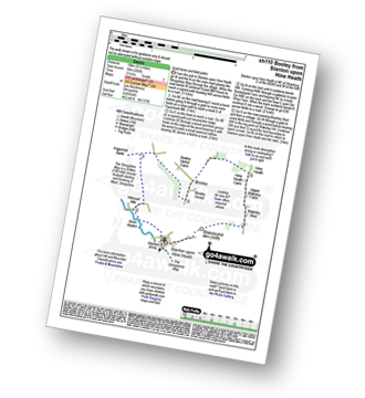
Vital Statistics:
| Length: | 3.75 miles (6 km) |
| Ascent: | 1,004ft (306m) |
| Time: | 2½ hrs |
| Grade: |  |

Route Summary:
Buckatree Farm Reservoir - Wrekin Cottage - The Shropshire Way - Hell Gate - Heaven Gate - The Wrekin - Little Hill - Needle's Eye - Wenlocks Wood - Buckatree Farm Reservoir
|
Vital Statistics:
| Length: | 5.25 miles (8.5 km) |
| Ascent: | 532ft (162m) |
| Time: | 2½ hrs |
| Grade: | |
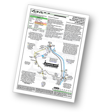
Route Summary:
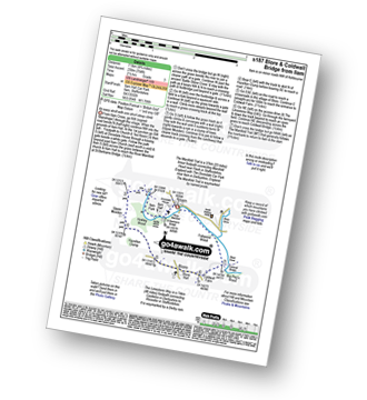
Eardington - Dinney Barn - The Jack Mytton Way - Chelmarsh Reservoir - Chelmarsh - Hampton - The Jack Mytton Way - The Severn Valley Railway - Hampton Loade - The Hampton Loade Ferry - The River Severn - The Severn Way - Eardington
|
Vital Statistics:
| Length: | 6.25 miles (10 km) |
| Ascent: | 295ft (90m) |
| Time: | 2½ hrs |
| Grade: |  |
Route Summary:
Stanton Upon Hine Heath - The Shropshire Way - River Roden - Harcourt Mill - Paperbank Mill - Hardcourt Farm - The Woodlands - Booley - Old Shop Farm - Quarry Coppice - Megan's Coppice - Hine Heath - Hine Heath Farm - Upper Blakeley Farm - Blakeley Stud - Blakeleyhill - Stanton Upon Hine Heath
|
Vital Statistics:
| Length: | 4 miles (6.5 km) |
| Ascent: | 830ft (253m) |
| Time: | 2.25hrs |
| Grade: | |

Route Summary:
Froghall Wharf - Moseymoor Wood - Whieldon's Wood - Cloughead Wood - Blackbank Brook - Foxt - Newfields Gallery - Shirley Hollow - Oldridge Pinnacle - Harston Wood - Oldridge - Froghall Wharf
|
Vital Statistics:
| Length: | 6 miles (9.5 km) |
| Ascent: | 860ft (262m) |
| Time: | 3 hrs |
| Grade: | |
Route Summary:
Froghall Wharf - Moseymoor Wood - Ipstones - New House Wood - Booth's Farm - Booth's Hall Farm - Glenwood House - Crowgutter Wood - Caldon Canal - The Staffordshire Way - Consall Forge - Churnet Valley Railway - Consall New Lock - Booth's Wood - Podmores Bridge - Cherryeye Bridge - Ruelow Wood - Froghall - Froghall Wharf
|
Vital Statistics:
| Length: | 4.75 miles (7.5 km) |
| Ascent: | 295ft (90m) |
| Time: | 2 hrs |
| Grade: | |

Route Summary:
Uffington - Haughmond Hill (Forest Commisison) - The Hollies - Haughmond Abbey - Abbey Wood - Haughmond Farm - New Coppice - Haughmond Hill (Forest Commisison) - Uffington
|
Vital Statistics:
| Length: | 5 miles (8 km) |
| Ascent: | 161ft (49m) |
| Time: | 2 hrs |
| Grade: |  |
Route Summary:
Upper Astley - The Shropshire Way - Wheatley Farm - Sunderton Farm - Sundorne Farm - Sundorne Castle Farm - Shrewsbury Rugby Club - New Coppice - Colin's Rough - Wheatley Farm - Upper Astley
|
Vital Statistics:
| Length: | 7.5 miles (12 km) |
| Ascent: | 361ft (110m) |
| Time: | 3 hrs |
| Grade: | |
Route Summary:
Upper Astley - The Shropshire Way - Wheatley Farm - Sunderton Farm - Sundorne Farm - Sundorne Castle Farm - The River Severn - Uffington - Haughmond Hill (Forest Commisison) - The Hollies - Haughmond Abbey - Abbey Wood - Haughmond Farm - New Coppice - Colins Rough - Wheatley Farm - Upper Astley
|
Vital Statistics:
| Length: | 5 miles (8 km) |
| Ascent: | 542ft (165m) |
| Time: | 2½ hrs |
| Grade: | |
Route Summary:
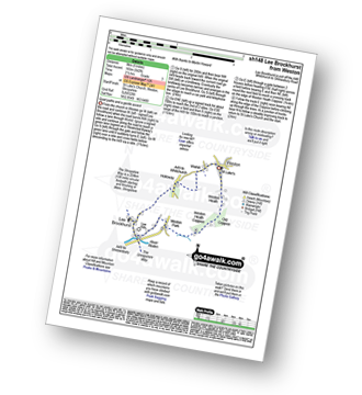
Weston - Wixhill - Lee Brockhurst - The Shropshire Way - Weston Heath Coppice - Weston Heath - Weston
|
Vital Statistics:
| Length: | 6.5 miles (10.5 km) |
| Ascent: | 1,152ft (351m) |
| Time: | 3½ hrs |
| Grade: | |

Route Summary:
Cleobury North - Stanbroughs Wood - Brown Clee Hill (Abdon Burf) - The Shropshire Way - Sandy Nap - Monkeys Fold - Green Lea - Brown Clee Hill (Clee Burf) - Chapelwod Farm - Wallermoore Wood - Harewood - Cleobury North
|
Vital Statistics:
| Length: | 4.75 miles (7.5 km) |
| Ascent: | 742ft (226m) |
| Time: | 2½ hrs |
| Grade: | |

Route Summary:
Ipstones - Booth's Hall Farm - Cherryeye Bridge - Caldon Canal - The Staffordshire Way - Podmores Bridge - Booth's Wood - Consall New Lock - Crowgutter Wood - Churnet Valley Railway - Consall Forge - River Churnet - Devil's Staircase - Belmont Hall - Noonsun Common - Ipstones
|
Vital Statistics:
| Length: | 9 miles (14.5 km) |
| Ascent: | 797ft (243m) |
| Time: | 4.25hrs |
| Grade: | |

Route Summary:
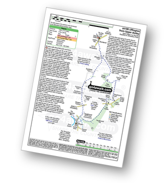
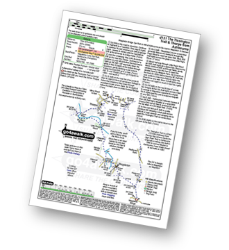
Corbet Wood - Grinshill - Clive - Grumpy - Myddle - The Marches Way - Webscott - Newton on the Hill - Yorton - Clive - Grinshill - The Shropshire Way - Corbet Wood - Grinshill
|
Vital Statistics:
| Length: | 5.25 miles (8.5 km) |
| Ascent: | 459ft (140m) |
| Time: | 2½ hrs |
| Grade: | |

Not familiar with the area around ST19?
See these 30 nearest walks to UK Postcode ST19 on a google map
|
Vital Statistics:
| Length: | 6.25 miles (10 km) |
| Ascent: | 558ft (170m) |
| Time: | 2.75hrs |
| Grade: | |

Route Summary:
Corbet Wood - Clive - Witterage Green - Newton On The Hill - Yorton - Grinshill - Corbet Wood
|
Vital Statistics:
| Length: | 6 miles (9.5 km) |
| Ascent: | 351ft (107m) |
| Time: | 2½ hrs |
| Grade: | |
Route Summary:
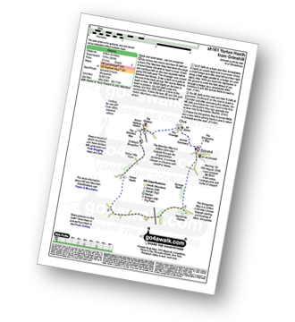
Grinshill - The Marches Way - Yorton Villa Farm - Yorton House Farm - Yorton Heath - Sansaw Heath - Sheepcotes - Sansaw Business Park - The Shropshire Way - Grinshill
|
Vital Statistics:
| Length: | 6.5 miles (10.5 km) |
| Ascent: | 738ft (225m) |
| Time: | 3.25hrs |
| Grade: | |
Route Summary:
Cheddleton - Basford Bridge - Monk's Wood - Basfordbridge Farm - Felt House Farm - Consall - Consall Forge - River Churnet - Churnet Valley Railway - Caldon Canal - The Staffordshire Way - Consall Wood - Cheddleton
|
Vital Statistics:
| Length: | 3.5 miles (5.5 km) |
| Ascent: | 289ft (88m) |
| Time: | 1.75hrs |
| Grade: | |

Route Summary:
Conkers Discovery Centre - Swadlincote - Conkers Waterside - Ashby Woulds Heritage Trail - Donisthorpe - Donisthorpe Woodland Park - Ashby De La Zouch Canal - Moira Lock - Moira Furnace Museum - Moira - Sarah's Wood - Conkers Waterside - Conkers Discovery Centre - Swadlincote.
|
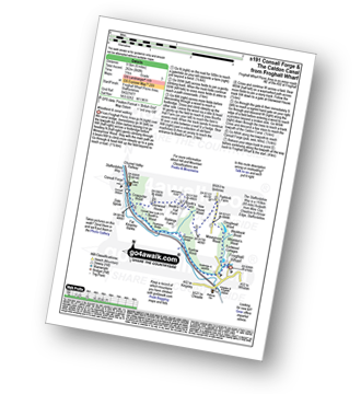
Vital Statistics:
| Length: | 8.25 miles (13 km) |
| Ascent: | 1,588ft (484m) |
| Time: | 4½ hrs |
| Grade: | |

Route Summary:
Waterhouses - The Manifold Way - The River Hamps - Sparrowlee Bridge - Lee House - Hell Hole - Old Soles Wood - Soles Coppice - The River Manifold - Weag's Bridge - Beeston Tor Farm - Throwley Hall Farm - Throwley Cottage - Farwall Farm - The Manifold Way - Waterhouses
|
Vital Statistics:
| Length: | 11.5 miles (18 km) |
| Ascent: | 1,267ft (386m) |
| Time: | 5½ hrs |
| Grade: | |

Route Summary:
Waterhouses - Waterfall Cross - Martins Low - River Hamps - Ford - Onecote - Grindonmoor Gate - Grindon Moor (Grindon Moor) - Grindon - Lee House - The Manifold Way - Waterhouses
|
Vital Statistics:
| Length: | 4 miles (6.5 km) |
| Ascent: | 712ft (217m) |
| Time: | 2.25hrs |
| Grade: | |

|
Vital Statistics:
| Length: | 8.5 miles (13.5 km) |
| Ascent: | 1,791ft (546m) |
| Time: | 5 hrs |
| Grade: | |
Route Summary:
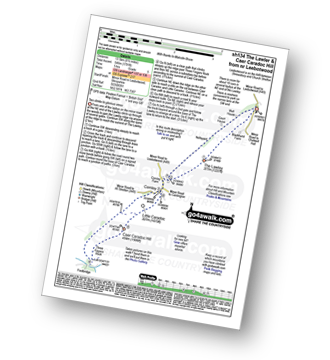
Leebotwood - The Lawley - Comley - Caer Caradoc Hill - Three Fingers Rock - Comley - Leebotwood
|
Vital Statistics:
| Length: | 6 miles (9.5 km) |
| Ascent: | 918ft (280m) |
| Time: | 3.25hrs |
| Grade: | |

Route Summary:
Swinscoe - Hillend Farm - Feenie Lee - Blore - The Limestone Way - Coldwall Bridge - River Dove - Big Peg's Wood - Little Peg's Wood - Littlepark Farm - Mappleton (aka Mapleton) - Okeover Hall - Okeover Park - Cowclose Wood - Martin Hill - Woodhouse Farm - Swinscoe
|
Vital Statistics:
| Length: | 6.75 miles (11 km) |
| Ascent: | 876ft (267m) |
| Time: | 3½ hrs |
| Grade: | |
Route Summary:
Mappleton Lane (Ashbourne) - The Tissington Trail - Thorpe - The Limestone Way - Coldwall Bridge - River Dove - Big Peg's Wood - Little Peg's Wood - Littlepark Farm - Mappleton (aka Mapleton) - Callow Top - Mappleton Lane (Ashbourne)
|
Vital Statistics:
| Length: | 12.25 miles (19.5 km) |
| Ascent: | 1,930ft (588m) |
| Time: | 6½ hrs |
| Grade: |  |

Route Summary:
Mappleton Lane (Ashbourne) - The Tissington Trail - Thorpe - Pike House - Bostern Grange Farm - Hanson Grange - The Nabs - Dove Dale - Dove Holes - Taylors Wood - Pickering Rock - Ilam Rock - Shaplow Dale - Lin Dale - Thorpe Cloud - Thorpe Mill Farm - The Limestone Way - Coldwall Bridge - River Dove - Big Peg's Wood - Little Peg's Wood - Littlepark Farm - Mappleton (aka Mapleton) - Callow Top - Mappleton Lane (Ashbourne)
|
Vital Statistics:
| Length: | 6.5 miles (10.5 km) |
| Ascent: | 745ft (227m) |
| Time: | 3.25hrs |
| Grade: | |

Route Summary:
Mappleton (aka Mapleton) - Okeover Bridge - Okeover Hall - Okeover Park - Cowclose Wood - Martin Hill Farm - Woodhouses Farm - Blore - Blore Pastures - Ilam - River Manifold - The Manifold Trail - Fishpond Wood - River Dove - Coldwall Bridge - Big Peg's Wood - Little Peg's Wood - Littlepark Farm - Okeover Bridge - Mappleton (aka Mapleton)
|
Vital Statistics:
| Length: | 7 miles (11 km) |
| Ascent: | 1,076ft (328m) |
| Time: | 3½ hrs |
| Grade: | |

Route Summary:
Leek - Mount Road - Holly House - Beely Barn - Morridge - Moor Top - Morridge Side - Egg Well - Roost Hill - Ashenhurst Mill - Lowe Hill - Leek
|
Vital Statistics:
| Length: | 4.75 miles (7.5 km) |
| Ascent: | 754ft (230m) |
| Time: | 2½ hrs |
| Grade: | |
Route Summary:
Ilam - Ilam Country Park - River Manifold - Lower Dove Dale - Upper Musden - Hazelton Clump - Blore - Coldwall Farm - The Limestone Way - Coldwall Bridge - The Manifold Trail - River Dove - Fishpond Wood - River Manifold - Ilam
|
Vital Statistics:
| Length: | 9.75 miles (15.5 km) |
| Ascent: | 2,146ft (654m) |
| Time: | 5.75hrs |
| Grade: | |
Route Summary:
Ilam - Ilam Country Park - River Manifold - Castern Hall - Castern Wood Nature Reserve - Wetton Low - Wetton - Alstonefield - Milldale - Achas Bank - Raven's Tor - Hall Dale - Dove Dale Wood - Air Cottage - Ilam Tops - Ilamtops Farm - Ilam
Not familiar with the area around ST19?
See these 30 nearest walks to UK Postcode ST19 on a google map


