UK Postcode M26 - The 30 nearest easy-to-follow, circular walk route maps to you
The thirty nearest easy-to-follow, circular walk route maps to you in UK Postcode M26 in Walk Grade Order
The UK cities, towns and villages in Greater Manchester, England that have M26 in their UK Postcode include:
• Prestolee • Radcliffe •
Not familiar with the area around M26?
See these 30 nearest walks to UK Postcode M26 on a google map

   |
Vital Statistics:
| Length: | 4 miles (6.5 km) |
| Ascent: | 590 ft (180 m) |
| Time: | 2.25 hrs |
| Grade: |  |
Walk route map pdf
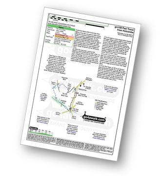
Detailed walk route map PDF
complete with GPS Waypoints
Route Summary:
Holcombe Moor Car Park - Branch Rd - Top O'th' Moor Farm - Peel Tower - Taylor's Farm - Redisher Wood - Holcombe Brook - Holcombe Moor Car Park


|
Vital Statistics:
| Length: | 5.25 miles (8.5 km) |
| Ascent: | 686 ft (210 m) |
| Time: | 2.75 hrs |
| Grade: |  |
Walk route map pdf
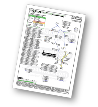
Detailed walk route map PDF
complete with GPS Waypoints
Route Summary:
Holcombe Moor Car Park - Holcombe - Higher Tops - Chatterton Close Farm - Buckden Wood - The Rossendale Way - Beetle Hill - Bull Hill (Holcombe Moor) - Pilgrim's Cross - Harcles Hill - Peel Tower - Top o'th'Moor Farm - Branch Road - Holcombe Moor Car Park

|
Vital Statistics:
| Length: | 6.75 miles (11 km) |
| Ascent: | 1,050 ft (320 m) |
| Time: | 3.75 hrs |
| Grade: |  |
Walk route map pdf
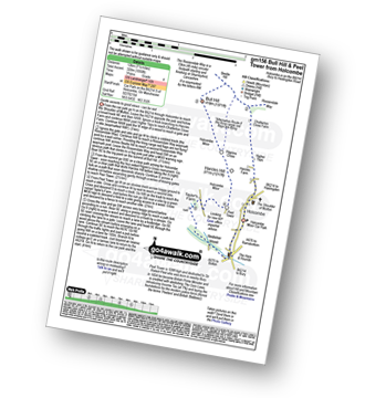
Detailed walk route map PDF
complete with GPS Waypoints
Route Summary:
Holcombe Moor Car Park - Holcombe - Higher Tops - Chatterton Close Farm - Buckden Wood - The Rossendale Way - Beetle Hill - Bull Hill (Holcombe Moor) - Pilgrim's Cross - Harcles Hill - Peel Tower - Taylor's Farm - Redisher Wood - Holcombe Brook - Holcombe Car Park.

|
Vital Statistics:
| Length: | 5 miles (8 km) |
| Ascent: | 1,044 ft (318 m) |
| Time: | 3 hrs |
| Grade: | |
Walk route map pdf

Detailed walk route map PDF
complete with GPS Waypoints
Route Summary:
Edenfield - Gin Croft Lane - Dearden Moor - Sand Beds Farm - Cowpe Lowe - The Rossendale Way - Foe Edge - Horncliffe Close - Waugh's Well Reservoir - Scout Moor Brook - Dearden Clough - Edenfield

|
Vital Statistics:
| Length: | 7.25 miles (11.5 km) |
| Ascent: | 1,355 ft (413 m) |
| Time: | 4 hrs |
| Grade: |  |
Walk route map pdf

Detailed walk route map PDF
complete with GPS Waypoints
Route Summary:
Edenfield - Gin Croft Lane - Dearden Moor - Sand Beds Farm - Cowpe Lowe - The Rossendale Way - Foe Edge - Cowpe Moss - Cragg Quarry - Hail Storm Hill - Tottington Higher End Moor - Whittle Hill - New Gate Brook - Fecit Delf Endm Scout Moss - Turn - Dearden Clough - Edenfield

|
Vital Statistics:
| Length: | 8.5 miles (13.5 km) |
| Ascent: | 1,753 ft (534 m) |
| Time: | 4.75 hrs |
| Grade: | |
Walk route map pdf
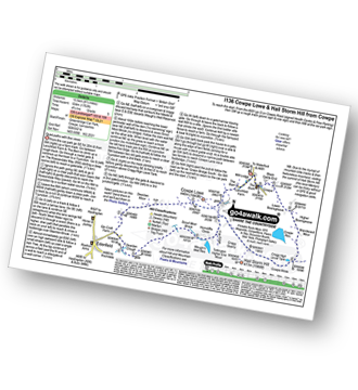
Detailed walk route map PDF
complete with GPS Waypoints
Route Summary:
Cowpe - Greenbridge Car Park - Lenchfold Farm - The Rossendale Way - Cowpe Lowe - Sand Beds Farm - Dearden Moor - Gin Croft Lane - Dearden Clough - Scout Moor Brook - Waugh's Well Reservoir - Horncliffe Close - Foe Edge - Cragg Quarry - Hail Storm Hill - Cowpe Moss - Cragg High Level Tank - Brandwood Moor - Higher Boarsgreave Moor - Lower Boarsgreave Moor - Cowpe,.

|
Vital Statistics:
| Length: | 5.5 miles (8.5 km) |
| Ascent: | 1,093 ft (333 m) |
| Time: | 3 hrs |
| Grade: | |
Walk route map pdf
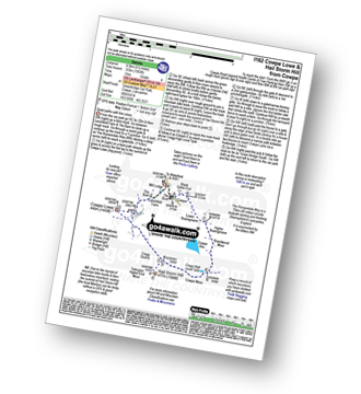
Detailed walk route map PDF
complete with GPS Waypoints
Route Summary:
Cowpe - Greenbridge Car Park - Lenchfold Farm - The Rossendale Way - Cowpe Lowe - Cragg Quarry - Hail Storm Hill - Cowpe Moss - Cragg High Level Tank - Brandwood Moor - Higher Boarsgreave Moor - Lower Boarsgreave Moor - Cowpe,.

|
Vital Statistics:
| Length: | 7.75 miles (12.5 km) |
| Ascent: | 1,536 ft (468 m) |
| Time: | 4½ hrs |
| Grade: | |
Walk route map pdf
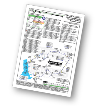
Detailed walk route map PDF
complete with GPS Waypoints
Route Summary:
Rivington Lane Car Park - Lever Park - The Castle (Lower Rivington Reservoir) - Lower Rivington Reservoir - Great House Information Centre - Rivington Hall - Rivington Cottage - Rivington Upper Barn - Pigeon Tower (Rivington Moor) - Catter Nab - Noon Hill Slack - Moor Bottom - Winter Hill (Rivington Moor) - Crooked Edge Hill - Two Lads (Rivington Moor) - Pike Cottage - Brown Hill (Rivington Moor) - Rivington Pike - Higher Knoll - Rivington Lane Car Park

|
Vital Statistics:
| Length: | 5.5 miles (8.5 km) |
| Ascent: | 1,113 ft (339 m) |
| Time: | 3.25 hrs |
| Grade: | |
Walk route map pdf
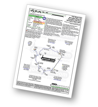
Detailed walk route map PDF
complete with GPS Waypoints
Route Summary:
Rivington Upper Barn - Pigeon Tower (Rivington Moor) - Catter Nab - Noon Hill Slack - Moor Bottom - Winter Hill (Rivington Moor) - Crooked Edge Hill - Two Lads (Rivington Moor) - Pike Cottage - Brown Hill (Rivington Moor) - Rivington Pike - Pigeon Tower (Rivington Moor) - Rivington Upper Barn

|
Vital Statistics:
| Length: | 8.5 miles (13.5 km) |
| Ascent: | 1,549 ft (472 m) |
| Time: | 4.75 hrs |
| Grade: | |
Walk route map pdf
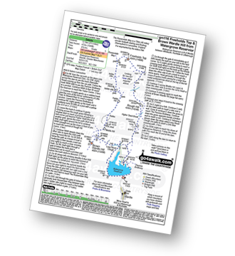
Detailed walk route map PDF
complete with GPS Waypoints
Route Summary:
Watergrove Reservoir - Wardle - Ramsden Road - The Pennine Bridleway - Crook Moor - Higher Slack Brook - Rough Hill (Shore Moor) - Freeholds Top - Trough Edge End - The Rossendale Way - Trough Edge - Deacon Pasture - Hades Hill - Hades - Middle Hill (Whitworth) - Brown Wardle Hill - Long Shoot Clough - Watergrove Reservoir - Wardle.

|
Vital Statistics:
| Length: | 4.5 miles (7 km) |
| Ascent: | 893 ft (272 m) |
| Time: | 2½ hrs |
| Grade: | |
Walk route map pdf

Detailed walk route map PDF
complete with GPS Waypoints
Route Summary:
Great House Information Centre - Rivington Hall - Rivington Cottage - Rivington Upper Barn - Pigeon Tower (Rivington Moor) - Rivington Pike - Brown Hill (Rivington Moor) - Higher Knoll - Rivington Lane Car Park - Lever Park - The Castle (Lower Rivington Reservoir) - Lower Rivington Reservoir - Great House Information Centre

|
Vital Statistics:
| Length: | 6.25 miles (10 km) |
| Ascent: | 1,017 ft (310 m) |
| Time: | 3½ hrs |
| Grade: | |
Walk route map pdf

Detailed walk route map PDF
complete with GPS Waypoints
Route Summary:
Hollingworth Lake Car Park - Ealees Brook - Brearley - Whittaker Golf Club - Lydgate - Blackstone Edge Pasture - The Pennine Way - Aiggin Stone - Blackstone Edge - Robin Hood Bed - Broad Head Drain - Hoar Edge - Clegg Moor - Dry Moor - Benny Hill - Syke Nab - Hollingworth Lake.

|
Vital Statistics:
| Length: | 6.25 miles (10 km) |
| Ascent: | 879 ft (268 m) |
| Time: | 3.25 hrs |
| Grade: | |
Walk route map pdf

Detailed walk route map PDF
complete with GPS Waypoints
Route Summary:
Lower Rivington Reservoir - Rivington - Upper Rivington Reservoir - Pilkington Wood - Street Wood - Yarrow Reservoir - Bradley Wood - Anglezarke Reservoir - High Bullough Reservoir - John Meadow Wood - Heapey Waterman's Cottage - Grey Heights Wood - Heapey Fold Lane - Kays Farm - Waring Fram - Lane Ends (Adlington) - Upper Rivington Reservoir - Lower Rivington Reservoir

|
Vital Statistics:
| Length: | 10 miles (16 km) |
| Ascent: | 1,115 ft (340 m) |
| Time: | 4½ hrs |
| Grade: | |
Walk route map pdf
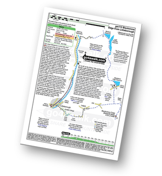
Detailed walk route map PDF
complete with GPS Waypoints
Route Summary:
Littleborough - Rochdale Way - Ealees Road - Ealees Brook - Brearley - Whittaker Colf Club - Lydgate - Blackstone Edge Pasture - Aiggin Stone - The Pennine Way - Blackstone Edge Moor - Blackstone Edge Reservoir - Chelburn Moor - Utley Edge - Light Hazzles Reservoir - Warland Reservoir - Warland - Rochdale Canal - Summit - Timbercliffe - Claderbrook - Littleborough

|
Vital Statistics:
| Length: | 6 miles (9.5 km) |
| Ascent: | 236 ft (72 m) |
| Time: | 2½ hrs |
| Grade: | |
Walk route map pdf

Detailed walk route map PDF
complete with GPS Waypoints
Route Summary:
Dunham Town - The Bridgewater Canal - The Cheshire Ring Canal Walk - Agden Bridge - Agden Brook Farm - Arthill Farm - Reddy Lane Cottage - Little Bollington - Dunham Massey Park - Dunham Park - Dunham Town
Not familiar with the area around M26?
See these 30 nearest walks to UK Postcode M26 on a google map

|
Vital Statistics:
| Length: | 8.25 miles (13 km) |
| Ascent: | 1,230 ft (375 m) |
| Time: | 4 hrs |
| Grade: | |
Walk route map pdf
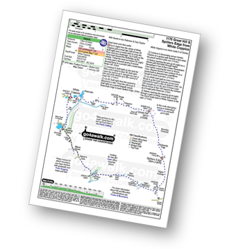
Detailed walk route map PDF
complete with GPS Waypoints
Route Summary:
White Coppice - Wheelton Moor - Withnell Moor - Great Hill - Redmonds Edge - Spitlers Edge - Horden Pasture - Lead Mines Clough - Anglezarke Reservoir - White Coppice

|
Vital Statistics:
| Length: | 5.5 miles (9 km) |
| Ascent: | 817 ft (249 m) |
| Time: | 2.75 hrs |
| Grade: | |
Walk route map pdf

Detailed walk route map PDF
complete with GPS Waypoints
Route Summary:
Warland - Warland Reservoir - Warland Drain - Langfield Common - Gaddings Dam - Basin Stones - Rake End - Walsden - Rochdale Canal - Warland,.

|
Vital Statistics:
| Length: | 8.5 miles (13.5 km) |
| Ascent: | 453 ft (138 m) |
| Time: | 3½ hrs |
| Grade: | |
Walk route map pdf

Detailed walk route map PDF
complete with GPS Waypoints
Route Summary:
Hale (near Altrincham) - The River Bollin - The Bollin Valley Way - Coppice Farm - Ryecroft Farm - Birkin Farm - Birtles Farm - New Mills - Breach House Farm - Higherhouse Farm - The River Bollin - Ross Mill - Hale.

|
Vital Statistics:
| Length: | 9 miles (14.5 km) |
| Ascent: | 131 ft (40 m) |
| Time: | 3½ hrs |
| Grade: | |
Walk route map pdf

Detailed walk route map PDF
complete with GPS Waypoints
Route Summary:
Blackstone Edge Reservoir - The Pennine Way - Cow Head - Byron Edge - Light Hazzles Edge - White Holme Reservoir - Farther Hill - Little Moor Stone - White Holme Drain - Blake Moor - Middle Moor - Cloven Stone - Turley Moor - Higher House Moor - Bird Nest Hill - Withins Moor - Warland Drain - The Pennine Way - Withins Clough Head - Warland Reservoir - Light Hazzles Reservoir - Utley Edge - Chelburn Moor - Blackstone Edge Reservoir

|
Vital Statistics:
| Length: | 5.25 miles (8.5 km) |
| Ascent: | 246 ft (75 m) |
| Time: | 2.25 hrs |
| Grade: | |
Walk route map pdf

Detailed walk route map PDF
complete with GPS Waypoints
Route Summary:
The Trans Pennine Trail (Lymm) - Lymm - The Bridgewater Canal - The Cheshire Ring Canal Walk - Lymm Village - The Dingle - Lymm Dam - The Bongs - Crosfield Bridge - Oughtrington - The Bridgewater Canal - The Cheshire Ring Canal Walk - Rushgreen - Slitten Gorge - The Trans Pennine Trail - Lymm.

|
Vital Statistics:
| Length: | 11 miles (17.5 km) |
| Ascent: | 269 ft (82 m) |
| Time: | 4½ hrs |
| Grade: | |
Walk route map pdf

Detailed walk route map PDF
complete with GPS Waypoints
Route Summary:
The Trans Pennine Trail (Lymm) - Lymm - Carr Green - Oldfield Brow - Altrincham - The Bridgewater Canal - The Cheshire Ring Canal Walk - Dunham Town - Dunham Massey - Little Bollington - The Bridgewater Canal - The Cheshire Ring Canal Walk - Agden Bridge - Oughtrington - Lymm Village - Slitten Gorge - The Trans Pennine Trail - Lymm.

|
Vital Statistics:
| Length: | 3.75 miles (6 km) |
| Ascent: | 204 ft (62 m) |
| Time: | 2 hrs |
| Grade: |  |
Walk route map pdf

Detailed walk route map PDF
complete with GPS Waypoints
Route Summary:
The Trans Pennine Trail (Lymm) - Lymm - The Bridgewater Canal - The Cheshire Ring Canal Walk - Lymm Village - The Dingle - Lymm Dam - The Bongs - Crosfield Bridge - Lymm Dam - The Dingle - Lymm Cross - The Bridgewater Canal - The Cheshire Ring Canal Walk - Slitten Gorge - The Trans Pennine Trail - Lymm.

|
Vital Statistics:
| Length: | 9.5 miles (15 km) |
| Ascent: | 1,543 ft (470 m) |
| Time: | 5 hrs |
| Grade: | |
Walk route map pdf
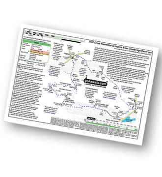
Detailed walk route map PDF
complete with GPS Waypoints
Route Summary:
Clowbridge Reservoir - The Burnley Way - Nutshaw Hill - Lower Nutshaw - Hameldon Hill - May Road Well - Great Hameldon - Hameldon Common - Hameldon Scouts - Lane Ends - Hapton - New Barn Farm - Helm Clough - Clowbridge Reservoir

|
Vital Statistics:
| Length: | 8.25 miles (13 km) |
| Ascent: | 1,230 ft (396 m) |
| Time: | 4.25 hrs |
| Grade: | |
Walk route map pdf
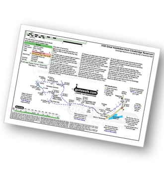
Detailed walk route map PDF
complete with GPS Waypoints
Route Summary:
Clowbridge Reservoir - The Burnley Way - Nutshaw Hill - Lower Nutshaw - Hameldon Hill - May Road Well - Great Hameldon - Hameldon Common - Hameldon Scouts - Clowbridge Reservoir

|
Vital Statistics:
| Length: | 7.25 miles (11.5 km) |
| Ascent: | 1,421 ft (433 m) |
| Time: | 4 hrs |
| Grade: | |
Walk route map pdf
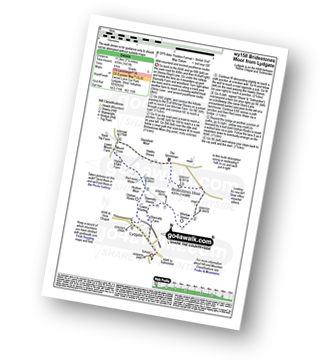
Detailed walk route map PDF
complete with GPS Waypoints
Route Summary:
Ewood Lane Car Park - Lydgate - Stoney Royd Lane - Stony Lane - Whirlaw Stones - Bridestones Moor - Hawks Stones - Mount Cross - Red Mires Water - Hudson Moor - Orphan Rocks - Lydgate.

|
Vital Statistics:
| Length: | 7 miles (11 km) |
| Ascent: | 1,615 ft (492 m) |
| Time: | 4.25 hrs |
| Grade: | |
Walk route map pdf

Detailed walk route map PDF
complete with GPS Waypoints
Route Summary:
Dove Stone Reservoir - Greenfield - The Oldham Way - Chew Brook - Chew Reservoir - Stable Stones Brow (Hoarstone Edge) - Alphin Pike - Dove Stone Reservoir

|
Vital Statistics:
| Length: | 8.5 miles (13.5 km) |
| Ascent: | 1,848 ft (563 m) |
| Time: | 5 hrs |
| Grade: |  |
Walk route map pdf

Detailed walk route map PDF
complete with GPS Waypoints
Route Summary:
Dove Stone Reservoir - Greenfield - The Oldham Way - Yeoman Hey Reservoir - Greenfield Reservoir - Birchin Clough - Raven Stones Brow - Ashway Rocks - Ashway Gap - Dean Rocks - Great Dove Stone Rocks - Dove Stone Moss - Chew Reservoir - Chew Brook - Dove Stone Reservoir

|
Vital Statistics:
| Length: | 6.25 miles (10 km) |
| Ascent: | 1,441 ft (439 m) |
| Time: | 3.75 hrs |
| Grade: | |
Walk route map pdf

Detailed walk route map PDF
complete with GPS Waypoints
Route Summary:
Dove Stone Reservoir - Greenfield - The Oldham Way - Yeoman Hey Reservoir - Ashway Rocks - Ashway Gap - Dean Rocks - Great Dove Stone Rocks - Dove Stone Moss - Chew Reservoir - Chew Brook - Dove Stone Reservoir

|
Vital Statistics:
| Length: | 8.25 miles (13 km) |
| Ascent: | 1,870 ft (570 m) |
| Time: | 4½ hrs |
| Grade: | |
Walk route map pdf
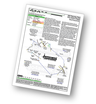
Detailed walk route map PDF
complete with GPS Waypoints
Route Summary:
Holme Chapel - The Burnley Way - Scout Farm - Cow Side Farm - Black Clough (Deerplay Moor) - Thieveley Pike - Heald Moor - Portsmouth - Dean Farm - Black Scout - Cartridge Pasture - Holme Chapel

|
Vital Statistics:
| Length: | 4.5 miles (7 km) |
| Ascent: | 729 ft (222 m) |
| Time: | 2½ hrs |
| Grade: | |
Walk route map pdf
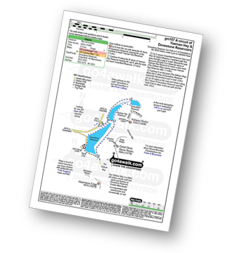
Detailed walk route map PDF
complete with GPS Waypoints
Route Summary:
Dove Stone Reservoir - Greenfield - The Oldham Way - Yeoman Hey Reservoir - Dove Stone Reservoir
Not familiar with the area around M26?
See these 30 nearest walks to UK Postcode M26 on a google map


