Nineteen easy to follow walks from Low Wray National Trust Campsite, Low Wray, The Lake District, Cumbria, England
To reach Low Wray National Trust Campsite, Low Wray, in-car SatNav users should select the Latitude/Longitude (Lat Lon) screen and enter:
Lat = N54.40082 and Lon = W2.96621 or postcode: LA22 0JA
Tap/mouse over a coloured circle (1-3 easy walks, 4-6 moderate walks, 7-9 hard walks) and click to select.
Tap/mouse over a coloured circle (1-3 easy walks, 4-6 moderate walks, 7-9 hard walks) and click to select.
Nineteen easy to follow walks from Low Wray National Trust Campsite, Low Wray, The Lake District, Cumbria, England
Scroll down the list of walks below & click on each walk title (in blue) to locate it on the map above.
   |
Vital Statistics:
| Length: | 5.5 miles (9 km) |
| Ascent: | 893ft (272m) |
| Time: | 3 hrs |
| Grade: |  |
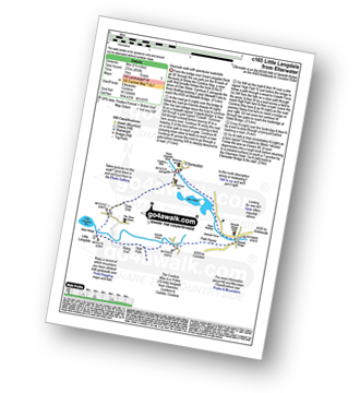
Route Summary:
Elterwater - The Cumbria Way - Elter Water - Skelwith Force - River Brathay - Skelwith Bridge - Low Park - High Park - High Colwith - Colwith Force - Stang End - Little Langdale - Slater Bridge - Little Langdale Tarn - Dale End - Elterwater
|
Vital Statistics:
| Length: | 8.75 miles (14 km) |
| Ascent: | 558ft (170m) |
| Time: | 3½ hrs |
| Grade: | |
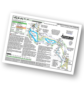
Route Summary:
Ambleside - Scandale Beck - Rydal Park - Rydal Hall - Rydal - Rydal Mount - Rydal Water - Coffin Route - Dove Cottage - Grasmere Village - Silverhowe - The Lea - Grasmere - Red Bank - Rydal Cave - Jobson Close - Rough Intake - Pelter Bridge - Foxghyll - River Rothay - Rothay Park - Ambleside
|
Vital Statistics:
| Length: | 3.25 miles (5 km) |
| Ascent: | 1,428ft (435m) |
| Time: | 2½ hrs |
| Grade: | |

|
Vital Statistics:
| Length: | 7.25 miles (11.5 km) |
| Ascent: | 1,247ft (380m) |
| Time: | 3.75hrs |
| Grade: |  |

Route Summary:
Windermere - Orrest Head - Moorhowe - Dubbs Road - Garburn Road - Longmire Road - Far Orrest Farm - Orrest Head - Windermere
|
Vital Statistics:
| Length: | 6 miles (9.5 km) |
| Ascent: | 1,401ft (427m) |
| Time: | 3½ hrs |
| Grade: | |

Route Summary:
Ambleside - Rothay Park - Ivy Fell - Loughrigg Fell - Loughrigg Terrace - Rydal Water - Loughrigg Caves - River Rothay - Pelter Bridge - Ambleside
|
Vital Statistics:
| Length: | 7.5 miles (12 km) |
| Ascent: | 787ft (240m) |
| Time: | 3½ hrs |
| Grade: | |

Route Summary:
Windermere - Ellery Woods - Orrest Head - Near Orrest Farm - Mislet Farm - Heaning Farm - Blackmoss Farm - School Knott Plantation - School Knott - The Dales Way - High Cleabarrow Farm - Matson Ground - Heaththwaite Manor - Windermere
|
Vital Statistics:
| Length: | 5.25 miles (8.5 km) |
| Ascent: | 1,099ft (335m) |
| Time: | 3 hrs |
| Grade: | |

Route Summary:
Elterwater - Walthwaite Common - Huntingstile Crag - Red Bank Wood - Loughrigg Terrace - Loughrigg Fell - Ivy Crag - Loughrigg Tarn - Tarn Foot - Skelwith Bridge - River Brathay - Skelwith Force - The Cumbria Way - Elter Water - Elterwater
|
Vital Statistics:
| Length: | 7.25 miles (11.5 km) |
| Ascent: | 896ft (273m) |
| Time: | 3½ hrs |
| Grade: | |

Route Summary:
Hawkshead - Colthouse - Long Height - Holland Band Planation - Wise Een Tarn - Scale Tarn - Moss Eccles Tarn - Stones Lane - Near Sawrey - Hill Top (former Home of Beatrix Potter) - Ees Bridge - Esthwaite Tarn - Howe Farm - Roger Ground - Hawkshead
|
Vital Statistics:
| Length: | 5 miles (8 km) |
| Ascent: | 1,769ft (539m) |
| Time: | 3.75hrs |
| Grade: | |

Route Summary:
Ambleside - Stockghyll Force - Wansfell Pike - Baystones (Wansfell) - Wansfell Pike - Stockghyll Force - Ambleside
|
Vital Statistics:
| Length: | 8.5 miles (13.5 km) |
| Ascent: | 1,644ft (501m) |
| Time: | 4.75hrs |
| Grade: |  |

Route Summary:
Far Sawrey - Mitchell Knotts - Low Pate Crag - Claife Heights (High Blind How) - The Heald - High Moss - Belle Grange Beck - Long Height - Latterbarrow - High Wray - Red Nap Car Park - Lake Windermere - Belle Grange Bay - Bark Barn Ferry - Slape Scar - Strawberry Gardens - Far Sawrey
|
Vital Statistics:
| Length: | 8.5 miles (13.5 km) |
| Ascent: | 1,447ft (441m) |
| Time: | 4½ hrs |
| Grade: | |

Route Summary:
Elterwater - Elterwater Bridge - Little Langdale - Little Langdale Tarn - Bridge End - Fell Foot Bridge - Castle Howe - Blea Tarn (Langdale) - Great Langdale - Oak Howe - Chapel Stile - Elterwater
|
Vital Statistics:
| Length: | 6 miles (9.5 km) |
| Ascent: | 2,192ft (668m) |
| Time: | 5 hrs |
| Grade: | |
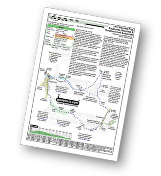
Route Summary:
Ambleside - Stockghyll Force - Wansfell Pike - Baystones (Wansfell) - The Hundreds - Nanny Lane - Troutbeck - Robin Lane - High Skelghyll Farm - Skelghyll Wood - Jenkin Crag - Ambleside
|
Vital Statistics:
| Length: | 7 miles (11 km) |
| Ascent: | 1,920ft (585m) |
| Time: | 4½ hrs |
| Grade: | |

Route Summary:
Elterwater - Blea Tarn (Langdale) - Side Pike - Fat Man's Agony (or Fat Man's Struggle) - Lingmoor Fell - Dale End - Birk Howe - Slater Bridge - Little Langdale Tarn - Bridge End - Fell Foot Bridge - Castle Howe - Blea Tarn (Langdale) - Elterwater
|
Vital Statistics:
| Length: | 7 miles (11 km) |
| Ascent: | 1,976ft (602m) |
| Time: | 4½ hrs |
| Grade: | |

Route Summary:
Elterwater - Elterwater Bridge - Dale End - Lingmoor Fell - Fat Man's Agony (or Fat Man's Struggle) - Side Pike - Great Langdale - Side House Farm - The Cumbria Way - Oak Howe - Chapel Stile - Elterwater Bridge - Elterwater
|
Vital Statistics:
| Length: | 7.5 miles (12 km) |
| Ascent: | 2,519ft (768m) |
| Time: | 5.25hrs |
| Grade: |  |
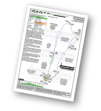
Route Summary:
Ambleside - Snarker Pike - Red Screes - Scandale Pass - High Sweden Bridge - Ambleside
|
Vital Statistics:
| Length: | 9.75 miles (15.5 km) |
| Ascent: | 3,551ft (1,082m) |
| Time: | 7.25hrs |
| Grade: |  |

Route Summary:
Ambleside - Snarker Pike - Red Screes - Scandale Pass - Little Hart Crag - Dove Crag - High Pike (Scandale) - Low Pike (Scandale) - High Sweden Bridge - Ambleside
|
Vital Statistics:
| Length: | 11 miles (17.5 km) |
| Ascent: | 3,633ft (1,107m) |
| Time: | 7.75hrs |
| Grade: | |

Route Summary:
Ambleside - Rydal - Nab Scar - Heron Pike - Rydal Fell (Heron Pike North Top) - Great Rigg - Fairfield - Rydal Head - Hart Crag - Dove Crag - High Pike (Scandale) - Low Pike (Scandale) - High Sweden Bridge - High Sweden Coppice - Ambleside
|
Vital Statistics:
| Length: | 12.5 miles (20 km) |
| Ascent: | 3,411ft (1,040m) |
| Time: | 8 hrs |
| Grade: |  |

Route Summary:
Ambleside - Rydal - Nab Scar - Heron Pike - Rydal Fell (Heron Pike North Top) - Great Rigg - Fairfield - Rydal Head - Hart Crag - Dove Crag - Little Hart Crag - Scandale Pass - Red Screes - Snarker Pike - Ambleside
|
Vital Statistics:
| Length: | 12.25 miles (19.5 km) |
| Ascent: | 3,984ft (1,214m) |
| Time: | 8½ hrs |
| Grade: | |

Route Summary:
Ambleside - Rydal - Nab Scar - Heron Pike - Rydal Fell (Heron Pike North Top) - Greenhead Gill Head - Stone Arthur - Great Rigg - Fairfield - Rydal Head - Hart Crag - Dove Crag - High Pike (Scandale) - Low Pike (Scandale) - High Sweden Bridge - High Sweden Coppice - Ambleside


