
![]()
Red Screes
776m (2547ft)
The Eastern Fells, The Lake District, Cumbria, England
Tap/mouse over a coloured circle (1-3 easy walks, 4-6 moderate walks, 7-9 hard walks) and click to select.
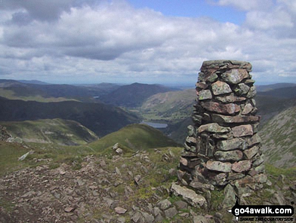
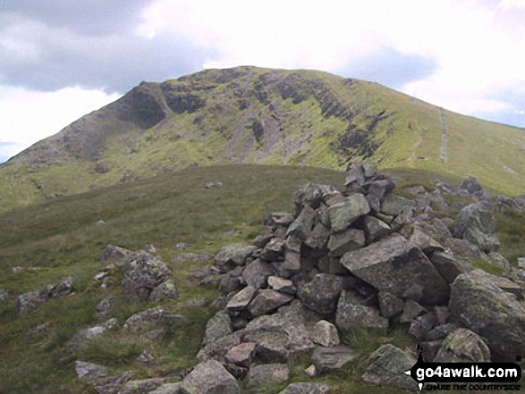
The summit of Red Screes is marked by an Ordnance Survey Trig Point.
Not familiar with this top?
   |
|---|
Vital Statistics:
| Length: | 7ml (11km) |
|---|---|
| Ascent: | 2,373ft (723m) |
| Time: | 5 hrs |
| Grade: |  (Moderate) (Moderate) |
Route Summary:
Cow Bridge - Brothers Water - Hartsop Hall - Kirkstone Beck - Caiston Beck - Middle Dodd - Red Screes - Scandale Pass - Caiston Beck - Brothers Water.
|
|---|
Vital Statistics:
| Length: | 7ml (11km) |
|---|---|
| Ascent: | 2,737ft (834m) |
| Time: | 5.25hrs |
| Grade: |  (Moderate) (Moderate) |
Route Summary:
Cow Bridge - Brothers Water - Hartsop Hall - Kirkstone Beck - Caiston Beck - Middle Dodd - Red Screes - Scandale Pass - Little Hart Crag - High Hartsop Dodd - Caiston Beck - Cow Bridge - Brothers Water.
|
|---|
Vital Statistics:
| Length: | 7.5ml (12km) |
|---|---|
| Ascent: | 2,519ft (768m) |
| Time: | 5.25hrs |
| Grade: | (Moderate) |
Route Summary:
Ambleside - Snarker Pike - Red Screes - Scandale Pass - High Sweden Bridge - Ambleside
|
|---|
Vital Statistics:
| Length: | 9.75ml (15.5km) |
|---|---|
| Ascent: | 3,551ft (1,082m) |
| Time: | 7.25hrs |
| Grade: |  (Hard) (Hard) |

Route Summary:
Ambleside - Snarker Pike - Red Screes - Scandale Pass - Little Hart Crag - Dove Crag - High Pike (Scandale) - Low Pike (Scandale) - High Sweden Bridge - Ambleside
|
|---|
Vital Statistics:
| Length: | 9.75ml (15.5km) |
|---|---|
| Ascent: | 3,699ft (1,127m) |
| Time: | 7.25hrs |
| Grade: | (Hard) |
Route Summary:
Cow Bridge Car Park - Brothers Water - Hartsop Hall - Kirkstone Beck - Caiston Beck - Middle Dodd - Red Screes - Scandale Pass - Little Hart Crag - Dove Crag - Hart Crag - Blake Brow - Hartsop Above How - Hoggill Brow - Gale Crag - Bleaberry Knott - Cockley How - Cow Bridge
|
|---|
Vital Statistics:
| Length: | 12.5ml (20km) |
|---|---|
| Ascent: | 3,411ft (1,040m) |
| Time: | 8 hrs |
| Grade: |  (Hard) (Hard) |

Route Summary:
Ambleside - Rydal - Nab Scar - Heron Pike - Rydal Fell (Heron Pike North Top) - Great Rigg - Fairfield - Rydal Head - Hart Crag - Dove Crag - Little Hart Crag - Scandale Pass - Red Screes - Snarker Pike - Ambleside
|
|---|
Vital Statistics:
| Length: | 13.75ml (22km) |
|---|---|
| Ascent: | 5,501ft (1,676m) |
| Time: | 10½ hrs |
| Grade: |  (Very Hard) (Very Hard) |
Route Summary:
Cow Bridge Car Park - Brothers Water - Hartsop - Hartsop Dodd - Caudale Moor - Stony Cove Pike (Caudale Moor) - Caudale Head - Pike How - St Raven's Edge - The Kirkstone Pass - Red Screes - Smallthwaite Band - Middle Dodd - Scandale Pass - Little Hart Crag - High Hartsop Dodd - Little Hart Crag - Scandale Head - Dove Crag - Hart Crag - Blake Brow - Hartsop Above How - Hoggill Brow - Gale Crag - Bleaberry Knott - Cockley How - Cow Bridge
See Red Screes and the surrounding tops on our free-to-access 'Google Style' Peak Bagging Maps:
The Eastern Fells of The Lake District National Park
Less data - quicker to download
The Whole of The Lake District National Park
More data - might take a little longer to download
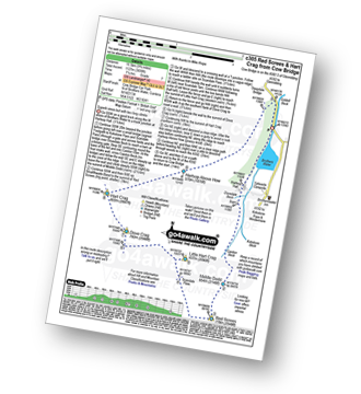
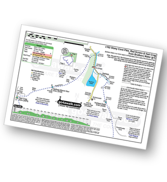
See Red Screes and the surrounding tops on our downloadable Peak Bagging Maps in PDF format:

NB: Whether you print off a copy or download it to your phone, these PDF Peak Baggers' Maps might prove incredibly useful when your are up there on the tops and you cannot get a phone signal.
*This version is marked with the walk routes you need to follow to Walk all 214 Wainwrights in just 59 walks.
You can find Red Screes & all the walks that climb it on these unique free-to-access Interactive Walk Planning Maps:
1:25,000 scale OS Explorer Map (orange/yellow covers):
1:50,000 scale OS Landranger Map (pink/magenta covers):
 Fellow go4awalkers who have already walked, climbed, summited & bagged Red Screes
Sarah Moore walked up Red Screes on December 30th, 2025 [from/via/route] c351 route - but started at Sykeside as staying in the bunkhouse. East start & don't feel like I've missed anything! [with] A day on my own - not done that in a while. [weather] Great winter conditions. Clear to start until I got to Red Screes but the cloud came in & I even felt a touch of snow! Perfect but very cold & essential to be wrapped up properly. - Loved it - it felt slow; particularly going up Middle Dodd, but this was never about racing & it was so icy & slippery in places. I did NOT expect the view as I hit the Red Screes trig - & to be able to see to the coast... just wow. Not many people out - didn't see anyone for an hour & a half, & only 5 groups all the way round - perfect.
Jason Aspinall climbed it on May 1st, 2025 [from/via/route] Brothers Water [weather] Sunny
Andrew Gayne bagged it on April 30th, 2025 [from/via/route] From Brothers Water Car Park [with] Becky [weather] Really sunny & very hot, hottest day of the year - In the lakes for 2 days. Stayed in Ambleside overnight & drove to Brothers Water. A long lovely walk to the start of the climb up Middle Dodd but got lost & missed the path & had a tortuous climb up a mossy steep slope that made for a difficult & long walk. Went on to Red Screes, then Little Hart Crag & finally High Hartsop Dodd
David Higginbottom hiked Red Screes on April 30th, 2025 [from/via/route] Walk 351 very nice walk but tough at start [with] Carolyn [weather] Clear & nice & sunny
Ian Ashton summited on April 2nd, 2022 [with] Solo - Done 2nd time 29/09/24 with jph
To add (or remove) your name and experiences on this page - Log On and edit your Personal Mountain Bagging Record
. . . [see more walk reports]
More Photographs & Pictures of views from, on or of Red Screes

Red Screes (left), Thornthwaite Crag, Froswick, Ill Bell and Yoke from Baystones (Wansfell)
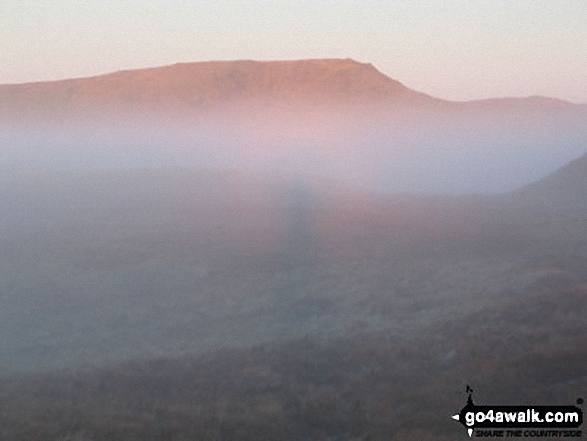
A Brocken Spectre (almost) with Red Screes beyond from the lower slopes of Yoke
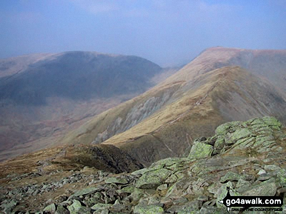
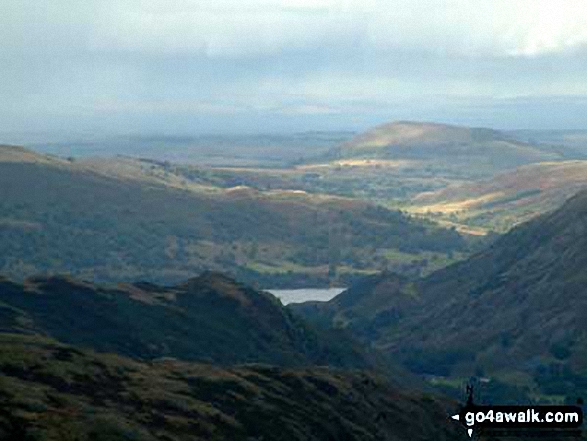
Middle Dodd, Red Screes, Snarker Pike, the Scandale Valley and Lake Windermere from High Pike (Scandale)
Thornthwaite Crag (left), Hartsop Dodd and Stony Cove Pike (Caudale Moor) (centre), Red Screes (right) and the shoulder of Hartsop above How (foreground) from Arnison Crag, Patterdale
Cofa Pike and Fairfield from High Crag (Helvellyn) with Red Screes in the distance
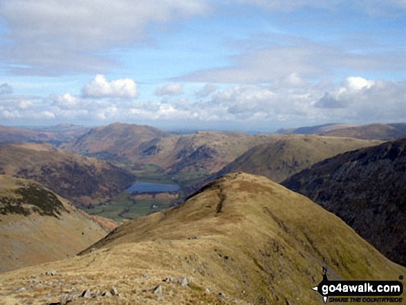
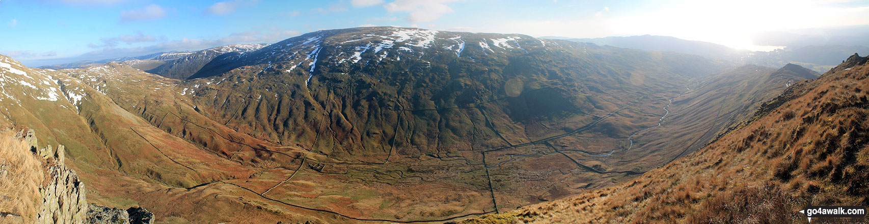
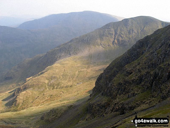
Middle Dodd with Place Fell, Angletarn Peaks and Hartsop Dodd beyond Brothers Water in the valley below from Red Screes

. . . see all 17 walk photographs & pictures of views from, on or of Red Screes
Send us your photographs and pictures on, of, or from Red Screes
If you would like to add your walk photographs and pictures to this page, please send them as email attachments (configured for any computer) along with your name to:
and we shall do our best to publish them.
(Guide Resolution = 300dpi. At least = 660pixels (wide) x 440 pixels (high).)

You can also submit photos via our Facebook Page.
NB. Please indicate where each photo was taken and whether you wish us to credit your photos with a Username or your First Name/Last Name.


