Snowdonia National Park - a fully detailed list of all the Mountains, Peaks, Tops and Hills (Page 1 of 2)
Snowdonia National Park in Clwyd, Conwy, Gwynedd and Powys is the area of Wales within the Snowdonia National Park boundary including the non-National Park 'island' around Blaenau Ffestiniog.
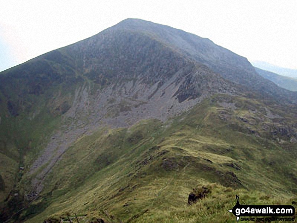
If you count only the Marilyns there are 47 tops to climb, bag & conquer and the highest point is Snowdon (Yr Wyddfa) at 1,085m (3,561ft).
To see these Mountains, Peaks, Tops and Hills displayed in different ways - see the options in the left-hand column and towards the bottom of this page.
LOG ON and RELOAD this page to show which Mountains, Peaks, Tops and Hills you have already climbed, bagged & conquered [. . . more details]
Page 1 of 2 Go to page:
1 2 |
See this list in: Alphabetical Order
| Height Order‡
To reverse the order select the link again.
Mountain, Peak, Top or Hill:
Bagged
1. Gamallt (Abergynolwyn)
288m (945ft)
Marilyn (145th in Wales, 1399th in GB)
We hope to have walks that climb & bag Gamallt (Abergynolwyn) very soon
See the location of Gamallt (Abergynolwyn) and walks up it on a google MapGamallt (Abergynolwyn) is on interactive maps:
OS Explorer (Orange Covers): OL23
OS Landranger (Pink Covers): 124
Gamallt (Abergynolwyn) is on downloadable PDF you can Print or Save to your Phone:
|
2. Ffridd Cocyn
313m (1,027ft)
Marilyn (139th in Wales, 1363rd in GB)
We hope to have walks that climb & bag Ffridd Cocyn very soon
See the location of Ffridd Cocyn and walks up it on a google MapFfridd Cocyn is on interactive maps:
OS Explorer (Orange Covers): OL23
OS Landranger (Pink Covers): 135
Ffridd Cocyn is on downloadable PDF you can Print or Save to your Phone:
|
3. Craig y Castell
321m (1,054ft)
Marilyn (138th in Wales, 1343rd in GB)
We hope to have walks that climb & bag Craig y Castell very soon
See the location of Craig y Castell and walks up it on a google MapCraig y Castell is on interactive maps:
OS Explorer (Orange Covers): OL23
OS Landranger (Pink Covers): 124
Craig y Castell is on downloadable PDF you can Print or Save to your Phone:
|
4. Foel Cae'rberllan
380m (1,247ft)
Marilyn (118th in Wales, 1248th in GB)
We hope to have walks that climb & bag Foel Cae'rberllan very soon
See the location of Foel Cae'rberllan and walks up it on a google MapFoel Cae'rberllan is on interactive maps:
OS Explorer (Orange Covers): OL23
OS Landranger (Pink Covers): 124
Foel Cae'rberllan is on downloadable PDF you can Print or Save to your Phone:
|
5. Moel y Dyniewyd
382m (1,254ft)
Marilyn (115th in Wales, 1242nd in GB)
We hope to have walks that climb & bag Moel y Dyniewyd very soon
See the location of Moel y Dyniewyd and walks up it on a google MapMoel y Dyniewyd is on interactive maps:
OS Explorer (Orange Covers): OL17
OS Landranger (Pink Covers): 115
Moel y Dyniewyd is on downloadable PDF you can Print or Save to your Phone:
|
6. Foel Offrwm
405m (1,329ft)
Marilyn (109th in Wales, 1197th in GB)
We hope to have walks that climb & bag Foel Offrwm very soon
See the location of Foel Offrwm and walks up it on a google MapFoel Offrwm is on interactive maps:
OS Explorer (Orange Covers): OL18
OS Landranger (Pink Covers): 124
Foel Offrwm is on downloadable PDF you can Print or Save to your Phone:
|
7. Mynydd Cwmcelli (Craig Goch)
469m (1,539ft)
Marilyn (94th in Wales, 1053rd in GB)
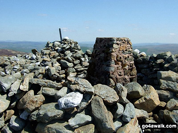
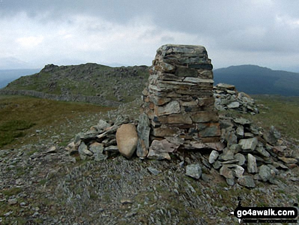
OS Trig Point
We hope to have walks that climb & bag Mynydd Cwmcelli (Craig Goch) very soon
See the location of Mynydd Cwmcelli (Craig Goch) and walks up it on a google MapMynydd Cwmcelli (Craig Goch) is on interactive maps:
OS Explorer (Orange Covers): OL23
OS Landranger (Pink Covers): 124
Mynydd Cwmcelli (Craig Goch) is on downloadable PDF you can Print or Save to your Phone:
|
8. Mynydd Nodol
539m (1,769ft)
Dewey (119th in Wales, 213th in England & Wales)
Marilyn (74th in Wales, 898th in GB)
We hope to have walks that climb & bag Mynydd Nodol very soon
See the location of Mynydd Nodol and walks up it on a google MapMynydd Nodol is on interactive maps:
OS Explorer (Orange Covers): OL18
OS Landranger (Pink Covers): 124 and
125
Mynydd Nodol is on downloadable PDF you can Print or Save to your Phone:
|
9. Moel-ddu (Moel Hebog)
553m (1,814ft)
Dewey (86th in Wales, 150th in England & Wales)
Marilyn (67th in Wales, 866th in GB)
We hope to have walks that climb & bag Moel-ddu (Moel Hebog) very soon
See the location of Moel-ddu (Moel Hebog) and walks up it on a google MapMoel-ddu (Moel Hebog) is on interactive maps:
OS Explorer (Orange Covers): OL17
OS Landranger (Pink Covers): 124
Moel-ddu (Moel Hebog) is on downloadable PDF you can Print or Save to your Phone:
|
10. Moelfre (Rhinogs)
589m (1,933ft)
Dewey (29th in Wales, 48th in England & Wales)
Marilyn (59th in Wales, 788th in GB)
We hope to have walks that climb & bag Moelfre (Rhinogs) very soon
See the location of Moelfre (Rhinogs) and walks up it on a google MapMoelfre (Rhinogs) is on interactive maps:
OS Explorer (Orange Covers): OL18
OS Landranger (Pink Covers): 124
Moelfre (Rhinogs) is on downloadable PDF you can Print or Save to your Phone:
|
11. Tal y Fan
610m (2,002ft)
Mountain (135th in Wales, 315th in England & Wales)
Nuttall (187th in Wales, 437th in England & Wales)
Marilyn (54th in Wales, 751st in GB)
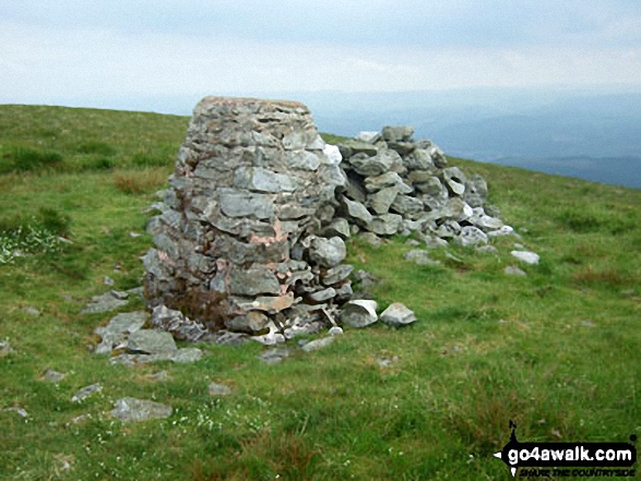
OS Trig Point
To walk, climb & bag Tal y Fan use any of these easy-to-follow walks:
See the location of Tal y Fan and walks up it on a google MapTal y Fan is on interactive maps:
OS Explorer (Orange Covers): OL17
OS Landranger (Pink Covers): 115
Tal y Fan is on downloadable PDF you can Print or Save to your Phone:
|
12. Moel Ysgyfarnogod
623m (2,044ft)
Mountain (121st in Wales, 287th in England & Wales)
Nuttall (168th in Wales, 395th in England & Wales)
Marilyn (50th in Wales, 722nd in GB)
OS Trig Point
To walk, climb & bag Moel Ysgyfarnogod use this easy-to-follow walk:
See the location of Moel Ysgyfarnogod and walks up it on a google MapMoel Ysgyfarnogod is on interactive maps:
OS Explorer (Orange Covers): OL18
OS Landranger (Pink Covers): 124
Moel Ysgyfarnogod is on downloadable PDF you can Print or Save to your Phone:
|
13. Y Garn (Rhinogs)
629m (2,064ft)
Mountain (117th in Wales, 278th in England & Wales)
Nuttall (161st in Wales, 376th in England & Wales)
Marilyn (49th in Wales, 717th in GB)
To walk, climb & bag Y Garn (Rhinogs) use this easy-to-follow walk:
See the location of Y Garn (Rhinogs) and walks up it on a google MapY Garn (Rhinogs) is on interactive maps:
OS Explorer (Orange Covers): OL18
OS Landranger (Pink Covers): 124
Y Garn (Rhinogs) is on downloadable PDF you can Print or Save to your Phone:
|
14. Tarrenhendre
634m (2,081ft)
Mountain (111th in Wales, 268th in England & Wales)
Nuttall (151st in Wales, 360th in England & Wales)
Marilyn (48th in Wales, 712th in GB)
To walk, climb & bag Tarrenhendre use either of these easy-to-follow walks:
See the location of Tarrenhendre and walks up it on a google MapTarrenhendre is on interactive maps:
OS Explorer (Orange Covers): OL23
OS Landranger (Pink Covers): 135
Tarrenhendre is on downloadable PDF you can Print or Save to your Phone:
|
15. Manod Mawr
661m (2,169ft)
Mountain (95th in Wales, 230th in England & Wales)
Nuttall (127th in Wales, 307th in England & Wales)
Marilyn (45th in Wales, 674th in GB)
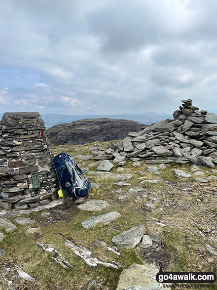
OS Trig Point
To walk, climb & bag Manod Mawr use this easy-to-follow walk:
See the location of Manod Mawr and walks up it on a google MapManod Mawr is on interactive maps:
OS Explorer (Orange Covers): OL18
OS Landranger (Pink Covers): 124
Manod Mawr is on downloadable PDF you can Print or Save to your Phone:
|
16. Tarren y Gesail
667m (2,189ft)
Mountain (91st in Wales, 222nd in England & Wales)
Nuttall (121st in Wales, 295th in England & Wales)
Marilyn (43rd in Wales, 661st in GB)
OS Trig Point
To walk, climb & bag Tarren y Gesail use this easy-to-follow walk:
See the location of Tarren y Gesail and walks up it on a google MapTarren y Gesail is on interactive maps:
OS Explorer (Orange Covers): OL23
OS Landranger (Pink Covers): 124
Tarren y Gesail is on downloadable PDF you can Print or Save to your Phone:
|
17. Carnedd y Filiast (Arenigs)
669m (2,195ft)
Mountain (89th in Wales, 217th in England & Wales)
Nuttall (117th in Wales, 287th in England & Wales)
Marilyn (41st in Wales, 652nd in GB)
OS Trig Point
We hope to have walks that climb & bag Carnedd y Filiast (Arenigs) very soon
See the location of Carnedd y Filiast (Arenigs) and walks up it on a google MapCarnedd y Filiast (Arenigs) is on interactive maps:
OS Explorer (Orange Covers): OL18
OS Landranger (Pink Covers): 124 and
125
Carnedd y Filiast (Arenigs) is on downloadable PDF you can Print or Save to your Phone:
|
18. Esgeiriau Gwynion
671m (2,202ft)
Mountain (85th in Wales, 213th in England & Wales)
Nuttall (115th in Wales, 284th in England & Wales)
Marilyn (40th in Wales, 650th in GB)
To walk, climb & bag Esgeiriau Gwynion use this easy-to-follow walk:
See the location of Esgeiriau Gwynion and walks up it on a google MapEsgeiriau Gwynion is on interactive maps:
OS Explorer (Orange Covers): OL23
OS Landranger (Pink Covers): 124
Esgeiriau Gwynion is on downloadable PDF you can Print or Save to your Phone:
|
19. Moel Cynghorion
674m (2,212ft)
Mountain (83rd in Wales, 205th in England & Wales)
Nuttall (113th in Wales, 274th in England & Wales)
Marilyn (39th in Wales, 643rd in GB)
To walk, climb & bag Moel Cynghorion use any of these easy-to-follow walks:
See the location of Moel Cynghorion and walks up it on a google MapMoel Cynghorion is on interactive maps:
OS Explorer (Orange Covers): OL17
OS Landranger (Pink Covers): 115
Moel Cynghorion is on downloadable PDF you can Print or Save to your Phone:
|
20. Creigiau Gleision
678m (2,225ft)
Mountain (80th in Wales, 197th in England & Wales)
Nuttall (109th in Wales, 263rd in England & Wales)
Marilyn (37th in Wales, 634th in GB)
To walk, climb & bag Creigiau Gleision use any of these easy-to-follow walks:
See the location of Creigiau Gleision and walks up it on a google MapCreigiau Gleision is on interactive maps:
OS Explorer (Orange Covers): OL17
OS Landranger (Pink Covers): 115
Creigiau Gleision is on downloadable PDF you can Print or Save to your Phone:
|
21. Maesglase (Craig Rhiw-erch)
678m (2,226ft)
Mountain (82nd in Wales, 199th in England & Wales)
Nuttall (108th in Wales, 261st in England & Wales)
Marilyn (38th in Wales, 641st in GB)
To walk, climb & bag Maesglase (Craig Rhiw-erch) use this easy-to-follow walk:
See the location of Maesglase (Craig Rhiw-erch) and walks up it on a google MapMaesglase (Craig Rhiw-erch) is on interactive maps:
OS Explorer (Orange Covers): OL23
OS Landranger (Pink Covers): 124 and
125
Maesglase (Craig Rhiw-erch) is on downloadable PDF you can Print or Save to your Phone:
|
22. Arenig Fach
689m (2,261ft)
Mountain (73rd in Wales, 184th in England & Wales)
Nuttall (95th in Wales, 239th in England & Wales)
Marilyn (36th in Wales, 613th in GB)
OS Trig Point
To walk, climb & bag Arenig Fach use this easy-to-follow walk:
See the location of Arenig Fach and walks up it on a google MapArenig Fach is on interactive maps:
OS Explorer (Orange Covers): OL18
OS Landranger (Pink Covers): 124 and
125
Arenig Fach is on downloadable PDF you can Print or Save to your Phone:
|
23. Allt-fawr (Moelwyns)
698m (2,291ft)
Mountain (68th in Wales, 175th in England & Wales)
Nuttall (88th in Wales, 223rd in England & Wales)
Marilyn (34th in Wales, 599th in GB)
To walk, climb & bag Allt-fawr (Moelwyns) use this easy-to-follow walk:
See the location of Allt-fawr (Moelwyns) and walks up it on a google MapAllt-fawr (Moelwyns) is on interactive maps:
OS Explorer (Orange Covers): OL17
OS Landranger (Pink Covers): 115
Allt-fawr (Moelwyns) is on downloadable PDF you can Print or Save to your Phone:
|
24. Mynydd Mawr (Llyn Cwellyn)
698m (2,291ft)
Mountain (69th in Wales, 176th in England & Wales)
Nuttall (89th in Wales, 224th in England & Wales)
Marilyn (35th in Wales, 601st in GB)
To walk, climb & bag Mynydd Mawr (Llyn Cwellyn) use this easy-to-follow walk:
See the location of Mynydd Mawr (Llyn Cwellyn) and walks up it on a google MapMynydd Mawr (Llyn Cwellyn) is on interactive maps:
OS Explorer (Orange Covers): OL17
OS Landranger (Pink Covers): 115
Mynydd Mawr (Llyn Cwellyn) is on downloadable PDF you can Print or Save to your Phone:
|
25. Trum y Ddysgl
709m (2,327ft)
Mountain (65th in Wales, 160th in England & Wales)
Nuttall (84th in Wales, 202nd in England & Wales)
Marilyn (32nd in Wales, 572nd in GB)
To walk, climb & bag Trum y Ddysgl use any of these easy-to-follow walks:
See the location of Trum y Ddysgl and walks up it on a google MapTrum y Ddysgl is on interactive maps:
OS Explorer (Orange Covers): OL17
OS Landranger (Pink Covers): 115
Trum y Ddysgl is on downloadable PDF you can Print or Save to your Phone:
|
26. Rhinog Fach
712m (2,337ft)
Mountain (63rd in Wales, 156th in England & Wales)
Nuttall (82nd in Wales, 198th in England & Wales)
Marilyn (31st in Wales, 559th in GB)
Rhinog Fach was promoted to Marilyn status in August, 2021
To walk, climb & bag Rhinog Fach use this easy-to-follow walk:
See the location of Rhinog Fach and walks up it on a google MapRhinog Fach is on interactive maps:
OS Explorer (Orange Covers): OL18
OS Landranger (Pink Covers): 124
Rhinog Fach is on downloadable PDF you can Print or Save to your Phone:
|
27. Rhinog Fawr
720m (2,363ft)
Mountain (61st in Wales, 148th in England & Wales)
Nuttall (77th in Wales, 185th in England & Wales)
Marilyn (30th in Wales, 548th in GB)
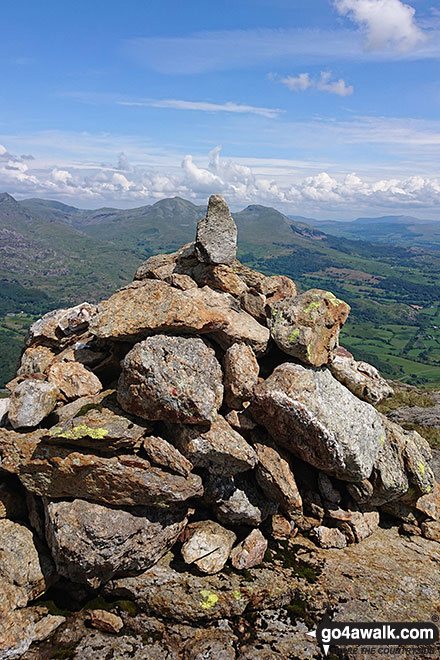
OS Trig Point
To walk, climb & bag Rhinog Fawr use this easy-to-follow walk:
See the location of Rhinog Fawr and walks up it on a google MapRhinog Fawr is on interactive maps:
OS Explorer (Orange Covers): OL18
OS Landranger (Pink Covers): 124
Rhinog Fawr is on downloadable PDF you can Print or Save to your Phone:
|
28. Moel Eilio (Llanberis)
726m (2,383ft)
Mountain (59th in Wales, 142nd in England & Wales)
Nuttall (73rd in Wales, 176th in England & Wales)
Marilyn (28th in Wales, 535th in GB)
To walk, climb & bag Moel Eilio (Llanberis) use either of these easy-to-follow walks:
See the location of Moel Eilio (Llanberis) and walks up it on a google MapMoel Eilio (Llanberis) is on interactive maps:
OS Explorer (Orange Covers): OL17
OS Landranger (Pink Covers): 115
Moel Eilio (Llanberis) is on downloadable PDF you can Print or Save to your Phone:
|
29. Rhobell Fawr
734m (2,408ft)
Mountain (57th in Wales, 137th in England & Wales)
Nuttall (71st in Wales, 169th in England & Wales)
Marilyn (27th in Wales, 518th in GB)
OS Trig Point
To walk, climb & bag Rhobell Fawr use this easy-to-follow walk:
See the location of Rhobell Fawr and walks up it on a google MapRhobell Fawr is on interactive maps:
OS Explorer (Orange Covers): OL23
OS Landranger (Pink Covers): 124
Rhobell Fawr is on downloadable PDF you can Print or Save to your Phone:
|
30. Craig Cwm Silyn
734m (2,409ft)
Mountain (55th in Wales, 134th in England & Wales)
Nuttall (69th in Wales, 166th in England & Wales)
Marilyn (25th in Wales, 514th in GB)
To walk, climb & bag Craig Cwm Silyn use any of these easy-to-follow walks:
See the location of Craig Cwm Silyn and walks up it on a google MapCraig Cwm Silyn is on interactive maps:
OS Explorer (Orange Covers): OL17
OS Landranger (Pink Covers): 115
Craig Cwm Silyn is on downloadable PDF you can Print or Save to your Phone:
|
Page 1 of 2 Go to page:
1 2 |
View these 47 Mountains, Peaks, Tops and Hills:
# Whether you print copies or download them to your phone, these Peak Baggers' Maps will prove incredibly useful if you want to know what's what when you are up in the mountains and cannot get a phone signal.
Is there a Mountain, Peak, Top or Hill missing from the above google map or list?
Let us know an we will add it to our database.


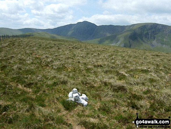


 Snowdon (Yr Wyddfa) in The Moel Hebog areaSnowdonia


