
![]()
Moel Eilio (Llanberis)
726m (2383ft)
The Snowdon Area, Snowdonia, Gwynedd, Wales
Moel Eilio (Llanberis) means 'Supporting Bare Hill' in Welsh and is pronounced 'moil ay-leo'.
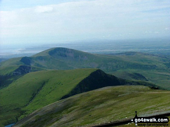
The summit of Moel Eilio (Llanberis) is marked by a windshelter.

Not familiar with this top?
   |
|---|
Vital Statistics:
| Length: | 11ml (17.5km) |
|---|---|
| Ascent: | 4,175ft (1,273m) |
| Time: | 8 hrs |
| Grade: |  (Hard) (Hard) |
Route Summary:
Snowdon Mountain Railway Llanberis Station - Cader Ellyll - Llanberis Path - Halfway Station - Llechog (Llanberis Path) - Clogwyn Station - Llyn Du'r Arrdu - Bwlch Cwm Brwynog - Moel Cynghorion - Bwlch Maesgwm - Foel Goch (Snowdon) - Foel Gron - Moel Eilio (Llanberis) - Llanberis.
|
|---|
Vital Statistics:
| Length: | 13.25ml (21km) |
|---|---|
| Ascent: | 5,651ft (1,723m) |
| Time: | 10½ hrs |
| Grade: |  (Very Hard) (Very Hard) |

Route Summary:
Snowdon Mountain Railway Llanberis Station - Cader Ellyll - Llanberis Path - Halfway Station - Llechog (Llanberis Path) - Clogwyn Station - Garnedd Ugain (Crib y Ddysgl) - Bwlch Glas - Snowdon (Yr Wyddfa) - Clogwyn Du'r Arddu Path - Snowdon Ranger Path - Moel Cynghorion - Bwlch Maesgwm - Foel Goch (Snowdon) - Foel Gron - Moel Eilio (Llanberis) - Llanberis.
See Moel Eilio (Llanberis) and the surrounding tops on our free-to-access 'Google Style' Peak Bagging Maps:
The Snowdon Area of Snowdonia National Park
Less data - quicker to download
The Whole of Snowdonia National Park
More data - might take a little longer to download
See Moel Eilio (Llanberis) and the surrounding tops on our downloadable Peak Bagging Map in PDF format:

NB: Whether you print off a copy or download it to your phone, this PDF Peak Baggers' Map might prove incredibly useful when your are up there on the tops and you cannot get a phone signal.
You can find Moel Eilio (Llanberis) & all the walks that climb it on these unique free-to-access Interactive Walk Planning Maps:
1:25,000 scale OS Explorer Map (orange/yellow covers):
1:50,000 scale OS Landranger Map (pink/magenta covers):
 Fellow go4awalkers who have already walked, climbed, summited & bagged Moel Eilio (Llanberis)
Donovan Suddell walked up Moel Eilio (Llanberis) on May 27th, 2023 [from/via/route] Tyn Yr Onnen Farm [with] Solo [weather] summit in cloud - Early morning walk
Melfyn Parry climbed it on September 6th, 2020 [from/via/route] Circumnavigation of Moel Eilio. Start point 573609, Padarn Country Park. Walked through woods alongside caravan park, round back of Siemens & up through the old quarry. Ascent of Moel Eilio & then on to Foel Gron & Foel Goch before descending to path to cross Snowdon railway line & then down to station. Visited the waterfall on Afon Arddu before returning to carpark. [with] PRC [weather] Heavy showers but not too much wind. Brighter later.
Sion Britton bagged it on April 3rd, 2021 [from/via/route] Llwybr Llechi wrth Waunfawr. [with] Rhiannon [weather] Braf.
Andy Buxton hiked Moel Eilio (Llanberis) during August, 1967 [with] Dad
Angela Moroney summited during May, 2018 [with] 3PEAKS
To add (or remove) your name and experiences on this page - Log On and edit your Personal Mountain Bagging Record
. . . [see more walk reports]
More Photographs & Pictures of views from, on or of Moel Eilio (Llanberis)

Mynydd Mawr (Llyn Cwellyn) from Trum y Ddysgl - with Moel Eilio (Llanberis) (beyond right)
Mynydd Mawr (Llyn Cwellyn), Craig y Bera and Moel Eilio (Llanberis) from Y Garn (Moel Hebog)
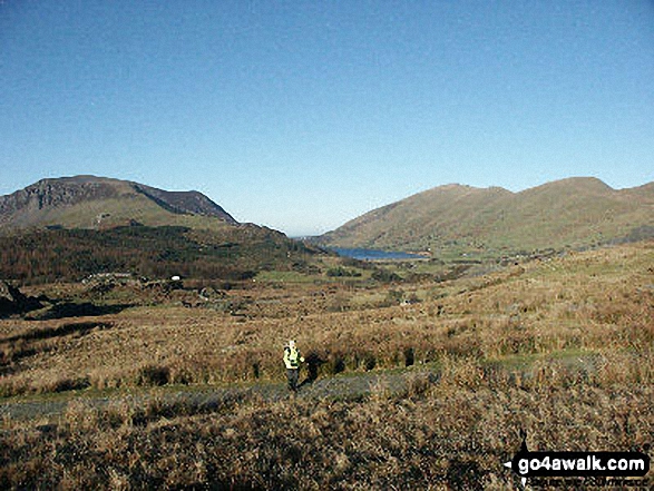
Mynydd Mawr (Llyn Cwellyn) (left), Llyn Cwellyn, Moel Eilio (Llanberis) (right) and Foel Gron (far right) from the Rhyd Ddu path
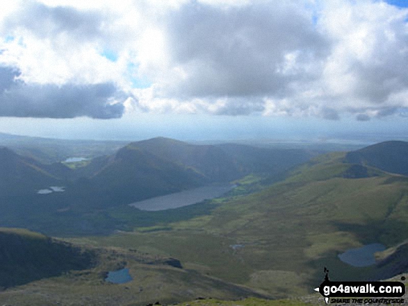
Llyn Cwellyn and Mynydd Mawr (Llyn Cwellyn) (centre left) and Moel Eilio (Llanberis) (far right) from Snowdon (Yr Wyddfa)

On Y Clegyr above Llyn Padarn (Llanberis) with Crib Goch, Garnedd Ugain (Crib y Ddysgl), Snowdon (Yr Wyddfa), Moel Cynghorion, Foel Goch (Snowdon), Foel Gron and Moel Eilio (Llanberis) in the background
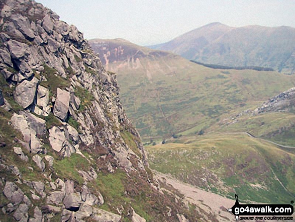
Cefn-Du, Moel Eilio (Llanberis), Foel Gron, Foel Goch and Moel Cynghorion from Snowdon (Yr Wyddfa)

Mynydd Mawr (Llyn Cwellyn), Y Garn (Moel Hebog), The Nantlle Ridge and Mynydd Drws-y-coed from Trum y Ddysgl - with The Snowdon Massif (Moel Eilio (Llanberis), Foel Gron, Moel Cynghorion, Garnedd Ugain (Crib y Ddysgl), Snowdon (Yr Wyddfa), Y Lliwedd and Yr Aran) forming the backdrop

Llyn Nantlle Uchaf, Dyffryn Nantlle, Mynydd Mawr, Rhyd Ddu, Llyn y Dywarchen, The Snowdon Massif (Moel Eilio (Llanberis), Foel Gron, Moel Cynghorion, Garnedd Ugain (Crib y Ddysgl), Snowdon (Yr Wyddfa), Y Lliwedd and Yr Aran from Y Garn (Moel Hebog)
Send us your photographs and pictures on, of, or from Moel Eilio (Llanberis)
If you would like to add your walk photographs and pictures to this page, please send them as email attachments (configured for any computer) along with your name to:
and we shall do our best to publish them.
(Guide Resolution = 300dpi. At least = 660pixels (wide) x 440 pixels (high).)

You can also submit photos via our Facebook Page.
NB. Please indicate where each photo was taken and whether you wish us to credit your photos with a Username or your First Name/Last Name.


