Scotland - a fully detailed list of all the Mountains, Peaks, Tops and Hills (Page 7 of 10)
If you count only the Munros there are 282 tops to climb, bag & conquer and the highest point is Ben Nevis at 1,344m (4,411ft).
To see these Mountains, Peaks, Tops and Hills displayed in different ways - see the options in the left-hand column and towards the bottom of this page.
![]() Your Personal Bagging Record for Scotland
Your Personal Bagging Record for Scotland
Log On and Reload this page to show which Mountains, Peaks, Tops and Hills you have already climbed, bagged & conquered [. . . more details]
See this list in: Alphabetical Order‡
| Height Order
To reverse the order select the link again.
Mountain, Peak, Top or Hill:
Bagged

![]()
181. Cairn Gorm (Cairngorms)
1,244m (4,082ft)
Cairn Gorm (Cairngorms) is on interactive maps:
A downloadable go4awalk.com PDF Peak Bagging Map featuring Cairn Gorm (Cairngorms) will be available soon. |

![]()
182. Cairn Bannoch
1,012m (3,321ft)
Cairn Bannoch is on interactive maps:
A downloadable go4awalk.com PDF Peak Bagging Map featuring Cairn Bannoch will be available soon. |
![]()
183. Bynack More
1,090m (3,577ft)
Bynack More is on interactive maps:
A downloadable go4awalk.com PDF Peak Bagging Map featuring Bynack More will be available soon. |
![]()
184. Buachaille Etive Mor (Stob Dearg)
1,021m (3,351ft)
Buachaille Etive Mor (Stob Dearg) is on interactive maps:
A downloadable go4awalk.com PDF Peak Bagging Map featuring Buachaille Etive Mor (Stob Dearg) will be available soon. |
![]()
185. Buachaille Etive Beag (Stob Dubh)
958m (3,144ft)
Buachaille Etive Beag (Stob Dubh) is on interactive maps:
A downloadable go4awalk.com PDF Peak Bagging Map featuring Buachaille Etive Beag (Stob Dubh) will be available soon. |

![]()
186. Bruach na Frithe
958m (3,144ft)
Bruach na Frithe is on interactive maps:
A downloadable go4awalk.com PDF Peak Bagging Map featuring Bruach na Frithe will be available soon. |

![]()
187. Broad Cairn
998m (3,275ft)
Broad Cairn is on interactive maps:
A downloadable go4awalk.com PDF Peak Bagging Map featuring Broad Cairn will be available soon. |
![]()
188. Braigh Coire Chruinn-bhalgain
1,070m (3,512ft)
Braigh Coire Chruinn-bhalgain is on interactive maps:
A downloadable go4awalk.com PDF Peak Bagging Map featuring Braigh Coire Chruinn-bhalgain will be available soon. |

![]()
189. Braeriach (Braigh Riabhach)
1,296m (4,253ft)
Braeriach (Braigh Riabhach) is on interactive maps:
A downloadable go4awalk.com PDF Peak Bagging Map featuring Braeriach (Braigh Riabhach) will be available soon. |

![]()
190. Bla Bheinn (Blaven)
928m (3,046ft)
Bla Bheinn (Blaven) is on interactive maps:
A downloadable go4awalk.com PDF Peak Bagging Map featuring Bla Bheinn (Blaven) will be available soon. |
![]()
191. Binnein Mor
1,130m (3,709ft)
Binnein Mor is on interactive maps:
A downloadable go4awalk.com PDF Peak Bagging Map featuring Binnein Mor will be available soon. |

![]()
192. Binnein Beag
943m (3,095ft)
Binnein Beag is on interactive maps:
A downloadable go4awalk.com PDF Peak Bagging Map featuring Binnein Beag will be available soon. |
![]()
193. Bidein a' Choire Sheasgaich
945m (3,101ft)
Bidein a' Choire Sheasgaich is on interactive maps:
A downloadable go4awalk.com PDF Peak Bagging Map featuring Bidein a' Choire Sheasgaich will be available soon. |

![]()
194. Bidean nam Bian
1,150m (3,774ft)
Bidean nam Bian is on interactive maps:
A downloadable go4awalk.com PDF Peak Bagging Map featuring Bidean nam Bian will be available soon. |

![]()
195. Ben Wyvis (Glas Leathad Mor)
1,046m (3,433ft)
Ben Wyvis (Glas Leathad Mor) is on interactive maps:
A downloadable go4awalk.com PDF Peak Bagging Map featuring Ben Wyvis (Glas Leathad Mor) will be available soon. |
![]()
196. Ben Vorlich (The Arrochar Alps)
943m (3,094ft)
Ben Vorlich (The Arrochar Alps) is on interactive maps:
A downloadable go4awalk.com PDF Peak Bagging Map featuring Ben Vorlich (The Arrochar Alps) will be available soon. |
![]()
197. Ben Vorlich (Coire Garbh)
985m (3,233ft)
Ben Vorlich (Coire Garbh) is on interactive maps:
A downloadable go4awalk.com PDF Peak Bagging Map featuring Ben Vorlich (Coire Garbh) will be available soon. |

![]()
198. Ben Vane
915m (3,003ft)
Ben Vane is on interactive maps:
A downloadable go4awalk.com PDF Peak Bagging Map featuring Ben Vane will be available soon. |

![]()
199. Ben Starav
1,078m (3,538ft)
Ben Starav is on interactive maps:
A downloadable go4awalk.com PDF Peak Bagging Map featuring Ben Starav will be available soon. |

![]()
200. Ben Oss
1,029m (3,377ft)
Ben Oss is on interactive maps:
A downloadable go4awalk.com PDF Peak Bagging Map featuring Ben Oss will be available soon. |
![]()
201. Ben Nevis
1,344m (4,411ft)
Ben Nevis is on interactive maps:
A downloadable go4awalk.com PDF Peak Bagging Map featuring Ben Nevis will be available soon. |
![]()
202. Ben More Assynt
998m (3,275ft)
Ben More Assynt is on interactive maps:
A downloadable go4awalk.com PDF Peak Bagging Map featuring Ben More Assynt will be available soon. |
![]()
203. Ben More (The Crianlarich Hills)
1,174m (3,853ft)
Ben More (The Crianlarich Hills) is on interactive maps:
A downloadable go4awalk.com PDF Peak Bagging Map featuring Ben More (The Crianlarich Hills) will be available soon. |

![]()
204. Ben More (Mull)
966m (3,170ft)
Ben More (Mull) is on interactive maps:
A downloadable go4awalk.com PDF Peak Bagging Map featuring Ben More (Mull) will be available soon. |

![]()
205. Ben Macdui (Beinn MacDuibh)
1,309m (4,296ft)
Ben Macdui (Beinn MacDuibh) is on interactive maps:
A downloadable go4awalk.com PDF Peak Bagging Map featuring Ben Macdui (Beinn MacDuibh) will be available soon. |

![]()
206. Ben Lui (Beinn Laoigh)
1,130m (3,708ft)
Ben Lui (Beinn Laoigh) is on interactive maps:
A downloadable go4awalk.com PDF Peak Bagging Map featuring Ben Lui (Beinn Laoigh) will be available soon. |

![]()
207. Ben Lomond
974m (3,196ft)
Ben Lomond is on interactive maps:
A downloadable go4awalk.com PDF Peak Bagging Map featuring Ben Lomond will be available soon. |

![]()
208. Ben Lawers
1,214m (3,984ft)
Ben Lawers is on interactive maps:
A downloadable go4awalk.com PDF Peak Bagging Map featuring Ben Lawers will be available soon. |

![]()
209. Ben Klibreck (Meall nan Con)
962m (3,157ft)
Send it in and we'll publish it here.
Ben Klibreck (Meall nan Con) is on interactive maps:
A downloadable go4awalk.com PDF Peak Bagging Map featuring Ben Klibreck (Meall nan Con) will be available soon. |
![]()
210. Ben Hope
927m (3,042ft)
Ben Hope is on interactive maps:
A downloadable go4awalk.com PDF Peak Bagging Map featuring Ben Hope will be available soon. |

View these 282 Mountains, Peaks, Tops and Hills:
- On an Interactive Google Map with a list of tops below it.
(makes it easier to locate a particular top) - On a Detailed List in:
Alphabetical Order | Height Order - On one page with 'yet-to-be-bagged' listed 1st
& then 'already-bagged' tops listed 2nd in:
Alphabetical Order | Height Order - On one page with 'already-bagged' tops listed 1st
& then 'yet-to-be-bagged' tops listed 2nd in:
Alphabetical Order | Height Order
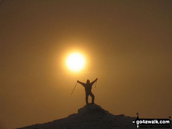
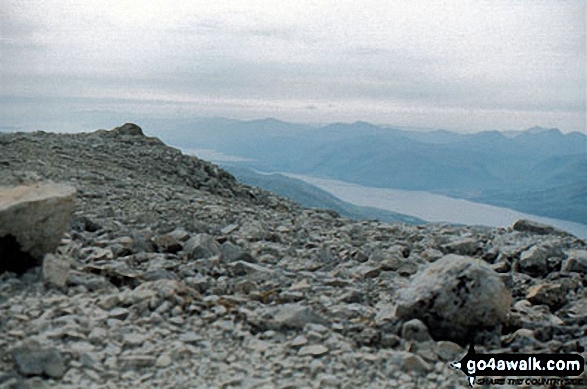 The summit of Ben Nevis
Photo: John Reed
Is there a Mountain, Peak, Top or Hill missing from the above google map or list?
Let us know an we will add it to our database.
To contribute to go4awalk.com or to contact us about anything at all - see Talk To Us.
For help see Help.
go4awalk.com and go4awalk.co.uk are registered trademarks of TMDH Limited.
Copyright © 2000-2026 TMDH Limited. All rights reserved.
Copyright Terms & Conditions Privacy Statement
A - Z Walks Home Log On/Accounts Photo Gallery Walk Ideas and Collections Fell Facts Hill Skills Walking Questions and Answers Your Stories News Competitions Product Reviews/Gear Tests Walking Gear Guides Peaks and Mountains Peak Bagging Find New Walking Friends Camping GPS Waypoints for Walking Contents Walk Search Talk To Us go4awalk.com Help Free Example Walks Newsletter


