|
Vital Statistics:
| Length: | 9mls (14.5km) |
| Ascent: | 3,387ft (1,032m) |
| Time: | 6¾hrs |
| Grade: |  |

Route outline for walk c414:
Great Langdale - The Old Dungeon Ghyll - Oxendale - Oxendale Beck - Red Tarn (Langdale) - Great Knott - Crinkle - Crags (South Top) - Bad Step - Crinkle Crags (Long Top) - Crinkle Crags (Gunson Knott) - Shelter Crags - Shelter Crags (North Top) - Three Tarns - Climbers' Traverse (optional) - Flat Crag - Cambridge Crag - Bowfell Buttress - Bow Fell (Bowfell) - Three Tarns - Earing Crag - White Stones - The Band - Stool End Farm - Mickleden Beck - Mickleden - The Old Dungeon Ghyll - Great Langdale


Peaks, Summits and Tops reached on this walk:
 3 English Mountains |
 2 Wainwrights |
 5 English Nuttalls |
 0 English Deweys |
 0 Wainwright Outlying Fells |
 0 Marilyns |
 0 Bridgets |
Peak Bagging Statistics for this walk:
The highest point of this walk is Bow Fell (Bowfell) at 902m (2960ft). Bow Fell (Bowfell) is classified as an English Mountain (Hewitt) (8th highest in England, 24th highest in England & Wales) and a Wainwright (No. 6).
Bow Fell (Bowfell) is also known as an English Nuttall (10th highest in England, 27th highest in England & Wales).
Completing this walk will also take you to the top of Crinkle Crags (Long Top) at 859m (2819ft). Crinkle Crags (Long Top) is classified as an English Mountain (Hewitt) (20th highest in England, 43rd highest in England & Wales) and a Wainwright (No. 17).
Crinkle Crags (Long Top) is also known as an English Nuttall (24th highest in England, 50th highest in England & Wales).
You will also reach the summit of Shelter Crags at 815m (2675ft). Shelter Crags is classified as an English Mountain (Hewitt) (35th highest in England, 66th highest in England & Wales)
Shelter Crags is also known as an English Nuttall (42nd highest in England, 79th highest in England & Wales).
Along the way you will also bag:
- Shelter Crags (North Top) at 775m (2543ft). Shelter Crags (North Top) is known as an English Nuttall (70th highest in England, 122nd highest in England & Wales).
- Great Knott at 695m (2281ft). Great Knott is known as an English Nuttall (140th highest in England, 229th highest in England & Wales).
You can find this walk and other nearby walks on these unique free-to-access Interactive Walk Planning Maps:
1:25,000 scale OS Explorer Map (orange/yellow covers):
1:50,000 scale OS Landranger Maps (pink/magenta covers):
Some Photos and Pictures from Walk c414 Crinkle Crags and Bow Fell (Bowfell) from The Old Dungeon Ghyll, Great Langdale
In no particular order . . .


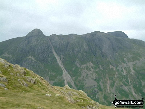
Crinkle Crags (South Top), Crinkle Crags (Long Top), Crinkle Crags (Gunson Knott), Shelter Crags, Shelter Crags, (North Top), The Band , Bow Fell (Bowfell) and Bow Fell (Bowfell) (North Top), Esk Pike, Rossett Pike and The Langdale Pikes including Pike of Stickle (Pike o' Stickle) (left) Loft Crag and Harrison Stickle from Stool End, Great Langdale



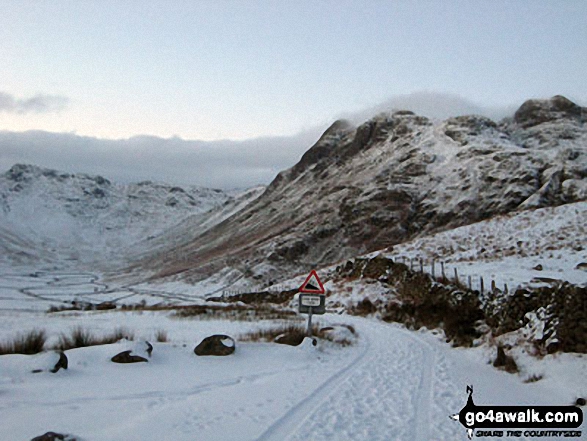
Crinkle Crags (Long Top), Crinkle Crags (Gunson Knott), Shelter Crags and Shelter Crags (North Top) from Great Langdale

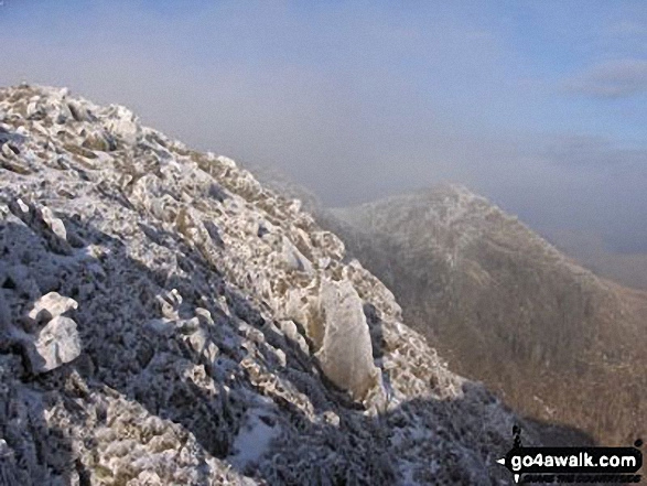
Crinkle Crags - The second Crinkle - Crinkle Crags (Long Top) and the third Crinkle - Gunson Knott from the first Crinkle - Crinkle Crags (South Top)

The Langdale Pikes - Pike of Stickle (left) and Loft Crag (centre right) from The Band

*Crinkle Crags featuring Crinkle Crags (Long Top), Gunson Knott & Crinkle Crags (South Top) (left), Bow Fell (Bowfell) (centre) and The Langdale Pikes (right) from Great Langdale

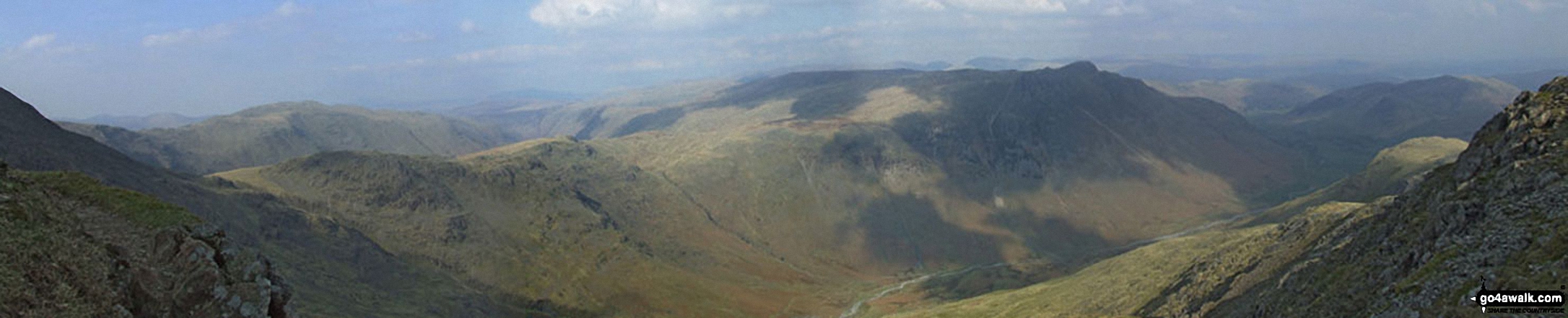
Rossett Crag, Black Crags, Mart Crag, Pike of Stickle, The Langdale Pikes, Mickleden and Great Langdale from The Climbers' Traverse below Bow Fell (Bowfell)

Send us your photographs and pictures from your walks and hikes
We would love to see your photographs and pictures from walk c414 Crinkle Crags and Bow Fell (Bowfell) from The Old Dungeon Ghyll, Great Langdale. Send them in to us as email attachments (configured for any computer) along with your name and where the picture was taken to:
and we shall do our best to publish them.
(Guide Resolution = 300dpi. At least = 660 pixels (wide) x 440 pixels (high).)

You can also submit photos from walk c414 Crinkle Crags and Bow Fell (Bowfell) from The Old Dungeon Ghyll, Great Langdale via our Facebook Page.
NB. Please indicate where each photo was taken.