Walk c263 The High Stile Ridge from Buttermere
This 8¾ mile, Grade 7 (Hard), easy-to-follow, hand-crafted walk, complete with GPS Waypoints, starts at Buttermere & will take about 6¼ hrs to complete.
   |
Vital Statistics:
| Length: | 8¾mls (14km) |
| Ascent: | 3,390ft (1,033m) |
| Time: | 6¼hrs |
| Grade: |  |

Route outline for walk c263:
Buttermere - Scale Force - Scale Beck - Blea Crag - Lingcomb Edge - Red Pike (Buttermere) - High Stile - High Crag (Buttermere) - Gamlin End - Seat (Buttermere) - Scarth Gap - Burtness Wood - Sourmilk Gill - Buttermere
Peaks, Summits and Tops reached on this walk:
 3 English Mountains |
 3 Wainwrights |
 3 English Nuttalls |
 1 English Dewey |
 0 Wainwright Outlying Fells |
 1 Marilyn |
 0 Bridgets |
Peak Bagging Statistics for this walk:
The highest point of this walk is High Stile at 807m (2646ft). High Stile is classified as an English Mountain (Hewitt) (38th highest in England, 71st highest in England & Wales) and a Wainwright (No. 29).
High Stile is also known as an English Nuttall (45th highest in England, 86th highest in England & Wales) and an English Marilyn (13th highest in England, 378th highest in the UK).
Completing this walk will also take you to the top of Red Pike (Buttermere) at 755m (2478ft). Red Pike (Buttermere) is classified as an English Mountain (Hewitt) (67th highest in England, 116th highest in England & Wales) and a Wainwright (No. 62).
Red Pike (Buttermere) is also known as an English Nuttall (83rd highest in England, 142nd highest in England & Wales).
You will also reach the summit of High Crag (Buttermere) at 744m (2442ft). High Crag (Buttermere) is classified as an English Mountain (Hewitt) (72nd highest in England, 126th highest in England & Wales) and a Wainwright (No. 65).
High Crag (Buttermere) is also known as an English Nuttall (89th highest in England, 154th highest in England & Wales).
Along the way you will also bag and tick-off:
- Seat (Buttermere) at 561m (1841ft). Seat (Buttermere) is classified as an English Dewey (53rd highest in England, 122nd highest in England & Wales).
You can find this walk and other nearby walks on these unique Interactive Walk Planning Maps:
(worth a look if you're new to go4awalk.com & have never seen one of these before.)
1:25,000 scale OS Explorer Map (orange/yellow covers):
1:50,000 scale OS Landranger Map (pink/magenta covers):
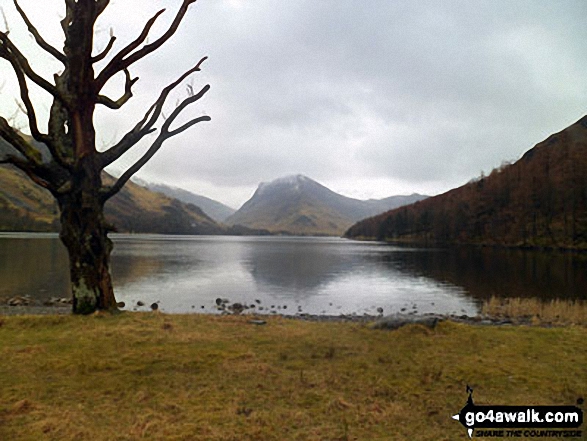
Some Photos and Pictures from Walk c263 The High Stile Ridge from Buttermere
In no particular order . . .
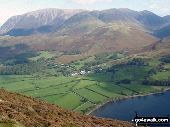
Buttermere village from Red Pike (Buttermere) with the Grasmoor massif looming large in the background

Looking across Buttermere Lake to a Cottage below Hay Stacks (Haystacks) from Hassness

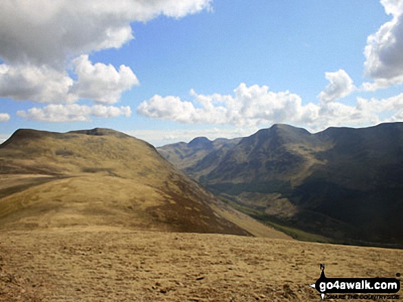
Red Pike (Buttermere) summit from Lingcomb Edge with Pillar prominent across Ennerdale


Innominate Tarn on Hay stacks (frozen solid) with Great Gable rising majestically in the background
. . . load all 92 walk photos from Walk c263 The High Stile Ridge from Buttermere
Send us your photographs and pictures from your walks and hikes
We would love to see your photographs and pictures from walk c263 The High Stile Ridge from Buttermere. Send them in to us as email attachments (configured for any computer) along with your name and where the picture was taken to:
and we shall do our best to publish them.
(Guide Resolution = 300dpi. At least = 660 pixels (wide) x 440 pixels (high).)

You can also submit photos from walk c263 The High Stile Ridge from Buttermere via our Facebook Page.
NB. Please indicate where each photo was taken.
To contribute to go4awalk.com or to contact us about anything at all - see Talk To Us.
For help see Help.
go4awalk.com and go4awalk.co.uk are registered trademarks of TMDH Limited.
Copyright © 2000-2026 TMDH Limited. All rights reserved.
Copyright Terms & Conditions Privacy Statement
A - Z Walks Home Log On/Accounts Photo Gallery Walk Ideas and Collections Fell Facts Hill Skills Walking Questions and Answers Your Stories News Competitions Product Reviews/Gear Tests Walking Gear Guides Peaks and Mountains Peak Bagging Find New Walking Friends Camping GPS Waypoints for Walking Contents Walk Search Talk To Us go4awalk.com Help Free Example Walks Newsletter


