Walk c256 Grasmoor Ridge and Whiteless Pike from Lanthwaite Green
This 7 mile, Grade 6 (Moderate), easy-to-follow, hand-crafted walk, complete with GPS Waypoints, starts at Lanthwaite Green & will take about 5¾ hrs to complete.
   |
Vital Statistics:
| Length: | 7mls (11km) |
| Ascent: | 3,243ft (988m) |
| Time: | 5¾hrs |
| Grade: |  |

Route outline for walk c256:
Lanthwaite Green - Grasmoor - Wandope - Whiteless Edge - Whiteless Pike - Whiteless Breast - Low Bank - Rannerdale Knotts - Crummock Water - Lanthwaite Green
Peaks, Summits and Tops reached on this walk:
 3 English Mountains |
 4 Wainwrights |
 3 English Nuttalls |
 0 English Deweys |
 0 Wainwright Outlying Fells |
 1 Marilyn |
 0 Bridgets |
Peak Bagging Statistics for this walk:
The highest point of this walk is Grasmoor at 851m (2794ft). Grasmoor is classified as an English Mountain (Hewitt) (23rd highest in England, 47th highest in England & Wales) and a Wainwright (No. 20).
Grasmoor is also known as an English Nuttall (28th highest in England, 55th highest in England & Wales) and an English Marilyn (9th highest in England, 313th highest in the UK).
Completing this walk will also take you to the top of Wandope at 773m (2539ft). Wandope is classified as an English Mountain (Hewitt) (57th highest in England, 99th highest in England & Wales) and a Wainwright (No. 51).
Wandope is also known as an English Nuttall (71st highest in England, 123rd highest in England & Wales).
You will also reach the summit of Whiteless Pike at 660m (2166ft). Whiteless Pike is classified as an English Mountain (Hewitt) (135th highest in England, 234th highest in England & Wales) and a Wainwright (No. 105).
Whiteless Pike is also known as an English Nuttall (181st highest in England, 310th highest in England & Wales).
Along the way you will also bag and tick-off:
- Rannerdale Knotts at 355m (1165ft). Rannerdale Knotts is classified as a Wainwright (No. 210)
You can find this walk and other nearby walks on these unique Interactive Walk Planning Maps:
(worth a look if you're new to go4awalk.com & have never seen one of these before.)
1:25,000 scale OS Explorer Map (orange/yellow covers):
1:50,000 scale OS Landranger Map (pink/magenta covers):
Some Photos and Pictures from Walk c256 Grasmoor Ridge and Whiteless Pike from Lanthwaite Green
In no particular order . . .

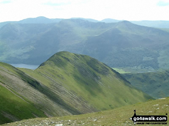
The shoulder of Grasmoor (left), Robinson, Rannerdale Knotts (centre) and the High Stile Ridge (High Crag, High Stile and Red Pike (Buttermere) reflected beautifully in a very still Crummock Water taken from the north west shore below Mellbreak

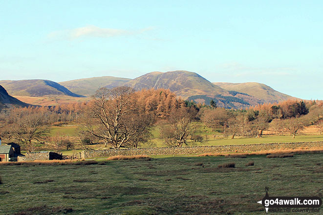
Gavel Fell (left), Blake Fell, Carling Knott and Burnbank Fell from Lanthwaite Green
Fleetwith Pike and Haystacks at the end of Buttermere, with the Buttermere Fells - High Crag, High Stile and Red Pike (Buttermere) - from Rannerdale Knotts
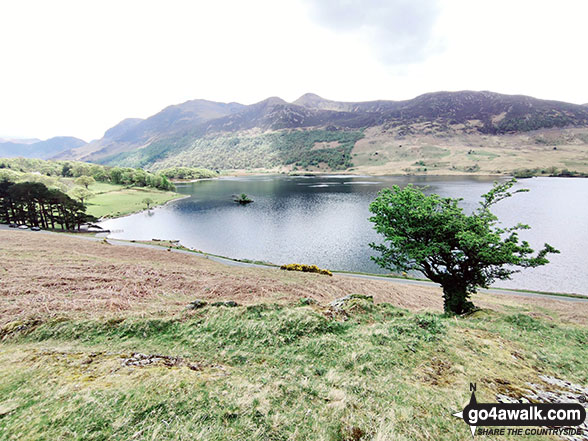
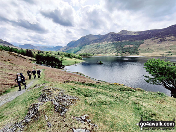
The Buttermere Fells across Crummock Water from the lower slopes of Rannerdale Knotts
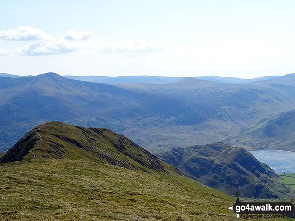
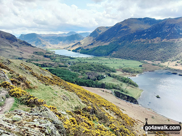
Looking down over Whiteless Pike and Rannerdale Knotts to Crummock Water from Wandope
. . . load all 87 walk photos from Walk c256 Grasmoor Ridge and Whiteless Pike from Lanthwaite Green
Send us your photographs and pictures from your walks and hikes
We would love to see your photographs and pictures from walk c256 Grasmoor Ridge and Whiteless Pike from Lanthwaite Green. Send them in to us as email attachments (configured for any computer) along with your name and where the picture was taken to:
and we shall do our best to publish them.
(Guide Resolution = 300dpi. At least = 660 pixels (wide) x 440 pixels (high).)

You can also submit photos from walk c256 Grasmoor Ridge and Whiteless Pike from Lanthwaite Green via our Facebook Page.
NB. Please indicate where each photo was taken.

To contribute to go4awalk.com or to contact us about anything at all - see Talk To Us.
For help see Help.
go4awalk.com and go4awalk.co.uk are registered trademarks of TMDH Limited.
Copyright © 2000-2026 TMDH Limited. All rights reserved.
Copyright Terms & Conditions Privacy Statement
A - Z Walks Home Log On/Accounts Photo Gallery Walk Ideas and Collections Fell Facts Hill Skills Walking Questions and Answers Your Stories News Competitions Product Reviews/Gear Tests Walking Gear Guides Peaks and Mountains Peak Bagging Find New Walking Friends Camping GPS Waypoints for Walking Contents Walk Search Talk To Us go4awalk.com Help Free Example Walks Newsletter


