UK Postcode WR9 - The 30 nearest easy-to-follow, circular walk route maps to you
The thirty nearest easy-to-follow, circular walk route maps to you in UK Postcode WR9 in Walk Grade Order
The UK cities, towns and villages in Hereford and Worcester, England that have WR9 in their UK Postcode include:
• Cutnall Green • Doverdale • Droitwich • Earl's Common • Elmbridge • Elmley Lovett • Hadzor • Hampton Lovett • Hawford • Himbleton • Holt Fleet • Huddington • Oddingley • Oldfield • Ombersley • Rushock • Sale Green • Salwarpe • Tibberton • Uphampton • Wychbold •
Not familiar with the area around WR9?
See these 30 nearest walks to UK Postcode WR9 on a google map
   |
Vital Statistics:
| Length: | 6.25 miles (10 km) |
| Ascent: | 1,615ft (492m) |
| Time: | 4 hrs |
| Grade: |  |
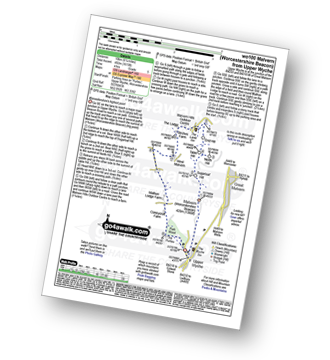
Route Summary:
Upper Wyche - Malvern (Worcestershire Beacon) - Sugarloaf Hill (Malverns) - North Hill (Malverns) - Table Hill (Malverns) - End Hill (Malverns) - The Malvern Hills Outdoor Centre - Birches Farm - West Malvern - Mathon Lodge Farm - Coneycroft Farm - The Perlieu - Upper Wyche
|
Vital Statistics:
| Length: | 5.25 miles (8.5 km) |
| Ascent: | 532ft (162m) |
| Time: | 2½ hrs |
| Grade: |  |
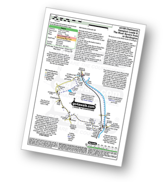
Route Summary:
Eardington - Dinney Barn - The Jack Mytton Way - Chelmarsh Reservoir - Chelmarsh - Hampton - The Jack Mytton Way - The Severn Valley Railway - Hampton Loade - The Hampton Loade Ferry - The River Severn - The Severn Way - Eardington
|
Vital Statistics:
| Length: | 7 miles (11 km) |
| Ascent: | 151ft (46m) |
| Time: | 2.75hrs |
| Grade: |  |

Route Summary:
Stratford-upon-Avon - Tramway - River Stour - Clifford Chambers - The Greenway - River Avon - Stratford-upon-Avon
|
Vital Statistics:
| Length: | 4 miles (6.5 km) |
| Ascent: | 1,011ft (308m) |
| Time: | 2½ hrs |
| Grade: | |

Route Summary:
Dhustone - The Shropshire Way - Nine Spring Farm - Titterstone Incline - Titterstone Clee Hill - Hullabaloo House - Titterstone - Benson' Brook - Woodlands - Greenacres - Dhustone
|
Vital Statistics:
| Length: | 9.5 miles (15.5 km) |
| Ascent: | 1,132ft (345m) |
| Time: | 4.75hrs |
| Grade: | |
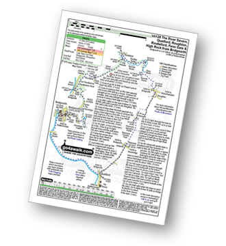
Route Summary:
Bridgnorth - The River Severn - Quatford - Stanmore Country Park - Hoccum - Roughton - Burcote House - River Worfe - Soudley Rocks - Rindleford - Batch House - Fenn Gate - Woodside - High Rock - Caves - The Hermitage - Hermitage Hill Coppice - Bridgnorth
|
Vital Statistics:
| Length: | 10 miles (16 km) |
| Ascent: | 722ft (220m) |
| Time: | 4.25hrs |
| Grade: |  |

Route Summary:
Bridgnorth - Lower Town - River Severn - The Severn Way - Apley Forge - Nordley - Astley Abbots - Cross Lane Head - High Town - Bridgnorth - Lower Town - Bridgnorth
|
Vital Statistics:
| Length: | 8.5 miles (13.5 km) |
| Ascent: | 951ft (290m) |
| Time: | 4 hrs |
| Grade: | |

Route Summary:
Winchcombe - River Isbourne - The Cotswold Way - Salter's Lane - Hailes Abbey - North Farmcote - Lynes Barn - Campden Lane (Track) - Deadmanbury Gate - Wardens' Way - Salt Way - The Warren - Parks Farm - Sudeley Lodge - Sudeley Castle - Winchcombe
|
Vital Statistics:
| Length: | 6.5 miles (10.5 km) |
| Ascent: | 1,152ft (351m) |
| Time: | 3½ hrs |
| Grade: | |

Route Summary:
Cleobury North - Stanbroughs Wood - Brown Clee Hill (Abdon Burf) - The Shropshire Way - Sandy Nap - Monkeys Fold - Green Lea - Brown Clee Hill (Clee Burf) - Chapelwod Farm - Wallermoore Wood - Harewood - Cleobury North
|
Vital Statistics:
| Length: | 10.25 miles (16.5 km) |
| Ascent: | 463ft (141m) |
| Time: | 4.25hrs |
| Grade: | |

Route Summary:
Moreton-in-Marsh - The Mornarch's Way - Upper Fields Farm - Longborough - Donnington - Broadwell - Quinmoor Far - River Evenlode - Evenlode - Codicote Farm - Moreton-in-Marsh
|
Vital Statistics:
| Length: | 5.5 miles (9 km) |
| Ascent: | 669ft (204m) |
| Time: | 2.75hrs |
| Grade: | |
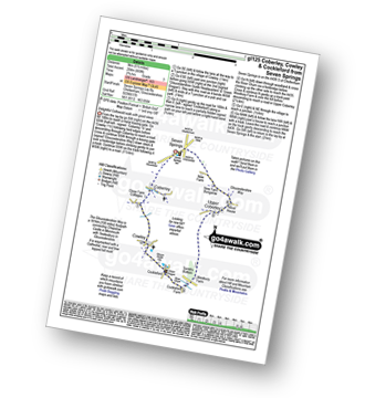
Route Summary:
Seven Springs - Coberley - The Gloucestershire Way - Cowley - Cockleford - Westbury Farm - Tomtit's Bottom - Upper Coberley - New Farm Bungalow - Seven Springs
|
Vital Statistics:
| Length: | 8.25 miles (13 km) |
| Ascent: | 912ft (278m) |
| Time: | 4 hrs |
| Grade: | |

Route Summary:
Seven Springs - Coberley - The Gloucestershire Way - Cowley - Cockleford - Butlers Hill Farm - Butler's Farm - Colesbourne - Forty Acre Plantation - Balbarrow Wood - The Forest - Pinswell Plantation - Mercombe Wood - Hilcot Wood - Upper Coberley - New Farm Bungalow - Seven Springs
|
Vital Statistics:
| Length: | 6 miles (9.5 km) |
| Ascent: | 508ft (155m) |
| Time: | 2½ hrs |
| Grade: | |

Route Summary:
Stow-on-the-Wold - The Monarch's Way - Broadwell - Donnington - Battle of Stow Memorial - The Gloucestershire Way - Upper Swell - Stow-on-the-Wold
|
Vital Statistics:
| Length: | 7.75 miles (12.5 km) |
| Ascent: | 410ft (125m) |
| Time: | 3.25hrs |
| Grade: | |

Route Summary:
Dilwyn - Townsend House - Little Stocking - Stocking Farm - Gad Bridge - Weobley Marsh - Ledgemoor - Garnstone Park - Weobley Castle - Weobley - Bent's House - Homme Shrubs - Dilwyn
|
Vital Statistics:
| Length: | 8.25 miles (13 km) |
| Ascent: | 696ft (212m) |
| Time: | 3.75hrs |
| Grade: | |

|
Vital Statistics:
| Length: | 6.25 miles (10 km) |
| Ascent: | 670ft (204m) |
| Time: | 3 hrs |
| Grade: | |
Route Summary:
Adlestrop - The Macmillan Way - Chastleton - Chastleton House - Chastleton Barrow Iron Age Fort - Cornwell - Adlestrop
Not familiar with the area around WR9?
See these 30 nearest walks to UK Postcode WR9 on a google map
|
Vital Statistics:
| Length: | 9 miles (14.5 km) |
| Ascent: | 801ft (244m) |
| Time: | 4.25hrs |
| Grade: | |

Route Summary:
Adlestrop - The Macmillan Way - Chastleton - Chastleton House - Chastleton Barrow Iron Age Fort - Cornwell - Daylesford - The Macmillan Way - Lower Oddington - Adlestrop Park - Adlestrop
|
Vital Statistics:
| Length: | 3.75 miles (6 km) |
| Ascent: | 394ft (120m) |
| Time: | 1.75hrs |
| Grade: | |
Route Summary:
Adlestrop - The Macmillan Way - Chastleton - Chastleton House - Chastleton Barrow Iron Age Fort - Long Drive - Adlestrop
|
Vital Statistics:
| Length: | 10.75 miles (17 km) |
| Ascent: | 689ft (210m) |
| Time: | 4.75hrs |
| Grade: | |
Route Summary:
Bourton-on-the-Water - The Warden's Way - River Eye - Lower Slaughter - Upper Slaughter - Brockhill Farm - Naunton - The Windrush Way - River Windrush - Aston Farm - Bourton-on-the-Water
|
Vital Statistics:
| Length: | 6.75 miles (11 km) |
| Ascent: | 312ft (95m) |
| Time: | 3 hrs |
| Grade: | |

Route Summary:
Bourton-on-the-Water - Little Rissington - Great Rissington - New Bridge - River Windrush - Bourton-on-the-Water
|
Vital Statistics:
| Length: | 10.25 miles (16.5 km) |
| Ascent: | 1,526ft (465m) |
| Time: | 5.25hrs |
| Grade: |  |

Route Summary:
Craven Arms - Ireland Cottage - Hills and Dales Hike - Lower Dinchope - Hanging Wood - Wenlock Edge - Callow Hill (Little Stretton) - Flounders Folly - Frizland Coppice - Westhope - Wenlock Edge - Alcaton Common - Strefford Wood - Halford - Craven Arms
|
Vital Statistics:
| Length: | 7 miles (11 km) |
| Ascent: | 880ft (268m) |
| Time: | 3½ hrs |
| Grade: | |
Route Summary:
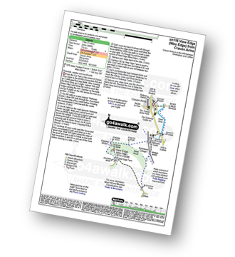
Craven Arms - River Onny - Hills and Dales Hike - Stokesay Castle - Clapping Wicket - View Edge (Weo Edge) - Aldon - Stokesay Castle - River Onny - Craven Arms
|
Vital Statistics:
| Length: | 6.5 miles (10.5 km) |
| Ascent: | 853ft (260m) |
| Time: | 3.25hrs |
| Grade: | |

Route Summary:
Craven Arms - River Onny - Halford - Ireland Cottage - Hills and Dales Hike - Lower Dinchope - Hanging Wood - Callowhill Plantation - Wenlock Edge - Callow Hill (Little Stretton) - Flounders Folly - Frizland Coppice - Moorwood Farm - Strefford Wood - Berrymill Wood - Halford - Craven Arms
|
Vital Statistics:
| Length: | 9 miles (14.5 km) |
| Ascent: | 1,004ft (306m) |
| Time: | 4½ hrs |
| Grade: | |
Route Summary:
Craven Arms - River Onny - Hills and Dales Hike - Stokesay Castle - Clapping Wicket - View Edge (Weo Edge) - Gorst Barn - Brandhill Gutter - Aldon Gutter - Aldon - Stokesay Castle - River Onny - Craven Arms
|
Vital Statistics:
| Length: | 5.75 miles (9 km) |
| Ascent: | 571ft (174m) |
| Time: | 2.75hrs |
| Grade: | |

Route Summary:
Chedworth Roman Villa - The Macmillan Way - River Coln - Yanworth Common - Yanworth Wood - Streetfold - Yanworth - Dean Grove - Sheep Wash - Oxpens Farm - The Monarch's Way - Stowell Grove - Budford's Grove - Yanworth Mill - River Coln - Chedworth Woods - Chedworth Roman Villa
|
Vital Statistics:
| Length: | 9 miles (14.5 km) |
| Ascent: | 754ft (230m) |
| Time: | 4 hrs |
| Grade: | |

Route Summary:
Chedworth - Woodlands Farm - Postcombe - Withington Woods - Withington - River Coln - Woodbridge - Cassey Compton - Turpin's Green - Hutnage - Chedworth Roman Villa - The Monarch's Way - The Macmillan Way - Yanworth Mill - Chedworth Woods - Chedworth
|
Vital Statistics:
| Length: | 8.5 miles (13.5 km) |
| Ascent: | 1,791ft (546m) |
| Time: | 5 hrs |
| Grade: | |
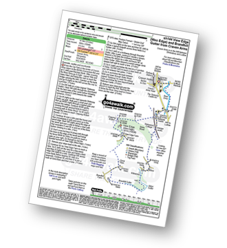
Route Summary:
Leebotwood - The Lawley - Comley - Caer Caradoc Hill - Three Fingers Rock - Comley - Leebotwood
|
Vital Statistics:
| Length: | 4 miles (6.5 km) |
| Ascent: | 712ft (217m) |
| Time: | 2.25hrs |
| Grade: | |

|
Vital Statistics:
| Length: | 3.75 miles (6 km) |
| Ascent: | 1,004ft (306m) |
| Time: | 2½ hrs |
| Grade: | |

Route Summary:
Buckatree Farm Reservoir - Wrekin Cottage - The Shropshire Way - Hell Gate - Heaven Gate - The Wrekin - Little Hill - Needle's Eye - Wenlocks Wood - Buckatree Farm Reservoir
|
Vital Statistics:
| Length: | 5.25 miles (8.5 km) |
| Ascent: | 945ft (288m) |
| Time: | 3 hrs |
| Grade: | |
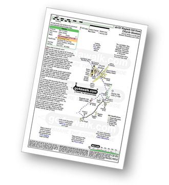
Route Summary:
Church Stretton - The Jack Mytton Way - Snatchfield Farm - Clemcroft - Ragleth Hill - Ragdon Manor - Church Stretton
|
Vital Statistics:
| Length: | 7 miles (11 km) |
| Ascent: | 1,214ft (370m) |
| Time: | 3.75hrs |
| Grade: | |

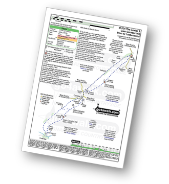
Route Summary:
Church Stretton - Three Fingers Rock - Caer Caradoc Hill - Little Caradoc - Comley - Church Stretton
Not familiar with the area around WR9?
See these 30 nearest walks to UK Postcode WR9 on a google map


