UK Postcode BA13 - The 30 nearest easy-to-follow, circular walk route maps to you
The thirty nearest easy-to-follow, circular walk route maps to you in UK Postcode BA13 in Walk Grade Order
The UK cities, towns and villages in Wiltshire, England that have BA13 in their UK Postcode include:
• Bratton • Chapmanslade • Coulston • Dilton Marsh • Edington • Hawkeridge • Heywood • Westbury • Westbury Leigh •
Not familiar with the area around BA13?
See these 30 nearest walks to UK Postcode BA13 on a google map
   |
Vital Statistics:
| Length: | 5.75 miles (9.5 km) |
| Ascent: | 600ft (183m) |
| Time: | 2.75hrs |
| Grade: |  |

Route Summary:
Mells - Wadbury Hill Fort - Mells Stream - Wadbury Valley - Great Elm - The Macmillan Way - Buckland Brook - Buckland Dinham - Clareham Lane - Hill House Farm - Conduit Bridge - Mells
|
Vital Statistics:
| Length: | 7.25 miles (15.5 km) |
| Ascent: | 584ft (178m) |
| Time: | 3.25hrs |
| Grade: | |

Route Summary:
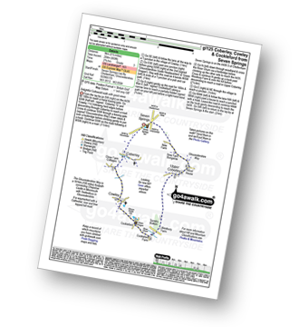
Bushton - Parsonage Farm - Common Farm - Boradtown Road Farm - Cotmarsh - Tyning Farm - The White Horse Trail - Broad Town White Horse - Broadtown Hill - Preachers' Point - Broad Town - Clyffe Pypard - Bushton
|
Vital Statistics:
| Length: | 2.25 miles (3.5 km) |
| Ascent: | 164ft (50m) |
| Time: | 1 hrs |
| Grade: |  |

Route Summary:
Salisbury - Poultry Cross - High Street Gate - Choristers Square - Salisbury Cathedral - The River Avon - Churchill Gardens - St Martin's Church - Salisbury
|
Vital Statistics:
| Length: | 7.5 miles (12 km) |
| Ascent: | 656ft (200m) |
| Time: | 3.25hrs |
| Grade: | |

Route Summary:
Cheddar Gorge - Black Rock Nature Reserve - Long Wood Nature Reserve - Tyning's Farm - Beacon Batch (Mendip Hills) - Charterhouse - Velvet Bottom Nature Reserve - Black Rock Nature Reserve - Cheddar Gorge
|
Vital Statistics:
| Length: | 8.25 miles (13 km) |
| Ascent: | 660ft (201m) |
| Time: | 3.75hrs |
| Grade: |  |

Route Summary:
Great Bedwyn - Kennet and Avon Canal - Castle Copse - Bedwyn Brail - Wilton - Wilton Windmill - Kennet and Avon Canal - Crofton Crossing - Crofton Farm - Haw Wood - Stock Common - Bedwyn Common - Chisbury Wood - Great Bedwyn
|
Vital Statistics:
| Length: | 6.5 miles (10.5 km) |
| Ascent: | 420ft (128m) |
| Time: | 2.70hrs |
| Grade: | |
Route Summary:
Great Bedwyn - Kennet and Avon Canal - Crofton Crossing - Crofton Farm - Haw Wood - Stock Common - Bedwyn Common - Chisbury Wood - Great Bedwyn
|
Vital Statistics:
| Length: | 5 miles (8 km) |
| Ascent: | 410ft (125m) |
| Time: | 2.25hrs |
| Grade: |  |

Route Summary:
Great Bedwyn - Kennet and Avon Canal - Castle Copse - Bedwyn Brail - Wilton - Wilton Windmill - Crofton Crossing - Kennet and Avon Canal - Great Bedwyn
|
Vital Statistics:
| Length: | 5.5 miles (8.5 km) |
| Ascent: | 722ft (220m) |
| Time: | 2.75hrs |
| Grade: | |

Route Summary:
Easton-in-Gordano - The Gordano Round - Hails Wood - The Bottoms - Summer House Wood - Windmill Hill - Buddings Wood - Downs School - Charlton Farm Children's Hospice - Prior's Wood - Portbury - Portbury Standing Stone - Gordano Services - Easton-in-Gordano
|
Vital Statistics:
| Length: | 8.5 miles (13.5 km) |
| Ascent: | 873ft (266m) |
| Time: | 4 hrs |
| Grade: | |

Route Summary:
Aldbourne - The Giant's Grave - Upper Upham - The Ridgeway - Sugar Hill - Four Barrows - Aldbourne
|
Vital Statistics:
| Length: | 4.75 miles (7.5 km) |
| Ascent: | 1,405ft (428m) |
| Time: | 3.25hrs |
| Grade: | |

Route Summary:
Uley - Uley Bury Hill Fort - Cliff Wood - Crawley Barns - The Cotswolds Way - Hodgecombe Farm - Cam Long Down - Peaked Down - Uleyfield - Downham Hill (Smallpox Hill) - Hydegate - Uley Bury Hill Fort - Uley
|
Vital Statistics:
| Length: | 6 miles (9.5 km) |
| Ascent: | 496ft (151m) |
| Time: | 2.75hrs |
| Grade: | |

Route Summary:
Coleshill - Brimstone Farm - Badbury Hill Fort - Badbury Hill - Great Coxwell - Ashen Copse Farm - Flamborough Wood - Coleshill Park - Coleshill
|
Vital Statistics:
| Length: | 5 miles (8 km) |
| Ascent: | 558ft (170m) |
| Time: | 2½ hrs |
| Grade: | |
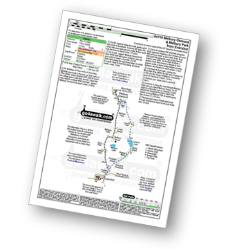
Route Summary:
Evershot - Paradise Wood - Evershot Plantation - Banger's Moor - Sares Wood - Lucerne Lake - Melbury Park - The Macmillan Way - Melbury Osmond - Lower Barton - Melbury House - Evershot
|
Vital Statistics:
| Length: | 5.25 miles (8.5 km) |
| Ascent: | 322ft (98m) |
| Time: | 2.25hrs |
| Grade: | |
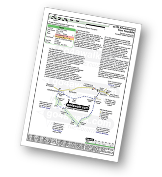
Route Summary:
Tolpuddle - Southover Heath - Clyff Copse - Tincleton Hang - Cowpound Wood - Athelhamton - Park Farm - Tolpuddle
|
Vital Statistics:
| Length: | 5.5 miles (9 km) |
| Ascent: | 397ft (121m) |
| Time: | 2½ hrs |
| Grade: | |
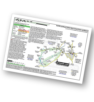
Route Summary:
Lyndhurst - Emery Down - White Moor - Buckhill Hole - The New Forest - Highland Water - Roman Bridge - Bramble Hill - Allum Green House - Cut Walk - Swan Green - Lyndhurst
|
Vital Statistics:
| Length: | 5 miles (8 km) |
| Ascent: | 561ft (171m) |
| Time: | 2½ hrs |
| Grade: | |
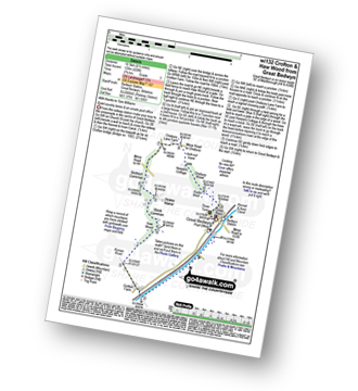
Route Summary:
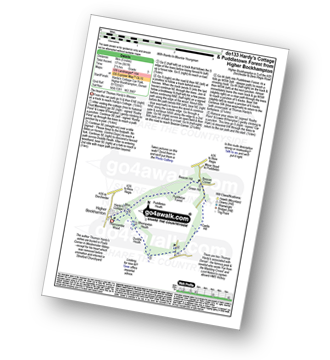
Higher Bockhampton - Thorncombe Wood - Hardy's Cottage (Thomas Hardy's Birthplace) - Bhompston Heath - Duddle Heath - Castle Hill - Beacon Corner - Beacon Hill - Puddletown Forest - Hardy's Cottage (Thomas Hardy's Birthplace) - Higher Bockhampton
Not familiar with the area around BA13?
See these 30 nearest walks to UK Postcode BA13 on a google map
|
Vital Statistics:
| Length: | 4.75 miles (7.5 km) |
| Ascent: | 499ft (152m) |
| Time: | 2.25hrs |
| Grade: | |
Route Summary:
Higher Bockhampton - Stinsford - Lower Bockhampton - Kingston Maurward - Duddle Heath - Bhompston Heath - Puddleton Heath - Hardy's Cottage (Thomas Hardy's Birthplace) - Thorncombe Wood - Higher Bockhampton
|
Vital Statistics:
| Length: | 7.25 miles (11.5 km) |
| Ascent: | 643ft (196m) |
| Time: | 3.25hrs |
| Grade: | |

Route Summary:
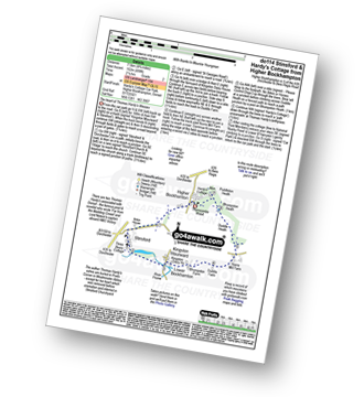
Higher Bockhampton - Stinsford - Lower Bockhampton - Kingston Maurward - River Frome - Duddle Heath - Castle Hill - Beacon Corner - Beacon Hill - Puddletown Forest - Hardy's Cottage (Thomas Hardy's Birthplace) - Higher Bockhampton
|
Vital Statistics:
| Length: | 9 miles (14.5 km) |
| Ascent: | 754ft (230m) |
| Time: | 4 hrs |
| Grade: | |

Route Summary:
Chedworth - Woodlands Farm - Postcombe - Withington Woods - Withington - River Coln - Woodbridge - Cassey Compton - Turpin's Green - Hutnage - Chedworth Roman Villa - The Monarch's Way - The Macmillan Way - Yanworth Mill - Chedworth Woods - Chedworth
|
Vital Statistics:
| Length: | 9.75 miles (15.5 km) |
| Ascent: | 1,126ft (343m) |
| Time: | 4.75hrs |
| Grade: |  |

Route Summary:
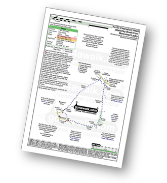
Winchester - Tun Bridge - The Itchen Way - Itchen Navigation - St Catherine's Hill - Pilgrims' Trail - Twyford Down - Morestead Down - Hydes Cottages - Fawley Down - The Allan King's Way - Cheesefoot Head Car Park - Cheesefoot Head (Matterley Bowl) - The South Downs Way - The Pilgrim's Way - Telegraph Hill - Little Golders - Chilcomb - Highcliffe - The Soke - City Mill - Wharf Bridge - Tun Bridge - Winchester
|
Vital Statistics:
| Length: | 5.75 miles (9 km) |
| Ascent: | 571ft (174m) |
| Time: | 2.75hrs |
| Grade: | |

Route Summary:
Chedworth Roman Villa - The Macmillan Way - River Coln - Yanworth Common - Yanworth Wood - Streetfold - Yanworth - Dean Grove - Sheep Wash - Oxpens Farm - The Monarch's Way - Stowell Grove - Budford's Grove - Yanworth Mill - River Coln - Chedworth Woods - Chedworth Roman Villa
|
Vital Statistics:
| Length: | 5.5 miles (9 km) |
| Ascent: | 669ft (204m) |
| Time: | 2.75hrs |
| Grade: | |
Route Summary:
Seven Springs - Coberley - The Gloucestershire Way - Cowley - Cockleford - Westbury Farm - Tomtit's Bottom - Upper Coberley - New Farm Bungalow - Seven Springs
|
Vital Statistics:
| Length: | 8.25 miles (13 km) |
| Ascent: | 912ft (278m) |
| Time: | 4 hrs |
| Grade: | |

Route Summary:
Seven Springs - Coberley - The Gloucestershire Way - Cowley - Cockleford - Butlers Hill Farm - Butler's Farm - Colesbourne - Forty Acre Plantation - Balbarrow Wood - The Forest - Pinswell Plantation - Mercombe Wood - Hilcot Wood - Upper Coberley - New Farm Bungalow - Seven Springs
|
Vital Statistics:
| Length: | 7.25 miles (11.5 km) |
| Ascent: | 847ft (258m) |
| Time: | 3½ hrs |
| Grade: | |
Route Summary:
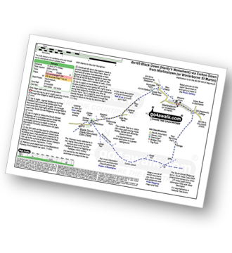
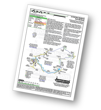
Martinstown (or Winterborne St Martin) - Four Barrows Farm - Great Hill - South Dorset Ridgeway - Corton Down - Bronkham Hill - Jubilee Trail - Blackdown - Smitten Corner - Black Down (Hardy Monument) - East Rew Farm - Rew Manor - Martinstown (or Winterboune St Martin).
|
Vital Statistics:
| Length: | 7 miles (11 km) |
| Ascent: | 1,037ft (316m) |
| Time: | 3½ hrs |
| Grade: | |

Route Summary:
Martinstown (or Winterborne St Martin) - Grove Hill Bottom - Great Hill - South Dorset Ridgeway - Corton Down - Bronkham Hill - Jubilee Trail - Blackdown - Smitten Corner - Black Down (Hardy Monument) - Bronkham Hill - Pen Barn Farm - Grove Hill Bottom - Martinstown (or Winterborne St Martin)
|
Vital Statistics:
| Length: | 4.75 miles (7.5 km) |
| Ascent: | 443ft (135m) |
| Time: | 2.25hrs |
| Grade: | |
Route Summary:
Morestead - Old Copse Down - Old Down Wood - Old Down Plantation - Longwood Warren - The Allan King's Way - Cheesefoot Head (Matterley Bowl) - Fawley Down - Morestead Down - Morestead
|
Vital Statistics:
| Length: | 5.5 miles (9 km) |
| Ascent: | 630ft (192m) |
| Time: | 2.75hrs |
| Grade: | |

Route Summary:
Askerswell - South Eggardon Farm - North Eggardon Farm - Eggardon Hill Fort - Eggardon Hill - Haydon Down - Stancombe Farm - Askerswell Down - Nallers Farm - Askerswell
|
Vital Statistics:
| Length: | 10 miles (16 km) |
| Ascent: | 985ft (300m) |
| Time: | 4.75hrs |
| Grade: | |

Route Summary:
Cheesefoot Head Car Park - Cheesefoot Head (Matterley Bowl) - Fawley Down - Hydes Cottages - Morestead - Old Down Copse - Bushy Copse - Longwood House - Longwood Dead Farm - Lane End - The South Downs Way - Holden Farm - Gander Down - Temple Valley - Cheesefoot Head Car Park
|
Vital Statistics:
| Length: | 5.25 miles (8.5 km) |
| Ascent: | 1,234ft (376m) |
| Time: | 3.25hrs |
| Grade: | |

Route Summary:
Durdle Door Car Park - Daggers Gate - The Warren - Chaldon Down - The South West Coast Path - West Bottom - Middle Bottom - Bat's Hole - Bat's Head - The Jurassic Coast - Swyre Head - Scratchy Bottom - Durdle Door - Durdle Door Car Park
|
Vital Statistics:
| Length: | 6.25 miles (10 km) |
| Ascent: | 558ft (170m) |
| Time: | 2.75hrs |
| Grade: | |
Route Summary:
Burford - Fulbrook - Widley Copse - Dean Bottom - Widford Church - River Windrush - Burford
|
Vital Statistics:
| Length: | 9 miles (14.5 km) |
| Ascent: | 1,191ft (363m) |
| Time: | 4½ hrs |
| Grade: | |

Route Summary:
Lulworth Cove - West Lulworth - Durdle Door Caravan Park - Newlands Farm - Daggers Gate - The Warren - Chaldon Down - Ringstead Bay - The Jurassic Coast - The South West Coast Path - White Nothe - Whitenothe Cottage - West Bottom - Middle Bottom - Bats Hole - Bats Head - Swyre Head - Scratchy Bottom - Durdle Door - St Oswald's Bay - Hambury Tout - Dungy Head - Stair Hole - Lulworth Cove
Not familiar with the area around BA13?
See these 30 nearest walks to UK Postcode BA13 on a google map


