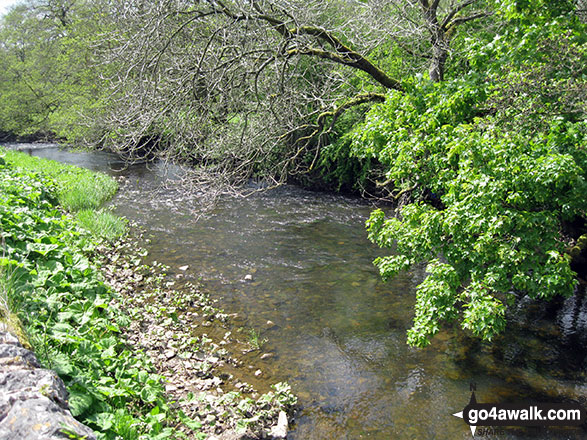
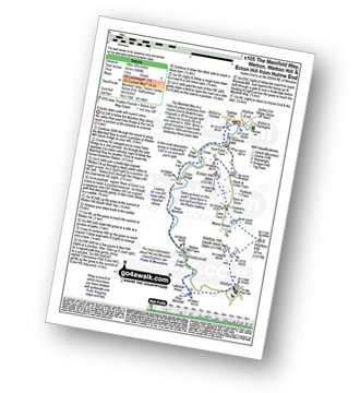
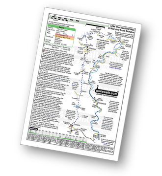
The River Manifold
The White Peak Area,
The Peak District National Park,
Staffordshire, England
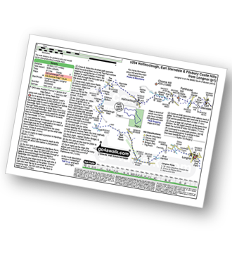
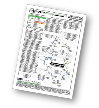
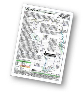
See views like this by using any of these 24 easy-to-follow circular walk route maps:
   |
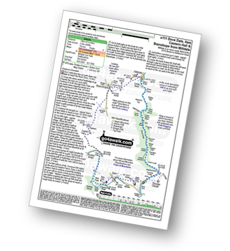
Vital Statistics:
| Length: | 3.75 miles (6 km) |
| Ascent: | 289ft (88m) |
| Time: | 1.75hrs |
| Grade: |  |

Route Summary:
Hulme End - Manifold Valley Visitors Centre - Lowend - Low End Farm - Buttsend - Brund - The Manifold Way - The River Manifold - Brund Mill - Holme House - Hulme End
|
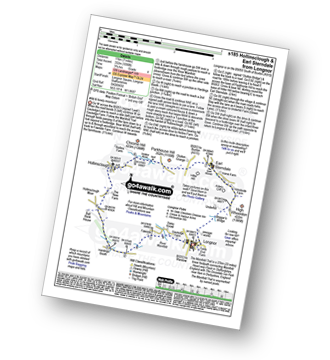
Vital Statistics:
| Length: | 5 miles (8 km) |
| Ascent: | 640ft (195m) |
| Time: | 2½ hrs |
| Grade: |  |

Route Summary:
Longnor - The Manifold Trail - River Manifold - Lower Boothfold Farm - Ludburn Farm - Bridge End - The Ferns Farm - Heath House - Longnor
|
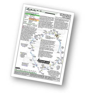
Vital Statistics:
| Length: | 6 miles (9.5 km) |
| Ascent: | 1,034ft (315m) |
| Time: | 3.25hrs |
| Grade: | |
Route Summary:
Hulme End - Manifold Valley Visitors Centre - The Manifold Way - Dale Bridge - The Lee - Tunnel - River Manifold - Wetton Mill Farm - Wettonmill - Dale Farm - Sugarloaf (Wetton) - Broad Ecton Farm - Ecton Hill - Westside Mill - The Manifold Way - Hulme End
|
Vital Statistics:
| Length: | 4.75 miles (7.5 km) |
| Ascent: | 659ft (201m) |
| Time: | 2½ hrs |
| Grade: | |

Route Summary:
Longnor - Beggar's Bridge - River Dove - Crowdecote (Crowdicote) - Bridge End Farm - Under Wwhitle Farm - Over Boothlow Farm - The Manifold Trail - River Manifold - Longnor.
|
Vital Statistics:
| Length: | 4.5 miles (7 km) |
| Ascent: | 623ft (190m) |
| Time: | 2.25hrs |
| Grade: | |

Route Summary:
Wetton - River Manifold - Wettonmill - The Manifold Way - Thor's Cave - Manor House - Wetton
|
Vital Statistics:
| Length: | 6.5 miles (10.5 km) |
| Ascent: | 689ft (210m) |
| Time: | 3.25hrs |
| Grade: | |
Route Summary:
Weag's Bridge - River Manifold - The Manifold Way - River Hamps - Lee House Farm - Farwell Farm - Calton - Slade House - Throwley Moor - Soles Hollow - The Manifold Way - River Manifold - Weag's Bridge
|
Vital Statistics:
| Length: | 4.75 miles (7.5 km) |
| Ascent: | 754ft (230m) |
| Time: | 2½ hrs |
| Grade: | |
Route Summary:
Ilam - Ilam Country Park - River Manifold - Lower Dove Dale - Upper Musden - Hazelton Clump - Blore - Coldwall Farm - The Limestone Way - Coldwall Bridge - The Manifold Trail - River Dove - Fishpond Wood - River Manifold - Ilam
|
Vital Statistics:
| Length: | 6.5 miles (10.5 km) |
| Ascent: | 745ft (227m) |
| Time: | 3.25hrs |
| Grade: | |

Route Summary:
Mappleton (aka Mapleton) - Okeover Bridge - Okeover Hall - Okeover Park - Cowclose Wood - Martin Hill Farm - Woodhouses Farm - Blore - Blore Pastures - Ilam - River Manifold - The Manifold Trail - Fishpond Wood - River Dove - Coldwall Bridge - Big Peg's Wood - Little Peg's Wood - Littlepark Farm - Okeover Bridge - Mappleton (aka Mapleton)
|
Vital Statistics:
| Length: | 8.25 miles (13 km) |
| Ascent: | 689ft (210m) |
| Time: | 3.75hrs |
| Grade: |  |
Route Summary:
Milldale - Dove Dale - Viator's Bridge - River Dove - Dove Holes - Upper Taylor's Wood - Pickering Tor,Raynard's Cave - Natural Arch - Sharplow Dale - Jacob's Ladder (Dove Dale) - Lover's Leap - Twelve Apostles - Dove Dale Castle - Thorpe Cloud - Ilam - Ilam Country Park - St Bartram's Bridge - River Manifold - Battle Stone Cross - Ilam Wood - River Lodge - Castern Hall - Castern Farm - Stanshope - Milldale
|
Vital Statistics:
| Length: | 7 miles (11 km) |
| Ascent: | 1,090ft (332m) |
| Time: | 3.75hrs |
| Grade: | |
Route Summary:
Longnor - The Manifold Trail - Gauledge Farm - Fawside Farm - The River Manifold - Hardings Booth - Hollinsclough Moor - Hollinsclough - Swallow Brook - Earl Sterndale - Abbotside Farm - Green Lane - Beaggar's Bridge - Longnor
|
Vital Statistics:
| Length: | 7.5 miles (12 km) |
| Ascent: | 811ft (247m) |
| Time: | 3½ hrs |
| Grade: | |
Route Summary:
Longnor - The Manifold Trail - River Manifold - Lower Boothfold Farm - Ludburn Farm - Reaps Moor - Blake Brook - Boosley Grange - Bank House Farm - Shining Ford Farm - Hardings Booth Farm - Fawside Farm - Gualedge Farm - Longnor
|
Vital Statistics:
| Length: | 7 miles (10.5 km) |
| Ascent: | 787ft (240m) |
| Time: | 3.25hrs |
| Grade: | |

Route Summary:
Wettonmill - Hoo Brook - Butterton - Warslow - Dale Bridge - Ecton - The Manifold Way - The River Manifold - Manifold Valley - Wettonmill
|
Vital Statistics:
| Length: | 8.25 miles (13 km) |
| Ascent: | 1,588ft (484m) |
| Time: | 4½ hrs |
| Grade: |  |

Route Summary:
Waterhouses - The Manifold Way - The River Hamps - Sparrowlee Bridge - Lee House - Hell Hole - Old Soles Wood - Soles Coppice - The River Manifold - Weag's Bridge - Beeston Tor Farm - Throwley Hall Farm - Throwley Cottage - Farwall Farm - The Manifold Way - Waterhouses
|
Vital Statistics:
| Length: | 8.75 miles (14 km) |
| Ascent: | 1,690ft (515m) |
| Time: | 5 hrs |
| Grade: | |
Route Summary:
Butterton - Grindon Moor (Grindon Moor) - Ford - Ryebrook Farm - Grindon - Weag's Bridge - The Manifold Way - The River Manifold - Thor's Cave - Ladyside Wood - Dafar Bridge - Wettonmill - Hoo Brook - Butterton
|
Vital Statistics:
| Length: | 14.5 miles (23.5 km) |
| Ascent: | 3,049ft (929m) |
| Time: | 8½ hrs |
| Grade: | |
Route Summary:
Longnor - The Manifold Trail - Gauledge Farm - Fawside Farm - The River Manifold - Hardings Booth - Ball Bank Farm - The River Manifold - Heathylee House - Hollinsclough Moor - Wilshaw Bottom - Wilshaw Farm - Moorside Farm - Hollinsclough - Hollins Farm - Swallow Brook - Parkhouse Hill - Hitter Hill - Earl Sterndale - Abbots Grove - Wheeldon Trees - High Wheeldon - Crowdecote - Bridge End Farm - Pilsbury Castle Hills - Pilsbury - Sheen Lane Farm - Ridge End Farm - The Manifold Trail - Lower Boothlow Farm - Folds End Farm - Longnor
|
Vital Statistics:
| Length: | 11 miles (17.5 km) |
| Ascent: | 1,342ft (409m) |
| Time: | 5.25hrs |
| Grade: | |

Route Summary:
Longnor - River Manifold - The Manifold Trail - Over Boothlow Farm - Lower Boothlow Farm - Hill End Farm - Sheen Hill - Slate House Farm - Sheen - Brund - River Manifold - Brund Mill - New Road Farm - Field House Farm - Reaps Moor - Black Brook - Smedley Sytch - Boosley Grange - Fawfield Head - Bank House - Shining Ford - The Manifold Trail - Hardings Booth - Fawside Farm - Gauledge Farm,Longnor.
|
Vital Statistics:
| Length: | 10.25 miles (16.5 km) |
| Ascent: | 1,486ft (453m) |
| Time: | 5.25hrs |
| Grade: | |

Route Summary:
Ilam - The Manifold Trail - Ilam Country Park - River Manifold - Castern Hall - Castern Wood Nature Reserve - Weag's Bridge - The Manifold Way - The River Hamps - Manifold Valley - Lee House Farm - Throwley Moor - Slade House - Rushley - Ilam Country Park - Ilam
|
Vital Statistics:
| Length: | 7 miles (11 km) |
| Ascent: | 1,395ft (425m) |
| Time: | 4 hrs |
| Grade: | |
Route Summary:
Hollinsclough - The New Farm - The Manifold Trail - Hardings Booth - Shining Ford - Holly Grove Farm - Oakenclough Brook - Oakenclough Hall Farm - Blackstone Edge - Bradshaw Farm - High Ash Farm - The River Manifold - Heathylee House - Hollinsclough Moor - Wilshaw Bottom - Wilshaw Farm - Moorside Farm - Hollinsclough
|
Vital Statistics:
| Length: | 8.75 miles (14 km) |
| Ascent: | 1,848ft (563m) |
| Time: | 5 hrs |
| Grade: |  |
Route Summary:
Hulme End - Manifold Valley Visitors Centre - The Manifold Way - Dale Bridge - The Lee - Tunnel - River Manifold - Wetton Mill Farm - Wettonmill - Dafar Bridge - Ladyside Wood - Wetton - Wetton Hill (South West Top) - Wetton Hill - Cantrell's House - Ecton Hill - Westside Mill - The Manifold Way - Hulme End
|
Vital Statistics:
| Length: | 9.75 miles (15.5 km) |
| Ascent: | 2,146ft (654m) |
| Time: | 5.75hrs |
| Grade: | |
Route Summary:
Ilam - Ilam Country Park - River Manifold - Castern Hall - Castern Wood Nature Reserve - Wetton Low - Wetton - Alstonefield - Milldale - Achas Bank - Raven's Tor - Hall Dale - Dove Dale Wood - Air Cottage - Ilam Tops - Ilamtops Farm - Ilam
|
Vital Statistics:
| Length: | 11.5 miles (18.5 km) |
| Ascent: | 1,487ft (453m) |
| Time: | 2.75hrs |
| Grade: | |

Route Summary:
Longnor - The Manifold Trail - Gauledge Farm - Fawside Farm - The River Manifold - Hardings Booth - Shining Ford - Holly Grove Farm - Newtown - Lady Edge - Round Knowl - Noon Sun Farm - Blake Mere (Merryton Low) - Blake Brook - Lower Fleetgreen Farm - Little Fernyford Farm - The Manifold Trail - Brund Mill - Pool Farm - Lower Boothlow Farm - Over Boothlow Farm - Folds End Farm - Longnor
|
Vital Statistics:
| Length: | 10.25 miles (16.5 km) |
| Ascent: | 1,969ft (600m) |
| Time: | 2.75hrs |
| Grade: | |

Route Summary:
Ilam - The Manifold Trail - Ilam Country Park - River Manifold - Rushley - Slade House - Throwley Moor - Lee House Farm - Manifold Valley - River Hamps - Saucefield Farm - Grindon - Weag's Bridge - Beeston Tor Farm - The Manifold Trail - Throwley Hall Farm - Rushley - Ilam Country Park - Ilam
|
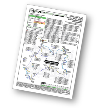
Vital Statistics:
| Length: | 10.5 miles (17 km) |
| Ascent: | 1,847ft (563m) |
| Time: | 5.75hrs |
| Grade: | |
Route Summary:
Grindon - Weag's Bridge - The Manifold Way - The River Manifold - Thor's Cave - Dafar Bridge - Wettonmill - Ecton Bridge - Dale Bridge - Ecton - Hulme End - Hollow Farm - Warslow Hall - Upper Brownhill Farm - Warslow - Villa Farm - Clayton House - Wallacre - Hoo Brook - Ladyside Farm - Grindon
|
Vital Statistics:
| Length: | 15 miles (24 km) |
| Ascent: | 2,028ft (618m) |
| Time: | 8 hrs |
| Grade: |  |

Route Summary:
Weag's Bridge - River Manifold - Beeston Tor Farm - River Hamps - Soles Coppice - Old Soles Wood - Hell Hole - Lee House - Farwell Farm - Calton - Carlton Green - Rushley Wood - Musden Wood - Rushley - Ilam Country Park - Ilam - River Dove - Dovedale Castle - Dove Dale - The River Dove - Stepping Stones - Lover's Leap - Tissington Spires - Shaplow Dale,Natural Arch - Raynard's Cave - Upper Taylor's Wood - Dove Holes - Viator's Bridge - Milldale - Alstonefield - Wetton - Thor's Cave - Weag's Bridge
Send us your photographs and pictures of walks and hikes in the British countryside
If you would like to see your digital photographs as part of this collection, please send them as email attachments (configured for any computer) along with your name to:
and we shall do our best to publish them.
(Guide Resolution = 300dpi. At least = 587 pixels (wide) x 440 pixels (high).)

You can also submit photos via our Facebook Page.
NB. Please indicate where each photo was taken.
NB. To see photographs and pictures from a particular walk choose your walk from Walks or use our Walk Search facility.
To see photographs and pictures on, of or from a particular Mountain, Peak, Top or Hill select from Peaks & Mountains' or enter the Mountain, Peak, Top or Hill Name into our 'Photo Search facility.


