Dewey, Marilyn & OS Trig Point Icon

Shining Tor
559m (1835ft)

The White Peak Area, The Peak District, Cheshire, England

Shining Tor is the highest point in the county of Cheshire.

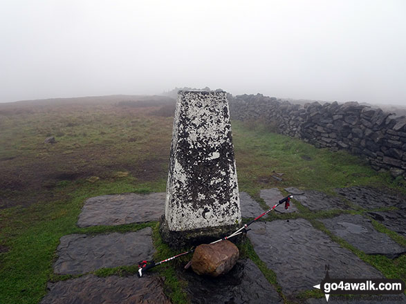
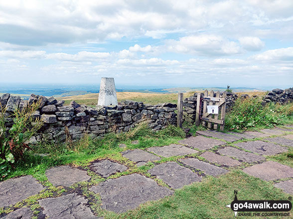
The summit of Shining Tor is marked by an Ordnance Survey Trig Point.


Record Shining Tor as Bagged, Climbed & Conquered


English Dewey Icon

English Dewey
54th in England,
124th in England & Wales

English Marilyn Icon

English Marilyn
59th highest in England,
851st highest in Great Britain

English Trig Point Icon


English Trig Point (Pillar)

Walk Shining Tor walking UK Mountains in The White Peak Area The Peak District National Park CheshireDerbyshire, England

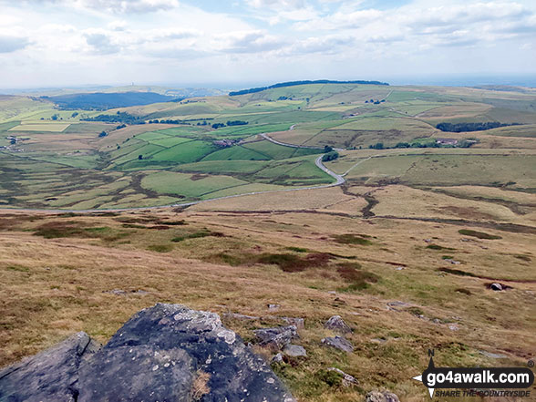
The view from the summit of Shining Tor

Photo: Rachael Barber

You can find Shining Tor & all the walks that climb it on these unique free-to-access Interactive Walk Planning Maps: (click/TAP to select)

The Peak District National Park


1:25,000 scale OS Explorer Map (the ones with orange/yellow covers):

OL24 The Peak District - White Peak area


1:50,000 scale OS Landranger Map (the ones with pink/magenta covers):

118 Stoke-on-Trent & Macclesfield


See Shining Tor and the surrounding tops on our free-to-access 'Google Style' Peak Bagging Maps:

See Shining Tor and the surrounding tops on our downloadable PDF Peak Bagging Map:


You can walk to the top of Shining Tor by using any of these 5 easy‑to‑follow route maps:
Walking Boot Print Icon

Walk d282 Shining Tor and Errwood Hall via Foxlow Edge from Errwood Reservoir, The Goyt Valley

The ascent up Shining Tor is well worth it

Walk GPS Icon
Walk GPX Icon
Walk PDF Icon

Vital Statistics:

Length: 6ml (9.5km)
Ascent:1,310ft (399m)
Time:3½ hrs
Grade:Walk Grade 4 Icon (Moderate)
Walking Boot Print Icon

Walk ch157 Shining Tor and Cats Tor from Lamaload Reservoir

Steady climb to great views

Walk GPS Icon
Walk GPX Icon
Walk PDF Icon

Vital Statistics:

Length: 6.25ml (10km)
Ascent:1,224ft (373m)
Time:3½ hrs
Grade:Walk Grade 4 Icon (Moderate)
Walking Boot Print Icon

Walk ch131 Shining Tor and Yearns Low from Lamaload Reservoir

Steady climb to great views

Walk GPS Icon
Walk GPX Icon
Walk PDF Icon

Vital Statistics:

Length: 7.25ml (11.5km)
Ascent:1,680ft (512m)
Time:4½ hrs
Grade:Walk Grade 5 Icon (Moderate)
Walking Boot Print Icon

Walk d221 Shining Tor and Windgather Rocks from Errwood Reservoir, The Goyt Valley

A stiff ascent is rewarded by spectacular views

Walk GPS Icon
Walk GPX Icon
Walk PDF Icon

Vital Statistics:

Length: 8.75ml (14km)
Ascent:1,694ft (516m)
Time:5 hrs
Grade:Walk Grade 5 Icon (Moderate)
Walking Boot Print Icon

Walk ch146 Kettleshulme and Shining Tor from Lamaload Reservoir

Varied walking

Walk GPS Icon
Walk GPX Icon
Walk PDF Icon

Vital Statistics:

Length: 9.5ml (15km)
Ascent:1,611ft (491m)
Time:5 hrs
Grade:Walk Grade 5 Icon (Moderate)

Other walkers who hiked, climbed, bagged and summited Shining Tor Fellow go4awalkers who have already walked, climbed, summited & bagged Shining Tor

Darin Torrance walked up Shining Tor on October 23rd, 2022 [from/via/route] Lamaload [with] Moose [weather] Humid foggy - 7 mile circular walk

Neall Garrad climbed Shining Tor on January 26th, 2019 [from/via/route] From Gradbach, via Shutlingsloe & Shining Tor & back to Gradbach. [with] WWESU Explorers [weather] Mixed

Patrick Molloy bagged Shining Tor on September 18th, 2021 [from/via/route] From Pym's Chair. Via Cat's Tor [with] Nadia & Baz [weather] Partial Sun Warm

Wendy Nield hiked Shining Tor on April 29th, 2021 [from/via/route] 6.75 mile circular walk from Errwood Hall car park also bagging Cats Tor. [with] Hillbilly Baggers [weather] Mainly cloudy with sunny spells & snow flurries !! - Saw numerous Skylarks & heard a cuckoo.

Angela Haworth summited Shining Tor on June 22nd, 2020 [from/via/route] Errwood Hall - Shooter's Clough - Shining Tor - Cats Tor - Foxlow Edge - Errwood Hall [with] companion [weather] warm & sunny

Tracy Hudson conquered Shining Tor on November 7th, 2020 [weather] Sunny

John Bramwell scaled Shining Tor on September 23rd, 2020 [from/via/route] From Errwood Hall & on to Cats Tor & Foxlow Edge [with] Alone [weather] Cloudy & light rain - poor visibility

Sharron Barker walked up Shining Tor on May 12th, 2019 [from/via/route] LAMALOAD RESERVOIR [weather] SUN

Christine Shepherd climbed Shining Tor on March 18th, 2019 [from/via/route] Walked from Lamaload Reservoir using walk ch157. [with] On my own [weather] Cloudy & rainy with occasional hail, cloud did clear occasionally to see the views. - Once I had found Lamaload Reservoir, (rely on a map not a sat nav!), the route was clear & easy to follow. I am sure there would be wonderful views throughout this walk on a clear day.

Lucy Perchard bagged Shining Tor on February 17th, 2019 [from/via/route] walk up from Goyt Valley to Shining Tor, Cats Tor, Pym Chair & Wingather Rocks [with] Tony [weather] Mostly cloudy & quite windy - Lovely winter walk

To add (or remove) your name and experiences on this page - Log On and edit your Personal Mountain Bagging Record

. . . [see more walk reports]


More Photographs & Pictures of views from, on or of Shining Tor

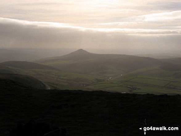
Looking North-West from the summit of Shining Tor

Looking North-West from the summit of Shining Tor

Photo: Mike Walker (586)

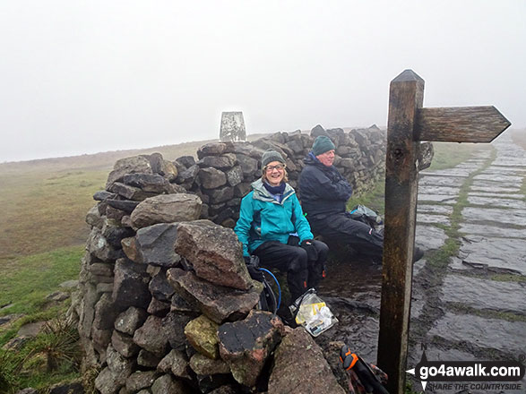
On the summit of Shining Tor

On the summit of Shining Tor

Photo: Christine Shepherd (740)

Panoramic View from the summit of Shining Tor

Panoramic View from the summit of Shining Tor

Photo: Mike Walker (585)

Cat's Tor and Shining Tor from Windgather Rocks

Cat's Tor and Shining Tor from Windgather Rocks

Photo: Mike Walker (584)

Shining Tor summit

Shining Tor summit

Photo: Mike Walker (591)

Shining Tor summit Trig Point

Shining Tor summit Trig Point

Photo: Christine Shepherd (739)

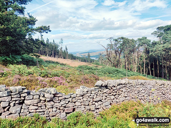
Errwood Reservoir visible through a gap in the trees on the lower slopes of Shining Tor

Errwood Reservoir visible through a gap in the trees on the lower slopes of Shining Tor

Photo: Mike Walker (595)

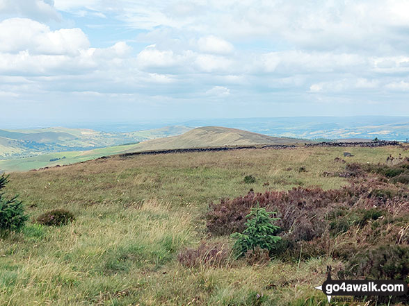
Cat's Tor from the summit of Shining Tor

Cat's Tor from the summit of Shining Tor

Photo: Mike Walker (590)

Looking South towards Shutlingsloe and Croker Hill from the summit of Shining Tor

Looking South towards Shutlingsloe and Croker Hill from the summit of Shining Tor

Photo: Mike Walker (588)

Looking West towards Teggs Nose from the summit of Shining Tor

Looking West towards Teggs Nose from the summit of Shining Tor

Photo: Mike Walker (587)

Unusual gate on Shining Tor with Shutlingsloe on the horizon

Unusual gate on Shining Tor with Shutlingsloe on the horizon

Photo: Mike Walker (592)

Looking South to Shutlingsloe from the summit of Shining Tor

Looking South to Shutlingsloe from the summit of Shining Tor

Photo: Rachael Barber (1)

Descending from Shining Tor

Descending from Shining Tor

Photo: Mike Walker (594)

Macclesfield Forest (left) and Shining Tor (centre left - on the horizon) from a rather misty Shutlingsloe summit

Macclesfield Forest (left) and Shining Tor (centre left - on the horizon) from a rather misty Shutlingsloe summit

Photo: Tim Hope (19)

Kinder Scout from Shining Tor

Kinder Scout from Shining Tor

Photo: Paul Brierley (2)

Cats Tor from Shining Tor

Cats Tor from Shining Tor

Photo: Peter Wood (1)

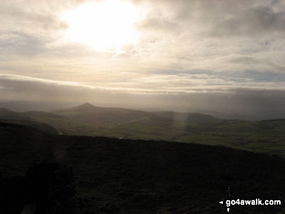
Shutlingsloe from Shining Tor

Shutlingsloe from Shining Tor

Photo: Mike Walker (593)

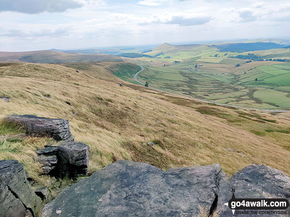
Looking down onto Lamaload Reservoir from Shining Tor

Looking down onto Lamaload Reservoir from Shining Tor

Photo: Amanda Jones (1)

The trig point on the summit of Shining Tor

The trig point on the summit of Shining Tor

Photo: Mike Walker (589)


Send us your photographs and pictures on, of, or from Shining Tor

If you would like to add your walk photographs and pictures featuring views from, on or of Shining Tor to this page, please send them as email attachments (configured for any computer) along with your name to:


and we shall do our best to publish them.

(Guide Resolution = 300dpi. At least = 660pixels (wide) x 440 pixels (high).)

Send us your photographs and pictures on, of, or from Shining Tor via Facebook

You can also submit photos via our Facebook Page.

NB. Please indicate where each photo was taken.


Follow go4awalk.com on Twitter Follow go4awalk.com on Facebook


Home


Find new Friends to go walking with

Walk all 214 Wainwrights in just 59 Walks. Download GPS Waypoints - Great Walks you must not miss!

Walk The Yorkshire Three Peaks Challenge Walk - All the Latest Route Information, GPS Waypoints and Split Times to keep you on Schedule

Walk The British Three Peaks Challenge Walk - All the Latest Route Information and GPS Waypoints

See our pick of The Best Walks in The Lake District - Great Walks you must not miss!

Walk our pick of the Best Lake District Ridge Walks - Great Walks you must not miss!

Walk our pick of the Best Lake District Walks to do in the rain - Great Walks you must not miss!

Walk our pick of The Best Walks in Snowdonia - Great Walks you must not miss!

Walk our pick of The Best Ridge Walks in Wales - Walks you must not miss!

Walk our pick of The Best Walks in The Brecon Beacons - Great Walks you must not miss!

Walk our pick of The Best Walks in The Yorkshire Dales - Walks you must not miss!

Walk our pick of The Best Walks in The Peak District - Walks you must not miss!

Walk our pick of The Best Walks in The Forest of Bowland - Walks you must not miss!

Walk our pick of The Best Walks in Shropshire - Walks you must not miss!

Walk our pick of The Best Walks in Cheshire - Walks you must not miss!

Walk our pick of The Best Walks in Lancashire - Walks you must not miss!

Not sure where to walk next? Try Peak Bagging - Great Walks you must not miss!

Not sure where to walk next? Walk part of a National Trail - Great Walks you must not miss!

Walks with Downloadable and Uploadable GPS Waypoint Data

Walking Kit and Gear Tested by Walkers

Full Site Search