Wainwright Icon

Middle Dodd
654m (2146ft)

The Eastern Fells, The Lake District, Cumbria, England


Tap/mouse over a coloured circle (1-3 easy walks, 4-6 moderate walks, 7-9 hard walks) and click to select.


Record Middle Dodd as Bagged, Climbed & Conquered


Wainwright Icon

Wainwright
(No. 111)

Walk Middle Dodd walking UK Mountains in The Eastern Fells The Lake District National Park Cumbria, England

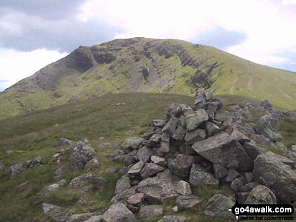
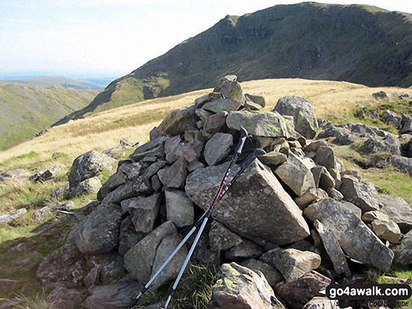
Middle Dodd Summit

Photo: Chris Pearson

You can find Middle Dodd & all the walks that climb it on these unique free-to-access Interactive Walk Planning Maps: (click/TAP to select)

The Lake District National Park


1:25,000 scale OS Explorer Maps (the ones with orange/yellow covers):

OL5 The English Lakes - North Eastern area


OL7 The English Lakes - South Eastern area


1:50,000 scale OS Landranger Map (the ones with pink/magenta covers):

90 Penrith & Keswick, Ambleside


See Middle Dodd and the surrounding tops on our free-to-access 'Google Style' Peak Bagging Maps:

See Middle Dodd and the surrounding tops on our downloadable PDF Peak Bagging Maps:

NB: Whether you print off a copy on to paper or download it to your phone, these PDF Peak Baggers Maps will prove incredibly useful when your are up there on the tops and you cannot get a phone signal!


You can walk to the top of Middle Dodd by using any of these 4 easy‑to‑follow route maps:
Walking Boot Print Icon

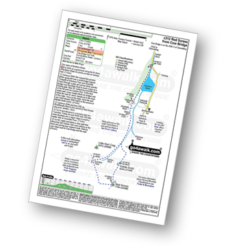
Walk c312 Red Screes from Brothers Water

Fine views of Brothers Water

Walk GPS Icon
Walk GPX Icon
Walk PDF Icon

Vital Statistics:

Length: 7ml (11km)
Ascent:2,373ft (723m)
Time:5 hrs
Grade:Walk Grade 5 Icon (Moderate)
Walking Boot Print Icon

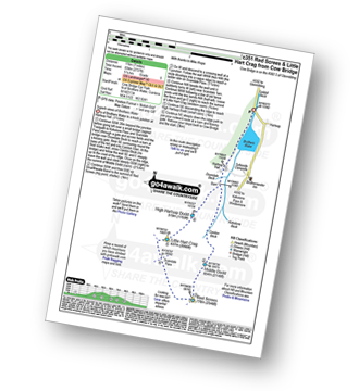
Walk c351 Red Screes and Little Hart Crag from Brothers Water

Superb views of Brothers Water

Walk GPS Icon
Walk GPX Icon
Walk PDF Icon

Vital Statistics:

Length: 7ml (11km)
Ascent:2,737ft (834m)
Time:5.25hrs
Grade:Walk Grade 6 Icon (Moderate)
Walking Boot Print Icon

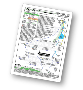
Walk c305 Red Screes and Hart Crag from Brothers Water

Superb views of Brothers Water and Patterdale

Walk GPS Icon
Walk GPX Icon
Walk PDF Icon

Vital Statistics:

Length: 9.75ml (15.5km)
Ascent:3,699ft (1,127m)
Time:7.25hrs
Grade:Walk Grade 7 Icon (Hard)
Walking Boot Print Icon

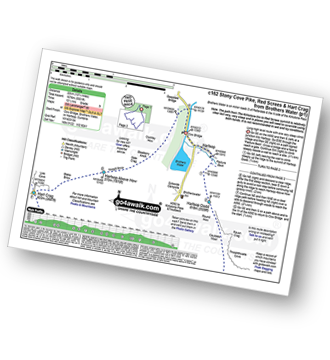
Walk c162 Stony Cove Pike (Caudale Moor), Red Screes and Hart Crag from Brothers Water

Long high level route with one very steep climb

Walk GPS Icon
Walk GPX Icon
Walk PDF Icon

Vital Statistics:

Length: 13.75ml (22km)
Ascent:5,501ft (1,676m)
Time:10½ hrs
Grade:Walk Grade 9 Icon (Very Hard)

Other walkers who hiked, climbed, bagged and summited Middle Dodd Fellow go4awalkers who have already walked, climbed, summited & bagged Middle Dodd

Richard Fulcher walked up Middle Dodd on October 31st, 2024 [from/via/route] Parked in a layby near Caudale Bridge on the Kirkstone Pass. Walked down to the footbridge over Kirkstone Beck & then began the relentlessly steep ascent to the top of Middle Dodd. From there we followed an extremely boggy route across to the Red Screes-Scandale Pass path. We ascended the path on the opposite side of the Scandale Pass up to the tarn near Little Hart Crag, then followed another boggy path to the summit of Little Hart Crag. From there we descended to High Hartsop Dodd & then down the other side to the barn at the base of the fell. We then followed the path across the boulder strewn fields to Hartsop Hall & back to the car via Sykeside. [with] Jen [weather] Most of the walk over 1000 feet was in low cloud. This dispersed around 3pm to give a wonderful show of swirling clouds flowing over the fells, backlit be the sun. We even had 'Glory' & 'Brocken Spectre' - due the low sun piercing through the low cloud! The temperature varied between 14C at low levels to single figures on the tops … the wind also varied tremendously, at times blowing 30mph on the exposed sections for a while .. but still at ground level. - Great views when the low cloud dispersed.

Ian Ashton climbed Middle Dodd on April 2nd, 2022 [with] Solo - Done 2nd time 29/09/24 with jph

James Hughes bagged Middle Dodd on June 2nd, 2024 [from/via/route] Red Screes & Little Hart Crag from Cow Bridge c351 - From Brotherswater Inn [weather] Clear - Post walk pint in Brotherswater Inn... stiff climb up Middle Dodd, meander down to Little Hart Crag passing group of older walkers.

Kate Peacock hiked Middle Dodd on July 5th, 2024 [from/via/route] From Cow Bridge free car park [with] Me, Sheila & Skye [weather] Cloudy & windy, had to layer up however no rain. Underfoot was slippy

Tim Winn summited Middle Dodd on May 15th, 2023 [from/via/route] Cow Bridge car park [with] Barry [weather] Sunny

David Hughes conquered Middle Dodd on December 3rd, 2022 [from/via/route] Done 21 June 2023 [with] Dg

Neil Heywood scaled Middle Dodd on April 29th, 2023 [from/via/route] Ambleside [with] logan Heywood [weather] Mixed

Angeline Grieveson walked up Middle Dodd on November 20th, 2022 [with] Dotty

John Ramsbottom climbed Middle Dodd on October 24th, 2022 [from/via/route] walk c351 [with] Lola/ Skratch [weather] dry/ windy

Christine Shepherd bagged Middle Dodd on September 1st, 2010 [from/via/route] Walked from Cow Bridge using walk c312 Climbed again on 31.07.21 from The Kirstone Inn via Red screes. Repeated the walk from The Kirkstone Inn again on 4.6.22 [with] On my own [weather] Sunny - Climbed this after bagging Lingmell in the morning & then driving over to Brother's Water. Started climbing about 4.00pm.

To add (or remove) your name and experiences on this page - Log On and edit your Personal Mountain Bagging Record

. . . [see more walk reports]


More Photographs & Pictures of views from, on or of Middle Dodd

Me, Wainwright bagging, at the top of Middle Dodd with Brothers Water and Place Fell in the distance

Me, Wainwright bagging, at the top of Middle Dodd with Brothers Water and Place Fell in the distance

Photo: Gail Caruana (1)

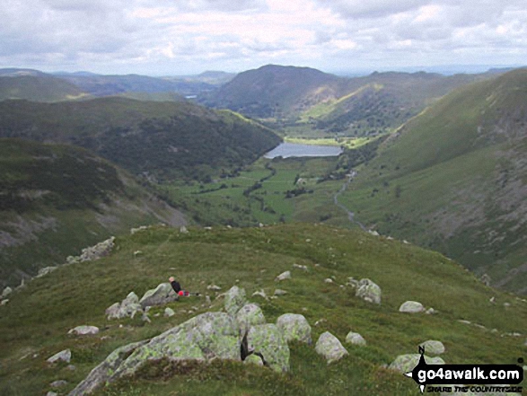
Middle Dodd and Brothers Water from Red Screes

Middle Dodd and Brothers Water from Red Screes

Photo: Chris Pearson (8)

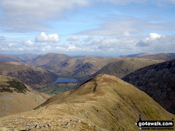
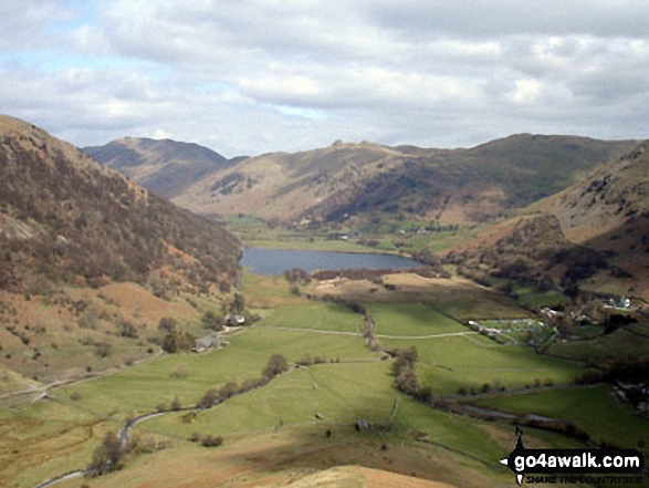
Brothers Water from Middle Dodd

Brothers Water from Middle Dodd

Photo: Chris Pearson (10)

Brothers Water from Middle Dodd

Brothers Water from Middle Dodd

Photo: Andy Malcolm (84)

Middle Dodd, Red Screes, Snarker Pike, the Scandale Valley and Lake Windermere from High Pike (Scandale)

Middle Dodd, Red Screes, Snarker Pike, the Scandale Valley and Lake Windermere from High Pike (Scandale)

Photo: Mike Walker (323)

Middle Dodd summit cairn

Middle Dodd summit cairn

Photo: Christine Shepherd (536)

High Hartsop Dodd and Middle Dodd from Hartsop Hall

High Hartsop Dodd and Middle Dodd from Hartsop Hall

Photo: David Hayter (60)

Middle Dodd with Place Fell, Angletarn Peaks and Hartsop Dodd beyond Brothers Water in the valley below from Red Screes

Middle Dodd with Place Fell, Angletarn Peaks and Hartsop Dodd beyond Brothers Water in the valley below from Red Screes

Photo: Andy Malcolm (85)

Brothers Water, Place Fell and the Angle Tarn Peaks from Middle Dodd

Brothers Water, Place Fell and the Angle Tarn Peaks from Middle Dodd

Photo: David Hayter (67)

The Angle Tarn Pikes from Middle Dodd

The Angle Tarn Pikes from Middle Dodd

Photo: David Hayter (69)


Send us your photographs and pictures on, of, or from Middle Dodd

If you would like to add your walk photographs and pictures featuring views from, on or of Middle Dodd to this page, please send them as email attachments (configured for any computer) along with your name to:


and we shall do our best to publish them.

(Guide Resolution = 300dpi. At least = 660pixels (wide) x 440 pixels (high).)

Send us your photographs and pictures on, of, or from Middle Dodd via Facebook

You can also submit photos via our Facebook Page.

NB. Please indicate where each photo was taken.


Do not miss our pick of the Best Walks in the UK


Follow go4awalk.com on Twitter Follow go4awalk.com on Facebook


Home


Find new Friends to go walking with

Walk all 214 Wainwrights in just 59 Walks. Download GPS Waypoints - Great Walks you must not miss!

Walk The Yorkshire Three Peaks Challenge Walk - All the Latest Route Information, GPS Waypoints and Split Times to keep you on Schedule

Walk The British Three Peaks Challenge Walk - All the Latest Route Information and GPS Waypoints

See our pick of The Best Walks in The Lake District - Great Walks you must not miss!

Walk our pick of the Best Lake District Ridge Walks - Great Walks you must not miss!

Walk our pick of the Best Lake District Walks to do in the rain - Great Walks you must not miss!

Walk our pick of The Best Walks in Snowdonia - Great Walks you must not miss!

Walk our pick of The Best Ridge Walks in Wales - Walks you must not miss!

Walk our pick of The Best Walks in The Brecon Beacons - Great Walks you must not miss!

Walk our pick of The Best Walks in The Yorkshire Dales - Walks you must not miss!

Walk our pick of The Best Walks in The Peak District - Walks you must not miss!

Walk our pick of The Best Walks in The Forest of Bowland - Walks you must not miss!

Walk our pick of The Best Walks in Shropshire - Walks you must not miss!

Walk our pick of The Best Walks in Cheshire - Walks you must not miss!

Walk our pick of The Best Walks in Lancashire - Walks you must not miss!

Not sure where to walk next? Try Peak Bagging - Great Walks you must not miss!

Not sure where to walk next? Walk part of a National Trail - Great Walks you must not miss!

Walks with Downloadable and Uploadable GPS Waypoint Data

Walking Kit and Gear Tested by Walkers

Full Site Search
Do not miss our pick of the Best Walks in the UK