
![]()
Garnedd Ugain (Crib y Ddysgl)
1066m (3499ft)
The Snowdon Area, Snowdonia, Gwynedd, Wales
Tap/mouse over a coloured circle (1-3 easy walks, 4-6 moderate walks, 7-9 hard walks) and click to select.
Garnedd Ugain (Crib y Ddysgl) means 'Dish Ridge' in Welsh and is pronounced 'kreeb ee thysgl'.
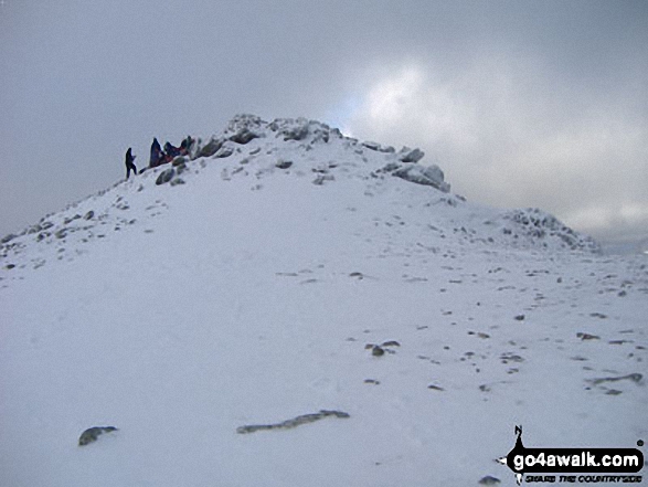
The summit of Garnedd Ugain (Crib y Ddysgl) is marked by an Ordnance Survey Trig Point.

Not familiar with this top?
You can walk/hike to the top of Garnedd Ugain (Crib y Ddysgl) by using any of these 4 easy‑to‑follow route maps:
Walk gw198 The Welsh 3000's (Snowdon Area) from Pen-y-Pass
A classic horseshoe walk - but Crib Goch is not for the faint hearted!
   |
|---|
Vital Statistics:
| Length: | 7ml (11km) |
|---|---|
| Ascent: | 3,805ft (1,160m) |
| Time: | 6.25hrs |
| Grade: |  (Moderate) (Moderate) |

Route Summary:
Pen-y-Pass - Pyg Track - Bwlch y Moch - Craig Fach - Crib Goch - Garnedd Ugain (Crib y Ddysgl) - Snowdon Mountain Railway - Snowdon (Yr Wyddfa) - The Scree Path - Bwlch y Saethau - Bwlch Ciliau - Y Lliwedd - Y Lliwedd (East Top) - Lliwedd Bach - Miners' Track - Pen-y-Pass
Walk gw136 The Snowdon (Yr Wyddfa) Horseshoe from Pen-y-Pass
A classic - but Crib Goch is not for the faint hearted!
|
|---|
Vital Statistics:
| Length: | 7.5ml (12km) |
|---|---|
| Ascent: | 4,100ft (1,250m) |
| Time: | 6½ hrs |
| Grade: |  (Hard) (Hard) |

Route Summary:
Pen-y-Pass - Pyg Track - Bwlch y Moch - Craig Fach - Crib Goch - Garnedd Ugain (Crib y Ddysgl) - Snowdon Mountain Railway - Snowdon (Yr Wyddfa) - The Scree Path - Bwlch y Saethau - Bwlch Ciliau - Y Lliwedd - Y Lliwedd (East Top) - Lliwedd Bach - Gallt y Wenallt - Afon Glaslyn - Miners' Track - Pen-y-Pass
Walk gw186 Garnedd Ugain, Snowdon (Yr Wyddfa) & Moel Cynghorion from Llanberis
For when climbing just Snowdon is not enough
|
|---|
Vital Statistics:
| Length: | 11.5ml (18.5km) |
|---|---|
| Ascent: | 4,179ft (1,346m) |
| Time: | 8.75hrs |
| Grade: |  (Hard) (Hard) |

Route Summary:
Snowdon Mountain Railway Llanberis Station - Cader Ellyll - Llanberis Path - Halfway Station - Llechog (Llanberis Path) - Clogwyn Station - Garnedd Ugain (Crib y Ddysgl) - Bwlch Glas - Snowdon (Yr Wyddfa) - Clogwyn Du'r Arddu Path - Snowdon Ranger Path - Moel Cynghorion - Bwlch Maesgwm - Llanberis.
Walk gw158 Garnedd Ugain, Snowdon, Moel Cynghorion, Foel Gron and Moel Eilio from Llanberis
Testing hike over Snowdon & her sisters
|
|---|
Vital Statistics:
| Length: | 13.25ml (21km) |
|---|---|
| Ascent: | 5,651ft (1,723m) |
| Time: | 10½ hrs |
| Grade: |  (Very Hard) (Very Hard) |

Route Summary:
Snowdon Mountain Railway Llanberis Station - Cader Ellyll - Llanberis Path - Halfway Station - Llechog (Llanberis Path) - Clogwyn Station - Garnedd Ugain (Crib y Ddysgl) - Bwlch Glas - Snowdon (Yr Wyddfa) - Clogwyn Du'r Arddu Path - Snowdon Ranger Path - Moel Cynghorion - Bwlch Maesgwm - Foel Goch (Snowdon) - Foel Gron - Moel Eilio (Llanberis) - Llanberis.
See Garnedd Ugain (Crib y Ddysgl) and the surrounding tops on our free-to-access 'Google Style' Peak Bagging Maps:
The Snowdon Area of Snowdonia National Park
Less data - quicker to download
The Whole of Snowdonia National Park
More data - might take a little longer to download
See Garnedd Ugain (Crib y Ddysgl) and the surrounding tops on our unique, downloadable, PDF Peak Bagging Map:

NB: Whether you print off a copy or download it to your phone, this PDF Peak Baggers' Map might prove incredibly useful when your are up there on the tops and you cannot get a phone signal.
You can find Garnedd Ugain (Crib y Ddysgl) & all the walks that climb it on these unique free-to-access Interactive Walk Planning Maps:
1:25,000 scale OS Explorer Map (orange/yellow covers):
1:50,000 scale OS Landranger Map (pink/magenta covers):
 Fellow go4awalkers who have already walked, climbed, scaled, summited, hiked & bagged Garnedd Ugain (Crib y Ddysgl)
Stephanie Doyle walked up Garnedd Ugain (Crib y Ddysgl) on November 8th, 2025 [from/via/route] Pen y pass [with] Friend [weather] Damp
David Peebles climbed it on February 27th, 2023 [from/via/route] LLanberis Carpark [with] Solo [weather] Poor Weather. Cold at top.
Daniel Moran bagged it on December 5th, 2022 [from/via/route] Lanberris [with] Chel [weather] Snow - Snow flurries
David Buckley hiked Garnedd Ugain (Crib y Ddysgl) on September 12th, 2011 [with] Julie [weather] Windy, sunny, showers
Melfyn Parry summited on April 16th, 2023 [from/via/route] Started walk from car park at Nant Peris by catching the bus up to Pen y Pass, from here continued along Pyg track to Bwlch Glas then turned right to continue to summit of Garnedd Ugain. Returned to car park by descending to the right of the railway track to Clogwyn Station then over towards Llechog before dropping back to the Llanberis Path. From grid ref SH584586 we headed north east towards Wern & then dropped down to the main road A4086 & then on to the carpark. A walk of 15km, initially planned to do Crib Goch but the weather was not good so amended plans for safety reasons. [with] PRC [weather] A generally wet day, cold in the wind.
To add (or remove) your name and experiences on this page - Log On and edit your Personal Mountain Bagging Record
. . . [see more walk reports]
More Photographs & Pictures of views from, on, or of, Garnedd Ugain (Crib y Ddysgl)
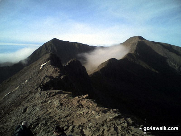
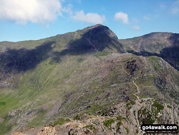
Crib Goch in all its glory with Garnedd Ugain (Crib y Ddysgl) (right) and Snowdon (Yr Wyddfa) (left) beyond from the start of Crib Goch
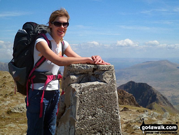
Clare on the summit of Garnedd Ugain (Crib y Ddysgl) with Crib Goch in the background (bottom right)
The Watkin Path from Bwlch Ciliau up to the summit of Snowdon (Yr Wyddfa) with Garnedd Ugain (Crib y Ddysgl) visible (far right) from Y Lliwedd
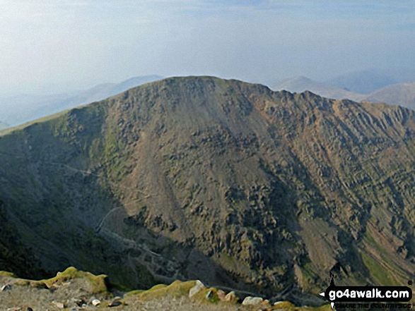
Garnedd Ugain (Crib y Ddysgl) - The 2nd highest mountain in England and Wales from the highest - Mount Snowdon (Yr Wyddfa)
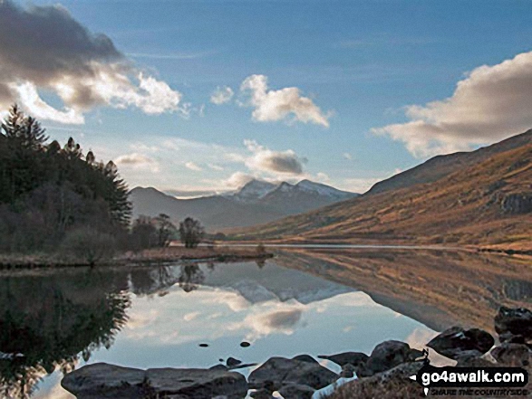
Snowdon Horseshoe reflected in Llynnau Mymbyr near Plas Y Brenin featuring Y Lliwedd (left) and Snowdon (Yr Wyddfa), Crib Goch and Garnedd Ugain (Crib y Ddysgl) (right)
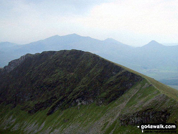
Mynydd Drws-y-coed & The Nantlle Ridge - with The Snowdon Massif (Garnedd Ugain (Crib y Ddysgl), Snowdon (Yr Wyddfa), Y Lliwedd and Yr Aran) beyond from Trum y Ddysgl
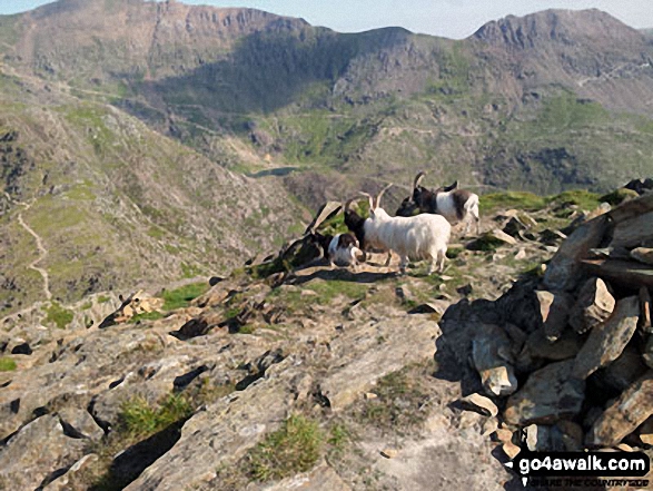
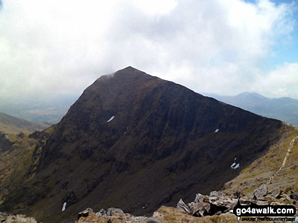
Goats on the summit of Y Lliwedd with Garnedd Ugain (Crib y Ddysgl) (left) and Crib Goch (right) in the distance
. . . see all 27 walk photographs & pictures of views from, on, or of, Garnedd Ugain (Crib y Ddysgl)
Send us your photographs and pictures on, of, or from Garnedd Ugain (Crib y Ddysgl)
If you would like to add your walk photographs and pictures to this page, please send them as email attachments (configured for any computer) along with your name to:
and we shall do our best to publish them.
(Guide Resolution = 300dpi. At least = 660pixels (wide) x 440 pixels (high).)

You can also submit photos via our Facebook Page.
NB. Please indicate where each photo was taken and whether you wish us to credit your photos with a Username or your First Name/Last Name.


