
![]()
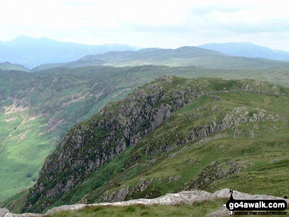
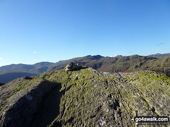
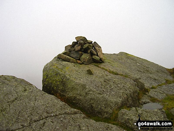
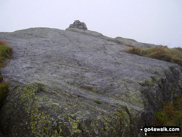
Eagle Crag
525m (1723ft)
The Central Fells, The Lake District, Cumbria, England
Tap/mouse over a coloured circle (1-3 easy walks, 4-6 moderate walks, 7-9 hard walks) and click to select.
Not familiar with this top?
You can walk/hike to the top of Eagle Crag by using any of these 3 easy‑to‑follow route maps:
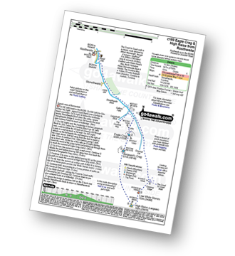
Walk c189 High Raise from Rosthwaite
Superb view of Borrowdale
   |
|---|
Vital Statistics:
| Length: | 9ml (14.5km) |
|---|---|
| Ascent: | 2,780ft (847m) |
| Time: | 6 hrs |
| Grade: |  (Moderate) (Moderate) |
Route Summary:
Rosthwaite - Stonethwaite - Wainwright's Coast to Coast Walk - Stonethwaite Beck - Galleny Force - The Cumbria Way - Langstrath Beck - Eagle Crag - Sergeant's Crag - High Raise (Langdale) - Low White Stones - Greenup Edge - Lining Crag - Greenup Gill - Stonethwaite Beck - Stonethwaite - Rosthwaite
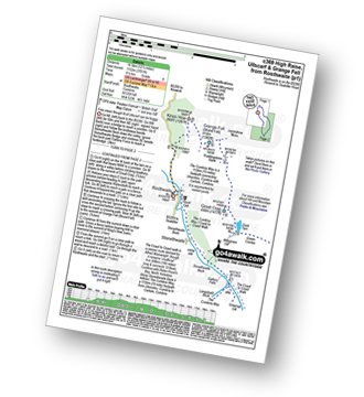
Walk c243 High Raise and Ullscarf from Rosthwaite
Fine views though N of Ullscarf - can be boggy
|
|---|
Vital Statistics:
| Length: | 11.25ml (18km) |
|---|---|
| Ascent: | 3,371ft (1,027m) |
| Time: | 7½ hrs |
| Grade: |  (Hard) (Hard) |

Route Summary:
Rosthwaite - Stonethwaite - Wainwright's Coast to Coast Walk - Stonethwaite Beck - Galleny Force - The Cumbria Way - Langstrath Beck - Eagle Crag - Sergeant's Crag - High Raise (Langdale) - Low White Stones - Greenup Edge - Ullscarf - High Saddle (Coldbarrow Fell) - Low Saddle (Coldbarrow Fell) - Lord's How - Dock Tarn - Willygrass Gill - Great Crag - Rosthwaite
Walk c369 High Raise, Ullscarf and Grange Fell from Rosthwaite
Good views though N of Ullscarf can be boggy
|
|---|
Vital Statistics:
| Length: | 12.25ml (19.5km) |
|---|---|
| Ascent: | 3,781ft (1,152m) |
| Time: | 8½ hrs |
| Grade: |  (Hard) (Hard) |
Route Summary:
Rosthwaite - The Cumbria Way - Stonethwaite - Wainwright's Coast to Coast Walk - Stonethwaite Beck - Galleny Force - The Cumbria Way - Langstrath Beck - Eagle Crag - Sergeant's Crag - High Raise (Langdale) - Low White Stones - Greenup Edge - Ullscarf - Low Saddle (Coldbarrow Fell) - Lord's How - Dock Tarn - Great Crag - Puddingstone Bank - Jopplety How - Joppletyhow Moss - Grange Fell (Brund Fell) - King's How - Rosthwaite
See Eagle Crag and the surrounding tops on our free-to-access 'Google Style' Peak Bagging Maps:
The Central Fells of The Lake District National Park
Less data - quicker to download
The Whole of The Lake District National Park
More data - might take a little longer to download
See Eagle Crag and the surrounding tops on our unique, downloadable, PDF Peak Bagging Maps:

NB: Whether you print off a copy or download it to your phone, these PDF Peak Baggers' Maps might prove incredibly useful when your are up there on the tops and you cannot get a phone signal.
*This version is marked with the walk routes you need to follow to Walk all 214 Wainwrights in just 59 walks.
You can find Eagle Crag & all the walks that climb it on these unique free-to-access Interactive Walk Planning Maps:
1:25,000 scale OS Explorer Map (orange/yellow covers):
1:50,000 scale OS Landranger Maps (pink/magenta covers):
 Fellow go4awalkers who have already walked, climbed, scaled, summited, hiked & bagged Eagle Crag
James Hughes walked up Eagle Crag on April 18th, 2025 [from/via/route] c369 Eagle Crag & Sergeant's Fell descent via Greenup Gill [weather] Some cloud, showers & increasingly blustery on tops - Ascent up Eagle Crag then onto Sergeant's Crag before deciding to drop down to Greenup Gill path across the gently sloping Fells. Pint at Langstrath.
Ian Ashton climbed it on January 4th, 2025 [with] JPH and Ella
Richard Fulcher bagged it on June 24th, 2024 [from/via/route] Parked next to the red telephone box in Stonethwaite (7:50am). Crossed the bridge & turned right following Stonethwaite Beck. Crossed river at Smithmire Island & followed the path on the other side of Greenup Gill to second pasture, turning right to follow the wall steeply up to Bleak How following Wainwright's route 'A'. Some climbing / scrambling required but nothing out of the ordinary for a 66 year old! After Eagle Crag I followed vague paths over the boggy terrain to Sergeant's Crag & then headed for Long Crag, finding a small path that traces the top of this crag & then crosses the bridleway that joins up with Grasmere? Followed an intermittent path up to Ullscarf that follows an old fence line ( only the iron posts remain). After Ullscarf I retraced my steps back to the bridleway turning right to follow this path down the valley & back to Stonethwaite. [weather] Started warm & cloudy but as the day wore on the clouds disappeared & the sun was fierce! - Great views of many Lakeland mountain ranges from Ullscarf. The heat made the descent very taxing. The route down is rocky with many opportunities to break your ankle.
Tim Winn hiked Eagle Crag on March 24th, 2024 [with] Barry, Roger, Andy and Paul [weather] Sunny & clear.
Christine Shepherd summited on May 25th, 2008 [from/via/route] From Borrowdale using walk c243 Climbed again using walk c189 but adding on Ullscarf on 15.10.21 on a stunning Autumn day. Climbed again with a lovely group from Mountain Madness, from Rosthwaite on 12.11.23 Started the walk in sunshine but finished in sleet & rain. [with] On my own [weather] Fine but windy - A bit blowy for the scramble but enjoyable none the less.
To add (or remove) your name and experiences on this page - Log On and edit your Personal Mountain Bagging Record
. . . [see more walk reports]
More Photographs & Pictures of views from, on, or of, Eagle Crag

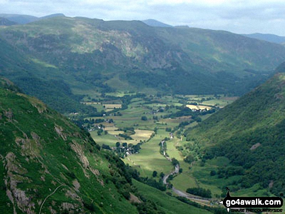

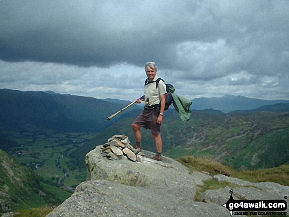

Mere Gill, Greenhow Gill and Footmoorgate Gill 'streaming' into Greenup Gill beyond Pounsey Crag (far right) as seen from Eagle Crag
. . . see all 16 walk photographs & pictures of views from, on, or of, Eagle Crag
Send us your photographs and pictures on, of, or from Eagle Crag
If you would like to add your walk photographs and pictures to this page, please send them as email attachments (configured for any computer) along with your name to:
and we shall do our best to publish them.
(Guide Resolution = 300dpi. At least = 660pixels (wide) x 440 pixels (high).)

You can also submit photos via our Facebook Page.
NB. Please indicate where each photo was taken and whether you wish us to credit your photos with a Username or your First Name/Last Name.


