A Google Peak Bagging Map of The Tarf and Tilt Hills (West) area of Scottish Region 6: The West Mounth - Blair Atholl to Braemar and Blairgowrie a fully detailed list
The Tarf and Tilt Hills (West) area of Scottish Region 6: The West Mounth - Blair Atholl to Braemar and Blairgowrie region is the area enclosed by an imaginary line connecting:
- Kingussie to Kincraig via the A9 through Loch Insh to the North West
- Kincraig to Bynack Burn via the River Feshie, Glen Geldie & Geldie Burn to the North East
- Bynack Burn to Straloch via Allt an t-Seilich, Dubh Alltan, Allt Garbh Buidhe, Glen Loch & Gleann Fearach to the East
- Straloch> to Pitlochry via the A924 through Glen Brerachen to the South
- Pitlochry to Dalnacardoch Lodge via the A9 though Killiecrankie & Blair Atholl to the South West
- Dalnacardoch Lodge to Kingussie via Edendon Water, Loch na t-Seilich, Glen Tromie and Drumguish to the West
If you include all the Munros, the Corbetts, the Grahams, the Donalds, the Murdos, the Marilyns, the Bridgets (Hills), and all the Mountains, Tops, Peaks and Hills with a Trig Point on them there are 19 tops to climb, bag & conquer and the highest point is Beinn a' Ghlo (Carn nan Gabhar) at 1,121m (3,679ft).
To see these Mountains, Peaks, Tops and Hills displayed in different ways - see the options in the left-hand column and towards the bottom of this page.
 Your Personal Bagging Record for The Tarf and Tilt Hills (West) area of Scottish Region 6: The West Mounth - Blair Atholl to Braemar and Blairgowrie
When logged on, you can mark each Mountain, Peak, Top or Hill as 'bagged' by either:
- if you opt to display the tops in this area using a google map, click or tap on its symbol on the map below. This will open a text window. Click or tap on the 'Record [mountain name] as Bagged, Climbed & Conquered' link towards the bottom of the text window, or
- if you opt to display the tops in this area as a list, click or tap on the red 'not yet' symbol to the right of the name of each 'top'
Either method will open a new page where you can complete all your details such as:
- when you bagged the Mountain, Peak, Top or Hill;
- which route you took
- who you went with
- what the weather was like
- any other comment that will remind you of the day
Once you have completed your details and click or tap the submit button, you will automatically return to this page and the top you bagged will show with a green tick.
NB. None of the above fields are 'mandatory' - you can leave them blank if you wish.
NNB. You also have the option whether to display your peak bagging exploits to other users of this site or keep them private so only you can see them when you are logged on.
Furthermore, since you can also access your Personal Mountain & Hill Bagging Record via go4awalk Mobile you can quickly & easily record, edit and view your achievements - whether you are at home/work on your desktop computer or in the pub/at the top of a mountain with your Mobile Phone. (You can even download your Personal Mountain & Hill Bagging Record as a .csv file for importing into and saving with spreadsheet software like Excel or NeoOffice!)
This facility costs one credit to initially access your personal bagging record. Once accessed, all other interactions, such as recording other Mountains, Peaks, Tops and Hills as 'bagged' or altering an existing bagging record, are free.
Click REGISTER to register and purchase credits.
LOG ON and RELOAD this page to show which Mountains, Peaks, Tops and Hills you have already climbed, bagged & conquered. [ . . . remove this text]
See this list in: Alphabetical Order
| Height Order‡
To reverse the order select the link again.
Mountain, Peak, Top or Hill:
Bagged


1. Beinn a' Ghlo (Carn nan Gabhar)
1,121m (3,679ft)
 Beinn a' Ghlo (Carn nan Gabhar) is on interactive maps:
A downloadable go4awalk.com PDF Peak Bagging Map featuring Beinn a' Ghlo (Carn nan Gabhar) will be available soon. |


2. Braigh Coire Chruinn-bhalgain
1,070m (3,512ft)
Braigh Coire Chruinn-bhalgain is on interactive maps:
A downloadable go4awalk.com PDF Peak Bagging Map featuring Braigh Coire Chruinn-bhalgain will be available soon. |


3. Airgiod Bheinn (Beinn a' Ghlo)
1,061m (3,482ft)
Send it in and we'll publish it here.
Airgiod Bheinn (Beinn a' Ghlo) is on interactive maps:
A downloadable go4awalk.com PDF Peak Bagging Map featuring Airgiod Bheinn (Beinn a' Ghlo) will be available soon. |
4. Beinn Dearg (The Tarf and Tilt Hills)
1,008m (3,308ft)
Send it in and we'll publish it here.
Beinn Dearg (The Tarf and Tilt Hills) is on interactive maps:
A downloadable go4awalk.com PDF Peak Bagging Map featuring Beinn Dearg (The Tarf and Tilt Hills) will be available soon. |
5. An Sgarsoch
1,006m (3,302ft)
An Sgarsoch is on interactive maps:
A downloadable go4awalk.com PDF Peak Bagging Map featuring An Sgarsoch will be available soon. |

6. Carn an Fhidhleir (Carn Ealar)
994m (3,262ft)
Send it in and we'll publish it here.
Carn an Fhidhleir (Carn Ealar) is on interactive maps:
A downloadable go4awalk.com PDF Peak Bagging Map featuring Carn an Fhidhleir (Carn Ealar) will be available soon. |
7. Carn Liath (Glen Tilt)
975m (3,200ft)
Send it in and we'll publish it here.
Carn Liath (Glen Tilt) is on interactive maps:
A downloadable go4awalk.com PDF Peak Bagging Map featuring Carn Liath (Glen Tilt) will be available soon. |
8. Carn a' Chlamain
963m (3,161ft)
Carn a' Chlamain is on interactive maps:
A downloadable go4awalk.com PDF Peak Bagging Map featuring Carn a' Chlamain will be available soon. |

9. Beinn Bhreac (Gaick Forest)
912m (2,994ft)
Send it in and we'll publish it here.
Beinn Bhreac (Gaick Forest) is on interactive maps:
A downloadable go4awalk.com PDF Peak Bagging Map featuring Beinn Bhreac (Gaick Forest) will be available soon. |

10. Leathad an Taobhain
912m (2,991ft)
Send it in and we'll publish it here.
Leathad an Taobhain is on interactive maps:
A downloadable go4awalk.com PDF Peak Bagging Map featuring Leathad an Taobhain will be available soon. |
11. Ben Vuirich (Beinn Bhuirich)
903m (2,964ft)
Ben Vuirich (Beinn Bhuirich) is on interactive maps:
A downloadable go4awalk.com PDF Peak Bagging Map featuring Ben Vuirich (Beinn Bhuirich) will be available soon. |
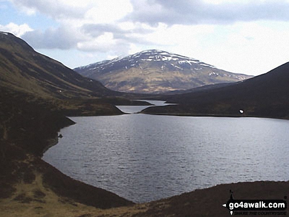
12. Beinn Mheadhonach (Atholl)
901m (2,955ft)
Send it in and we'll publish it here.
Beinn Mheadhonach (Atholl) is on interactive maps:
A downloadable go4awalk.com PDF Peak Bagging Map featuring Beinn Mheadhonach (Atholl) will be available soon. |
13. A' Chaoirnich (Creag an Loch)
875m (2,872ft)
Send it in and we'll publish it here.
A' Chaoirnich (Creag an Loch) is on interactive maps:
A downloadable go4awalk.com PDF Peak Bagging Map featuring A' Chaoirnich (Creag an Loch) will be available soon. |
14. Carn Dearg Mor (Glen Feshie)
857m (2,813ft)
Send it in and we'll publish it here.
Carn Dearg Mor (Glen Feshie) is on interactive maps:
A downloadable go4awalk.com PDF Peak Bagging Map featuring Carn Dearg Mor (Glen Feshie) will be available soon. |
15. Ben Vrackie
842m (2,762ft)
Ben Vrackie is on interactive maps:
A downloadable go4awalk.com PDF Peak Bagging Map featuring Ben Vrackie will be available soon. |


16. Sron a' Chleirich
816m (2,678ft)
Sron a' Chleirich is on interactive maps:
|
17. Meallach Mhor
769m (2,524ft)
Meallach Mhor is on interactive maps:
A downloadable go4awalk.com PDF Peak Bagging Map featuring Meallach Mhor will be available soon. |
18. Carn Dearg Beag
694m (2,277ft)
Carn Dearg Beag is on interactive maps:
|
19. Croidh-la
640m (2,100ft)
Croidh-la is on interactive maps:
|
View these 19 Mountains, Peaks, Tops and Hills:
- On an Interactive Google Map with a list of tops below it.
(makes it easier to locate a particular top) - On a Detailed List in:
Alphabetical Order | Height Order - On one page with 'yet-to-be-bagged' listed 1st
& then 'already-bagged' tops listed 2nd in:
Alphabetical Order | Height Order - On one page with 'already-bagged' tops listed 1st
& then 'yet-to-be-bagged' tops listed 2nd in:
Alphabetical Order | Height Order
Is there a Mountain, Peak, Top or Hill missing from the above google map or list?
Let us know an we will add it to our database.


To contribute to go4awalk.com or to contact us about anything at all - see Talk To Us.
For help see Help.
go4awalk.com and go4awalk.co.uk are registered trademarks of TMDH Limited.
Copyright © 2000-2026 TMDH Limited. All rights reserved.
Copyright Terms & Conditions Privacy Statement
A - Z Walks Home Log On/Accounts Photo Gallery Walk Ideas and Collections Fell Facts Hill Skills Walking Questions and Answers Your Stories News Competitions Product Reviews/Gear Tests Walking Gear Guides Peaks and Mountains Peak Bagging Find New Walking Friends Camping GPS Waypoints for Walking Contents Walk Search Talk To Us go4awalk.com Help Free Example Walks Newsletter