The East Midlands region of England - a fully detailed list of all the Mountains, Peaks, Tops and Hills
The East Midlands region of England comprises the traditional counties of Derbyshire, Leicestershire, Lincolnshire, Northamptonshire, Nottinghamshire and parts of the Peak District National Park.
If you include all the Mountains (Hewitts), the Deweys, the Nuttalls and the Marilyns there are 7 tops to climb, bag & conquer and the highest point is Kinder Scout at 636m (2,087ft).
To see these Mountains, Peaks, Tops and Hills displayed in different ways - see the options in the left-hand column and towards the bottom of this page.
![]() Your Personal Bagging Record for East Midlands of
Your Personal Bagging Record for East Midlands of
LOG ON and RELOAD this page to show which Mountains, Peaks, Tops and Hills you have already climbed, bagged & conquered [. . . more details]
See this list in: Alphabetical Order‡
| Height Order
To reverse the order select the link again.
Mountain, Peak, Top or Hill:
Bagged

![]()
1. Acre (Normanby le Wold)
168m (551ft)
Send it in and we'll publish it here.
Acre (Normanby le Wold) is on interactive maps:
A downloadable go4awalk.com PDF Peak Bagging Map featuring Acre (Normanby le Wold) will be available soon. |

![]()
2. Back Tor (Derwent Edge)
538m (1,766ft)
Back Tor (Derwent Edge) is on interactive maps:
Back Tor (Derwent Edge) is on downloadable PDF you can Print or Save to your Phone: |

![]()
3. Bardon Hill
278m (912ft)
Bardon Hill is on interactive maps:
|

![]()
4. Black Chew Head (Laddow Rocks)
542m (1,779ft)
Black Chew Head (Laddow Rocks) is on interactive maps:
Black Chew Head (Laddow Rocks) is on downloadable PDF you can Print or Save to your Phone: |
![]()
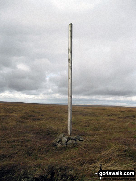
5. Horse Stone (Horse Stone Naze)
527m (1,730ft)
Horse Stone (Horse Stone Naze) is on interactive maps:
Horse Stone (Horse Stone Naze) is on downloadable PDF you can Print or Save to your Phone: |


![]()
6. Kinder Scout
636m (2,087ft)
Kinder Scout is on interactive maps:
Kinder Scout is on downloadable PDF you can Print or Save to your Phone: |
![]()
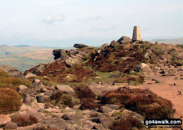
7. The Roaches
505m (1,657ft)
The Roaches is on interactive maps:
The Roaches is on downloadable PDF you can Print or Save to your Phone: |
View these 7 Mountains, Peaks, Tops and Hills:
- On an Interactive Google Map with a list of tops below it.
(makes it easier to locate a particular top) - On a Detailed List in:
Alphabetical Order | Height Order - On one page with 'yet-to-be-bagged' listed 1st
& then 'already-bagged' tops listed 2nd in:
Alphabetical Order | Height Order - On one page with 'already-bagged' tops listed 1st
& then 'yet-to-be-bagged' tops listed 2nd in:
Alphabetical Order | Height Order
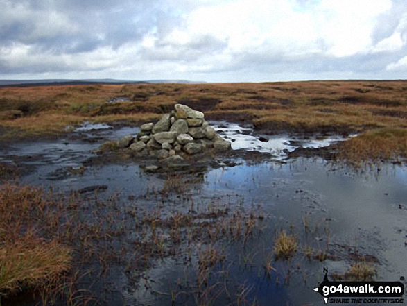 The summit of Kinder Scout in The White Peak Area area of The Peak District
Photo: Ben Lockett
Is there a Mountain, Peak, Top or Hill missing from the above google map or list?
Let us know an we will add it to our database.

To contribute to go4awalk.com or to contact us about anything at all - see Talk To Us.
For help see Help.
go4awalk.com and go4awalk.co.uk are registered trademarks of TMDH Limited.
Copyright © 2000-2026 TMDH Limited. All rights reserved.
Copyright Terms & Conditions Privacy Statement
A - Z Walks Home Log On/Accounts Photo Gallery Walk Ideas and Collections Fell Facts Hill Skills Walking Questions and Answers Your Stories News Competitions Product Reviews/Gear Tests Walking Gear Guides Peaks and Mountains Peak Bagging Find New Walking Friends Camping GPS Waypoints for Walking Contents Walk Search Talk To Us go4awalk.com Help Free Example Walks Newsletter


