UK Postcode CH8 - The 30 nearest easy-to-follow, circular walk route maps to you
The thirty nearest easy-to-follow, circular walk route maps to you in UK Postcode CH8 in Walk Grade Order
The UK cities, towns and villages in Flintshire, Wales that have CH8 in their UK Postcode include:
• Babell • Brynford • Carmel • Ffynnongroyw • Glan-y-don • Gorsedd • Greenfield • Gwespyr • Halkyn • Holywell • Lixwm • Llanasa • Llannerch-y-mor • Lloc • Mostyn • Pantasaph • Pentre Halkyn • Rhes-y-cae • Talacre • Trelogan • Walwen • Whitford • Ysceifiog •
Not familiar with the area around CH8?
See these 30 nearest walks to UK Postcode CH8 on a google map
   |
Vital Statistics:
| Length: | 7 miles (11 km) |
| Ascent: | 847ft (258m) |
| Time: | 3½ hrs |
| Grade: |  |
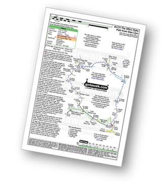
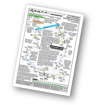
Route Summary:
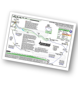
Glan Llyn - Coed Jenny Morgan - The Offa's Dyke Path - Coed Rhedyn-coch - Mynydd y Cwm (Coed Cwm) - Marian Cwm - Marian Ffrith - Bryn Cnewyllyn - Marian Mill Trout Farm - Henfryn Hall - The Clwydian Way - Swyn y Mynydd - Hendre Fawr - Glan Llyn
|
Vital Statistics:
| Length: | 4 miles (6.5 km) |
| Ascent: | 715ft (218m) |
| Time: | 2.25hrs |
| Grade: |  |

Route Summary:
Rhuallt - The Offa's Dyke Path - Brynllithrig Hall - Pen-y-mynydd - Coed Jenny Morgan - Glan Llyn - Bryn Gronw - Rhuallt
|
Vital Statistics:
| Length: | 9.5 miles (15 km) |
| Ascent: | 1,359ft (141m) |
| Time: | 4.75hrs |
| Grade: |  |
Route Summary:
Rhuallt - The Offa's Dyke Path - Brynllithrig Hall - Pen-y-mynydd - Coed Rhedyn-coch - Mynydd y Cwm (Coed Cwm) - Marian Cwm - Marian Ffrith - Bryn Cnewyllyn - Marian Mill Trout Farm - Henfryn Hall - The Clwydian Way - Swyn y Mynydd - Hendre Fawr - Glan Llyn - Bryn Gronw - Rhuallt
|
Vital Statistics:
| Length: | 7.5 miles (12 km) |
| Ascent: | 962ft (293m) |
| Time: | 3.75hrs |
| Grade: | |

Route Summary:
Rhuallt - The Offa's Dyke Path - A55 - Bryn Gronw - Cobweb Cottage - Ty Hir - Rhos Onnen - Croes-wian - Ffrith Farm - Bryngwyn Hall - Coed Bron-fawr - The Offa's Dyke Path - Bryn Gronw - A55 - Rhuallt
|
Vital Statistics:
| Length: | 5 miles (8 km) |
| Ascent: | 994ft (303m) |
| Time: | 3 hrs |
| Grade: | |
|
Vital Statistics:
| Length: | 9.75 miles (15.5 km) |
| Ascent: | 1,447ft (441m) |
| Time: | 5 hrs |
| Grade: | |

Route Summary:
Bodfari - The Offa's Dyke Path - Moel-y-Gaer - Pen y Bryn - Sodom Covert - Cefn Du - Pant Glas - Coed Bron-fawr - Bryngwyn Hall - Ffrith Farm - Croes-wian - Caerwys - Maes-mynan Hall - Candy Mill - Ty-draw - The Offa's Dyke Path - Bodfari
|
Vital Statistics:
| Length: | 12.25 miles (19.5 km) |
| Ascent: | 1,874ft (571m) |
| Time: | 6.25hrs |
| Grade: |  |

Route Summary:
Bodfari - The Offa's Dyke Path - Moel-y-Gaer - Pen y Bryn - Sodom Covert - Cefn Du - Pant Glas - Moel Maenefa - Bryn Gronw - Cobweb Cottage - Brick Kiln Rough - Ty Hir - Rhos Onnen - Croes-wian - Caerwys - Maes-mynan Hall - Candy Mill - Ty-draw - The Offa's Dyke Path - Bodfari
|
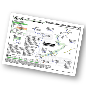
Vital Statistics:
| Length: | 7.5 miles (12 km) |
| Ascent: | 1,746ft (532m) |
| Time: | 4½ hrs |
| Grade: | |
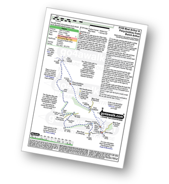
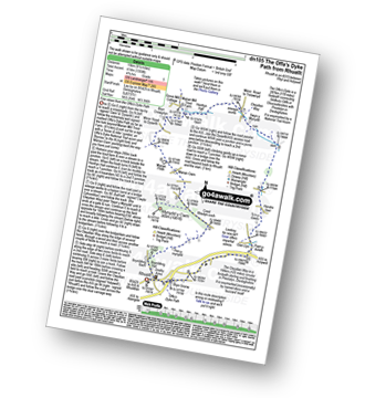
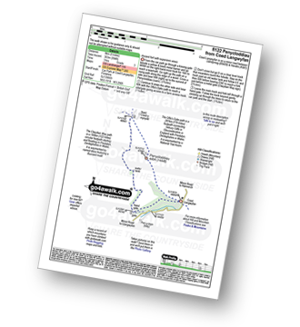
Route Summary:
Bwlch Arthur - Moel Arthur - Coed Llangwyfan - Penycloddiau - Nant Coed-y-mynydd - Pen-y-bryn - Bwlch Arthur
|
Vital Statistics:
| Length: | 4 miles (6.5 km) |
| Ascent: | 1,086ft (331m) |
| Time: | 2½ hrs |
| Grade: | |

|
Vital Statistics:
| Length: | 8.25 miles (13 km) |
| Ascent: | 1,943ft (592m) |
| Time: | 5 hrs |
| Grade: | |

Route Summary:
Cilcain - Y Pentre - Crug Farm - Ffrith - Bryn Fynnon - Moel Famau Country Park - Moel Famau - The Offa's Dyke Path - Moel Dywyll - Moel Llys-y-coed - Bwlch Arthur - Gronfoel Farm - Cilcain
|
Vital Statistics:
| Length: | 10.75 miles (17 km) |
| Ascent: | 916ft (279m) |
| Time: | 4.75hrs |
| Grade: | |
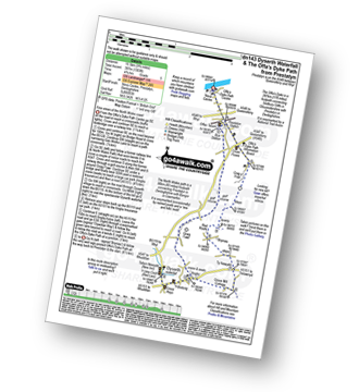
Route Summary:
Prestatyn - Ffrith Beach - Plas Newydd Farm - Rhydorddwy Goch Farm - Aberkinsey Farm - Dyserth - Dyserth Waterfall - The Offa's Dyke Path - Ty Newydd - Bryniau - Red Roofs - Crag y Fran - Prestatyn
|
Vital Statistics:
| Length: | 9.75 miles (15.5 km) |
| Ascent: | 1,303ft (397m) |
| Time: | 4.75hrs |
| Grade: | |
Route Summary:
Prestatyn - The North Wales Path - Dyserth - Dyserth Waterfall - The Offa's Dyke Path - Ty Newydd - Bryniau - Red Roofs - Crag y Fran - Prestatyn
|
Vital Statistics:
| Length: | 3.75 miles (6 km) |
| Ascent: | 961ft (293m) |
| Time: | 2½ hrs |
| Grade: | |

|
Vital Statistics:
| Length: | 11 miles (17.5 km) |
| Ascent: | 2,389ft (728m) |
| Time: | 6½ hrs |
| Grade: | |

Route Summary:
Moel Famau Country Park - Moel Famau - The Offa's Dyke Path - Moel Dywyll - Moel Llys-y-coed - Bwlch Arthur - Gronfoel Farm - Cilcain - Y Pentre - Crug Farm - Ffrith - Bryn Fynnon - Moel Famau Country Park
|
Vital Statistics:
| Length: | 12 miles (19 km) |
| Ascent: | 2,409ft (734m) |
| Time: | 6.75hrs |
| Grade: |  |
Route Summary:
Bwlch Penbarras - The Offa's Dyke Path - Moel Famau - Moel Dywyll - Moel Llys-y-coed - Bwlch Arthur - Gronfoel Farm - Cilcain - Y Pentre - Crug Farm - Ffrith - Bryn Fynnon - Moel Famua Country Park - Bwlch Penbarras
Not familiar with the area around CH8?
See these 30 nearest walks to UK Postcode CH8 on a google map
|
Vital Statistics:
| Length: | 5.5 miles (9 km) |
| Ascent: | 1,362ft (415m) |
| Time: | 3½ hrs |
| Grade: | |

|
Vital Statistics:
| Length: | 6.25 miles (10 km) |
| Ascent: | 1,254ft (382m) |
| Time: | 3½ hrs |
| Grade: | |

Route Summary:
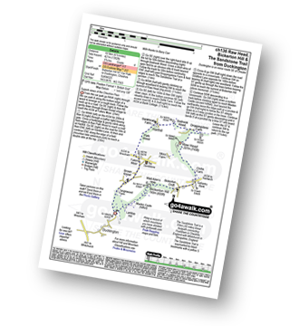
Frodsham - Beacon Hill (Frodsham) - Frodsham Golf Course - Dunsdale Wood - Tong Dean - Helsby Hill Fort - Helsby Hill - The Longster Trail - Harmers Wood - The Sandstone Trail - Snidley Moor and Woodhouse Hill - Snidley Moor Wood - Beacon Hill (Frodsham) - Frodsham
|
Vital Statistics:
| Length: | 6 miles (9.5 km) |
| Ascent: | 479ft (146m) |
| Time: | 2.75hrs |
| Grade: | |
Route Summary:
Hatchmere - Barns Bridge Gate - Delamere Forest - The Sandstone Way - The Delamere Way - Blakemere Moss - Linmere Visitor Centre - Eddisbury Hill - Eddisbury Hill Fort - Eddisbury Hill Farm - Hangingstone Hill (Eddisbury Hill) - Nettleford Wood - The Sandstone Way - Eddisbury Lodge Cottage - Eddisbury Lodge - Delamere Forest - Barns Bridge Gate - Hatchmere
|
Vital Statistics:
| Length: | 12.25 miles (19.5 km) |
| Ascent: | 2,356ft (718m) |
| Time: | 6.75hrs |
| Grade: | |

Route Summary:
Cynwyd - Afon Trystion - Cynwyd Forest - Pen Creigiau'r Barcut - Bwlch Cynwyd - Moel Fferna - Cerrig Coediog - Pan y Ladron - Pen Bwlch Llandrillo Top - Bwlch Llandrillo Wayfarer Memorial - Nant Gwyn - Nat y Cwm - Rhos-y-maerdy - Cynwyd
|
Vital Statistics:
| Length: | 15.5 miles (25 km) |
| Ascent: | 3,157ft (962m) |
| Time: | 8.75hrs |
| Grade: |  |
Route Summary:
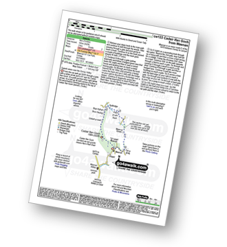
Cynwyd - Afon Trystion - Cynwyd Forest - Pen Creigiau'r Barcut - Bwlch Cynwyd - Moel Fferna - Cerrig Coediog - Pan y Ladron - Pen Bwlch Llandrillo Top - Bwlch Llandrillo Wayfarer Memorial - Blaen Llynor - Cadair Bronwen (North Top) - Cadair Bronwen - Bwlch Llandrillo Wayfarer Memorial - Nant Gwyn - Nat y Cwm - Rhos-y-maerdy - Cynwyd
|
Vital Statistics:
| Length: | 6.25 miles (10 km) |
| Ascent: | 128ft (39m) |
| Time: | 2½ hrs |
| Grade: |  |
Route Summary:
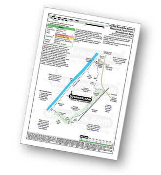
Ainsdale-on-Sea - Ainsdale Discovery Centre - Ainsdale Nature Reserve - Ainsdale Hills - West End Lodge - Woodvale Airfield - The Formby Hills - Massam's Slack - Irish Sea - Ainsdale Sands - Ainsdale-on-Sea
|
Vital Statistics:
| Length: | 3 miles (5 km) |
| Ascent: | 542ft (165m) |
| Time: | 2 hrs |
| Grade: |  |
Route Summary:
Maenan - Cadair Ifan Goch - Bryn Hyfryd - Pant-yr-ych Bach Farm - Maes-yr-Groes - Tyn-y-graig - Maenan
|
Vital Statistics:
| Length: | 6.5 miles (10.5 km) |
| Ascent: | 6ft (421m) |
| Time: | 2.75hrs |
| Grade: | |
Route Summary:
Duckington - Bickerton Hill - Brown Knowl - Fullers Moor - Harthill - Bodnook Wood - Droppingstone Farm - The Sandstone Trail - Raw Head (Rawhead) - Chiflik Farm - Gallantry Bank - Bickerton - Bickerton Hill - Maiden Castle (Bickerton Hill) - Duckington
|
Vital Statistics:
| Length: | 3.75 miles (6 km) |
| Ascent: | 197ft (60m) |
| Time: | 1.75hrs |
| Grade: | |
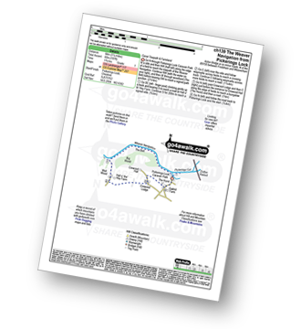
Route Summary:
Pickerings Lock - The Weaver Navigation - The Belt - Hall O' The' Hey Farm - Crewood Lodge - The Hurst - Oakwell Farm - Pickerings Lock
|
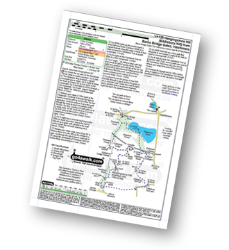
Vital Statistics:
| Length: | 5.5 miles (8.5 km) |
| Ascent: | 1,050ft (320m) |
| Time: | 3 hrs |
| Grade: | |
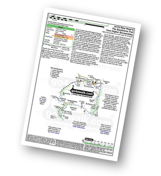
Route Summary:
Higher Burwardsley - The Sandstone Trail - Bulkeley Hill - Raw Head (Rawhead) - Bodnook Wood - Burwardsley Hill - Burwardsley - Higher Burwardsley
|
Vital Statistics:
| Length: | 9.5 miles (15 km) |
| Ascent: | 1,831ft (558m) |
| Time: | 5.25hrs |
| Grade: | |
Route Summary:
Higher Burwardsley - The Sandstone Trail - Bulkeley Hill - Raw Head (Rawhead) - Chiflik Farm - Gallantry Bank - Bickerton - Bickerton Hill - Maiden Castle (Bickerton Hill) - Brown Knowl - Fullers Moor - Harthill - Burwardsley - Higher Burwardsley
|
Vital Statistics:
| Length: | 6 miles (9.5 km) |
| Ascent: | 295ft (90m) |
| Time: | 2½ hrs |
| Grade: | |
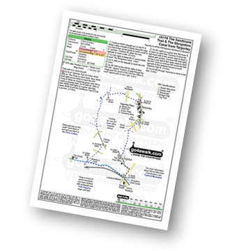
Route Summary:
Tarpoley - The Sandstone Trail - Ferney Lees - Wharton's Bridge - The Shorpshire Union Canal - Wharton's Lock - A49 - Tiverton - Tarpoley
|
Vital Statistics:
| Length: | 11.25 miles (18 km) |
| Ascent: | 883ft (269m) |
| Time: | 5 hrs |
| Grade: | |
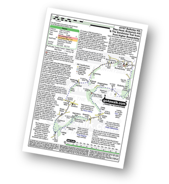
Route Summary:
Tarpoley - The Sandstone Trail - Ferney Lees - Wharton's Bridge - The Shorpshire Union Canal - Wharton's Lock - Beeston Castle - Beeston - Peckforton Woods - Higher Burwardsley - Waste Hill - Peckforton Hills - Peckforton Castle Lodge - Willis's Wood - Beeston - A49 - Tiverton - Tarpoley
|
Vital Statistics:
| Length: | 4.75 miles (7.5 km) |
| Ascent: | 515ft (157m) |
| Time: | 2.25hrs |
| Grade: | |

Route Summary:
Beeston - Beeston Castle - The Sandstone Trail - Peckforton Woods - Higher Burwardsley - Waste Hill - Peckforton Hills - Peckforton Castle Lodge - Willis's Wood - Beeston
|
Vital Statistics:
| Length: | 3.5 miles (5.5 km) |
| Ascent: | 286ft (87m) |
| Time: | 1.75hrs |
| Grade: | |

Route Summary:
Tiverton - The Shropshire Union Canal - Wharton's Lock - The Sandstone Trail - Beeston Castle - Beeston - Beeston Hall Farm - Tiverton
Not familiar with the area around CH8?
See these 30 nearest walks to UK Postcode CH8 on a google map


