
![]()
Y Lliwedd
898m (2947ft)
The Snowdon Area, Snowdonia, Gwynedd, Wales
Tap/mouse over a coloured circle (1-3 easy walks, 4-6 moderate walks, 7-9 hard walks) and click to select.
Y Lliwedd means 'The Hue' in Welsh and is pronounced 'uh-thl-ee-weth'.
The summit of Y Lliwedd is marked by a cairn.

Not familiar with this top?
   |
|---|
Vital Statistics:
| Length: | 7ml (11km) |
|---|---|
| Ascent: | 3,805ft (1,160m) |
| Time: | 6.25hrs |
| Grade: |  (Moderate) (Moderate) |

Route Summary:
Pen-y-Pass - Pyg Track - Bwlch y Moch - Craig Fach - Crib Goch - Garnedd Ugain (Crib y Ddysgl) - Snowdon Mountain Railway - Snowdon (Yr Wyddfa) - The Scree Path - Bwlch y Saethau - Bwlch Ciliau - Y Lliwedd - Y Lliwedd (East Top) - Lliwedd Bach - Miners' Track - Pen-y-Pass
|
|---|
Vital Statistics:
| Length: | 7.5ml (12km) |
|---|---|
| Ascent: | 4,100ft (1,250m) |
| Time: | 6½ hrs |
| Grade: |  (Hard) (Hard) |

Route Summary:
Pen-y-Pass - Pyg Track - Bwlch y Moch - Craig Fach - Crib Goch - Garnedd Ugain (Crib y Ddysgl) - Snowdon Mountain Railway - Snowdon (Yr Wyddfa) - The Scree Path - Bwlch y Saethau - Bwlch Ciliau - Y Lliwedd - Y Lliwedd (East Top) - Lliwedd Bach - Gallt y Wenallt - Afon Glaslyn - Miners' Track - Pen-y-Pass
See Y Lliwedd and the surrounding tops on our free-to-access 'Google Style' Peak Bagging Maps:
The Snowdon Area of Snowdonia National Park
Less data - quicker to download
The Whole of Snowdonia National Park
More data - might take a little longer to download
See Y Lliwedd and the surrounding tops on our downloadable Peak Bagging Map in PDF format:

NB: Whether you print off a copy or download it to your phone, this PDF Peak Baggers' Map might prove incredibly useful when your are up there on the tops and you cannot get a phone signal.
You can find Y Lliwedd & all the walks that climb it on these unique free-to-access Interactive Walk Planning Maps:
1:25,000 scale OS Explorer Map (orange/yellow covers):
1:50,000 scale OS Landranger Map (pink/magenta covers):
 Fellow go4awalkers who have already walked, climbed, summited & bagged Y Lliwedd
Daniel Moran walked up Y Lliwedd on December 5th, 2022 [from/via/route] Peny pas [with] Wardy [weather] Snow low wind high cloud with cloud cover - Amazing walk scramble ice axe & crampons needed
Mark Davidson climbed it on October 25th, 2016 [from/via/route] Walk gw136 The Snowdon (Yr Wyddfa) Horseshoe from Pen y Pass [with] Sub G's [weather] Rather cloudy - A classic - despite the weather
Melfyn Parry bagged it on June 15th, 2022 [from/via/route] Start point for the walk was the lay-by near Caffi Gwynant. Took Watkyn Path up to SH622516, then crossed bridge above waterfalls to continue on a path along edge of woods which eventually comes to a disused mine at SH634530. Route then indistinct but steep to gain the ridge. Path was more obvious from this point, following ridge to ascend Lliwedd Bach, continuing along to ascend Lliwedd's East & West peaks before descending back to car park down the Watkyn Path. [with] U3A [weather] Great day, mostly comfortable temperatures, cool on summits. No rain until the final descent when slight shower. - Tough ascent but great views
Donovan Suddell hiked Y Lliwedd on March 27th, 2022 [from/via/route] Pen Y Pass. Snowdon Horseshoe [with] son-in-law [weather] beautiful sunny morning.
Adrian Haywood summited on December 19th, 2021 [from/via/route] Miners path then down the watkin path from snowdon. [with] Rob [weather] Sunny
To add (or remove) your name and experiences on this page - Log On and edit your Personal Mountain Bagging Record
. . . [see more walk reports]
More Photographs & Pictures of views from, on or of Y Lliwedd


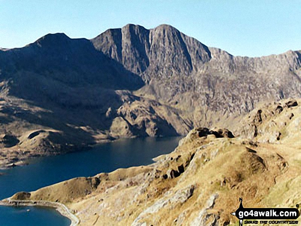
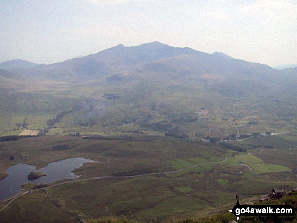
Garnedd Ugain (Crib y Ddysgl), Crib Goch, Craig Fach, The PYG Track, Llyn Llydaw and Y Lliwedd from the summit of Snowdon (Yr Wyddfa)


Mount Snowdon (Yr Wyddfa) & Y Lliwedd (left) and The Glyderau - Glyder Fach, Glyder Fawr & Tryfan (centre) and Carnedd Moel Siabod (right) with Moel Penamnen and Llyn Newydd & Llyn Bowydd (mid distance right) from the summit of Manod Mawr (North Top)
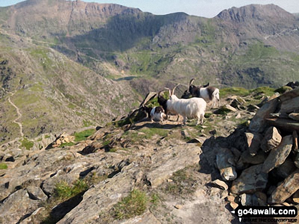
Goats on the summit of Y Lliwedd with Garnedd Ugain (Crib y Ddysgl) (left) and Crib Goch (right) in the distance
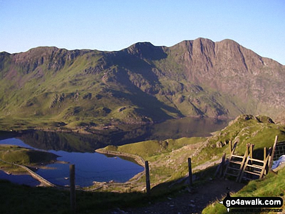
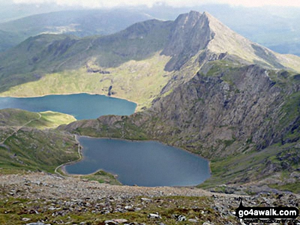
Glaslyn, Llyn Llydaw and Y Lliwedd from the Miners' Track near the summit of Snowdon (Yr Wyddfa)

Sunset over Llyn Lockwood (centre bottom), Llyn Gywant, Y Lliwedd and Snowdon (Yr Wyddfa) from the Miner's Track near Glyder Fach


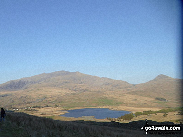
Llyn Du-bach & Maen-offeren Quarry (foreground) with Allt-fawr, Moel Druman, Ysgafel Wen in the distance and Yr Aran, Mount Snowdon (Yr Wyddfa) and Y Lliwedd on the horizon from the summit of Manod Mawr (North Top)

360 degree view from Moel Penamnen summit featuring (from left to right): The Moelwyns - Moelwyn Bach, Craigysgafn & Moelwyn Mawr, Allt-fawr, Moel Druman & Ysgafell Wen, Moel Farlwyd (foreground above/left of blue lake), Yr Aran (pointed peak above Moel Farlwyd), Mount Snowdon (Yr Wyddfa) & Y Lliwedd, The Glyderau - Glyder Fach, Glyder Fawr & Tryfan, Carnedd Moel Siabod, Y Ro Wen, Foel-fras (Moelwyns), Manod Mawr (above two light blue lakes) and The Arenigs - Arenig Fawr & Arenig Fach.
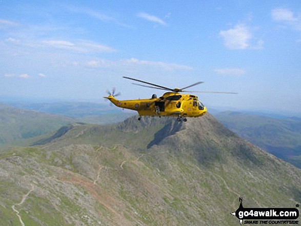
A RAF Helicopter above Y Lliwedd and the Watkin Path from Mount Snowdon (Yr Wyddfa)
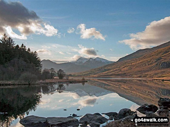
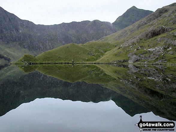
Snowdon Horseshoe reflected in Llynnau Mymbyr near Plas Y Brenin featuring Y Lliwedd (left) and Snowdon (Yr Wyddfa), Crib Goch and Garnedd Ugain (Crib y Ddysgl) (right)

Y Lliwedd, Y Lliwedd (East Top) and Y Lliwedd Bach from the Watkin Path on Bwlch Ciliau
On the way up Snowdon (Yr Wyddfa) on the PYG track with Cribau and Y Lliwedd prominent in the background

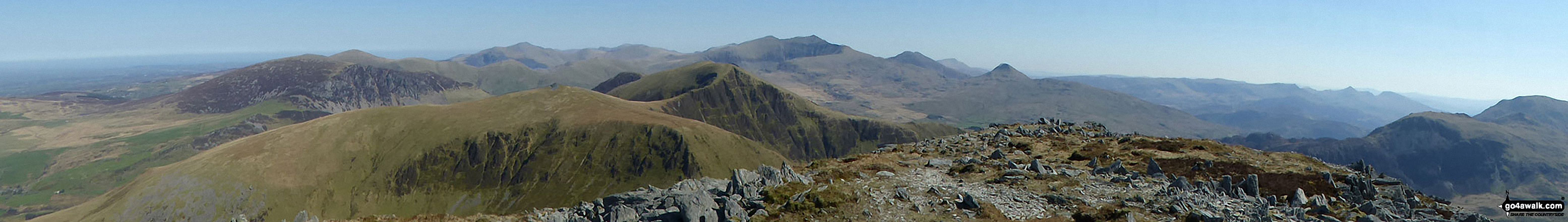
Mynydd Mawr (Llyn Cwellyn), Y Garn (Moel Hebog), The Nantlle Ridge and Mynydd Drws-y-coed from Trum y Ddysgl - with The Snowdon Massif (Moel Eilio (Llanberis), Foel Gron, Moel Cynghorion, Garnedd Ugain (Crib y Ddysgl), Snowdon (Yr Wyddfa), Y Lliwedd and Yr Aran) forming the backdrop

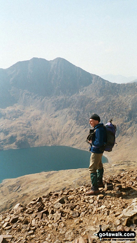
Glaslyn with the lower slopes of Y Lliwedd beyond from The Miners' Track below Mount Snowdon (Yr Wyddfa)

The Snowdon Horseshoe from Glyder Fach - featuring in the mid-distance: Y Lliwedd (centre left), Crib Goch (centre right), Snowdon (Yr Wyddfa) and Garnedd Ugain (Crib y Ddysgl) (far right)

Y Lliwedd (East Top) and Y Lliwedd from The Miners' Track near Llyn Llydaw
The Watkin Path from Bwlch Ciliau up to the summit of Snowdon (Yr Wyddfa) with Garnedd Ugain (Crib y Ddysgl) visible (far right) from Y Lliwedd
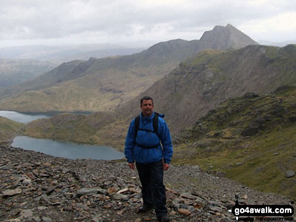
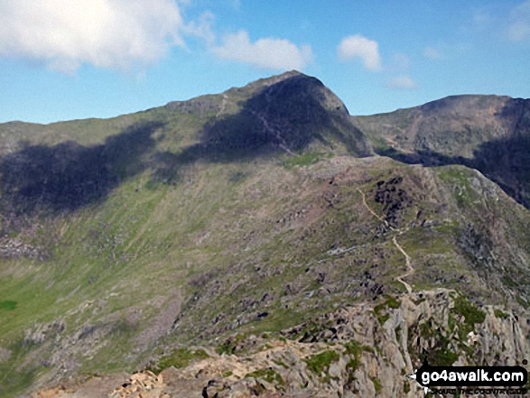
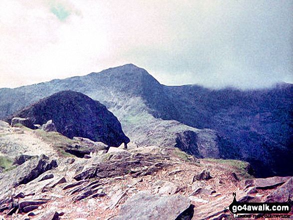
Y Lliwedd summit from Y Lliwedd (East Top) with Snowdon (Yr Wyddfa) in the distance

Mount Snowdon (Yr Wyddfa) & Y Lliwedd (left) and The Glyderau - Glyder Fach, Glyder Fawr & Tryfan (right) from Moel Penamnen

Mynydd Mawr (Llyn Celyn), Craig y Bera, Mynydd Tal-y-mignedd and Mynydd Drws-y-coed from the summit of Craig Cwm Silyn with Garnedd Ugain (Crib y Ddysgl), Snowdon (Yr Wyddfa), Y Lliwedd & Yr Aran on the horizon (centre) and Moel Lefn, Moel yr Ogof & Moel Hebog on the far left
Mynydd Drws-y-coed & The Nantlle Ridge - with The Snowdon Massif (Garnedd Ugain (Crib y Ddysgl), Snowdon (Yr Wyddfa), Y Lliwedd and Yr Aran) beyond from Trum y Ddysgl

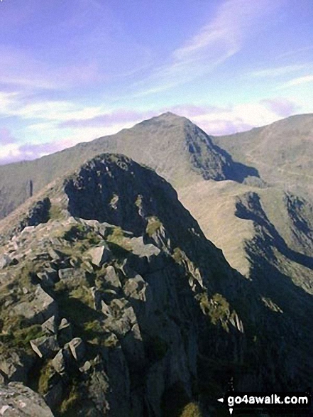
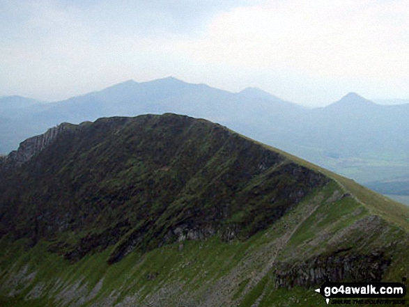
Y Lliwedd Bach (centre), Y Lliwedd (East Top) and Y Lliwedd (far right) from the north east ridge

Llyn Nantlle Uchaf, Dyffryn Nantlle, Mynydd Mawr, Rhyd Ddu, Llyn y Dywarchen, The Snowdon Massif (Moel Eilio (Llanberis), Foel Gron, Moel Cynghorion, Garnedd Ugain (Crib y Ddysgl), Snowdon (Yr Wyddfa), Y Lliwedd and Yr Aran from Y Garn (Moel Hebog)

Bwlch Ciliau, Y Lliwedd Bach and Y Lliwedd from the Finger Post at top of Scree Path near the summit of Snowdon (Yr Wyddfa)
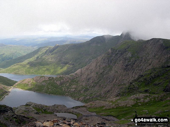
Glaslyn (bottom), Llyn Llydaw and Y Lliwedd (right) from the top of The PYG/Miners' Track, Snowdon
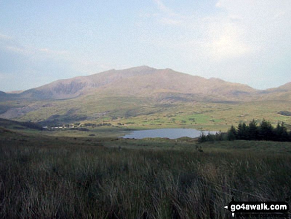
The Snowdon Massif - Garnedd Ugain (Crib y Ddysgl), Snowdon (Yr Wyddfa) & Y Lliwedd beyond Llyn-y-Gader from Cwm Marchnad at the northern edge of Beddgelert Forest
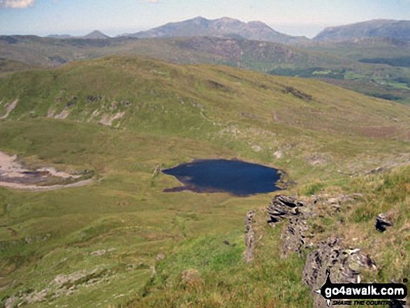
Llyn-y-Gader with Garnedd Ugain (Crib y Ddysgl), Snowdon (Yr Wyddfa), Y Lliwedd & Yr Aran (right) from Beddgelert Forest near Cwm Marchnad
Glaslyn with the shoulder of Y Lliwedd (left) and Snowdon (Yr Wyddfa) on the right
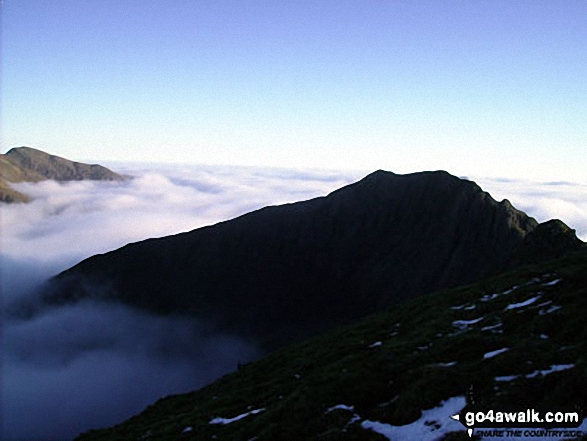
Cnicht (left) and Y Lliwedd poking through a Temerature Inversion seen from Crib Goch
Llynnau Barlwyd (foreground), Moel Farlwyd (midground left), Yr Aran (pointed peak above Moel Farlwyd), Mount Snowdon (Yr Wyddfa) & Y Lliwedd from Moel Penamnen

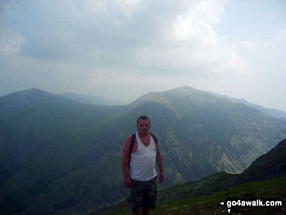
Nantgwynant with Ysgafell Wen and Cnicht on the horizon from the summit of Y Lliwedd
The Snowdon Massif - featuring Garnedd Ugain (Crib y Ddysgl), Snowdon (Yr Wyddfa), Bwlch Main, Llechog (Llanberis Path), Clogwyn Du and Y Lliwedd from Y Garn (Moel Hebog) with Llyn y Dywarchen and Rhyd Ddu in the valley below

The Snowdon Massif (Garnedd Ugain (Crib y Ddysgl), Snowdon (Yr Wyddfa), Y Lliwedd & Yr Aran) and Llyn y Dywarchen from Mynydd Drws-y-coed

Garnedd Ugain (Crib y Ddysgl), Snowdon (Yr Wyddfa), Y Lliwedd & Yr Aran from the summit of Craig Cwm Silyn

The Watkin Path on Bwlch Ciliau and Y Lliwedd from the top of the Scree Path close to the summit of Snowdon (Yr Wyddfa)
. . . see just 10 walk photographs & pictures of views from, on or of Y Lliwedd
Send us your photographs and pictures on, of, or from Y Lliwedd
If you would like to add your walk photographs and pictures to this page, please send them as email attachments (configured for any computer) along with your name to:
and we shall do our best to publish them.
(Guide Resolution = 300dpi. At least = 660pixels (wide) x 440 pixels (high).)

You can also submit photos via our Facebook Page.
NB. Please indicate where each photo was taken and whether you wish us to credit your photos with a Username or your First Name/Last Name.


