
![]()
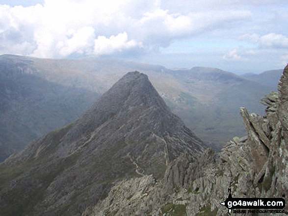
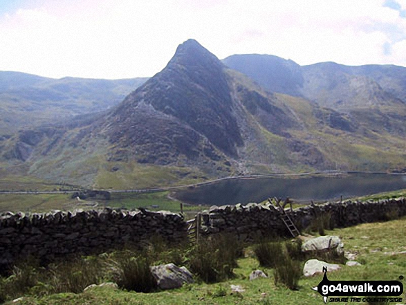
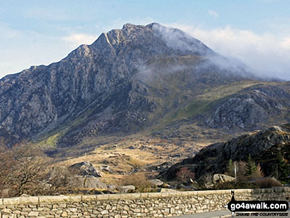
Tryfan
915m (3003ft)
The Glyders (or Glyderau), Snowdonia, Conwy, Wales
Tryfan means 'Three Tops' in Welsh and is pronounced 'tre-van'.
Not familiar with this top?
You can walk/hike to the top of Tryfan by using either of these 2 easy‑to‑follow route maps:
Walk cw119 Tryfan from Glan Dena, Llyn Ogwen
One of the finest mountains in Wales
   |
|---|
Vital Statistics:
| Length: | 7.5ml (12km) |
|---|---|
| Ascent: | 2,814ft (858m) |
| Time: | 5½ hrs |
| Grade: |  (Moderate) (Moderate) |
Route Summary:
Llyn Ogwen - Glan Dena - Llyn Ogwen - Gwern Gof Uchaf - Heather Terrace - Tryfan - (Adam and Eve) - Far South Peak - Bwlch Tryfan - Miner's Track - Llyn Caseg Fraith - Y Foel Goch - Gallt yr Ogof - Nant yr Ogof - Gwern Gof Isaf - Gwern Gof Uchaf - Glan Dena - Llyn Ogwen
Walk gw102 The Welsh 3000's (Glyderau) from Llanberis
5 of the 15 Welsh 3000's
|
|---|
Vital Statistics:
| Length: | 12.5ml (18.5km) |
|---|---|
| Ascent: | 5,327ft (1,624m) |
| Time: | 9½ hrs |
| Grade: |  (Hard) (Hard) |

Route Summary:
Pen-y-Gwryd Hotel - Llyn Caseg-fraith - Bwlch Tryfan - Tryfan - (Adam and Eve) - Bwlch Tryfan - Glyder Fach - The Cantilever Stone - Castell y Gwynt (Glyder Fach) - Bwlch y Ddwy-Glyder - Glyder Fawr - Y Garn (Glyderau) - Bwlch y Cywion - Foel-goch - Bwlch y Brecan - Bwlch y Marchlyn - Elidir Fawr - Afon Dudodyn - Nant Peris
See Tryfan and the surrounding tops on our free-to-access 'Google Style' Peak Bagging Maps:
The Glyders (or Glyderau) of Snowdonia National Park
Less data - quicker to download
The Whole of Snowdonia National Park
More data - might take a little longer to download
See Tryfan and the surrounding tops on our unique, downloadable, PDF Peak Bagging Map:

NB: Whether you print off a copy or download it to your phone, this PDF Peak Baggers' Map might prove incredibly useful when your are up there on the tops and you cannot get a phone signal.
You can find Tryfan & all the walks that climb it on these unique free-to-access Interactive Walk Planning Maps:
1:25,000 scale OS Explorer Map (orange/yellow covers):
1:50,000 scale OS Landranger Map (pink/magenta covers):
 Fellow go4awalkers who have already walked, climbed, scaled, summited, hiked & bagged Tryfan
Tia Cain has walked up Tryfan [from/via/route] From a layby off the main road on the north face [with] Daryn and Scott [weather] Perfect & clear - Bloody cream crackered after Tryfan North face & the Glyders!
Stephanie Doyle climbed it on April 29th, 2022 [with] Friend [weather] Ok
Adrian Haywood bagged it on February 27th, 2022 [from/via/route] North ridge [with] Solo [weather] Sunny
Melfyn Parry hiked Tryfan on September 1st, 2019 [from/via/route] Oggy 4, Y Garn, Glyder Fawr, Glyder Fach & Tryfan. Start point SH655602, car park after brew shack at Ogwen Lake. Ascent of Y Garn, steep path with upper slopes of scree. Descent to Llyn y Cwn for a short coffee break before making ascent of Glyder Fawr. This path was mainly scree, quite steep with poor visibility. Summit in low cloud, difficult to make out path, use of Satmap confirmed needed to be further to the right, spotted cairn which confirmed correct path, were able to follow line of cairns to toward Glyder Fach. Weather cleared briefly to show views down over Llyn Cwm Ffynnon to Pen y Gwryd Hotel. Circumnavigated Castell y Gwynt to Glyder Fach before descending Brisly scree path to Bwlch Tryfan. Stopped for lunch before ascending Tryfan south ridge. Weather was much better here & Tryfan was clear & quite busy. Descent via western gulley was tough on the knees & thighs & we were subjected to heavy showers for last half mile to car park. [with] PRC [weather] Poor most of the time occasional sunny spells but cold.
Neall Garrad summited on June 22nd, 2007 [from/via/route] 15 peaks route from Nant Peris to Llanfairfechan [with] Andy, Chris, John and Warren [weather] Mixed
To add (or remove) your name and experiences on this page - Log On and edit your Personal Mountain Bagging Record
. . . [see more walk reports]
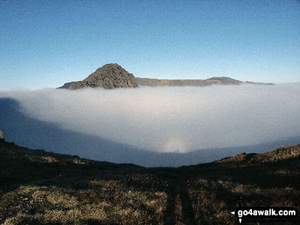
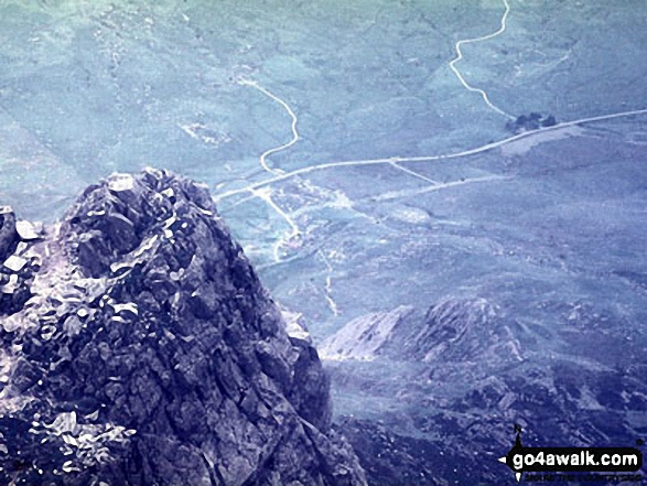
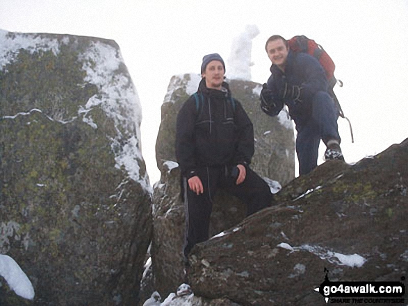
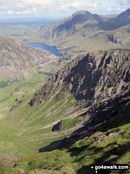
More Photographs & Pictures of views from, on, or of, Tryfan
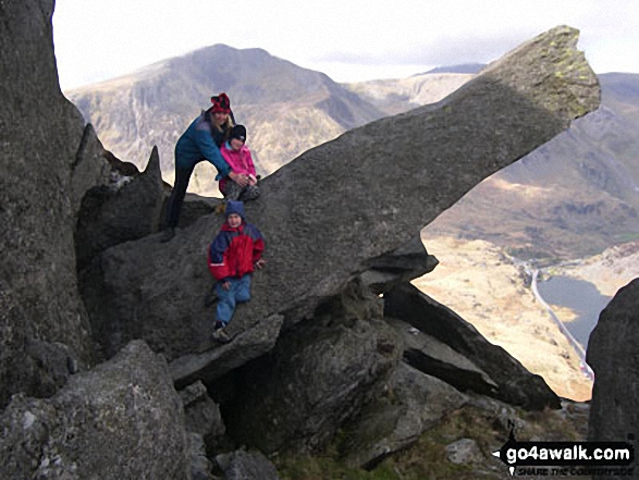
My wife with Meg and Joe on at The Cannon Stone on the North Ridge of Tryfan


. . . see all 58 walk photographs & pictures of views from, on, or of, Tryfan
Send us your photographs and pictures on, of, or from Tryfan
If you would like to add your walk photographs and pictures to this page, please send them as email attachments (configured for any computer) along with your name to:
and we shall do our best to publish them.
(Guide Resolution = 300dpi. At least = 660pixels (wide) x 440 pixels (high).)

You can also submit photos via our Facebook Page.
NB. Please indicate where each photo was taken and whether you wish us to credit your photos with a Username or your First Name/Last Name.


