
![]()
Pen Llithrig y Wrach
799m (2622ft)
The Carneddau, Snowdonia, Conwy, Wales
Tap/mouse over a coloured circle (1-3 easy walks, 4-6 moderate walks, 7-9 hard walks) and click to select.
Pen Llithrig y Wrach means 'Slippery Hill of the Witch' in Welsh and is pronounced 'Pen Thlith-rig ee racht'.
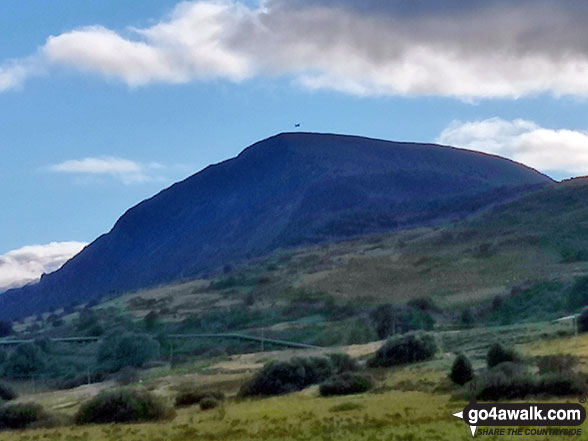
The summit of Pen Llithrig y Wrach is marked by a cairn.

Not familiar with this top?
   |
|---|
Vital Statistics:
| Length: | 9.5ml (15km) |
|---|---|
| Ascent: | 2,714ft (827m) |
| Time: | 6.25hrs |
| Grade: |  (Moderate) (Moderate) |
Route Summary:
Llyn Eigiau - Craig Eigiau - Cwm Eigiau - Pen Yr Helgi Du - Bwlch Tri y Marchog - Pen Llithrig y Wrach - Cedryn - Hafod-y-rhrw - Llyn Eigiau
|
|---|
Vital Statistics:
| Length: | 10ml (16km) |
|---|---|
| Ascent: | 2,945ft (898m) |
| Time: | 6½ hrs |
| Grade: |  (Hard) (Hard) |
Route Summary:
Capel Curig - Bron Heulog - Llyn Cowlyd - Pen Llithrig y Wrach - Bwlch y Tri Marchog - Pen Yr Helgi Du - Nant y Benglog - Capel Curig
|
|---|
Vital Statistics:
| Length: | 10ml (16km) |
|---|---|
| Ascent: | 3,027ft (923m) |
| Time: | 6½ hrs |
| Grade: | (Hard) |

Route Summary:
Llyn Eigiau - Hafod-y-rhrw - Cedryn - Pen Llithrig y Wrach - Llyn Colwyd Reservoir - Craiglwyn - Creigiau Gleision - Creigiau Gleision (North Top) - Eilio Farm - Llyn Eigiau
|
|---|
Vital Statistics:
| Length: | 11ml (17.5km) |
|---|---|
| Ascent: | 3,641ft (1,110m) |
| Time: | 7.75hrs |
| Grade: | (Hard) |

Route Summary:
Llyn Eigiau - Craig Eigiau - Gwaun Y Garnedd - Foel Grach - Carnedd Llewelyn - Craig Yr Ysfa - Bwlch Eryl Farchog - Pen yr Helgi Du - Bwlch y Tri Marchog - Pen Llithrig y Wrach - Cedryn - Hafod-y-rhrw - Llyn Eigiau
|
|---|
Vital Statistics:
| Length: | 13.5ml (21.5km) |
|---|---|
| Ascent: | 4,477ft (1,364m) |
| Time: | 9½ hrs |
| Grade: |  (Hard) (Hard) |

Route Summary:
Llyn Eigiau - Craig Eigiau - Cwm Eigiau - Pen Yr Helgi Du - Bwlch Tri Marchog - Pen Llithrig y Wrach - Llyn Colwyd Reservoir - Craiglwyn - Creigiau Gleision - Creigiau Gleision (North Top) - Eilio Farm - Llyn Eigiau
See Pen Llithrig y Wrach and the surrounding tops on our free-to-access 'Google Style' Peak Bagging Maps:
The Carneddau of Snowdonia National Park
Less data - quicker to download
The Whole of Snowdonia National Park
More data - might take a little longer to download
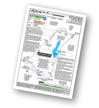
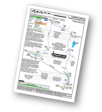
See Pen Llithrig y Wrach and the surrounding tops on our downloadable Peak Bagging Map in PDF format:

NB: Whether you print off a copy or download it to your phone, this PDF Peak Baggers' Map might prove incredibly useful when your are up there on the tops and you cannot get a phone signal.
You can find Pen Llithrig y Wrach & all the walks that climb it on these unique free-to-access Interactive Walk Planning Maps:
1:25,000 scale OS Explorer Map (orange/yellow covers):
1:50,000 scale OS Landranger Map (pink/magenta covers):
 Fellow go4awalkers who have already walked, climbed, summited & bagged Pen Llithrig y Wrach
Donovan Suddell walked up Pen Llithrig y Wrach on July 29th, 2024 [from/via/route] Capel Curig [with] solo [weather] Sunny Day, Perfect weather. (warm in the valley)
Adrian Haywood climbed it on January 22nd, 2023 [from/via/route] Pen yr Helgi Du & Pen Llithrig-y-Wrach circular [with] Darryl, Mike and Rob [weather] snow & cloudy & windy.
Melfyn Parry bagged it on January 12th, 2020 [from/via/route] Ascent of tarmac highway to leat. Along leat to ascend Y Braich to Pen yr Helgi Ddu and on to Pen Llithrig y Wrach returning down it's south ridge. Cross footbridge at south of LLyn Cowlyd followed the leat back to tarmac highway & returned to car park. [with] PRC [weather] Windy on Y Braich with hail showers.
Andy Buxton hiked Pen Llithrig y Wrach during August, 1964 [from/via/route] Dad - Took wrong turn: intended to Pen Llithrig, Pen Helgi & Carrneddau. Ended up doing Craig Eigiau & Pen y Castell as well. Very late back to Llanfairfechan.
Angela Moroney summited during 2017 - 2017 3PEAKS
To add (or remove) your name and experiences on this page - Log On and edit your Personal Mountain Bagging Record
. . . [see more walk reports]
More Photographs & Pictures of views from, on or of Pen Llithrig y Wrach

Glyder Fach (centre left), Glyder Fawr (centre) and Tryfan (centre right) from Pen Llithrig y Wrach

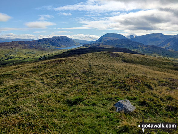
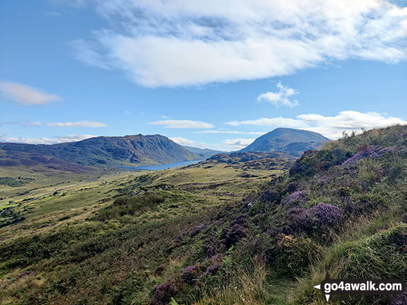
The Llyn Cowlyd Reservoir pipeline in Cwm Afon Ddu with Creigiau Gleision (left) & Pen Llithrig y Wrach (right) at the end of the valley
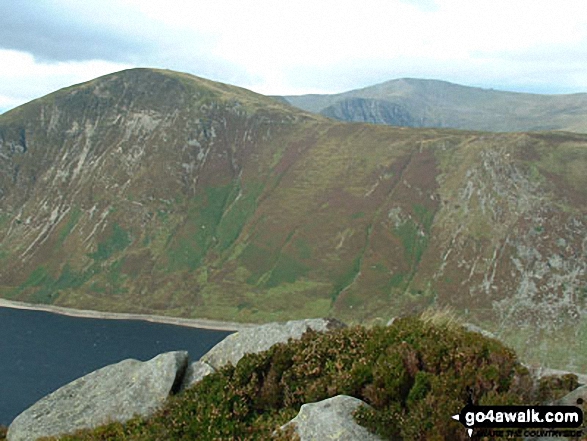
Creigiau Gleision (left), Llyn Cowlyd Reservoir, Pen Llithrig y Wrach (centre) and Pen yr Helgi Du from Moel Eilio (Dolgarrog)

Water channel on Tai-isaf-ardda with Creigiau Gleision (left) & Pen Llithrig y Wrach (right) at the end of the valley
Creigiau Gleision (left), Llyn Cowlyd Reservoir & Pen Llithrig y Wrach (right) from Moel Eilio (Dolgarrog)!

Tryfan and The Glyderau (Glyderau) from Cwm Tal-y-Braich below Pen Llithrig y Wrach
Send us your photographs and pictures on, of, or from Pen Llithrig y Wrach
If you would like to add your walk photographs and pictures to this page, please send them as email attachments (configured for any computer) along with your name to:
and we shall do our best to publish them.
(Guide Resolution = 300dpi. At least = 660pixels (wide) x 440 pixels (high).)

You can also submit photos via our Facebook Page.
NB. Please indicate where each photo was taken and whether you wish us to credit your photos with a Username or your First Name/Last Name.


