
![]()
Glyder Fawr
999m (3279ft)
The Glyders (or Glyderau), Snowdonia, Conwy/Gwynedd, Wales
Tap/mouse over a coloured circle (1-3 easy walks, 4-6 moderate walks, 7-9 hard walks) and click to select.
Glyder Fawr means 'Large Heap or Large Pile of Stones' in Welsh and is pronounced 'g-lid-der var'.

Not familiar with this top?
   |
|---|
Vital Statistics:
| Length: | 5.5ml (9km) |
|---|---|
| Ascent: | 2,854ft (870m) |
| Time: | 5 hrs |
| Grade: |  (Moderate) (Moderate) |

Route Summary:
Llyn Ogwen - Ogwen Cottage - Llyn Bochlwyd - Bwlch Tryfan - Bristly Ridge - The Cantilever Stone - Glyder Fach - Castell y Gwynt (Glyder Fach) - Bwlch y Ddwy-Glyder - Glyder Fawr - Llyn y Cwm - Twll Du (Devil's Kitchen) - Llyn Idwal - Ogwen Cottage - Pont Pen-y-benglog - Llyn Ogwen
|
|---|
Vital Statistics:
| Length: | 7ml (11km) |
|---|---|
| Ascent: | 3,308ft (1,008m) |
| Time: | 6 hrs |
| Grade: | (Moderate) |

Route Summary:
Llyn Ogwen - Ogwen Cottage - 'Tin Pan Alley' - Llyn Glyd - Y Garn (Glyderau) - Llyn y Cwm - Glyder Fawr - Bwlch y Ddwy-Glyder - Castell y Gwynt (Glyder Fach) - Glyder Fach - The Cantilever Stone - Bristly Ridge - Bwlch Tryfan - Llyn Bochlwyd - Ogwen Cottage - Pont Pen-y-benglog - Llyn Ogwen
|
|---|
Vital Statistics:
| Length: | 12.5ml (18.5km) |
|---|---|
| Ascent: | 5,327ft (1,624m) |
| Time: | 9½ hrs |
| Grade: |  (Hard) (Hard) |

Route Summary:
Pen-y-Gwryd Hotel - Llyn Caseg-fraith - Bwlch Tryfan - Tryfan - (Adam and Eve) - Bwlch Tryfan - Glyder Fach - The Cantilever Stone - Castell y Gwynt (Glyder Fach) - Bwlch y Ddwy-Glyder - Glyder Fawr - Y Garn (Glyderau) - Bwlch y Cywion - Foel-goch - Bwlch y Brecan - Bwlch y Marchlyn - Elidir Fawr - Afon Dudodyn - Nant Peris
See Glyder Fawr and the surrounding tops on our free-to-access 'Google Style' Peak Bagging Maps:
The Glyders (or Glyderau) of Snowdonia National Park
Less data - quicker to download
The Whole of Snowdonia National Park
More data - might take a little longer to download
See Glyder Fawr and the surrounding tops on our downloadable Peak Bagging Map in PDF format:

NB: Whether you print off a copy or download it to your phone, this PDF Peak Baggers' Map might prove incredibly useful when your are up there on the tops and you cannot get a phone signal.
You can find Glyder Fawr & all the walks that climb it on these unique free-to-access Interactive Walk Planning Maps:
1:25,000 scale OS Explorer Map (orange/yellow covers):
1:50,000 scale OS Landranger Map (pink/magenta covers):
 Fellow go4awalkers who have already walked, climbed, summited & bagged Glyder Fawr
Tia Cain has walked up Glyder Fawr [from/via/route] From Tryfan [with] Daryn and Scott [weather] Perfect & clear - Bloody cream crackered after Tryfan North face & the Glyders!
Hazel Gilbert climbed it on April 15th, 2009 [with] Lawrence [weather] Sunny
Daniel Moran bagged it on March 5th, 2021 [from/via/route] Lake below [with] Solo [weather] Sun & snow on the ground - Devils kitchen
Adrian Haywood hiked Glyder Fawr on April 9th, 2022 [from/via/route] Devil's Kitchen [with] Mike, Celia and Darryl [weather] mixed
Stephanie Doyle summited on August 6th, 2022 [from/via/route] Devil's Kitchen [with] Solo [weather] Nice
To add (or remove) your name and experiences on this page - Log On and edit your Personal Mountain Bagging Record
. . . [see more walk reports]
More Photographs & Pictures of views from, on or of Glyder Fawr

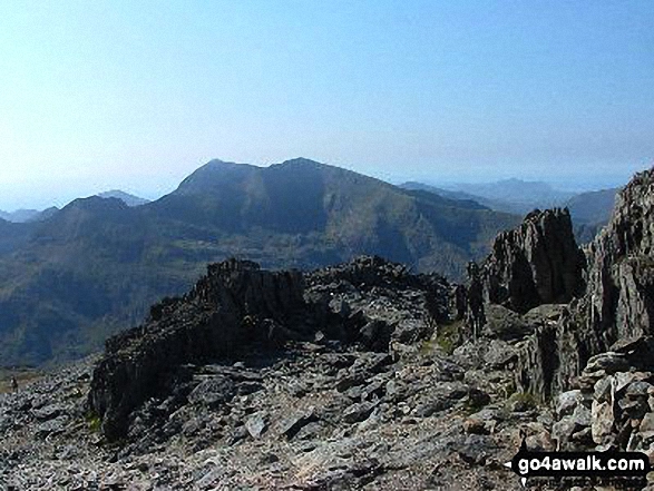
Snowdon (Yr Wyddfa) and Garnedd Ugain (Crib y Ddysgl) from Glyder Fawr


Mount Snowdon (Yr Wyddfa) & Y Lliwedd (left) and The Glyderau - Glyder Fach, Glyder Fawr & Tryfan (centre) and Carnedd Moel Siabod (right) with Moel Penamnen and Llyn Newydd & Llyn Bowydd (mid distance right) from the summit of Manod Mawr (North Top)
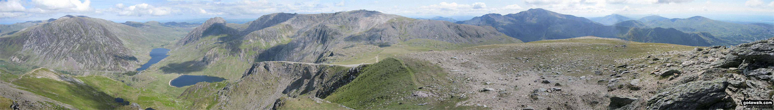
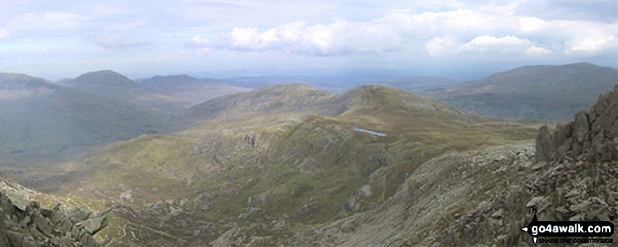
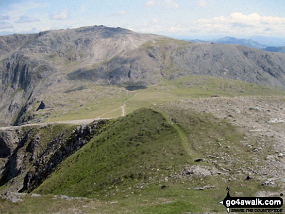
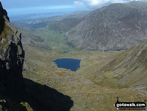
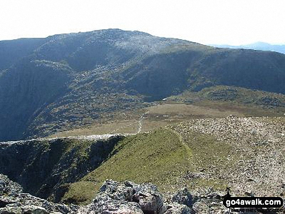
Pen yr Ole Wen, Llyn Clyd, Llyn Ogwen, Llyn Idwal, Tryfan, Glyder Fach, Glyder Fawr, Crib Goch and Garnedd Ugain from Y Garn (Glyderau)

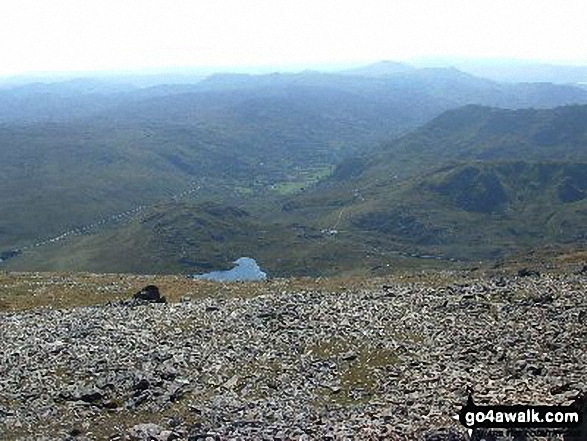
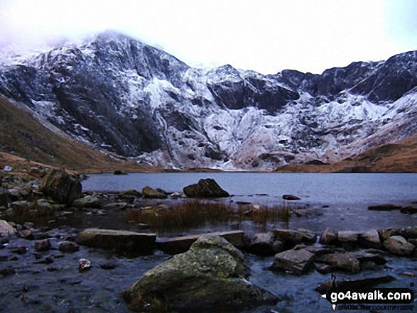
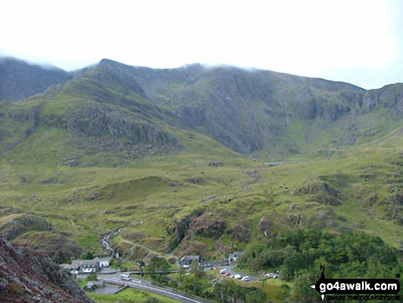
Cwm Idwal featuring Glyder Fawr (left), Twll Du or The Devil's Kitchen (centre) and Y Garn (right)


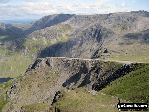
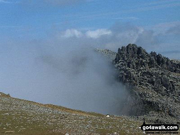
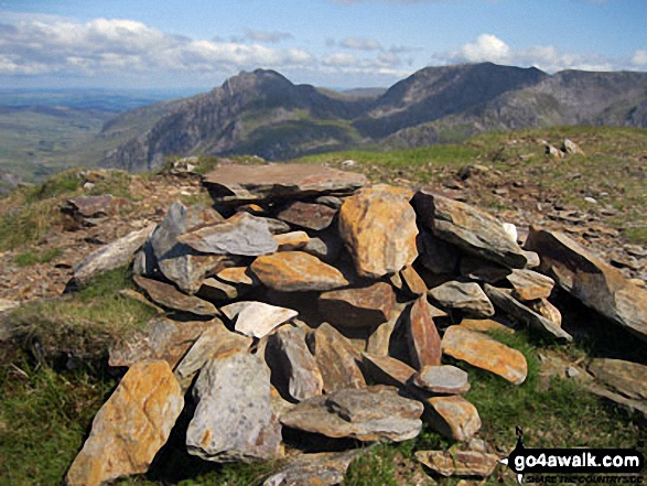
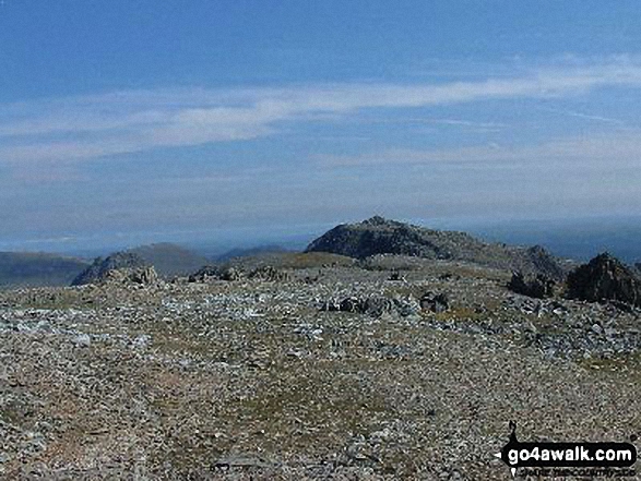
Bwlch y Ddwy-Glyder, Castell y Gwynt and Glyder Fach from Glyder Fawr in mist


Tryfan (left), Glyder Fawr, Y Garn (Glyderau) (right) and Llyn Ogwen from near Glan Dena

360 degree view from Moel Penamnen summit featuring (from left to right): The Moelwyns - Moelwyn Bach, Craigysgafn & Moelwyn Mawr, Allt-fawr, Moel Druman & Ysgafell Wen, Moel Farlwyd (foreground above/left of blue lake), Yr Aran (pointed peak above Moel Farlwyd), Mount Snowdon (Yr Wyddfa) & Y Lliwedd, The Glyderau - Glyder Fach, Glyder Fawr & Tryfan, Carnedd Moel Siabod, Y Ro Wen, Foel-fras (Moelwyns), Manod Mawr (above two light blue lakes) and The Arenigs - Arenig Fawr & Arenig Fach.

Mount Snowdon (Yr Wyddfa) & Y Lliwedd (left) and The Glyderau - Glyder Fach, Glyder Fawr & Tryfan (right) from Moel Penamnen


Glyder Fach (centre left), Glyder Fawr (centre) and Tryfan (centre right) from Pen Llithrig y Wrach

Garnedd Ugain (Crib y Ddysgl) and Snowdon (Yr Wyddfa) from Glyder Fawr

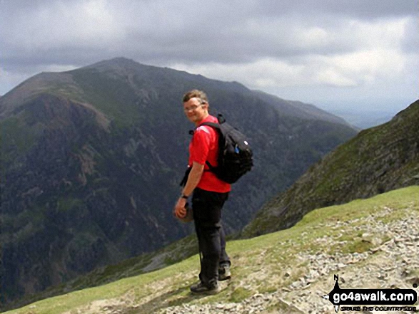
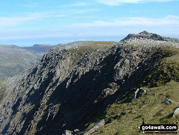
Roman standing in the summit of Craig Fach with Glyder Fawr forming the horizon

Moel Penamnen summit with Mount Snowdon (Yr Wyddfa) (left) and The Glyderau (Glyder Fach & Glyder Fawr) on the horizon


Glyder Fawr from Llechog (Llanberis Path) on the way up Snowdon (Yr Wyddfa)
. . . see just 10 walk photographs & pictures of views from, on or of Glyder Fawr
Send us your photographs and pictures on, of, or from Glyder Fawr
If you would like to add your walk photographs and pictures to this page, please send them as email attachments (configured for any computer) along with your name to:
and we shall do our best to publish them.
(Guide Resolution = 300dpi. At least = 660pixels (wide) x 440 pixels (high).)

You can also submit photos via our Facebook Page.
NB. Please indicate where each photo was taken and whether you wish us to credit your photos with a Username or your First Name/Last Name.


