
![]()
Glyder Fach
990m (3249ft)
The Glyders (or Glyderau), Snowdonia, Conwy, Wales
Glyder Fach means 'Small Heap or Small Pile of Stones' in Welsh and is pronounced 'g-lid-der vach'.

Not familiar with this top?
You can walk/hike to the top of Glyder Fach by using any of these 3 easy‑to‑follow route maps:
Walk gw115 Glyder Fach, Castell y Gwynt and Glyder Fawr from Ogwen Cottage, Llyn Ogwen
A very steep ascent and descent
   |
|---|
Vital Statistics:
| Length: | 5.5ml (9km) |
|---|---|
| Ascent: | 2,854ft (870m) |
| Time: | 5 hrs |
| Grade: |  (Moderate) (Moderate) |

Route Summary:
Llyn Ogwen - Ogwen Cottage - Llyn Bochlwyd - Bwlch Tryfan - Bristly Ridge - The Cantilever Stone - Glyder Fach - Castell y Gwynt (Glyder Fach) - Bwlch y Ddwy-Glyder - Glyder Fawr - Llyn y Cwm - Twll Du (Devil's Kitchen) - Llyn Idwal - Ogwen Cottage - Pont Pen-y-benglog - Llyn Ogwen
Walk gw187 Y Garn (Glyderau), Glyder Fawr, Castell y Gwynt and Glyder Fach from Ogwen Cottage, Llyn Ogwen
A strenuous walk to dramatic views
|
|---|
Vital Statistics:
| Length: | 7ml (11km) |
|---|---|
| Ascent: | 3,308ft (1,008m) |
| Time: | 6 hrs |
| Grade: | (Moderate) |

Route Summary:
Llyn Ogwen - Ogwen Cottage - 'Tin Pan Alley' - Llyn Glyd - Y Garn (Glyderau) - Llyn y Cwm - Glyder Fawr - Bwlch y Ddwy-Glyder - Castell y Gwynt (Glyder Fach) - Glyder Fach - The Cantilever Stone - Bristly Ridge - Bwlch Tryfan - Llyn Bochlwyd - Ogwen Cottage - Pont Pen-y-benglog - Llyn Ogwen
Walk gw102 The Welsh 3000's (Glyderau) from Llanberis
5 of the 15 Welsh 3000's
|
|---|
Vital Statistics:
| Length: | 12.5ml (18.5km) |
|---|---|
| Ascent: | 5,327ft (1,624m) |
| Time: | 9½ hrs |
| Grade: |  (Hard) (Hard) |

Route Summary:
Pen-y-Gwryd Hotel - Llyn Caseg-fraith - Bwlch Tryfan - Tryfan - (Adam and Eve) - Bwlch Tryfan - Glyder Fach - The Cantilever Stone - Castell y Gwynt (Glyder Fach) - Bwlch y Ddwy-Glyder - Glyder Fawr - Y Garn (Glyderau) - Bwlch y Cywion - Foel-goch - Bwlch y Brecan - Bwlch y Marchlyn - Elidir Fawr - Afon Dudodyn - Nant Peris
See Glyder Fach and the surrounding tops on our free-to-access 'Google Style' Peak Bagging Maps:
The Glyders (or Glyderau) of Snowdonia National Park
Less data - quicker to download
The Whole of Snowdonia National Park
More data - might take a little longer to download
See Glyder Fach and the surrounding tops on our unique, downloadable, PDF Peak Bagging Map:

NB: Whether you print off a copy or download it to your phone, this PDF Peak Baggers' Map might prove incredibly useful when your are up there on the tops and you cannot get a phone signal.
You can find Glyder Fach & all the walks that climb it on these unique free-to-access Interactive Walk Planning Maps:
1:25,000 scale OS Explorer Map (orange/yellow covers):
1:50,000 scale OS Landranger Map (pink/magenta covers):
 Fellow go4awalkers who have already walked, climbed, scaled, summited, hiked & bagged Glyder Fach
Tia Cain has walked up Glyder Fach [from/via/route] From Tryfan [with] Daryn and Scott [weather] Perfect & clear - Bloody cream crackered after Tryfan North face & the Glyders!
Hazel Gilbert climbed it on April 15th, 2009 [with] Lawrence [weather] Sunny
Daniel Moran bagged it on March 5th, 2021 [from/via/route] Lake below [with] Solo [weather] Sun & snow on the ground - Devils kitchen
Adrian Haywood hiked Glyder Fach on April 9th, 2022 [from/via/route] Devil's Kitchen [with] Mike, Celia and Darryl [weather] mixed
Stephanie Doyle summited on August 6th, 2022 [from/via/route] Devil's Kitchen [with] Solo [weather] Nice
Donovan Suddell conquered it on July 13th, 2022 [from/via/route] llyn Ogwen & Tryfan North Ridge [with] Wife [weather] Lots of sunny intervals
Andrew Cotter scaled it on April 4th, 2015 [weather] Sunny
Melfyn Parry walked up Glyder Fach on September 1st, 2019 [from/via/route] Oggy 4, Y Garn, Glyder Fawr, Glyder Fach & Tryfan. Start point SH655602, car park after brew shack at Ogwen Lake. Ascent of Y Garn, steep path with upper slopes of scree. Descent to Llyn y Cwn for a short coffee break before making ascent of Glyder Fawr. This path was mainly scree, quite steep with poor visibility. Summit in low cloud, difficult to make out path, use of Satmap confirmed needed to be further to the right, spotted cairn which confirmed correct path, were able to follow line of cairns to toward Glyder Fach. Weather cleared briefly to show views down over Llyn Cwm Ffynnon to Pen y Gwryd Hotel. Circumnavigated Castell y Gwynt to Glyder Fach before descending Brisly scree path to Bwlch Tryfan. Stopped for lunch before ascending Tryfan south ridge. Weather was much better here & Tryfan was clear & quite busy. Descent via western gulley was tough on the knees & thighs & we were subjected to heavy showers for last half mile to car park. [with] PRC [weather] Poor most of the time occasional sunny spells but cold.
Neall Garrad climbed it on June 22nd, 2007 [from/via/route] 15 peaks route from Nant Peris to Llanfairfechan [with] Andy, Chris, John and Warren [weather] Mixed
Mark Smith bagged it on July 9th, 2021 [with] Alstom group [weather] thick cloud
Andy Buxton hiked Glyder Fach on June 22nd, 1968 [from/via/route] 14 Peaks (but done before & since) [with] BVGS
Angela Moroney summited during 2011 - 2017 3PEAKS
Alan Pritchard conquered it on October 5th, 2014 [with] A group [weather] Good - Walked the 15 peaks in 24 hours challenge - enjoyed. Glyders were like being on Mars, ha.. 😎🚶♂️
Hugh Strickland scaled it on September 1st, 2018 [from/via/route] 20 miles (just under 10 hours, 8500 feet) Capel Curig to Y Garn, down to Ogwen upPen Yr Ole Wen & back along Carneddau including Pen Llithrig y Wrach
Bleddyn Rhys walked up Glyder Fach on October 24th, 2010 [from/via/route] Dyffryn Ogwen - cerdded lawr y lon o Ogwen Cottage, fynnu ar y ridge ac yn ol i'r Dwyrain ar hyd y copaon. [with] Gyda Kev [weather] Braf a chymylog. Golygfeudd gwych! - Diwrnod hir a da. Ymweld a goreuon Cymru.
Kevin Williams climbed it on April 21st, 2010 [from/via/route] Start from Llyn Ogwen car park via Devil's kitchen [with] Solo [weather] Sunny, with some snow
Robert Shaw bagged it on March 9th, 2013 [from/via/route] Straight up from Llyn Ogwen & via Tryfan. [with] Steve Capron. [weather] Misty & cold. - Was a tough climb straight up, enjoyed the walk across the top.
David Wand hiked Glyder Fach on July 30th, 2015 [weather] Sunny & hot - Wales 3000 14 peaks in 24hrs peak 9
Chris Newham summited on November 7th, 2015 [from/via/route] gw115 [with] Craig [weather] Heavy rain all day
David Noble conquered it on June 6th, 2015 [from/via/route] Capel Curig [with] Snakehips, Dom and Rob [weather] Windy & rain at time - Summited again via Tryfan & Bristly Ridge Scramble with Dom, Luke, Nathan & Deb on 10th October 2015
Paul Redman scaled it on July 6th, 2014 [from/via/route] Tryfan to Devils Kitchen [with] Solo [weather] windy
Rachael Tyler walked up Glyder Fach on August 15th, 2015 [from/via/route] Ogwen [with] Ashley [weather] Sunny / cloudy - Walked from Ogwen past Tryfan then up to Glyder Fach & along to Glyder Fawr. Descended via Devil's Kitchen. Fab day x
Iain Jones climbed it on June 1st, 2013 [from/via/route] Cneifion Ar�te from Cwm Idwal then Dolmen Ridge. Descent via Bristly Ridge. [with] Graeme High & Ralph Simpson - 08 November 2014 - walked from Ogwen Cottage with Chris Curtis; 24 May 2015 - run from Gwern Gof Isaf campsite with Graeme High
John Drysdale bagged it on June 4th, 2015 [from/via/route] Miners Track to col then Tryfan & back [with] Solo [weather] Sunny
Christina Lander hiked Glyder Fach on June 7th, 2015 [from/via/route] Llyn Ogwen - Llyn Idwal - Y Garn - Llyn y Cwn - Glyder Fawr - Glyder Fach - Bwlch Tryfan - Tryfan - Bwlch Tryfan - Llyn Bochlwyd - Llyn Ogwen [with] Dick [weather] Perfect sunny day
Geoff Titterton summited on October 9th, 2010 [with] Justine [weather] Fine
Ian Woodford has conquered it [from/via/route] Pen y pass [with] Matt, Ivan, Rich [weather] Cold - Crossed the road at pen y pass
Leon Harvey has scaled it [from/via/route] Y Gribin & the Glyder trio [with] Solo [weather] Lovely - Summit not that easy to reach (last 10m or so)
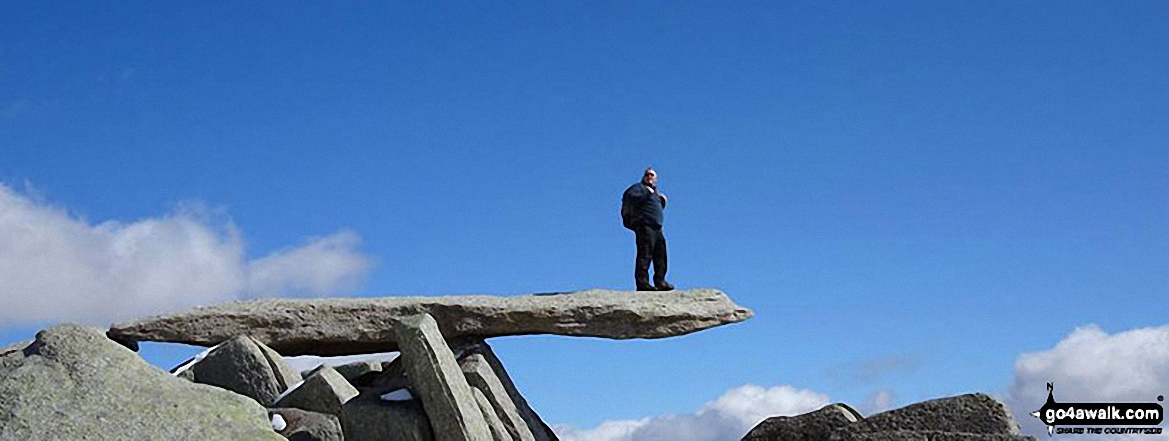
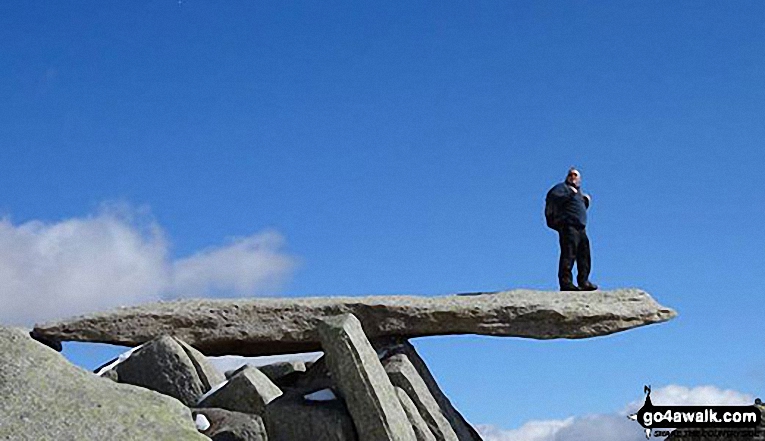
Simon Neilson-Clark walked up Glyder Fach on June 17th, 2014 [from/via/route] Tryfan [with] Mrs H [weather] White out - Followed a group who were lost but really odd rock formations A ledge going out horizontal as in the photographs you see in magazines or the photo here
Robert Taylor-Marriott climbed it on February 28th, 2010 [from/via/route] Route 7: Glyder Fach via Wetton Gully (GFWG) Completed 28.02.10 [with] Vince Wetton & Robert Taylor-Marriott [weather] Sunny & Snow. - Several accents over many years
Marilyn Wadkin bagged it on June 21st, 2014 [from/via/route] Ogwen Valley, Y Gribin [with] Rob [weather] Clear skies & sunshine. - We had already bagged Glyder Fawr then went on to bag Y Garn.
Wyn Griffiths hiked Glyder Fach on June 21st, 2014 [from/via/route] From Vaynol Arms [with] Chris & Andy [weather] Perfect - Briliant day
Stephen Eddy summited on May 16th, 2014 [from/via/route] Ogwen cottage [with] Tony Harris, Mike Woodhouse [weather] Sunny - Returned via devils kitchen
Gerald Murphy conquered it on May 16th, 2014 [from/via/route] ogwen cottage,llyn bochlwyd, bwlch tryfan, bristly ridge, glyder fach,glyder fawr, llyn cwn, llyn idwal, ogwen cottage [with] initially alone but teamed up with a walker(Clive) from Brentwood, Essex at the foot of Glyder Fach. [weather] initially sunny but patchy cloud as I gained the top of Bristly Ridge. The cloud disappeared after lunch near castell y Gwynt. - The usually muddy stretch from Ogwen Cottage up to LLyn Bochlwyd has been sorted. Bags of large stones had been dropped when I last walked that path on 13 April & the stones are now in place to provide a dry walk. the scree descent from Glyder Fawr to Llyn Cwn is as nasty as everyone says but the stretch past Devils Kitchen down to LLyn Idwal isn't much better for most of the way.
Stephen Lewis scaled it on November 22nd, 2013 [from/via/route] gw115, car park near Ogwen Cottage [with] Alone [weather] Cold, cloud, sun, ice & snow on high ground
Graham Williams walked up Glyder Fach on January 17th, 2014 [from/via/route] Ogwen Cottage [with] The Travelling Raspberries (Chris Barnes, Nick White, Russ Jones, Dave Jones, Luke White.) [weather] Wet, Snow & Ice on Summit
Tracey Parnell climbed it on January 25th, 2014 [from/via/route] Ogwen [with] Paul Cane, Carly Morson [weather] Snow, strong wind, hail, rain - Blown off my feet on the summit, pelted with hailstones that felt as big as golf balls.
Michael Smith bagged it during October, 2013 [from/via/route] Capel Curig [with] WKMW [weather] Fair - Very boggy
Tracey Parnell hiked Glyder Fach on June 15th, 2013 [from/via/route] Ogwen [with] Paul Cane, Sophie Parnell, Nikki Taylor [weather] Dry, warm
Carl Etheridge summited on April 4th, 2013 [from/via/route] ogwen go for a walk map [with] wife , son [weather] misty at first then clear
David Lane conquered it on November 2nd, 1996 [from/via/route] The Ogwen Valley via Tryfan. We then went on to tick off Glyder Fawr & Glyder Fach before descending via the Devil's Kitchen [with] Kelly
Vince Wetton scaled it on March 1st, 2010 [with] RTM
Stephen Millington walked up Glyder Fach on September 17th, 2012 [from/via/route] Bristly Ridge Also done from Dolmen ridge
Jeremy Maguire climbed it on February 29th, 2012 [from/via/route] From Llyn Ogwen. [with] On my own. [weather] Sunny with cloud. - Cloud seemed to chase me back down.
Paul Miller bagged it on June 4th, 2012 [from/via/route] tryfan north ridge & bristly ridge [with] hannah and nile [weather] good
Stuart Mellor hiked Glyder Fach on October 21st, 2009 [from/via/route] Ogwen Cottage GW187 via Bristly Edge with assistance 3 lads. [with] Dominic my son aged 11. [weather] Bright extremely windy
Patrick Rogozinski, Mark Davidson, Wendy Sockett, Darran Tunnah, Louis Smith, John Cuthbert, Anthony Jackson, Linda Mckeogh, Chris Reed, Craig Lewis, Edward Wells, Robert Maclean, Simon Duerden, Paul Booth, Trevor Williams, Paul Donoghue, Immacolata Pescatore, Steve Lockett, Stephen Hobdell, Wendy Sockett, Kath Edwards, Chris Bede, Paul Warren, Pete Howes and Steve Davenport have all walked, climbed & bagged Glyder Fach.
To add (or remove) your name and experiences on this page - Log On and edit your Personal Mountain Bagging Record
. . . [see less walk reports]
More Photographs & Pictures of views from, on, or of, Glyder Fach

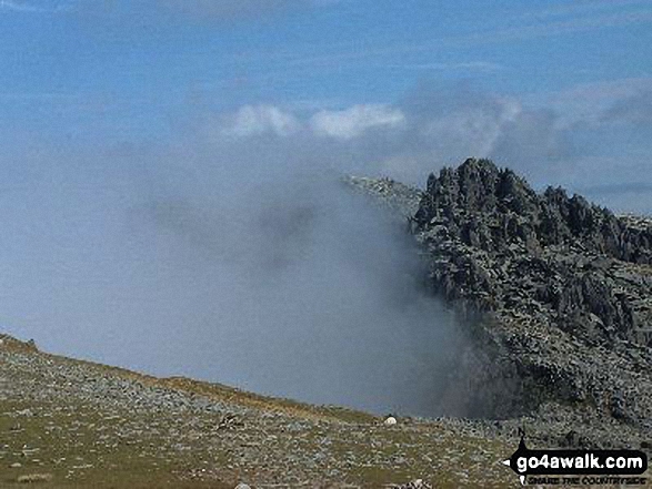
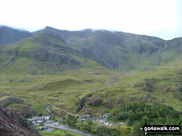
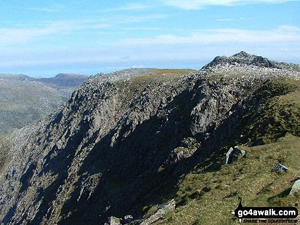
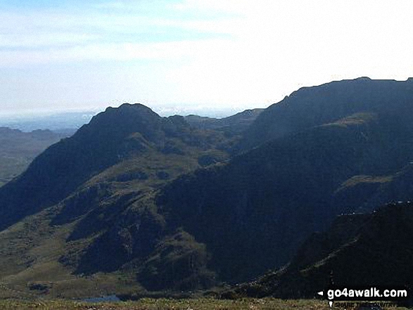
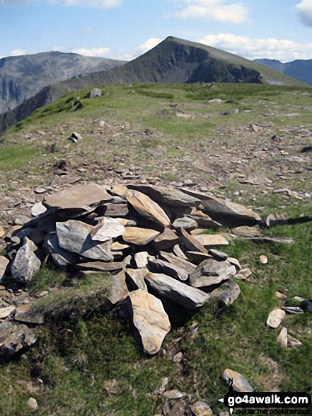
Bwlch y Ddwy-Glyder, Castell y Gwynt and Glyder Fach from Glyder Fawr in mist


Moel Penamnen summit with Mount Snowdon (Yr Wyddfa) (left) and The Glyderau (Glyder Fach & Glyder Fawr) on the horizon

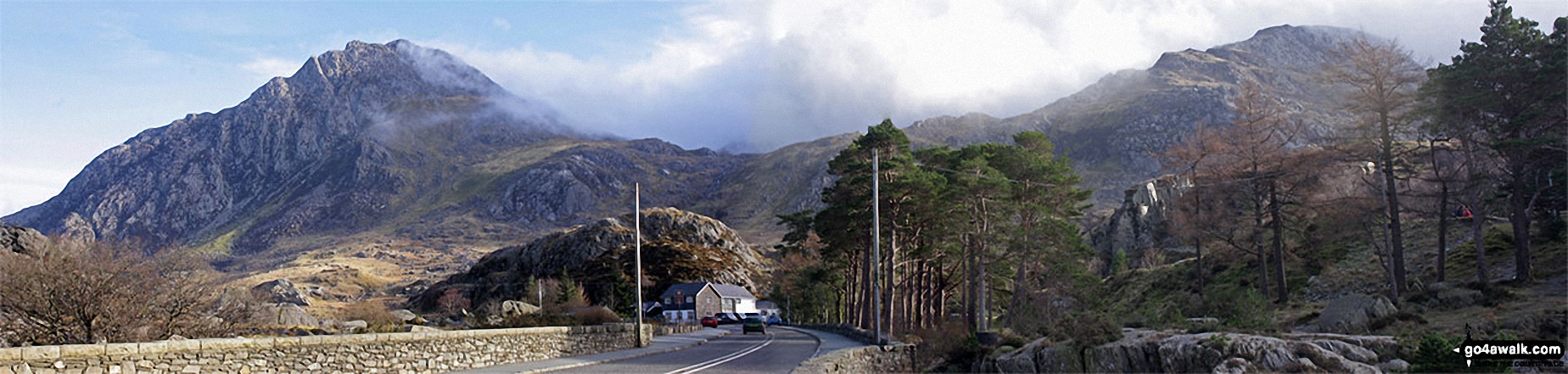
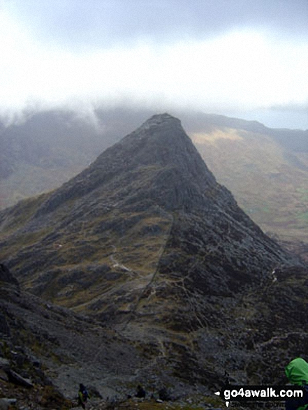
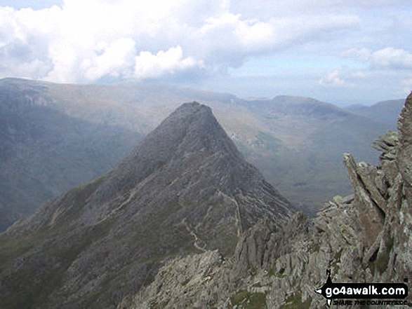
A sprinkling of snow on Tryfan (left) and Glyder Fach (right) above Llyn Ogwen from Pen yr Ole Wen


Mount Snowdon (Yr Wyddfa) & Y Lliwedd (left) and The Glyderau - Glyder Fach, Glyder Fawr & Tryfan (right) from Moel Penamnen

Mount Snowdon (Yr Wyddfa) & Y Lliwedd (left) and The Glyderau - Glyder Fach, Glyder Fawr & Tryfan (centre) and Carnedd Moel Siabod (right) with Moel Penamnen and Llyn Newydd & Llyn Bowydd (mid distance right) from the summit of Manod Mawr (North Top)


360 degree view from Moel Penamnen summit featuring (from left to right): The Moelwyns - Moelwyn Bach, Craigysgafn & Moelwyn Mawr, Allt-fawr, Moel Druman & Ysgafell Wen, Moel Farlwyd (foreground above/left of blue lake), Yr Aran (pointed peak above Moel Farlwyd), Mount Snowdon (Yr Wyddfa) & Y Lliwedd, The Glyderau - Glyder Fach, Glyder Fawr & Tryfan, Carnedd Moel Siabod, Y Ro Wen, Foel-fras (Moelwyns), Manod Mawr (above two light blue lakes) and The Arenigs - Arenig Fawr & Arenig Fach.


*360 degree panorama featuring Carnedd Dafydd, Foel-Goch (foreground), Tryfan and Glyder Fach, Y Garn (foreground), Crib Goch and Snowdon (Yr Wyddfa) from the summit of Elidir Fawr
My son Patrick climbing Y Garn (Glyderau) with Tryfan (left) and Glyder Fach (right) in the background

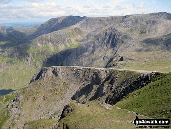
The Snowdon Horseshoe from Glyder Fach - featuring in the mid-distance: Y Lliwedd (centre left), Crib Goch (centre right), Snowdon (Yr Wyddfa) and Garnedd Ugain (Crib y Ddysgl) (far right)

Glyder Fach (centre left), Glyder Fawr (centre) and Tryfan (centre right) from Pen Llithrig y Wrach


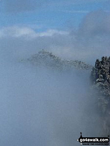
Temperature Inversion - Glyder Fach and Glyder Fach poking out of a sea of clouds from Carnedd Moel Siabod
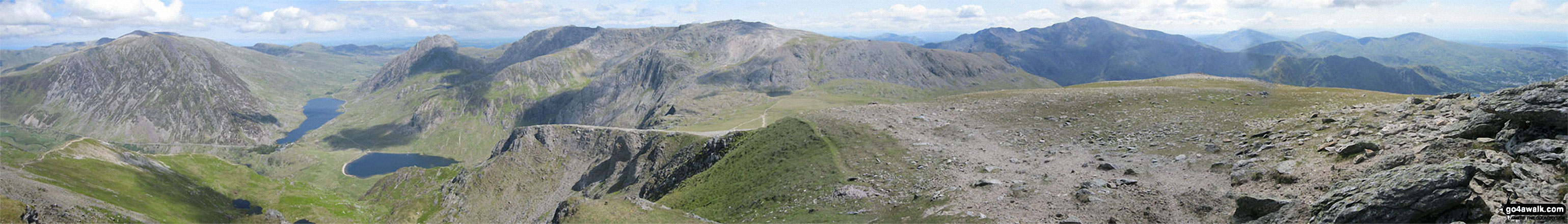
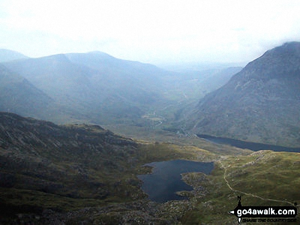
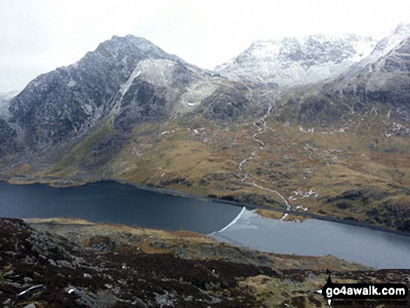
Pen yr Ole Wen, Llyn Clyd, Llyn Ogwen, Llyn Idwal, Tryfan, Glyder Fach, Glyder Fawr, Crib Goch and Garnedd Ugain from Y Garn (Glyderau)
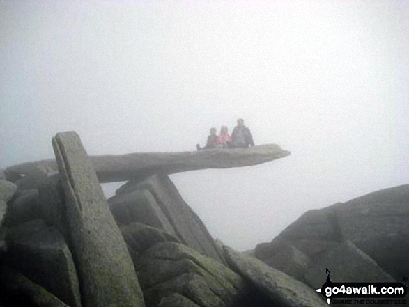
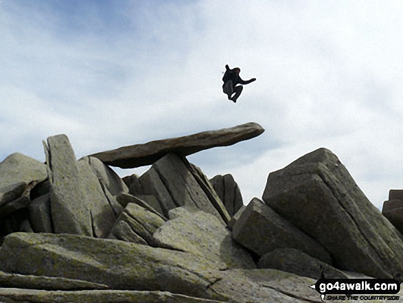
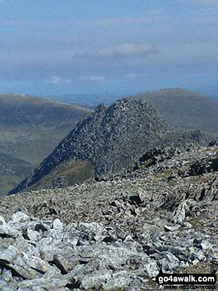
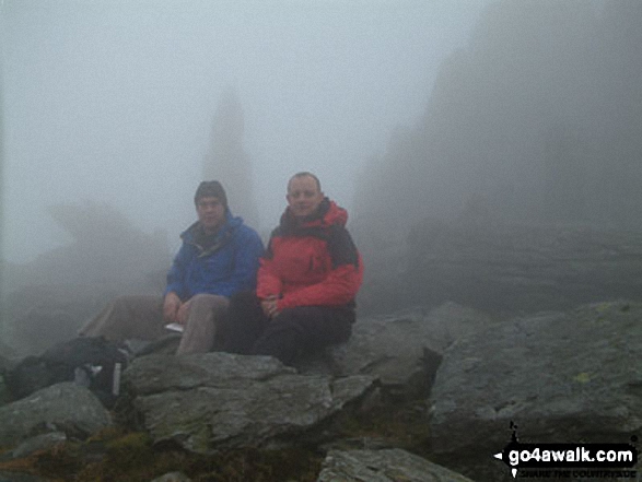
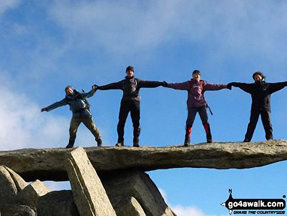
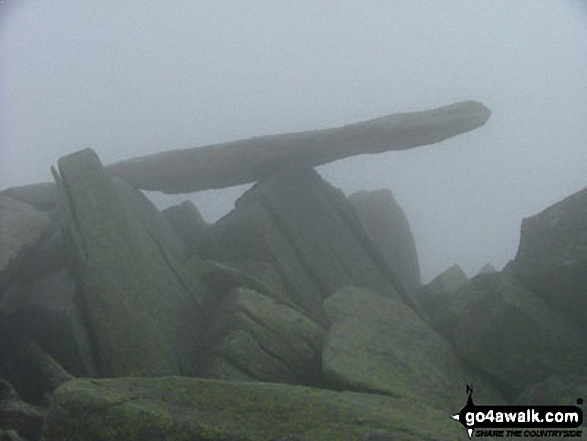
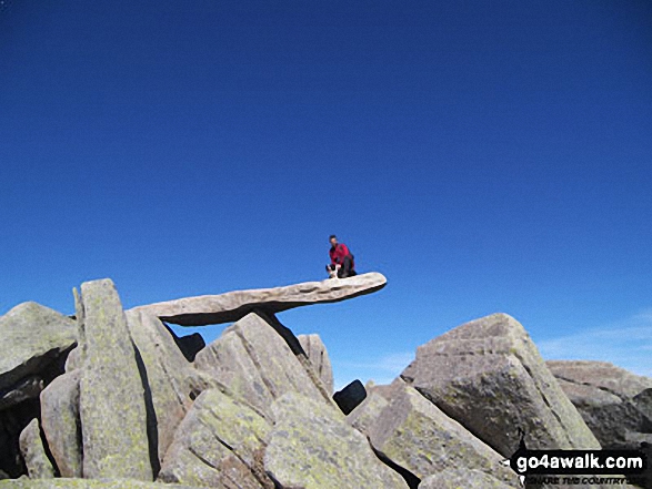
Hubby and kids, YingLi and WingHoi, on the cantilever rock on Glyder Fach in the mist


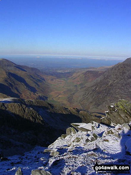
Sunset over Llyn Lockwood (centre bottom), Llyn Gywant, Y Lliwedd and Snowdon (Yr Wyddfa) from the Miner's Track near Glyder Fach
. . . see just 10 walk photographs & pictures of views from, on, or of, Glyder Fach
Send us your photographs and pictures on, of, or from Glyder Fach
If you would like to add your walk photographs and pictures to this page, please send them as email attachments (configured for any computer) along with your name to:
and we shall do our best to publish them.
(Guide Resolution = 300dpi. At least = 660pixels (wide) x 440 pixels (high).)

You can also submit photos via our Facebook Page.
NB. Please indicate where each photo was taken and whether you wish us to credit your photos with a Username or your First Name/Last Name.


