
![]()
Birkhouse Moor
718m (2356ft)
The Eastern Fells, The Lake District, Cumbria, England
Tap/mouse over a coloured circle (1-3 easy walks, 4-6 moderate walks, 7-9 hard walks) and click to select.

Not familiar with this top?
You can walk/hike to the top of Birkhouse Moor by using any of these 5 easy‑to‑follow route maps:
Walk c213 Helvellyn from Glenridding
Lakeland's 3rd highest via the infamous Striding & Swirral Edges - not for the faint hearted
   |
|---|
Vital Statistics:
| Length: | 8.5ml (13.5km) |
|---|---|
| Ascent: | 3,278ft (999m) |
| Time: | 6½ hrs |
| Grade: |  (Hard) (Hard) |

Route Summary:
Glenridding - Birkhouse Moor - Hole-in-the-Wall - Red Tarn (Helvellyn) - Bleaberry Crag - Low Spying How - High Spying How - Striding Edge (High Spying How) - Helvellyn - Swirral Edge - Catstye Cam - Hole-in-the-Wall - Brownend Plantation - Grisedale Beck - Lanty's Tarn - Keldas - Glenridding
Walk c220 Helvellyn via Striding Edge (High Spying How) from Glenridding
Lakeland's most climbed mountain via the infamous Striding Edge - not for the faint hearted
|
|---|
Vital Statistics:
| Length: | 10ml (16km) |
|---|---|
| Ascent: | 3,382ft (1,031m) |
| Time: | 7 hrs |
| Grade: | (Hard) |

Route Summary:
Glenridding - Birkhouse Moor - Hole-in-the-Wall - Red Tarn (Helvellyn) - Bleaberry Crag - Low Spying How - High Spying How - Striding Edge (High Spying How) - Helvellyn - Nethermost Pike - High Crag (Helvellyn) - Dollywaggon Pike - Grisdale Tarn - Ruthwaite Lodge - Grisedale Beck - Brownend Plantation - Lanty's Tarn - Keldas - Glenridding
Walk c224 Helvellyn via Swirral Edge and Raise from Glenridding
Lakeland's most popular via the easier Swirral Edge
|
|---|
Vital Statistics:
| Length: | 10.75ml (17km) |
|---|---|
| Ascent: | 3,449ft (1,051m) |
| Time: | 7.25hrs |
| Grade: | (Hard) |

Route Summary:
Glenridding - Birkhouse Moor - Hole-in-the-Wall - Red Tarn (Helvellyn) - Catstye Cam - Swirral Edge - Helvellyn - Lower Man (Helvellyn) - White Side - Raise (Helvellyn) - Sticks Pass - Lucy's Tongue - Glenridding Beck - Glenridding
Walk c269 The Grisedale Horseshoe from Patterdale
Lakeland's most climbed mountain - not for the faint hearted
|
|---|
Vital Statistics:
| Length: | 11.5ml (18.5km) |
|---|---|
| Ascent: | 4,582ft (1,396m) |
| Time: | 8.75hrs |
| Grade: |  (Hard) (Hard) |

Route Summary:
Patterdale - Grisedale Bridge - Grisedale Beck - Brownends Plantation - Hole-in-the-Wall - Birkhouse Moor - Hole-in-the-Wall - Red Tarn (Helvellyn) - Bleaberry Crag - Low Spying How - High Spying How - Striding Edge (High Spying How) - Helvellyn - Nethermost Pike - High Crag (Helvellyn) - Dollywaggon Pike - Grisedale Tarn - Deepdale Hause - St Sunday Crag - Birks - Patterdale
Walk c264 The Grisedale Round from Patterdale
Superb high level ridge walk
|
|---|
Vital Statistics:
| Length: | 13.25ml (21km) |
|---|---|
| Ascent: | 5,189ft (1,581m) |
| Time: | 10 hrs |
| Grade: |  (Very Hard) (Very Hard) |

Route Summary:
Patterdale - Grisedale Bridge - Grisedale Beck - Brownend Plantation - Hole-in-the-Wall - Birkhouse Moor - Hole-in-the-Wall - Red Tarn (Helvellyn) - Bleaberry Crag - Low Spying How - High Spying How - Striding Edge (High Spying How) - Helvellyn - Nethermost Pike - High Crag (Helvellyn) - Dollywaggon Pike - Seat Sandal - Grisedale Tarn - St Sunday Crag - Birks - Arnison Crag - Patterdale
See Birkhouse Moor and the surrounding tops on our free-to-access 'Google Style' Peak Bagging Maps:
The Eastern Fells of The Lake District National Park
Less data - quicker to download
The Whole of The Lake District National Park
More data - might take a little longer to download
See Birkhouse Moor and the surrounding tops on our unique, downloadable, PDF Peak Bagging Maps:

NB: Whether you print off a copy or download it to your phone, these PDF Peak Baggers' Maps might prove incredibly useful when your are up there on the tops and you cannot get a phone signal.
*This version is marked with the walk routes you need to follow to Walk all 214 Wainwrights in just 59 walks.
You can find Birkhouse Moor & all the walks that climb it on these unique free-to-access Interactive Walk Planning Maps:
1:25,000 scale OS Explorer Map (orange/yellow covers):
1:50,000 scale OS Landranger Map (pink/magenta covers):
 Fellow go4awalkers who have already walked, climbed, scaled, summited, hiked & bagged Birkhouse Moor
Nick Tippins walked up Birkhouse Moor on December 31st, 2019 [from/via/route] Helvellyn Circular from Glenridding via Birkhouse Moor, Striding Edge, & Catstye Cam [with] Fran
Richard Fulcher climbed it on March 10th, 2025 [from/via/route] Parked for free on the crescent in Glenridding! We followed the road up to the Helvellyn YHA & then followed the clear path up to Red Tarn. From Red Tarn we followed the path on the other side up to the 'Hole In The Wall' & then on to Birkhouse. Our descent followed the wall down to Lantys Tarn (devestated by forestry operations 😟) & then back to the car. [with] Jen [weather] Started clear & bright but changed by 10am to low cloud & increasingly windy … gusts of over 40 miles & hour. Very cold. - Finally completed after missing the top by 100ft on a previous walk up from Patterdale.
Kate Peacock bagged it on September 29th, 2024 [from/via/route] Glenridding [with] Me and Amber [weather] Blustery on the tops. Stayed dry. Quick walk! - Stoney walk
Martin Hartshorne hiked Birkhouse Moor on September 12th, 2024 [from/via/route] Eagle farmhouse to red tarn [with] finley [weather] Mostly sunny with a few light showers, evening sunshine to finish
Vincent Clarke summited on May 31st, 2024 [from/via/route] Glenridding on route to Helvlynn [with] Chopper [weather] Early morning
To add (or remove) your name and experiences on this page - Log On and edit your Personal Mountain Bagging Record
. . . [see more walk reports]
More Photographs & Pictures of views from, on, or of, Birkhouse Moor
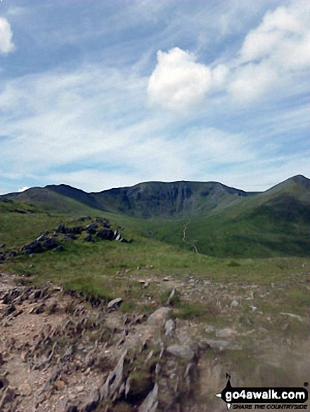
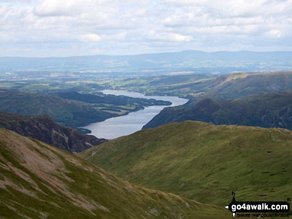
Striding Edge (High Spying How) (left), Helvellyn and Catstye Cam from the summit of Birkhouse Moor
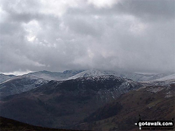
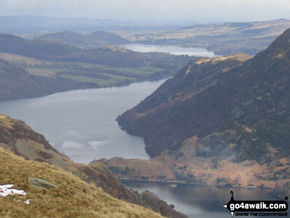
Striding Edge (High Spying How) and Helvellyn (in mist) with Birkhouse Moor in front, Catstycam and Sheffield Pike from Gowbarrow Fell (Airy Crag)
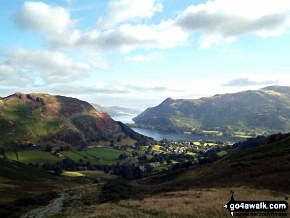


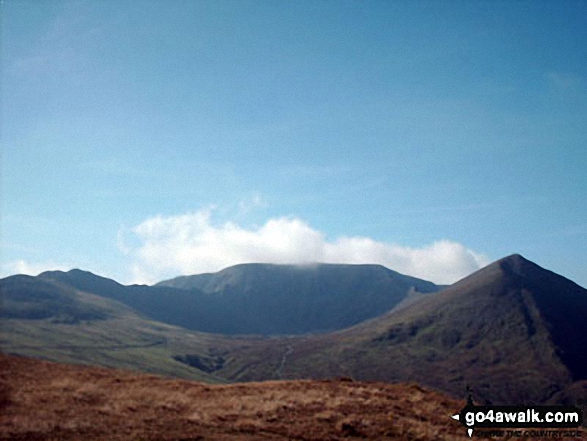
The shoulder of St Sunday Crag and Birks (left), Catstye Cam, Birkhouse Moor (centre) and Sheffield Pike from Arnison Crag, Patterdale
Striding Edge (High Spying How), (left), Helvellyn and Catstye Cam (right) from Birkhouse Moor
. . . see all 26 walk photographs & pictures of views from, on, or of, Birkhouse Moor
Send us your photographs and pictures on, of, or from Birkhouse Moor
If you would like to add your walk photographs and pictures to this page, please send them as email attachments (configured for any computer) along with your name to:
and we shall do our best to publish them.
(Guide Resolution = 300dpi. At least = 660pixels (wide) x 440 pixels (high).)

You can also submit photos via our Facebook Page.
NB. Please indicate where each photo was taken and whether you wish us to credit your photos with a Username or your First Name/Last Name.


