
![]()
Moelwyn Mawr
770m (2527ft)
The Moelwyns, Snowdonia, Gwynedd, Wales
Moelwyn Mawr means 'Big White Bare Hill' in Welsh.
The summit of Moelwyn Mawr is marked by an Ordnance Survey Trig Point.
Not familiar with this top?
   |
|---|
Vital Statistics:
| Length: | 6.20ml (10.5km) |
|---|---|
| Ascent: | 2,691ft (820m) |
| Time: | 5 hrs |
| Grade: |  (Moderate) (Moderate) |

Route Summary:
Tanygrisiau - Moel-yr-hydd - Rhosydd Quarry - Moelwyn Mawr (North Ridge Top) - Moelwyn Mawr - Craigysgafn - Bwlch Stwlan - Moelwyn Bach - Llyn Stwlan - Stwlan Dam - Tanygrisiau
|
|---|
Vital Statistics:
| Length: | 8.25ml (13km) |
|---|---|
| Ascent: | 3,037ft (926m) |
| Time: | 6 hrs |
| Grade: | (Moderate) |

Route Summary:
Croesor - Rhosydd Quarry - Bwlch y Rhosydd - Clogwyn Brith - Moel-yr-hydd - Moelwyn Mawr (North Ridge Top) - Moelwyn Mawr - Craigysgafn - Bwlch Stwlan - Moelwyn Bach - Croesor
|
|---|
Vital Statistics:
| Length: | 9ml (14.5km) |
|---|---|
| Ascent: | 3,355ft (1,023m) |
| Time: | 6.75hrs |
| Grade: |  (Hard) (Hard) |

Route Summary:
Croesor - Croesor Bach - Cnicht - Cnicht (North Top) - Llyn Yr Adar - Afon Cwm-y-foel - Llyn Cwm-corsiog - Clogwyn Birth - Rhosydd Quarry - Moel-yr-hydd - Moelwyn Mawr (North Ridge Top) - Moelwyn Mawr - Croesor
|
|---|
Vital Statistics:
| Length: | 10ml (16km) |
|---|---|
| Ascent: | 3,923ft (1,196m) |
| Time: | 7½ hrs |
| Grade: | (Hard) |

Route Summary:
Croesor - Croesor Bach - Cnicht - Cnicht (North Top) - Llyn Yr Adar - Afon Cwm-y-foel - Llyn Cwm-corsiog - Clogwyn Birth - Rhosydd Quarry - Moel-yr-hydd - Moelwyn Mawr (North Ridge Top) - Moelwyn Mawr - Craigysgafn - Bwlch Stwlan - Moelwyn Bach - Croesor
See Moelwyn Mawr and the surrounding tops on our free-to-access 'Google Style' Peak Bagging Maps:
The Moelwyns area of Snowdonia National Park
Less data - quicker to download
The Whole of Snowdonia National Park
More data - might take a little longer to download
See Moelwyn Mawr and the surrounding tops on our downloadable Peak Bagging Map in PDF format:

NB: Whether you print off a copy or download it to your phone, this PDF Peak Baggers' Map might prove incredibly useful when your are up there on the tops and you cannot get a phone signal.
You can find Moelwyn Mawr & all the walks that climb it on these unique free-to-access Interactive Walk Planning Maps:
1:25,000 scale OS Explorer Map (orange/yellow covers):
1:50,000 scale OS Landranger Map (pink/magenta covers):
 Fellow go4awalkers who have already walked, climbed, summited & bagged Moelwyn Mawr
Daniel Moran walked up Moelwyn Mawr on February 18th, 2024 [from/via/route] Slate mine carpark [with] Chel and frankie [weather] Cold wind no rain - Went in a mine, old abandoned village, turn back due to forgetting my bag, Frankie had no coat
Stephanie Doyle climbed it on June 18th, 2022 [with] Pals [weather] Nice
Melfyn Parry bagged it on April 11th, 2019 [from/via/route] Start & finish at Croesor car park at SH631446. Steep tarmac road to start of the walking path. Ascent to summit of Cnicht was via well defined path. Stunning views in all directions. Descent from summit toward Llyn Adar before turning right to pass by Llynnau Dwyffos. Path a little boggy along here up to brow of hill. Descent to Rhosydd quarry & then up the old incline to stop for lunch. Ascent to ridge line & then followed fence to summit of Moelwyn Mawr. Descent back to car park via grassy slope, not too steep & then tarmac lane. [with] DS [weather] Mainly sunny & warm, occasional cold breeze.
Donovan Suddell hiked Moelwyn Mawr on April 10th, 2021 [from/via/route] Croesor using gw173 [with] My wife [weather] Sunny & clear, odd sprinkle of snow - gw173 is a mighty fine walk.
Andy Buxton summited during August, 1965 [from/via/route] From Croesor-circular with Moelwyn Mawr & Bach [with] Dad
Bleddyn Rhys conquered it on October 31st, 2014 [from/via/route] Fynnu'r llwybr charael o Croesor, ac i lawr y 'south ridge' yn ol ir pentre. [with] gyda Caradog a Daniel! [weather] Reit neis, haul ar adegau, ambell i gwmwl. Aros yn sych - Yr hogia wedi gwirioni eu bod wedi cyrraedd top Moelwyn mawr!
Christina Lander scaled it on April 18th, 2018 [from/via/route] Croesor - Cnicht - Bwlch y Rhosydd - Llyn Croesor - Moelwyn Mawr - Moelwyn Bach - Croesor [with] Dick [weather] Started off overcast, but turned into a beautiful sunny day. Windy on top of Moelwyn Mawr & Moelwyn Bach
Mark Davidson walked up Moelwyn Mawr on August 20th, 2002 [with] Alone [weather] Sunny & warm with good views
Robert Taylor-Marriott climbed it on May 8th, 2013 [from/via/route] Route 51: Moel yr Hydd. Moelwyn Mawr NRT.Moelwyn Mawr. Craigysgafn. Moelwyn Bach (MMMB). [with] Vince Wetton & Robert Taylor-Marriott [weather] Very Fair.
Vince Wetton bagged it on May 7th, 2013 [from/via/route] Moelwyn Bach & 4 others [with] RTM [weather] Sunny Day
David Lane hiked Moelwyn Mawr on December 1st, 2006 [with] Kelly
Kath Edwards summited on March 10th, 2012 [from/via/route] As part of a walk doing Moelwyn Mawr & Bach [with] Bryony and Si [weather] good
Gerald Murphy conquered it on March 29th, 2012 [from/via/route] Based on gw200 but starting from Rhiwbryfdir in Blaenau Ffestiniog, following footpath Glanypwll to Tanygrisiau into Cwmorthin valley & ascending from Disused quarry over Foel Ddu to peak of Moel Yr Hydd. Frm there on I followed gw200 completely (except that I still had to walk back to Rhiwbryfdir after reaching gw200's start point. [with] alone [weather] Fine, sunny, warm, calm. Visibility (and photos) spoiled only by a slight heat haze - The walk directions didn't prepare me, as a novice walker for the steepness of some of the descents (eg from Moelwyn Mawr & Craigysgafn!
Kate Colbrook, Linda Mckeogh, Paul Booth, Trevor Williams, Keith Nicholson, Andrew Greenhill and Dave Milner have all walked, climbed & bagged Moelwyn Mawr.
To add (or remove) your name and experiences on this page - Log On and edit your Personal Mountain Bagging Record
. . . [see less walk reports]
More Photographs & Pictures of views from, on or of Moelwyn Mawr
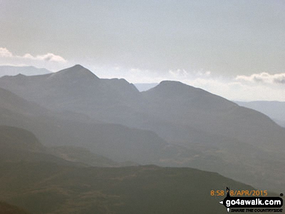
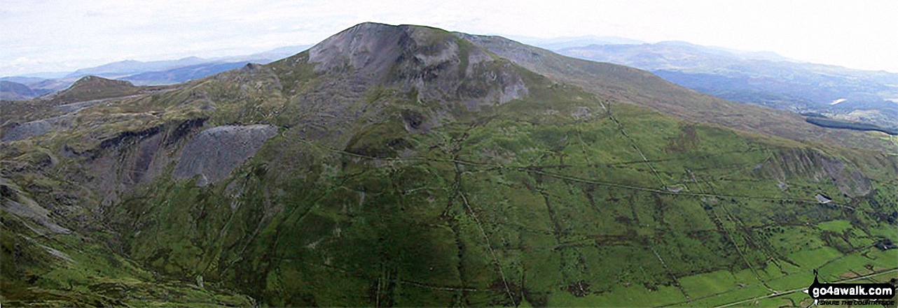
The Moelwyns - Cnicht (left) and Moelwyn Mawr (right) - from Mynydd Tal-y-mignedd
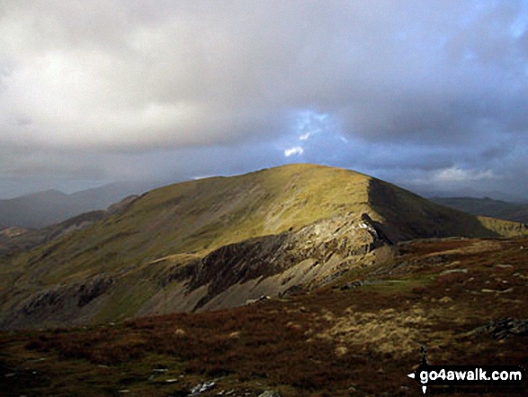
Moelwyn Bach, Craigysgafn and Moelwyn Mawr beyond the water leat on Moel Bowydd
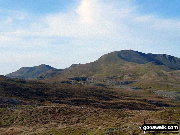
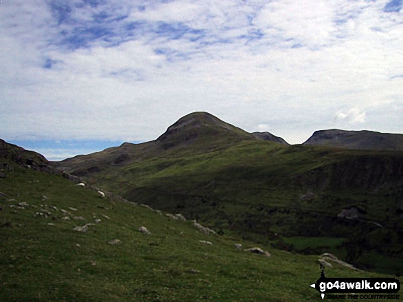
Moelwyn Bach, Bwlch Stwlan, Craigysgafn, Moelwyn Mawr and Moelwyn Mawr (North Ridge Top) (far right) from the col below Moel-yr-hydd

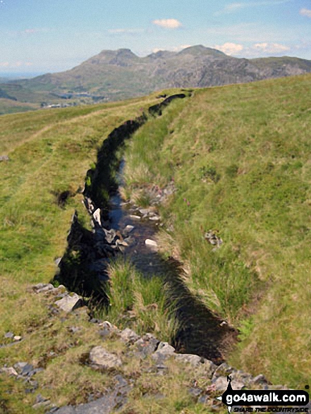
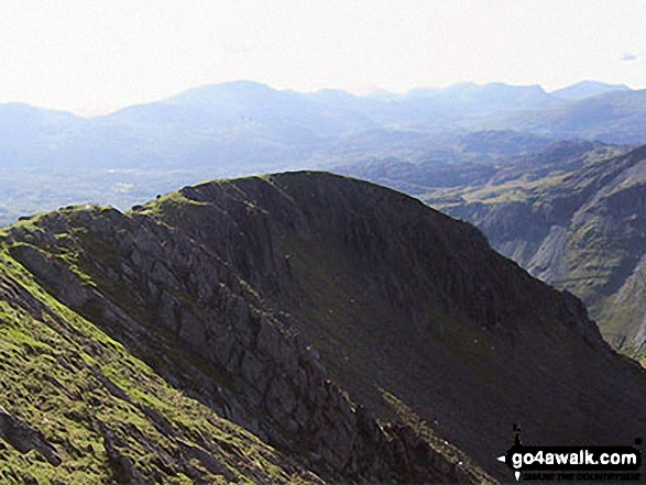
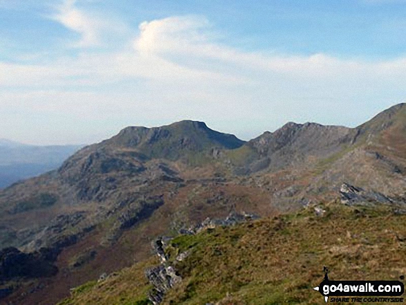
Moel-yr-hydd (left) and Moelwyn Mawr (centre) from the summit of Cnicht - the Welsh Matterhorn
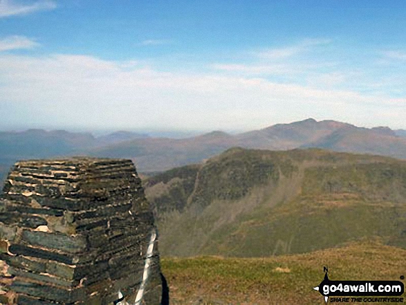
Cnicht and Cnicht (North Top) with The Snowdon Range beyond from Moelwyn Mawr
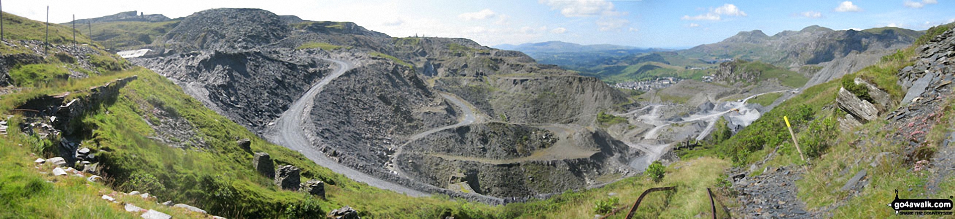
Maen-offeren Quarry from Drum House at the top of a disused incline with Arenig Fawr & Arenig Fach (on the horizon) and Moelwyn Bach, Craigysgafn and Moelwyn Mawr (mid-distance right)
Moelwyn Bach, Bwlch Stwlan, Craigysgafn and Moelwyn Mawr from near Rhosydd Quarry
. . . see all 33 walk photographs & pictures of views from, on or of Moelwyn Mawr
Send us your photographs and pictures on, of, or from Moelwyn Mawr
If you would like to add your walk photographs and pictures to this page, please send them as email attachments (configured for any computer) along with your name to:
and we shall do our best to publish them.
(Guide Resolution = 300dpi. At least = 660pixels (wide) x 440 pixels (high).)

You can also submit photos via our Facebook Page.
NB. Please indicate where each photo was taken and whether you wish us to credit your photos with a Username or your First Name/Last Name.


