A Google Peak Bagging Map of Scottish Region 3: Loch Leven to Connel Bridge, Strath of Orchy and Glen Lochy a fully detailed list (Page 1 of 3)
Scottish Region 3: Loch Leven to Connel Bridge, Strath of Orchy and Glen Lochy region is the area enclosed by an imaginary line connecting:
- Rubh' a' Bhaid Bheithe to Rannoch Station via Loch Linnhe, South Ballachulish, Glencoe, Loch Leven & Black Water to the North
- Rannoch Station to Tyndrum via the railway lineLoch Tulla & Bridge of Orchy to the East
- Tyndrum to Lynn of Lorn via the A85 through Glen Lochy, Dalmally, Loch Awe, The River Awe, The Pass of Brander, Taynuilt & Loch Etive to the South
- Lynn of Lorn to Rubh' a' Bhaid Bheithe via Loch Linnhe to the West
If you count only the Marilyns there are 62 tops to climb, bag & conquer and the highest point is Bidean nam Bian at 1,150m (3,774ft).
To see these Mountains, Peaks, Tops and Hills displayed in different ways - see the options in the left-hand column and towards the bottom of this page.
LOG ON and RELOAD this page to show which Mountains, Peaks, Tops and Hills you have already climbed, bagged & conquered [. . . more details]
See this list in: Alphabetical Order‡
| Height Order
To reverse the order select the link again.
Mountain, Peak, Top or Hill:
Bagged
1. Stob na Cruaiche
739m (2,425ft)
Stob na Cruaiche is on interactive maps:
A downloadable go4awalk.com PDF Peak Bagging Map featuring Stob na Cruaiche will be available soon. |
2. Stob Ghabhar
1,090m (3,577ft)
See the location of Stob Ghabhar and walks up it on a google Map Stob Ghabhar is on interactive maps:
A downloadable go4awalk.com PDF Peak Bagging Map featuring Stob Ghabhar will be available soon. |
3. Stob Dubh (Glen Etive)
883m (2,898ft)
Stob Dubh (Glen Etive) is on interactive maps:
A downloadable go4awalk.com PDF Peak Bagging Map featuring Stob Dubh (Glen Etive) will be available soon. |
4. Stob Coire Raineach (Buachaille Etive Beag)
925m (3,036ft)
See the location of Stob Coire Raineach (Buachaille Etive Beag) and walks up it on a google Map Stob Coire Raineach (Buachaille Etive Beag) is on interactive maps:
A downloadable go4awalk.com PDF Peak Bagging Map featuring Stob Coire Raineach (Buachaille Etive Beag) will be available soon. |
5. Stob Coir an Albannaich
1,044m (3,426ft)
Stob Coir an Albannaich is on interactive maps:
A downloadable go4awalk.com PDF Peak Bagging Map featuring Stob Coir an Albannaich will be available soon. |
6. Stob a' Choire Odhair (Black Mount)
945m (3,101ft)
Send it in and we'll publish it here.
See the location of Stob a' Choire Odhair (Black Mount) and walks up it on a google Map Stob a' Choire Odhair (Black Mount) is on interactive maps:
A downloadable go4awalk.com PDF Peak Bagging Map featuring Stob a' Choire Odhair (Black Mount) will be available soon. |
7. Sgurr na h-Ulaidh
994m (3,262ft)
Sgurr na h-Ulaidh is on interactive maps:
A downloadable go4awalk.com PDF Peak Bagging Map featuring Sgurr na h-Ulaidh will be available soon. |
8. Sgorr nam Fiannaidh (Aonach Eagach)
967m (3,174ft)
See the location of Sgorr nam Fiannaidh (Aonach Eagach) and walks up it on a google Map Sgorr nam Fiannaidh (Aonach Eagach) is on interactive maps:
A downloadable go4awalk.com PDF Peak Bagging Map featuring Sgorr nam Fiannaidh (Aonach Eagach) will be available soon. |
9. Sgorr na Ciche (Pap of Glencoe)
742m (2,435ft)
See the location of Sgorr na Ciche (Pap of Glencoe) and walks up it on a google Map Sgorr na Ciche (Pap of Glencoe) is on interactive maps:
A downloadable go4awalk.com PDF Peak Bagging Map featuring Sgorr na Ciche (Pap of Glencoe) will be available soon. |
10. Sgorr Dhonuill (Beinn a' Bheithir)
1,001m (3,285ft)
See the location of Sgorr Dhonuill (Beinn a' Bheithir) and walks up it on a google Map Sgorr Dhonuill (Beinn a' Bheithir) is on interactive maps:
A downloadable go4awalk.com PDF Peak Bagging Map featuring Sgorr Dhonuill (Beinn a' Bheithir) will be available soon. |
11. Sgorr Dhearg (Beinn a' Bheithir)
1,024m (3,361ft)
See the location of Sgorr Dhearg (Beinn a' Bheithir) and walks up it on a google Map Sgorr Dhearg (Beinn a' Bheithir) is on interactive maps:
A downloadable go4awalk.com PDF Peak Bagging Map featuring Sgorr Dhearg (Beinn a' Bheithir) will be available soon. |
12. Sgorr a' Choise
663m (2,176ft)
Sgorr a' Choise is on interactive maps:
A downloadable go4awalk.com PDF Peak Bagging Map featuring Sgorr a' Choise will be available soon. |
13. Na Maoilean
350m (1,149ft)
Na Maoilean is on interactive maps:
A downloadable go4awalk.com PDF Peak Bagging Map featuring Na Maoilean will be available soon. |
14. Meall Tairbh
665m (2,183ft)
Meall Tairbh is on interactive maps:
A downloadable go4awalk.com PDF Peak Bagging Map featuring Meall Tairbh will be available soon. |
15. Meall nan Eun (Lorn)
928m (3,046ft)
Send it in and we'll publish it here.
Meall nan Eun (Lorn) is on interactive maps:
A downloadable go4awalk.com PDF Peak Bagging Map featuring Meall nan Eun (Lorn) will be available soon. |
16. Meall Mor (Glen Coe)
676m (2,219ft)
Send it in and we'll publish it here.
Meall Mor (Glen Coe) is on interactive maps:
A downloadable go4awalk.com PDF Peak Bagging Map featuring Meall Mor (Glen Coe) will be available soon. |
17. Meall Mor (Black Mount)
492m (1,615ft)
Send it in and we'll publish it here.
Meall Mor (Black Mount) is on interactive maps:
A downloadable go4awalk.com PDF Peak Bagging Map featuring Meall Mor (Black Mount) will be available soon. |
18. Meall Lighiche
772m (2,534ft)
Meall Lighiche is on interactive maps:
A downloadable go4awalk.com PDF Peak Bagging Map featuring Meall Lighiche will be available soon. |
19. Meall Garbh (Glen Kinglass)
701m (2,301ft)
Send it in and we'll publish it here.
Meall Garbh (Glen Kinglass) is on interactive maps:
A downloadable go4awalk.com PDF Peak Bagging Map featuring Meall Garbh (Glen Kinglass) will be available soon. |
20. Meall a' Bhuiridh
1,108m (3,636ft)
See the location of Meall a' Bhuiridh and walks up it on a google Map Meall a' Bhuiridh is on interactive maps:
A downloadable go4awalk.com PDF Peak Bagging Map featuring Meall a' Bhuiridh will be available soon. |
21. Mam Hael (Beinn Bhreac)
726m (2,382ft)
Send it in and we'll publish it here.
Mam Hael (Beinn Bhreac) is on interactive maps:
A downloadable go4awalk.com PDF Peak Bagging Map featuring Mam Hael (Beinn Bhreac) will be available soon. |
22. Leathad Mor (Rannoch Moor)
548m (1,799ft)
Send it in and we'll publish it here.
Leathad Mor (Rannoch Moor) is on interactive maps:
A downloadable go4awalk.com PDF Peak Bagging Map featuring Leathad Mor (Rannoch Moor) will be available soon. |
23. Glas Bheinn Mhor (Glen Etive)
997m (3,272ft)
Glas Bheinn Mhor (Glen Etive) is on interactive maps:
A downloadable go4awalk.com PDF Peak Bagging Map featuring Glas Bheinn Mhor (Glen Etive) will be available soon. |
24. Glas Bheinn (Rannoch Moor)
501m (1,644ft)
Send it in and we'll publish it here.
Glas Bheinn (Rannoch Moor) is on interactive maps:
A downloadable go4awalk.com PDF Peak Bagging Map featuring Glas Bheinn (Rannoch Moor) will be available soon. |
25. Garbh Bheinn (Loch Leven)
867m (2,845ft)
Send it in and we'll publish it here.
Garbh Bheinn (Loch Leven) is on interactive maps:
A downloadable go4awalk.com PDF Peak Bagging Map featuring Garbh Bheinn (Loch Leven) will be available soon. |
26. Fraochaidh
879m (2,885ft)
Fraochaidh is on interactive maps:
A downloadable go4awalk.com PDF Peak Bagging Map featuring Fraochaidh will be available soon. |
27. Creise
1,100m (3,610ft)
See the location of Creise and walks up it on a google Map Creise is on interactive maps:
A downloadable go4awalk.com PDF Peak Bagging Map featuring Creise will be available soon. |
28. Creach Bheinn (Dunaneach)
810m (2,658ft)
Send it in and we'll publish it here.
Creach Bheinn (Dunaneach) is on interactive maps:
A downloadable go4awalk.com PDF Peak Bagging Map featuring Creach Bheinn (Dunaneach) will be available soon. |
29. Buachaille Etive Mor (Stob Dearg)
1,021m (3,351ft)
See the location of Buachaille Etive Mor (Stob Dearg) and walks up it on a google Map Buachaille Etive Mor (Stob Dearg) is on interactive maps:
A downloadable go4awalk.com PDF Peak Bagging Map featuring Buachaille Etive Mor (Stob Dearg) will be available soon. |
30. Buachaille Etive Beag (Stob Dubh)
958m (3,144ft)
See the location of Buachaille Etive Beag (Stob Dubh) and walks up it on a google Map Buachaille Etive Beag (Stob Dubh) is on interactive maps:
A downloadable go4awalk.com PDF Peak Bagging Map featuring Buachaille Etive Beag (Stob Dubh) will be available soon. |
View these 62 Mountains, Peaks, Tops and Hills:
- On an Interactive Google Map with a list of tops below it.
(makes it easier to locate a particular top) - On a Detailed List in:
Alphabetical Order | Height Order - On one page with 'yet-to-be-bagged' listed 1st
& then 'already-bagged' tops listed 2nd in:
Alphabetical Order | Height Order - On one page with 'already-bagged' tops listed 1st
& then 'yet-to-be-bagged' tops listed 2nd in:
Alphabetical Order | Height Order
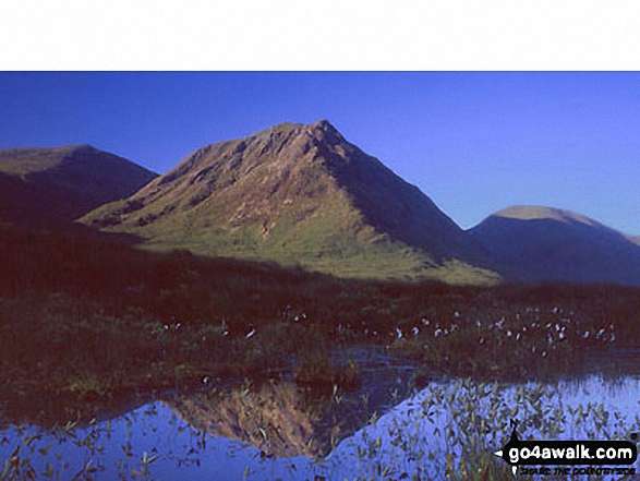
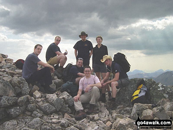
 Bidean nam Bian in Loch Leven to Connel Bridge, Strath of Orchy and Glen Lochy
Photo: Eric Smith
Is there a Mountain, Peak, Top or Hill missing from the above google map or list?
Let us know an we will add it to our database.


