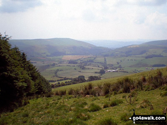
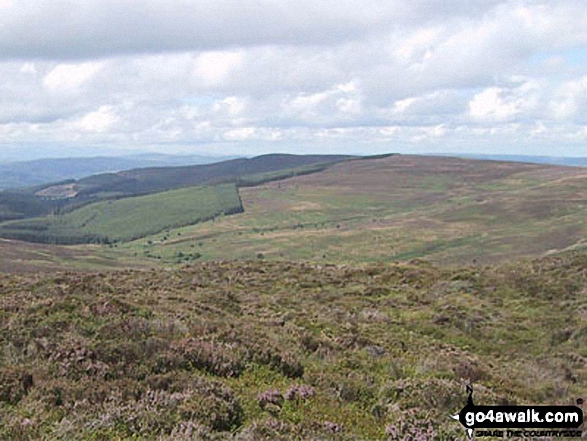
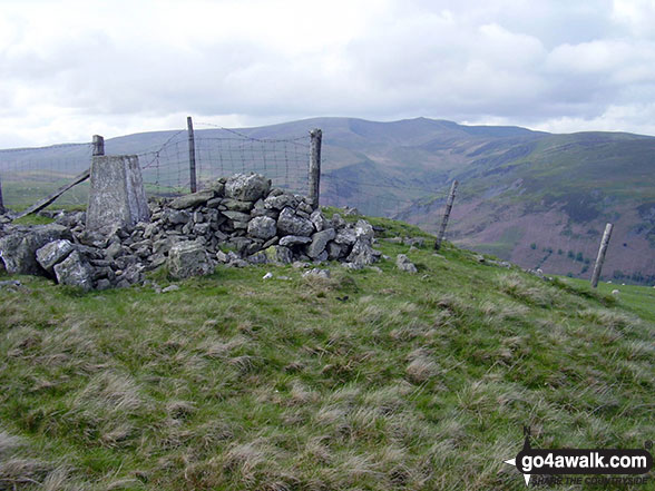
All the Mountains, Peaks, Tops and Hills in The Berwyns area of Snowdonia in Denbighshire, Gwynedd, Powys and Wrexham,, Wales as a detailed list

The Berwyns area of Snowdonia National Park in Denbighshire, Gwynedd, Powys and Wrexham, is the area enclosed by:


If you count only the Deweys there are 23 tops to climb, bag & conquer and the highest point is Glan Hafon (Y Garn) at 608m (1,995ft).


Wainwright
0/0
Wainwrights
Hewitt
14/0
Welsh
Mountains
Dewey
23/0
Welsh
Deweys
nuttall
24/0
Welsh
Nuttalls
Wainwright Outlying Fell
0/0
Wainwright
Outlying Fells
marilyn
5/0
Welsh
Marilyns
Bridget
6/0
Welsh
Bridgets
Trig Point
10/0
Trig
Points


To see all Mountains, Peaks, Tops and Hills displayed in different ways - see the options in the left-hand column and towards the bottom of this page.


LOG ON and RELOAD this page to show which Mountains, Peaks, Tops and Hills you have already climbed, bagged & conquered [. . . more]


See this list in: Alphabetical Order | Height Order
To reverse the order select the link again.


Mountain, Peak, Top or Hill:

Bagged


1. Moel Cae-Howel

508m (1,667ft)


Got a good photo of
Moel Cae-Howel?

Send it in and we'll publish it here.

Photo
Submission
Details

  • Dewey (216th in Wales, 382nd in England & Wales)

  • We hope to have walks that climb & bag Moel Cae-Howel very soon

    Google Maps Icon
    See the location of Moel Cae-Howel and walks up it on a google Map

    Moel Cae-Howel is on interactive maps:

  • OS Explorer (Orange Covers): OL23
  • OS Landranger (Pink Covers): 125

  • Moel Cae-Howel is on Peak Bagging Map and Hill Tick List:


    2. Cyrniau y Llyn

    518m (1,700ft)


    Got a good photo of
    Cyrniau y Llyn?

    Send it in and we'll publish it here.

    Photo
    Submission
    Details

  • Dewey (186th in Wales, 329th in England & Wales)

  • We hope to have walks that climb & bag Cyrniau y Llyn very soon

    Google Maps Icon
    See the location of Cyrniau y Llyn and walks up it on a google Map

    Cyrniau y Llyn is on interactive maps:

  • OS Explorer (Orange Covers): 239
  • OS Landranger (Pink Covers): 125

  • Cyrniau y Llyn is on Peak Bagging Map and Hill Tick List:


    3. Carnedd Das Eithin

    521m (1,709ft)


    Got a good photo of
    Carnedd Das Eithin?

    Send it in and we'll publish it here.

    Photo
    Submission
    Details

  • Dewey (175th in Wales, 313th in England & Wales)

  • We hope to have walks that climb & bag Carnedd Das Eithin very soon

    Google Maps Icon
    See the location of Carnedd Das Eithin and walks up it on a google Map

    Carnedd Das Eithin is on interactive maps:

  • OS Explorer (Orange Covers): 239
  • OS Landranger (Pink Covers): 125

  • Carnedd Das Eithin is on Peak Bagging Map and Hill Tick List:


    4. Moel Hen-fache

    521m (1,709ft)


    Got a good photo of
    Moel Hen-fache?

    Send it in and we'll publish it here.

    Photo
    Submission
    Details

  • Dewey (176th in Wales, 314th in England & Wales)

  • We hope to have walks that climb & bag Moel Hen-fache very soon

    Google Maps Icon
    See the location of Moel Hen-fache and walks up it on a google Map

    Moel Hen-fache is on interactive maps:

  • OS Explorer (Orange Covers): 255
  • OS Landranger (Pink Covers): 125

  • Moel Hen-fache is on Peak Bagging Map and Hill Tick List:


    5. Gyrn Moelfre

    523m (1,716ft)


    Got a good photo of
    Gyrn Moelfre?

    Send it in and we'll publish it here.

    Photo
    Submission
    Details

  • Dewey (167th in Wales, 298th in England & Wales)
  • Marilyn (78th in Wales, 925th in GB)
  • OS Trig Point

  • We hope to have walks that climb & bag Gyrn Moelfre very soon

    Google Maps Icon
    See the location of Gyrn Moelfre and walks up it on a google Map

    Gyrn Moelfre is on interactive maps:

  • OS Explorer (Orange Covers): 255
  • OS Landranger (Pink Covers): 125

  • Gyrn Moelfre is on Peak Bagging Map and Hill Tick List:


    6. Lledwyn Mawr

    527m (1,730ft)


    Got a good photo of
    Lledwyn Mawr?

    Send it in and we'll publish it here.

    Photo
    Submission
    Details

  • Dewey (159th in Wales, 279th in England & Wales)

  • We hope to have walks that climb & bag Lledwyn Mawr very soon

    Google Maps Icon
    See the location of Lledwyn Mawr and walks up it on a google Map

    Lledwyn Mawr is on interactive maps:

  • OS Explorer (Orange Covers): OL23
  • OS Landranger (Pink Covers): 125

  • Lledwyn Mawr is on Peak Bagging Map and Hill Tick List:


    7. Craig Rhiwarth

    532m (1,746ft)


    Got a good photo of
    Craig Rhiwarth?

    Send it in and we'll publish it here.

    Photo
    Submission
    Details

  • Dewey (147th in Wales, 256th in England & Wales)

  • We hope to have walks that climb & bag Craig Rhiwarth very soon

    Google Maps Icon
    See the location of Craig Rhiwarth and walks up it on a google Map

    Craig Rhiwarth is on interactive maps:

  • OS Explorer (Orange Covers): 239 and 255
  • OS Landranger (Pink Covers): 125

  • Craig Rhiwarth is on Peak Bagging Map and Hill Tick List:


    8. Mynydd Mawr (Berwyns)

    534m (1,752ft)

  • Dewey (139th in Wales, 245th in England & Wales)
  • OS Trig Point

  • We hope to have walks that climb & bag Mynydd Mawr (Berwyns) very soon

    Google Maps Icon
    See the location of Mynydd Mawr (Berwyns) and walks up it on a google Map

    Mynydd Mawr (Berwyns) is on interactive maps:

  • OS Explorer (Orange Covers): 255
  • OS Landranger (Pink Covers): 125

  • Mynydd Mawr (Berwyns) is on Peak Bagging Map and Hill Tick List:


    9. Ffordd Gefn (Bryn Gwyn)

    539m (1,768ft)


    Got a good photo of
    Ffordd Gefn (Bryn Gwyn)?

    Send it in and we'll publish it here.

    Photo
    Submission
    Details

  • Dewey (121st in Wales, 217th in England & Wales)

  • We hope to have walks that climb & bag Ffordd Gefn (Bryn Gwyn) very soon

    Google Maps Icon
    See the location of Ffordd Gefn (Bryn Gwyn) and walks up it on a google Map

    Ffordd Gefn (Bryn Gwyn) is on interactive maps:

  • OS Explorer (Orange Covers): 239
  • OS Landranger (Pink Covers): 125

  • Ffordd Gefn (Bryn Gwyn) is on Peak Bagging Map and Hill Tick List:


    10. Rhiwaedog-uwch-afon

    539m (1,769ft)


    Got a good photo of
    Rhiwaedog-uwch-afon?

    Send it in and we'll publish it here.

    Photo
    Submission
    Details

  • Dewey (120th in Wales, 214th in England & Wales)

  • We hope to have walks that climb & bag Rhiwaedog-uwch-afon very soon

    Google Maps Icon
    See the location of Rhiwaedog-uwch-afon and walks up it on a google Map

    Rhiwaedog-uwch-afon is on interactive maps:

  • OS Explorer (Orange Covers): OL23
  • OS Landranger (Pink Covers): 125

  • Rhiwaedog-uwch-afon is on Peak Bagging Map and Hill Tick List:


    11. Rhialgwm (Rhial Gwm)

    540m (1,772ft)


    Got a good photo of
    Rhialgwm (Rhial Gwm)?

    Send it in and we'll publish it here.

    Photo
    Submission
    Details

  • Dewey (118th in Wales, 211th in England & Wales)
  • Marilyn (73rd in Wales, 896th in GB)
  • OS Trig Point

  • We hope to have walks that climb & bag Rhialgwm (Rhial Gwm) very soon

    Google Maps Icon
    See the location of Rhialgwm (Rhial Gwm) and walks up it on a google Map

    Rhialgwm (Rhial Gwm) is on interactive maps:

  • OS Explorer (Orange Covers): 239
  • OS Landranger (Pink Covers): 125

  • Rhialgwm (Rhial Gwm) is on Peak Bagging Map and Hill Tick List:


    12. Bryn-llus

    549m (1,801ft)


    Got a good photo of
    Bryn-llus?

    Send it in and we'll publish it here.

    Photo
    Submission
    Details

  • Dewey (95th in Wales, 168th in England & Wales)

  • We hope to have walks that climb & bag Bryn-llus very soon

    Google Maps Icon
    See the location of Bryn-llus and walks up it on a google Map

    Bryn-llus is on interactive maps:

  • OS Explorer (Orange Covers): 255
  • OS Landranger (Pink Covers): 125

  • Bryn-llus is on Peak Bagging Map and Hill Tick List:


    13. Vivod Mountain

    559m (1,834ft)


    Got a good photo of
    Vivod Mountain?

    Send it in and we'll publish it here.

    Photo
    Submission
    Details

  • Dewey (73rd in Wales, 128th in England & Wales)

  • We hope to have walks that climb & bag Vivod Mountain very soon

    Google Maps Icon
    See the location of Vivod Mountain and walks up it on a google Map

    Vivod Mountain is on interactive maps:

  • OS Explorer (Orange Covers): 255
  • OS Landranger (Pink Covers): 125

  • Vivod Mountain is on Peak Bagging Map and Hill Tick List:


    14. Bryn Du (Y Fawnen)

    563m (1,847ft)


    Got a good photo of
    Bryn Du (Y Fawnen)?

    Send it in and we'll publish it here.

    Photo
    Submission
    Details

  • Dewey (64th in Wales, 114th in England & Wales)
  • OS Trig Point

  • We hope to have walks that climb & bag Bryn Du (Y Fawnen) very soon

    Google Maps Icon
    See the location of Bryn Du (Y Fawnen) and walks up it on a google Map

    Bryn Du (Y Fawnen) is on interactive maps:

  • OS Explorer (Orange Covers): 255
  • OS Landranger (Pink Covers): 125

  • Bryn Du (Y Fawnen) is on Peak Bagging Map and Hill Tick List:


    15. Moel Eunant

    568m (1,864ft)


    Got a good photo of
    Moel Eunant?

    Send it in and we'll publish it here.

    Photo
    Submission
    Details

  • Dewey (54th in Wales, 98th in England & Wales)

  • We hope to have walks that climb & bag Moel Eunant very soon

    Google Maps Icon
    See the location of Moel Eunant and walks up it on a google Map

    Moel Eunant is on interactive maps:

  • OS Explorer (Orange Covers): OL23 and 239
  • OS Landranger (Pink Covers): 125

  • Moel Eunant is on Peak Bagging Map and Hill Tick List:


    16. Moel yr Henfaes

    584m (1,916ft)


    Got a good photo of
    Moel yr Henfaes?

    Send it in and we'll publish it here.

    Photo
    Submission
    Details

  • Dewey (38th in Wales, 63rd in England & Wales)

  • We hope to have walks that climb & bag Moel yr Henfaes very soon

    Google Maps Icon
    See the location of Moel yr Henfaes and walks up it on a google Map

    Moel yr Henfaes is on interactive maps:

  • OS Explorer (Orange Covers): 255
  • OS Landranger (Pink Covers): 125

  • Moel yr Henfaes is on Peak Bagging Map and Hill Tick List:


    17. Rhwng y Ddwynant

    588m (1,929ft)


    Got a good photo of
    Rhwng y Ddwynant?

    Send it in and we'll publish it here.

    Photo
    Submission
    Details

  • Dewey (33rd in Wales, 53rd in England & Wales)

  • We hope to have walks that climb & bag Rhwng y Ddwynant very soon

    Google Maps Icon
    See the location of Rhwng y Ddwynant and walks up it on a google Map

    Rhwng y Ddwynant is on interactive maps:

  • OS Explorer (Orange Covers): OL23 and 239
  • OS Landranger (Pink Covers): 125

  • Rhwng y Ddwynant is on Peak Bagging Map and Hill Tick List:


    18. Foel Figenau

    590m (1,936ft)


    Got a good photo of
    Foel Figenau?

    Send it in and we'll publish it here.

    Photo
    Submission
    Details

  • Dewey (28th in Wales, 47th in England & Wales)

  • We hope to have walks that climb & bag Foel Figenau very soon

    Google Maps Icon
    See the location of Foel Figenau and walks up it on a google Map

    Foel Figenau is on interactive maps:

  • OS Explorer (Orange Covers): OL23
  • OS Landranger (Pink Covers): 125

  • Foel Figenau is on Peak Bagging Map and Hill Tick List:


    19. Cerrig Coediog

    593m (1,946ft)

  • Dewey (25th in Wales, 41st in England & Wales)

  • To walk, climb & bag Cerrig Coediog use either of these easy to follow walks:

    Google Maps Icon
    See the location of Cerrig Coediog and walks up it on a google Map

    Cerrig Coediog is on interactive maps:

  • OS Explorer (Orange Covers): 255
  • OS Landranger (Pink Covers): 125

  • Cerrig Coediog is on Peak Bagging Map and Hill Tick List:


    20. Cefn Coch (Berwyns)

    594m (1,949ft)


    Got a good photo of
    Cefn Coch (Berwyns)?

    Send it in and we'll publish it here.

    Photo
    Submission
    Details

  • Dewey (24th in Wales, 40th in England & Wales)

  • We hope to have walks that climb & bag Cefn Coch (Berwyns) very soon

    Google Maps Icon
    See the location of Cefn Coch (Berwyns) and walks up it on a google Map

    Cefn Coch (Berwyns) is on interactive maps:

  • OS Explorer (Orange Covers): OL23
  • OS Landranger (Pink Covers): 125

  • Cefn Coch (Berwyns) is on Peak Bagging Map and Hill Tick List:


    21. Cefn Perfedd (Pen y Lladron)

    604m (1,982ft)


    Got a good photo of
    Cefn Perfedd (Pen y Lladron)?

    Send it in and we'll publish it here.

    Photo
    Submission
    Details

  • Dewey (10th in Wales, 16th in England & Wales)

  • We hope to have walks that climb & bag Cefn Perfedd (Pen y Lladron) very soon

    Google Maps Icon
    See the location of Cefn Perfedd (Pen y Lladron) and walks up it on a google Map

    Cefn Perfedd (Pen y Lladron) is on interactive maps:

  • OS Explorer (Orange Covers): 255
  • OS Landranger (Pink Covers): 125

  • Cefn Perfedd (Pen y Lladron) is on Peak Bagging Map and Hill Tick List:


    22. Foel Tyn-y-fron (Moel y Pawl)

    606m (1,988ft)


    Got a good photo of
    Foel Tyn-y-fron (Moel y Pawl)?

    Send it in and we'll publish it here.

    Photo
    Submission
    Details

  • Dewey (5th in Wales, 8th in England & Wales)

  • We hope to have walks that climb & bag Foel Tyn-y-fron (Moel y Pawl) very soon

    Google Maps Icon
    See the location of Foel Tyn-y-fron (Moel y Pawl) and walks up it on a google Map

    Foel Tyn-y-fron (Moel y Pawl) is on interactive maps:

  • OS Explorer (Orange Covers): OL23
  • OS Landranger (Pink Covers): 125

  • Foel Tyn-y-fron (Moel y Pawl) is on Peak Bagging Map and Hill Tick List:


    23. Glan Hafon (Y Garn)

    608m (1,995ft)

  • Dewey (3rd in Wales, 6th in England & Wales)
  • OS Trig Point
  • The Trig Point on Glan Hafon (Y Garn) is about 180m E of the highest point.


    To walk, climb & bag Glan Hafon (Y Garn) use either of these easy to follow walks:

    Google Maps Icon
    See the location of Glan Hafon (Y Garn) and walks up it on a google Map

    Glan Hafon (Y Garn) is on interactive maps:

  • OS Explorer (Orange Covers): 239 and 255
  • OS Landranger (Pink Covers): 125

  • Glan Hafon (Y Garn) is on Peak Bagging Map and Hill Tick List:


    View all 54 Mountains, Peaks, Tops and Hills in The Berwyns area of :

    # Whether you print a copy or download it to your phone, this Peak Baggers' Map will prove incredibly useful if you want to know what's what when you are up in the mountains and cannot get a phone signal


    Is there a Mountain, Peak, Top or Hill missing from the above google map or list?

    Let us know an we will add it to our database.


    Do not miss our pick of the Best Walks in Britain


    Follow go4awalk.com on Twitter Follow go4awalk.com on Facebook


    Home


    Find new Friends to go walking with

    Walk all 214 Wainwrights in just 59 Walks. Download GPS Waypoints - Great Walks you must not miss!

    Walk The Yorkshire Three Peaks Challenge Walk - All the Latest Route Information, GPS Waypoints and Split Times to keep you on Schedule

    Walk The British Three Peaks Challenge Walk - All the Latest Route Information and GPS Waypoints

    See our pick of The Best Walks in The Lake District - Great Walks you must not miss!

    Walk our pick of the Best Lake District Ridge Walks - Great Walks you must not miss!

    Walk our pick of the Best Lake District Walks to do in the rain - Great Walks you must not miss!

    Walk our pick of The Best Walks in Snowdonia - Great Walks you must not miss!

    Walk our pick of The Best Ridge Walks in Wales - Walks you must not miss!

    Walk our pick of The Best Walks in The Brecon Beacons - Great Walks you must not miss!

    Walk our pick of The Best Walks in The Yorkshire Dales - Walks you must not miss!

    Walk our pick of The Best Walks in The Peak District - Walks you must not miss!

    Walk our pick of The Best Walks in The Forest of Bowland - Walks you must not miss!

    Walk our pick of The Best Walks in Shropshire - Walks you must not miss!

    Walk our pick of The Best Walks in Cheshire - Walks you must not miss!

    Walk our pick of The Best Walks in Lancashire - Walks you must not miss!

    Not sure where to walk next? Try Peak Bagging - Great Walks you must not miss!

    Not sure where to walk next? Walk part of a National Trail - Great Walks you must not miss!

    Walks with Downloadable and Uploadable GPS Waypoint Data

    Walking Kit and Gear Tested by Walkers

    Full Site Search
    Do not miss our pick of the Best Walks in Britain