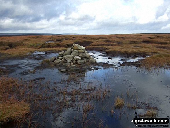
All the Mountains, Peaks, Tops and Hills in The Dark Peak Area of The Peak District, Derbyshire, Greater Manchester, West Yorkshire and South Yorkshire, England as a detailed list

The Dark Peak Area of The Peak District National Park, Derbyshire, Greater Manchester, West Yorkshire and South Yorkshire is area within the National Park boundary north of the A6 from Hazel Grove to Chapel-en-le-Frith, the A623 to Sparrowpit, the minor road from Sparrowpit along Rushup Edge to Castleton and the A6187 from Castleton to Sheffield.


If you include all the Mountains (Hewitts), the Deweys, the Nuttalls, the Marilyns and the Bridgets (Hills) there are 58 tops to climb, bag & conquer and the highest point is Kinder Scout at 636m (2,087ft).


Wainwright
0/0
Wainwrights
Hewitt
2/0
English
Mountains
Dewey
11/0
English
Deweys
nuttall
3/0
English
Nuttalls
Wainwright Outlying Fell
0/0
Wainwright
Outlying Fells
marilyn
2/0
English
Marilyns
Bridget
44/0
English
Bridgets
Trig Point
22/0
Trig
Points


To see all Mountains, Peaks, Tops and Hills displayed in different ways - see the options in the left-hand column and towards the bottom of this page.


LOG ON and RELOAD this page to show which Mountains, Peaks, Tops and Hills you have already climbed, bagged & conquered [. . . more]


Page 1 of 2    Go to page: 1 2


See this list in: Alphabetical Order | Height Order
To reverse the order select the link again.


Mountain, Peak, Top or Hill:

Bagged


1. Kinder Scout

636m (2,087ft)

  • Mountain (156th in England, 265th in England & Wales)
  • Nuttall (207th in England, 356th in England & Wales)
  • Marilyn (47th in England, 710th in GB)
  • Kinder Scout is the highest point in The Peak District National Park and the highest point in the county of Derbyshire.


    To walk, climb & bag Kinder Scout use any of these easy to follow walks:

    Google Maps Icon
    See the location of Kinder Scout and walks up it on a google Map

    Kinder Scout is on interactive maps:

  • OS Explorer (Orange Covers): OL1
  • OS Landranger (Pink Covers): 110

  • Kinder Scout is on Peak Bagging Map and Hill Tick List:


    2. Kinder Low (Kinder Scout)

    633m (2,078ft)

  • Bridget
  • OS Trig Point

  • To walk, climb & bag Kinder Low (Kinder Scout) use any of these easy to follow walks:

    Google Maps Icon
    See the location of Kinder Low (Kinder Scout) and walks up it on a google Map

    Kinder Low (Kinder Scout) is on interactive maps:

  • OS Explorer (Orange Covers): OL1
  • OS Landranger (Pink Covers): 110

  • Kinder Low (Kinder Scout) is on Peak Bagging Map and Hill Tick List:


    3. Bleaklow Head (Bleaklow Hill)

    633m (2,077ft)

  • Mountain (159th in England, 271st in England & Wales)
  • Nuttall (212th in England, 364th in England & Wales)

  • To walk, climb & bag Bleaklow Head (Bleaklow Hill) use any of these easy to follow walks:

    Google Maps Icon
    See the location of Bleaklow Head (Bleaklow Hill) and walks up it on a google Map

    Bleaklow Head (Bleaklow Hill) is on interactive maps:

  • OS Explorer (Orange Covers): OL1
  • OS Landranger (Pink Covers): 110

  • Bleaklow Head (Bleaklow Hill) is on Peak Bagging Map and Hill Tick List:


    4. Crowden Head (Kinder Scout)

    631m (2,071ft)

  • Bridget
  • Crowden Head (Kinder Scout) is in the middle of the Kinder Scout plateau.


    To walk, climb & bag Crowden Head (Kinder Scout) use this easy to follow walk:

    Google Maps Icon
    See the location of Crowden Head (Kinder Scout) and walks up it on a google Map

    Crowden Head (Kinder Scout) is on interactive maps:

  • OS Explorer (Orange Covers): OL1
  • OS Landranger (Pink Covers): 110

  • Crowden Head (Kinder Scout) is on Peak Bagging Map and Hill Tick List:


    5. Bleaklow Stones (Bleaklow Hill)

    628m (2,061ft)

  • Bridget

  • To walk, climb & bag Bleaklow Stones (Bleaklow Hill) use any of these easy to follow walks:

    Google Maps Icon
    See the location of Bleaklow Stones (Bleaklow Hill) and walks up it on a google Map

    Bleaklow Stones (Bleaklow Hill) is on interactive maps:

  • OS Explorer (Orange Covers): OL1
  • OS Landranger (Pink Covers): 110

  • Bleaklow Stones (Bleaklow Hill) is on Peak Bagging Map and Hill Tick List:


    6. Fairbrook Naze (Kinder Scout)

    625m (2,051ft)

  • Bridget

  • To walk, climb & bag Fairbrook Naze (Kinder Scout) use either of these easy to follow walks:

    Google Maps Icon
    See the location of Fairbrook Naze (Kinder Scout) and walks up it on a google Map

    Fairbrook Naze (Kinder Scout) is on interactive maps:

  • OS Explorer (Orange Covers): OL1
  • OS Landranger (Pink Covers): 110

  • Fairbrook Naze (Kinder Scout) is on Peak Bagging Map and Hill Tick List:


    7. The Edge (Kinder Scout)

    624m (2,048ft)

  • Bridget
  • OS Trig Point

  • To walk, climb & bag The Edge (Kinder Scout) use any of these easy to follow walks:

    Google Maps Icon
    See the location of The Edge (Kinder Scout) and walks up it on a google Map

    The Edge (Kinder Scout) is on interactive maps:

  • OS Explorer (Orange Covers): OL1
  • OS Landranger (Pink Covers): 110

  • The Edge (Kinder Scout) is on Peak Bagging Map and Hill Tick List:


    8. Higher Shelf Stones

    622m (2,041ft)

  • Nuttall (229th in England, 398th in England & Wales)
  • OS Trig Point

  • To walk, climb & bag Higher Shelf Stones use any of these easy to follow walks:

    Google Maps Icon
    See the location of Higher Shelf Stones and walks up it on a google Map

    Higher Shelf Stones is on interactive maps:

  • OS Explorer (Orange Covers): OL1
  • OS Landranger (Pink Covers): 110

  • Higher Shelf Stones is on Peak Bagging Map and Hill Tick List:


    9. Crowden Tower (Kinder Scout)

    619m (2,032ft)

  • Bridget

  • To walk, climb & bag Crowden Tower (Kinder Scout) use this easy to follow walk:

    Google Maps Icon
    See the location of Crowden Tower (Kinder Scout) and walks up it on a google Map

    Crowden Tower (Kinder Scout) is on interactive maps:

  • OS Explorer (Orange Covers): OL1
  • OS Landranger (Pink Covers): 110

  • Crowden Tower (Kinder Scout) is on Peak Bagging Map and Hill Tick List:


    10. Seal Stones (Kinder Scout)

    603m (1,979ft)

  • Bridget

  • To walk, climb & bag Seal Stones (Kinder Scout) use either of these easy to follow walks:

    Google Maps Icon
    See the location of Seal Stones (Kinder Scout) and walks up it on a google Map

    Seal Stones (Kinder Scout) is on interactive maps:

  • OS Explorer (Orange Covers): OL1
  • OS Landranger (Pink Covers): 110

  • Seal Stones (Kinder Scout) is on Peak Bagging Map and Hill Tick List:


    11. Grindslow Knoll (Kinder Scout)

    601m (1,972ft)

  • Bridget

  • To walk, climb & bag Grindslow Knoll (Kinder Scout) use either of these easy to follow walks:

    Google Maps Icon
    See the location of Grindslow Knoll (Kinder Scout) and walks up it on a google Map

    Grindslow Knoll (Kinder Scout) is on interactive maps:

  • OS Explorer (Orange Covers): OL1
  • OS Landranger (Pink Covers): 110

  • Grindslow Knoll (Kinder Scout) is on Peak Bagging Map and Hill Tick List:


    12. Barrow Stones

    591m (1,940ft)

  • Bridget

  • To walk, climb & bag Barrow Stones use either of these easy to follow walks:

    Google Maps Icon
    See the location of Barrow Stones and walks up it on a google Map

    Barrow Stones is on interactive maps:

  • OS Explorer (Orange Covers): OL1
  • OS Landranger (Pink Covers): 110

  • Barrow Stones is on Peak Bagging Map and Hill Tick List:


    13. Edale Moor (Kinder Scout)

    590m (1,936ft)

  • Bridget
  • OS Trig Point

  • To walk, climb & bag Edale Moor (Kinder Scout) use this easy to follow walk:

    Google Maps Icon
    See the location of Edale Moor (Kinder Scout) and walks up it on a google Map

    Edale Moor (Kinder Scout) is on interactive maps:

  • OS Explorer (Orange Covers): OL1
  • OS Landranger (Pink Covers): 110

  • Edale Moor (Kinder Scout) is on Peak Bagging Map and Hill Tick List:


    14. Black Hill (Soldier's Lump)

    582m (1,910ft)

  • Dewey (28th in England, 66th in England & Wales)
  • Marilyn (55th in England, 795th in GB)
  • OS Trig Point
  • Black Hill (Soldier's Lump) is the highest point in the county of West Yorkshire.


    To walk, climb & bag Black Hill (Soldier's Lump) use this easy to follow walk:

    Google Maps Icon
    See the location of Black Hill (Soldier's Lump) and walks up it on a google Map

    Black Hill (Soldier's Lump) is on interactive maps:

  • OS Explorer (Orange Covers): OL1
  • OS Landranger (Pink Covers): 110

  • Black Hill (Soldier's Lump) is on Peak Bagging Map and Hill Tick List:


    15. Brown Knoll (Edale)

    569m (1,867ft)

  • Dewey (41st in England, 91st in England & Wales)
  • OS Trig Point

  • To walk, climb & bag Brown Knoll (Edale) use any of these easy to follow walks:

    Google Maps Icon
    See the location of Brown Knoll (Edale) and walks up it on a google Map

    Brown Knoll (Edale) is on interactive maps:

  • OS Explorer (Orange Covers): OL1
  • OS Landranger (Pink Covers): 110

  • Brown Knoll (Edale) is on Peak Bagging Map and Hill Tick List:


    16. High Stones (Howden Moor)

    548m (1,798ft)

  • Dewey (74th in England, 173rd in England & Wales)

  • To walk, climb & bag High Stones (Howden Moor) use either of these easy to follow walks:

    Google Maps Icon
    See the location of High Stones (Howden Moor) and walks up it on a google Map

    High Stones (Howden Moor) is on interactive maps:

  • OS Explorer (Orange Covers): OL1
  • OS Landranger (Pink Covers): 110

  • High Stones (Howden Moor) is on Peak Bagging Map and Hill Tick List:


    17. Lord's Seat (Rushup Edge)

    546m (1,791ft)

  • Dewey (80th in England, 184th in England & Wales)

  • To walk, climb & bag Lord's Seat (Rushup Edge) use any of these easy to follow walks:

    Google Maps Icon
    See the location of Lord's Seat (Rushup Edge) and walks up it on a google Map

    Lord's Seat (Rushup Edge) is on interactive maps:

  • OS Explorer (Orange Covers): OL1
  • OS Landranger (Pink Covers): 110

  • Lord's Seat (Rushup Edge) is on Peak Bagging Map and Hill Tick List:


    18. Margery Hill

    546m (1,791ft)

  • Bridget
  • OS Trig Point

  • To walk, climb & bag Margery Hill use either of these easy to follow walks:

    Google Maps Icon
    See the location of Margery Hill and walks up it on a google Map

    Margery Hill is on interactive maps:

  • OS Explorer (Orange Covers): OL1
  • OS Landranger (Pink Covers): 110

  • Margery Hill is on Peak Bagging Map and Hill Tick List:


    19. Featherbed Moss (Howden Edge)

    545m (1,788ft)

  • Bridget

  • To walk, climb & bag Featherbed Moss (Howden Edge) use either of these easy to follow walks:

    Google Maps Icon
    See the location of Featherbed Moss (Howden Edge) and walks up it on a google Map

    Featherbed Moss (Howden Edge) is on interactive maps:

  • OS Explorer (Orange Covers): OL1
  • OS Landranger (Pink Covers): 110

  • Featherbed Moss (Howden Edge) is on Peak Bagging Map and Hill Tick List:


    20. Featherbed Top (Featherbed Moss)

    544m (1,785ft)

  • Dewey (85th in England, 196th in England & Wales)

  • To walk, climb & bag Featherbed Top (Featherbed Moss) use either of these easy to follow walks:

    Google Maps Icon
    See the location of Featherbed Top (Featherbed Moss) and walks up it on a google Map

    Featherbed Top (Featherbed Moss) is on interactive maps:

  • OS Explorer (Orange Covers): OL1
  • OS Landranger (Pink Covers): 110

  • Featherbed Top (Featherbed Moss) is on Peak Bagging Map and Hill Tick List:


    21. Mill Hill (Ashop Head)

    544m (1,785ft)

  • Dewey (86th in England, 197th in England & Wales)

  • To walk, climb & bag Mill Hill (Ashop Head) use any of these easy to follow walks:

    Google Maps Icon
    See the location of Mill Hill (Ashop Head) and walks up it on a google Map

    Mill Hill (Ashop Head) is on interactive maps:

  • OS Explorer (Orange Covers): OL1
  • OS Landranger (Pink Covers): 109

  • Mill Hill (Ashop Head) is on Peak Bagging Map and Hill Tick List:


    22. Black Chew Head (Laddow Rocks)

    542m (1,779ft)

  • Dewey (90th in England, 204th in England & Wales)

  • To walk, climb & bag Black Chew Head (Laddow Rocks) use either of these easy to follow walks:

    Google Maps Icon
    See the location of Black Chew Head (Laddow Rocks) and walks up it on a google Map

    Black Chew Head (Laddow Rocks) is on interactive maps:

  • OS Explorer (Orange Covers): OL1
  • OS Landranger (Pink Covers): 109

  • Black Chew Head (Laddow Rocks) is on Peak Bagging Map and Hill Tick List:


    23. Featherbed Moss (Chew Reservoir)

    541m (1,775ft)

  • Bridget
  • OS Trig Point

  • To walk, climb & bag Featherbed Moss (Chew Reservoir) use this easy to follow walk:

    Google Maps Icon
    See the location of Featherbed Moss (Chew Reservoir) and walks up it on a google Map

    Featherbed Moss (Chew Reservoir) is on interactive maps:

  • OS Explorer (Orange Covers): OL1
  • OS Landranger (Pink Covers): 110

  • 24. Outer Edge

    541m (1,775ft)

  • Bridget
  • OS Trig Point

  • To walk, climb & bag Outer Edge use any of these easy to follow walks:

    Google Maps Icon
    See the location of Outer Edge and walks up it on a google Map

    Outer Edge is on interactive maps:

  • OS Explorer (Orange Covers): OL1
  • OS Landranger (Pink Covers): 110

  • Outer Edge is on Peak Bagging Map and Hill Tick List:


    25. Back Tor (Derwent Edge)

    538m (1,766ft)

  • Dewey (96th in England, 219th in England & Wales)
  • OS Trig Point

  • To walk, climb & bag Back Tor (Derwent Edge) use any of these easy to follow walks:

    Google Maps Icon
    See the location of Back Tor (Derwent Edge) and walks up it on a google Map

    Back Tor (Derwent Edge) is on interactive maps:

  • OS Explorer (Orange Covers): OL1
  • OS Landranger (Pink Covers): 110

  • Back Tor (Derwent Edge) is on Peak Bagging Map and Hill Tick List:


    26. Horse Stone (Horse Stone Naze)

    527m (1,730ft)

  • Dewey (119th in England, 278th in England & Wales)

  • To walk, climb & bag Horse Stone (Horse Stone Naze) use this easy to follow walk:

    Google Maps Icon
    See the location of Horse Stone (Horse Stone Naze) and walks up it on a google Map

    Horse Stone (Horse Stone Naze) is on interactive maps:

  • OS Explorer (Orange Covers): OL1
  • OS Landranger (Pink Covers): 110

  • Horse Stone (Horse Stone Naze) is on Peak Bagging Map and Hill Tick List:


    27. Britland Edge Hill

    524m (1,720ft)

  • Bridget

  • To walk, climb & bag Britland Edge Hill use this easy to follow walk:

    Google Maps Icon
    See the location of Britland Edge Hill and walks up it on a google Map

    Britland Edge Hill is on interactive maps:

  • OS Explorer (Orange Covers): OL1
  • OS Landranger (Pink Covers): 110

  • Britland Edge Hill is on Peak Bagging Map and Hill Tick List:


    28. Windgate Edge

    523m (1,716ft)

  • Bridget

  • To walk, climb & bag Windgate Edge use this easy to follow walk:

    Google Maps Icon
    See the location of Windgate Edge and walks up it on a google Map

    Windgate Edge is on interactive maps:

  • OS Explorer (Orange Covers): OL1
  • OS Landranger (Pink Covers): 110

  • 29. Crookstone Knoll (Kinder Scout)

    521m (1,710ft)

  • Bridget

  • To walk, climb & bag Crookstone Knoll (Kinder Scout) use this easy to follow walk:

    Google Maps Icon
    See the location of Crookstone Knoll (Kinder Scout) and walks up it on a google Map

    Crookstone Knoll (Kinder Scout) is on interactive maps:

  • OS Explorer (Orange Covers): OL1
  • OS Landranger (Pink Covers): 110

  • Crookstone Knoll (Kinder Scout) is on Peak Bagging Map and Hill Tick List:


    30. Mam Tor

    517m (1,696ft)

  • Dewey (145th in England, 334th in England & Wales)
  • OS Trig Point

  • To walk, climb & bag Mam Tor use any of these easy to follow walks:

    Google Maps Icon
    See the location of Mam Tor and walks up it on a google Map

    Mam Tor is on interactive maps:

  • OS Explorer (Orange Covers): OL1
  • OS Landranger (Pink Covers): 110

  • Mam Tor is on Peak Bagging Map and Hill Tick List:


    Page 1 of 2    Go to page: 1 2


    View all 58 Mountains, Peaks, Tops and Hills in The Dark Peak Area of The Peak District:

    # Whether you print a copy or download it to your phone, this Peak Baggers' Map will prove incredibly useful if you want to know what's what when you are up in the mountains and cannot get a phone signal


    Is there a Mountain, Peak, Top or Hill missing from the above google map or list?

    Let us know an we will add it to our database.


    Do not miss our pick of the Best Walks in Britain


    Follow go4awalk.com on Twitter Follow go4awalk.com on Facebook


    Home


    Find new Friends to go walking with

    Walk all 214 Wainwrights in just 59 Walks. Download GPS Waypoints - Great Walks you must not miss!

    Walk The Yorkshire Three Peaks Challenge Walk - All the Latest Route Information, GPS Waypoints and Split Times to keep you on Schedule

    Walk The British Three Peaks Challenge Walk - All the Latest Route Information and GPS Waypoints

    See our pick of The Best Walks in The Lake District - Great Walks you must not miss!

    Walk our pick of the Best Lake District Ridge Walks - Great Walks you must not miss!

    Walk our pick of the Best Lake District Walks to do in the rain - Great Walks you must not miss!

    Walk our pick of The Best Walks in Snowdonia - Great Walks you must not miss!

    Walk our pick of The Best Ridge Walks in Wales - Walks you must not miss!

    Walk our pick of The Best Walks in The Brecon Beacons - Great Walks you must not miss!

    Walk our pick of The Best Walks in The Yorkshire Dales - Walks you must not miss!

    Walk our pick of The Best Walks in The Peak District - Walks you must not miss!

    Walk our pick of The Best Walks in The Forest of Bowland - Walks you must not miss!

    Walk our pick of The Best Walks in Shropshire - Walks you must not miss!

    Walk our pick of The Best Walks in Cheshire - Walks you must not miss!

    Walk our pick of The Best Walks in Lancashire - Walks you must not miss!

    Not sure where to walk next? Try Peak Bagging - Great Walks you must not miss!

    Not sure where to walk next? Walk part of a National Trail - Great Walks you must not miss!

    Walks with Downloadable and Uploadable GPS Waypoint Data

    Walking Kit and Gear Tested by Walkers

    Full Site Search