Scotland - a fully detailed list of all the Mountains, Peaks, Tops and Hills (Page 6 of 10)
If you count only the Munros there are 282 tops to climb, bag & conquer and the highest point is Ben Nevis at 1,344m (4,411ft).
To see these Mountains, Peaks, Tops and Hills displayed in different ways - see the options in the left-hand column and towards the bottom of this page.
![]() Your Personal Bagging Record for Scotland
Your Personal Bagging Record for Scotland
Log On and Reload this page to show which Mountains, Peaks, Tops and Hills you have already climbed, bagged & conquered [. . . more details]
See this list in: Alphabetical Order‡
| Height Order
To reverse the order select the link again.
Mountain, Peak, Top or Hill:
Bagged

![]()
151. Geal Charn (Mullach Coire an Lubhair)
1,049m (3,443ft)
Send it in and we'll publish it here.
Geal Charn (Mullach Coire an Lubhair) is on interactive maps:
A downloadable go4awalk.com PDF Peak Bagging Map featuring Geal Charn (Mullach Coire an Lubhair) will be available soon. |
![]()
152. Geal-charn (An Lairig)
1,132m (3,715ft)
Send it in and we'll publish it here.
Geal-charn (An Lairig) is on interactive maps:
A downloadable go4awalk.com PDF Peak Bagging Map featuring Geal-charn (An Lairig) will be available soon. |
![]()
153. Geal-charn (Loch Ericht)
917m (3,010ft)
Send it in and we'll publish it here.
Geal-charn (Loch Ericht) is on interactive maps:
A downloadable go4awalk.com PDF Peak Bagging Map featuring Geal-charn (Loch Ericht) will be available soon. |
![]()
154. Glas Bheinn Mhor (Glen Etive)
997m (3,272ft)
Glas Bheinn Mhor (Glen Etive) is on interactive maps:
A downloadable go4awalk.com PDF Peak Bagging Map featuring Glas Bheinn Mhor (Glen Etive) will be available soon. |

![]()
155. Glas Maol
1,068m (3,505ft)
Glas Maol is on interactive maps:
A downloadable go4awalk.com PDF Peak Bagging Map featuring Glas Maol will be available soon. |
![]()
156. Glas Tulaichean
1,051m (3,449ft)
Glas Tulaichean is on interactive maps:
A downloadable go4awalk.com PDF Peak Bagging Map featuring Glas Tulaichean will be available soon. |
![]()
157. Gleouraich
1,035m (3,397ft)
Gleouraich is on interactive maps:
A downloadable go4awalk.com PDF Peak Bagging Map featuring Gleouraich will be available soon. |

![]()
158. Ladhar Bheinn
1,020m (3,346ft)
Ladhar Bheinn is on interactive maps:
A downloadable go4awalk.com PDF Peak Bagging Map featuring Ladhar Bheinn will be available soon. |
![]()
159. Lochnagar (Cac Carn Beag)
1,155m (3,791ft)
Lochnagar (Cac Carn Beag) is on interactive maps:
A downloadable go4awalk.com PDF Peak Bagging Map featuring Lochnagar (Cac Carn Beag) will be available soon. |

![]()
160. Luinne Bheinn
939m (3,082ft)
Luinne Bheinn is on interactive maps:
A downloadable go4awalk.com PDF Peak Bagging Map featuring Luinne Bheinn will be available soon. |
![]()
161. Lurg Mhor
986m (3,236ft)
Lurg Mhor is on interactive maps:
A downloadable go4awalk.com PDF Peak Bagging Map featuring Lurg Mhor will be available soon. |
![]()
162. Mam Sodhail
1,181m (3,876ft)
Mam Sodhail is on interactive maps:
A downloadable go4awalk.com PDF Peak Bagging Map featuring Mam Sodhail will be available soon. |

![]()
163. Maoile Lunndaidh
1,004m (3,305ft)
Maoile Lunndaidh is on interactive maps:
A downloadable go4awalk.com PDF Peak Bagging Map featuring Maoile Lunndaidh will be available soon. |
![]()
164. Maol Chean-dearg
933m (3,062ft)
Maol Chean-dearg is on interactive maps:
A downloadable go4awalk.com PDF Peak Bagging Map featuring Maol Chean-dearg will be available soon. |
![]()
165. Maol Chinn-dearg
981m (3,220ft)
Maol Chinn-dearg is on interactive maps:
A downloadable go4awalk.com PDF Peak Bagging Map featuring Maol Chinn-dearg will be available soon. |
![]()
166. Mayar
928m (3,046ft)
Mayar is on interactive maps:
A downloadable go4awalk.com PDF Peak Bagging Map featuring Mayar will be available soon. |

![]()
167. Meall a' Bhuiridh
1,108m (3,636ft)
Meall a' Bhuiridh is on interactive maps:
A downloadable go4awalk.com PDF Peak Bagging Map featuring Meall a' Bhuiridh will be available soon. |

![]()
168. Meall a' Choire Leith
926m (3,039ft)
Send it in and we'll publish it here.
Meall a' Choire Leith is on interactive maps:
A downloadable go4awalk.com PDF Peak Bagging Map featuring Meall a' Choire Leith will be available soon. |
![]()
169. Meall a' Chrasgaidh
934m (3,065ft)
Send it in and we'll publish it here.
Meall a' Chrasgaidh is on interactive maps:
A downloadable go4awalk.com PDF Peak Bagging Map featuring Meall a' Chrasgaidh will be available soon. |
![]()
170. Meall Buidhe (Glen Lyon)
932m (3,059ft)
Send it in and we'll publish it here.
Meall Buidhe (Glen Lyon) is on interactive maps:
A downloadable go4awalk.com PDF Peak Bagging Map featuring Meall Buidhe (Glen Lyon) will be available soon. |
![]()
171. Meall Buidhe (Knoydart)
946m (3,105ft)
Send it in and we'll publish it here.
Meall Buidhe (Knoydart) is on interactive maps:
A downloadable go4awalk.com PDF Peak Bagging Map featuring Meall Buidhe (Knoydart) will be available soon. |
![]()
172. Meall Chuaich
951m (3,121ft)
Meall Chuaich is on interactive maps:
A downloadable go4awalk.com PDF Peak Bagging Map featuring Meall Chuaich will be available soon. |

![]()
173. Meall Corranaich
1,069m (3,508ft)
Meall Corranaich is on interactive maps:
A downloadable go4awalk.com PDF Peak Bagging Map featuring Meall Corranaich will be available soon. |
![]()
174. Meall Dearg (Aonach Eagach)
953m (3,128ft)
Meall Dearg (Aonach Eagach) is on interactive maps:
A downloadable go4awalk.com PDF Peak Bagging Map featuring Meall Dearg (Aonach Eagach) will be available soon. |

![]()
175. Meall Garbh (Glen Lyon)
968m (3,177ft)
Send it in and we'll publish it here.
Meall Garbh (Glen Lyon) is on interactive maps:
A downloadable go4awalk.com PDF Peak Bagging Map featuring Meall Garbh (Glen Lyon) will be available soon. |
![]()
176. Meall Garbh (Loch Tay)
1,123m (3,685ft)
Meall Garbh (Loch Tay) is on interactive maps:
A downloadable go4awalk.com PDF Peak Bagging Map featuring Meall Garbh (Loch Tay) will be available soon. |
![]()
177. Meall Ghaordaidh
1,039m (3,410ft)
Meall Ghaordaidh is on interactive maps:
A downloadable go4awalk.com PDF Peak Bagging Map featuring Meall Ghaordaidh will be available soon. |

![]()
178. Meall Glas (Glen Lochay)
959m (3,147ft)
Meall Glas (Glen Lochay) is on interactive maps:
A downloadable go4awalk.com PDF Peak Bagging Map featuring Meall Glas (Glen Lochay) will be available soon. |

![]()
179. Meall Gorm
949m (3,115ft)
Meall Gorm is on interactive maps:
A downloadable go4awalk.com PDF Peak Bagging Map featuring Meall Gorm will be available soon. |
![]()
180. Meall Greigh
1,001m (3,285ft)
Meall Greigh is on interactive maps:
A downloadable go4awalk.com PDF Peak Bagging Map featuring Meall Greigh will be available soon. |

View these 282 Mountains, Peaks, Tops and Hills:
- On an Interactive Google Map with a list of tops below it.
(makes it easier to locate a particular top) - On a Detailed List in:
Alphabetical Order | Height Order - On one page with 'yet-to-be-bagged' listed 1st
& then 'already-bagged' tops listed 2nd in:
Alphabetical Order | Height Order - On one page with 'already-bagged' tops listed 1st
& then 'yet-to-be-bagged' tops listed 2nd in:
Alphabetical Order | Height Order
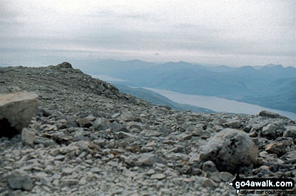 The summit of Ben Nevis
Photo: John Reed
Is there a Mountain, Peak, Top or Hill missing from the above google map or list?
Let us know an we will add it to our database.
To contribute to go4awalk.com or to contact us about anything at all - see Talk To Us.
For help see Help.
go4awalk.com and go4awalk.co.uk are registered trademarks of TMDH Limited.
Copyright © 2000-2026 TMDH Limited. All rights reserved.
Copyright Terms & Conditions Privacy Statement
A - Z Walks Home Log On/Accounts Photo Gallery Walk Ideas and Collections Fell Facts Hill Skills Walking Questions and Answers Your Stories News Competitions Product Reviews/Gear Tests Walking Gear Guides Peaks and Mountains Peak Bagging Find New Walking Friends Camping GPS Waypoints for Walking Contents Walk Search Talk To Us go4awalk.com Help Free Example Walks Newsletter


