UK Postcode LA6 - The 30 nearest easy-to-follow, circular walk route maps to you
The thirty nearest easy-to-follow, circular walk route maps to you in UK Postcode LA6 in Walk Grade Order
The UK cities, towns and villages in Lancashire, England that have LA6 in their UK Postcode include:
• Arkholme • Barbon • Borwick • Bullpot Farm • Burton in Lonsdale • Burton-in-Kendal • Cantsfield • Capernwray • Casterton • Chapel-le-Dale • Clawthorpe • Cowan Bridge • Farleton • Holme • Hutton Roof • Ingleton • Ireby • Kearstwick • Killington • Kirkby Lonsdale • Leck • Lupton • Mansergh • Melling • Middleton • Nether Burrow • Nether Kellet • Newton • Nook • Old Town • Over Kellet • Priest Hutton • Rigmaden Park • Skirwith • Slatenber • Tunstall • Weathercote • Westhouse • Whittington •
Not familiar with the area around LA6?
See these 30 nearest walks to UK Postcode LA6 on a google map

   |
Vital Statistics:
| Length: | 13.5 miles (21.5 km) |
| Ascent: | 2,317ft (706m) |
| Time: | 7.25hrs |
| Grade: |  |

Route Summary:
Hodge Bridge - Barbon - Thorn Moor - Eskholme Pike - Castle Knott - Calf Top - Barkin Top - Longbank Peat Moss - Long Bank - Fellside Farm - River Lune - Low Waterside Farm - Middleton Hall Bridge - Stockdale Beck - Applegarth - Borwens - Eller Beck - Barbon - Hodge Bridge


|
Vital Statistics:
| Length: | 8.5 miles (13.5 km) |
| Ascent: | 1,653ft (504m) |
| Time: | 4.75hrs |
| Grade: |  |

Route Summary:
Leck Fell House - The Three Men of Gragareth - Gragareth - Green Hill (Gragareth) - Lancashire County Stone - Great Coum - Crag Hill - Casterton Fell - Ease Gill - Leck Fell House

|
Vital Statistics:
| Length: | 4.75 miles (7.5 km) |
| Ascent: | 984ft (300m) |
| Time: | 3 hrs |
| Grade: |  |
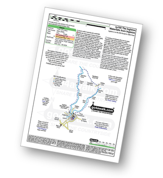
Route Summary:
Ingleton - The Ingleton Waterfalls Trail - River Twiss - Swilla Glen - The Money Tree - Helks - Mount - Manor Bridge - Constitution Hill - Pecca Bridge - Pecca Falls - Thornton Force - Raven Ray Bridge - Kingsdale - Twistleton Hall - River Doe - Beezley Falls - Rival Falls - Snow Falls - Ingleton

|
Vital Statistics:
| Length: | 16.5 miles (26 km) |
| Ascent: | 2,447ft (746m) |
| Time: | 8½ hrs |
| Grade: | |

Route Summary:
Ingleton - Thornton Hall Farm - Tow Scar - Gragareth - Green Hill (Gragareth) - Lancashire County Stone - High Pike - Kingsdale Beck - Braida Garth Farm - Twistleton Hall Farm - The Ingleton Waterfalls Trail - Beezley Falls - River Doe - Snow Falls - Ingleton

|
Vital Statistics:
| Length: | 10 miles (16 km) |
| Ascent: | 2,244ft (684m) |
| Time: | 5.75hrs |
| Grade: |  |

Route Summary:
Ingleton - Fell Lane - Crina Bottom Farm - Quaking Pot - Ingleborough - Humphrey Bottom - Ingleborough Nature Reserve - Braithwaite Wife Hole - Souther Scales Farm - Chapel-le-Dale - Twistleton Scars - Oddies Lane - The Ingleton Waterfalls Trail - Beezley Falls - Snow Falls - Ingleton

|
Vital Statistics:
| Length: | 9.5 miles (15 km) |
| Ascent: | 2,250ft (686m) |
| Time: | 5½ hrs |
| Grade: | |
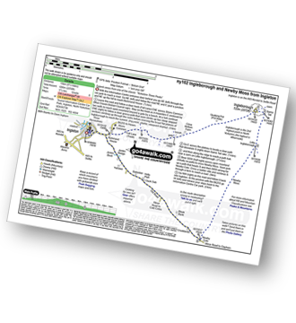
Route Summary:
Ingleton - Ingleton Information Centre - Richmond House - Fell Lane - Crina Bottom Farm - Quaking Pot - Ingleborough - Little Ingleborough - Newby Moss - Newby Cote - Bleak Bank - Duck Dub - Holly Platt - Slatenber - Jenkin Bridge - Ingleton

|
Vital Statistics:
| Length: | 5 miles (8 km) |
| Ascent: | 961ft (293m) |
| Time: | 3 hrs |
| Grade: | |

Route Summary:
Ingleton - Thornton Hall Farm - Kingsdale - River Dow - The Ingleton Waterfalls Trail Beezley Falls - Rival Falls - Snow Falls - Ingleton

|
Vital Statistics:
| Length: | 9.5 miles (15 km) |
| Ascent: | 2,362ft (720m) |
| Time: | 5.75hrs |
| Grade: | |

Route Summary:
Ingleton - Ingleton Tourist Information Centre - Fell Lane - Crina Bottom Farm - Quaking Pot - Ingleborough - Humphrey Bottom - Ingleborough Nature Reserve - Raven Scar - High Howeth - Harry Hallam's Moss - White Scars - Ingleton

|
Vital Statistics:
| Length: | 12.25 miles (19.5 km) |
| Ascent: | 1,568ft (478m) |
| Time: | 6 hrs |
| Grade: | |
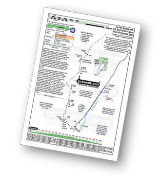
Route Summary:
Kingsdale - Tow Scar - Gragareth - Green Hill (Gragareth) - Lancashire County Stone - High Pike - Kingsdale Beck - Kingsdale

|
Vital Statistics:
| Length: | 9 miles (14.5 km) |
| Ascent: | 1,132ft (345m) |
| Time: | 4½ hrs |
| Grade: | |
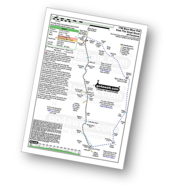
Route Summary:
The Great Stone of Forstone - Moor Cock Farm - Tatham Fells - Bank End Gate - Lyth Fell - Starkers Moor - Whitray Fell - Cross of Greet - Great Harlow - Raven's Castle - Crowd Stones - Thistley Hill - Thistle Hill - Tanstree Cragg - Burn Moor Fell - Hart Pot Gill - Stony Bank - Red Mire Queen of The Fairies Chair - Loftshaw Moss - The Great Stone of Forstone

|
Vital Statistics:
| Length: | 3.25 miles (5 km) |
| Ascent: | 131ft (40m) |
| Time: | 1.25hrs |
| Grade: |  |

Route Summary:
Crook o' Lune - Caton - The River Lune - Crook o' Lune Wood - Artle Beck - Waterworks Bridge - Applehouse Wood - Highfield Beck - Crook o' Lune

|
Vital Statistics:
| Length: | 11.5 miles (18.5 km) |
| Ascent: | 2,227ft (679m) |
| Time: | 6½ hrs |
| Grade: | |

Route Summary:
Ribblehead - (The Old Hill Inn) - Ingleborough Nature Reserve - Humphrey Bottom - Ingleborough - Simon Fell - Park Fell (Ribblehead) - New Close Farm - Ribblehead - Gunnerfleet Farm - Ivescar Farm - Broadrake Farm - Ellerbeck Farm - Jingle Pot - Chaple-le-Dale - The Old Hill Inn - Ribblehead

|
Vital Statistics:
| Length: | 8.25 miles (13 km) |
| Ascent: | 1,932ft (589m) |
| Time: | 5 hrs |
| Grade: | |

Route Summary:
Ribblehead - (The Old Hill Inn) - Chapel-le-Dale - Braithwaite Wife Hole - Ingleborough Nature Reserve - Humphrey Bottom - Ingleborough - Quaking Pot - Crina Bottom Farm - White Scars - High Howeth - Raven Scar - Harry Hallam's Moss - Old Hill Inn - Ribblehead

|
Vital Statistics:
| Length: | 3.75 miles (6 km) |
| Ascent: | 627ft (191m) |
| Time: | 2 hrs |
| Grade: |  |
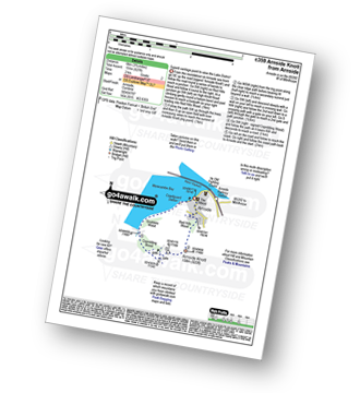
Route Summary:
Arnside (Morecambe Bay) - Red Hills Wood - Arnside Knott - Copridding Wood - Grubbins Wood - Morecambe Bay - The Cumbria Coastal Way - Arnside (Morecambe Bay)

|
Vital Statistics:
| Length: | 8.5 miles (13.5 km) |
| Ascent: | 2,178ft (664m) |
| Time: | 5 hrs |
| Grade: | |

Route Summary:
Clapham - Limekiln Plantation - Clapdale Farm - Ingleborough Cave - Trow Gill - Hernal Moss - Gaping Gill - Seat Haw - Little Ingleborough - Ingleborough - Little Ingleborough - Newby Moss - Cote Haw - Newby Cote - Clapham
Not familiar with the area around LA6?
See these 30 nearest walks to UK Postcode LA6 on a google map

|
Vital Statistics:
| Length: | 8.25 miles (13 km) |
| Ascent: | 951ft (290m) |
| Time: | 3.75hrs |
| Grade: |  |

Route Summary:
Clapham - Ingleborough Hall - Thwaite Lane - Summit Clump - Robin Proctor's Scar - Norber Brow - Nappa Scars - Crummack Lane - Crummack Farm - Crummack Dale - Begger's Stile - Thieves Moss - Sulber Gate - Long Scar - Long Lane (Track). Thwaite Scars - Clapham

|
Vital Statistics:
| Length: | 4 miles (6.5 km) |
| Ascent: | 558ft (170m) |
| Time: | 2 hrs |
| Grade: | |

Route Summary:
Clapham - Limekiln Plantation - Clapdale Farm - Ingleborough Cave - Trow Gill - Long Lane (Track) - Thwaite Scars - Thwaite Lane (Track) - Clapham

|
Vital Statistics:
| Length: | 5.5 miles (8.5 km) |
| Ascent: | 1,004ft (306m) |
| Time: | 3 hrs |
| Grade: | |

Route Summary:
Dent - Flinter Gill - Green Lane - Nun House Outrake - The Dales Way - River Dee - Dent

|
Vital Statistics:
| Length: | 9 miles (14.5 km) |
| Ascent: | 19,112ft (583m) |
| Time: | 5.25hrs |
| Grade: | |

Route Summary:
Dent - Flinter Gill - Crag Hill (Great Coum) - Great Coum - Lancashire County Stone - Blea Gills - Nun House Outrake - The Dales Way - River Dee - Dent

|
Vital Statistics:
| Length: | 12.25 miles (19.5 km) |
| Ascent: | 2,306ft (703m) |
| Time: | 6.70hrs |
| Grade: | |
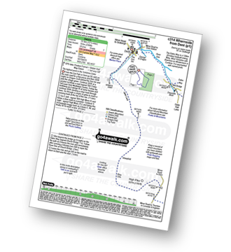
Route Summary:
Dent - Flinter Gill - Green Lane - High Pike - Whernside - Wernside Tarns - Craven Way - Mill Bridge (Deepdale Beck) - The Dales Way - Deepdale Beck - River Dee - Dent

|
Vital Statistics:
| Length: | 18 miles (29 km) |
| Ascent: | 2,945ft (898m) |
| Time: | 9½ hrs |
| Grade: |  |

Route Summary:
Dent - The Dales Way - Barth Bridge - Long Moor - Aye Gill Pike - Rise Hill - Little Snaizwold Fell - Snaizwold Fell - Cowgill Wold Moss - Crosshills Wold - Pikes Moss - Great Knoutberry Hill (Widdale Fell) - Arten Gill Beck - Dent Fell - The Dales Way - Stone House - Cowgill - Dent

|
Vital Statistics:
| Length: | 9.5 miles (15 km) |
| Ascent: | 1,404ft (428m) |
| Time: | 5 hrs |
| Grade: | |
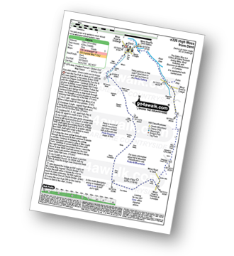
Route Summary:
Dent - Flinter Gill - Green Lane - Bill Varry's Moss - Garnet's Man - Megger Stones - Little Coombe Hill - Ralph's Moss - Flow Moss - Robin Constable - High Pike - High Moss - White Shaw - Deepdale Head - Johnston's Lathe - Mire Garth - Dyke Hall Lane - Deepdale Beck - The Dales Way - River Dee - Dent

|
Vital Statistics:
| Length: | 12.75 miles (20.5 km) |
| Ascent: | 1,830ft (558m) |
| Time: | 6½ hrs |
| Grade: | |

Route Summary:
Dent - The Dales Way - Barth Bridge - Long Moor - Aye Gill Pike - Rise Hill - Snaizwold Fell - Cowgill - The Dales Way - Dent

|
Vital Statistics:
| Length: | 7.75 miles (12.5 km) |
| Ascent: | 1,574ft (480m) |
| Time: | 4½ hrs |
| Grade: | |

Route Summary:
Ribblehead - Blea Moor - Force Gill - Grain Ing - Whernside - Broadrake Farm - Ivescar Farm - Ribblehead

|
Vital Statistics:
| Length: | 9 miles (14.5 km) |
| Ascent: | 1,644ft (501m) |
| Time: | 5 hrs |
| Grade: | |
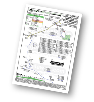
Route Summary:
Ribblehead - (Railway Station - After Train Journey From Horton in Ribblesdale) - B6255 - Old Hill Inn - Chapel-le-Dale - Braithwaite Wife Hole - Ingleborough - Pen-y-ghent Cafe - Horton in Ribblesdale.

|
Vital Statistics:
| Length: | 8.75 miles (14 km) |
| Ascent: | 1,772ft (540m) |
| Time: | 5 hrs |
| Grade: | |

Route Summary:
Ribblehead - (Railway Station) - Blea Moor Common - Blue Clay Ridge - Force Gill - Grain Ing - Greenset Moss - Whernside - Broadrake Farm - Bruntscar Farm - Philpin Farm - Scar Close - Ellerbeck Pasture - Ribblehead

|
Vital Statistics:
| Length: | 14 miles (22.5 km) |
| Ascent: | 3,207ft (977m) |
| Time: | 8½ hrs |
| Grade: | |

Route Summary:
Horton in Ribblesdale - Railway Station - Train Journey - Ribblehead Railway Station - Ribblehead - Blea Moor - Whernside - Broadrake Farm - Ribblehead - Blea Moor - Whernside - Broadrake Farm - Chapel-le-Dale - Braithwaite Wife Hole - Ingleborough - Pen-y-ghent Cafe - Horton in Ribblesdale.

|
Vital Statistics:
| Length: | 6.75 miles (11 km) |
| Ascent: | 1,243ft (379m) |
| Time: | 3.75hrs |
| Grade: | |
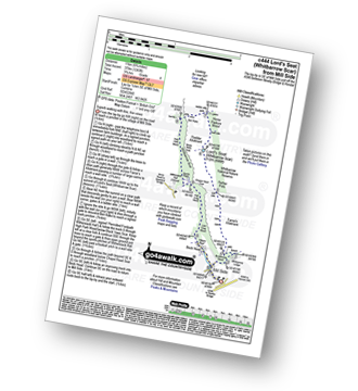
Route Summary:
Mill Side - Buckhouse Wood - Farrar's Allotment - Pether Pots. Whitbarrow National Nature Reserve - Lord's Seat (Whitbarrow Scar) - Flodder Allotment - Bell Rake - High Park Wood - Black Yew Scars - Witherslack Hall School - Chapel Head Scar - High Crag Wood - Low Crag Wood - Beck Head - Mill Side

|
Vital Statistics:
| Length: | 9.5 miles (15 km) |
| Ascent: | 3,114ft (949m) |
| Time: | 6½ hrs |
| Grade: | |

Route Summary:
Sedbergh - Settlebeck Gill - Winder Hill - Arant Haw - Calders - Bram Rigg Top - The Calf - White Fell Head - Long Rigg Beck - Ivy Crag - Eller Mire - Crosdale Beck - Nursery Wood - Lockbank Farm - Sedbergh

|
Vital Statistics:
| Length: | 5.75 miles (9 km) |
| Ascent: | 1,113ft (339m) |
| Time: | 3.25hrs |
| Grade: | |

Route Summary:
Cross of Greet Bridge - Near Crosty Clough - Shooters' Huts - Far Costy Clough - White Hill (Forest of Bowland) - Botton Head Hill - Whitray Fell - Cross of Greet - Cross of Greet Bridge
Not familiar with the area around LA6?
See these 30 nearest walks to UK Postcode LA6 on a google map





