
![]()
Great Knoutberry Hill (Widdale Fell)
672m (2205ft)
The Southern Dales Area, The Yorkshire Dales, Cumbria/North Yorkshire, England
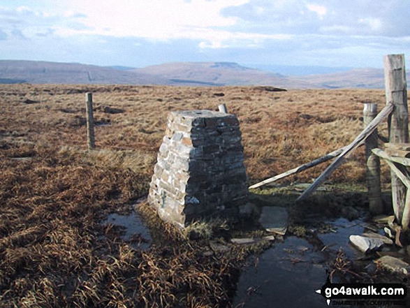
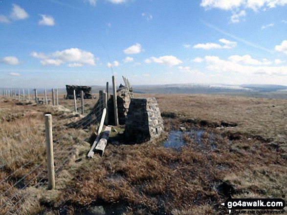
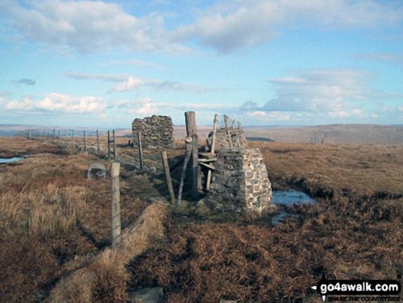
The summit of Great Knoutberry Hill (Widdale Fell) is marked by an Ordnance Survey Trig Point.
Not familiar with this top?
You can walk/hike to the top of Great Knoutberry Hill (Widdale Fell) by using any of these 4 easy‑to‑follow route maps:
Walk c157 Great Knoutberry Hill (Widdale Fell) from Crosshills Wold
Terrific panoramic views
   |
|---|
Vital Statistics:
| Length: | 4ml (6.5km) |
|---|---|
| Ascent: | 797ft (243m) |
| Time: | 2½ hrs |
| Grade: |  (Easy) (Easy) |
Route Summary:
Crosshills Wold (nr Dent Railway Station) - Pikes Moss - Great Knoutberry Hill (Widdale Fell) - Arten Gill Beck - Cross Wold - Crosshills Wold.
Walk c319 Cross Wold from Dent Railway Station
Terrific views of Dentdale
|
|---|
Vital Statistics:
| Length: | 6.5ml (10.5km) |
|---|---|
| Ascent: | 1,227ft (374m) |
| Time: | 3.75hrs |
| Grade: |  (Moderate) (Moderate) |

Route Summary:
Dent Railway Station - Crosshills Wold - Pikes Moss - Great Knoutberry Hill (Widdale Fell) - Arten Gill Beck - Dent Fell - The Dales Way - Stone House - Cowgill - Dent Railway Station
Walk c261 Great Knoutberry Hill (Widdale Fell) from Dent Station
Terrific panoramic views
|
|---|
Vital Statistics:
| Length: | 6.25ml (10km) |
|---|---|
| Ascent: | 1,548ft (472m) |
| Time: | 4 hrs |
| Grade: |  (Moderate) (Moderate) |
Route Summary:
Dent Railway Station - Crosshills Wold - Pikes Moss - Great Knoutberry Hill (Widdale Fell) - Arten Gill Beck - Dent Fell - The Dales Way - Stone House - Cowgill - Dent Railway Station
Walk c357 Aye Gill Pike, Snaizwold Fell and Great Knoutberry Hill from Dent
|
|---|
Vital Statistics:
| Length: | 18ml (29km) |
|---|---|
| Ascent: | 2,945ft (898m) |
| Time: | 9½ hrs |
| Grade: |  (Hard) (Hard) |

Route Summary:
Dent - The Dales Way - Barth Bridge - Long Moor - Aye Gill Pike - Rise Hill - Little Snaizwold Fell - Snaizwold Fell - Cowgill Wold Moss - Crosshills Wold - Pikes Moss - Great Knoutberry Hill (Widdale Fell) - Arten Gill Beck - Dent Fell - The Dales Way - Stone House - Cowgill - Dent
See Great Knoutberry Hill (Widdale Fell) and the surrounding tops on our free-to-access 'Google Style' Peak Bagging Maps:
The Southern Dales Area of The Yorkshire Dales National Park
Less data - quicker to download
The Whole of The Yorkshire Dales National Park
More data - might take a little longer to download
See Great Knoutberry Hill (Widdale Fell) and the surrounding tops on our unique, downloadable, PDF Peak Bagging Map:

NB: Whether you print off a copy or download it to your phone, this PDF Peak Baggers' Map might prove incredibly useful when your are up there on the tops and you cannot get a phone signal.
You can find Great Knoutberry Hill (Widdale Fell) & all the walks that climb it on these unique free-to-access Interactive Walk Planning Maps:
1:25,000 scale OS Explorer Map (orange/yellow covers):
1:50,000 scale OS Landranger Map (pink/magenta covers):
 Fellow go4awalkers who have already walked, climbed, scaled, summited, hiked & bagged Great Knoutberry Hill (Widdale Fell)
Philip Wilde walked up Great Knoutberry Hill (Widdale Fell) during 2022 [from/via/route] From Dent station
Chris Faulkner climbed it on March 20th, 2022 [from/via/route] Dent Station [with] Michelle Chandler [weather] Bright & blustery. - 3 hour wait for return train!!
Adrian Howard bagged it on June 22nd, 2017 [from/via/route] From minor road NW of summit
Margaret Richards hiked Great Knoutberry Hill (Widdale Fell) on September 5th, 2018 [from/via/route] Dent Station, C261 [with] Don [weather] Clear sunny day - Great views
Caroline Winter summited on October 23rd, 2017 [from/via/route] Pennine Bridle Way on road to Dent station, fence line on West side [with] Becky [weather] low cloud & drizzle. Visibility 40 M - Walked the wood post lying horizontally to get to the trig
To add (or remove) your name and experiences on this page - Log On and edit your Personal Mountain Bagging Record
. . . [see more walk reports]
More Photographs & Pictures of views from, on, or of, Great Knoutberry Hill (Widdale Fell)
Dentdale with Whernside (left) Calf Top (centre) and Aye Gill Pike (right) from Great Knoutberry Hill (Widdale Fell)

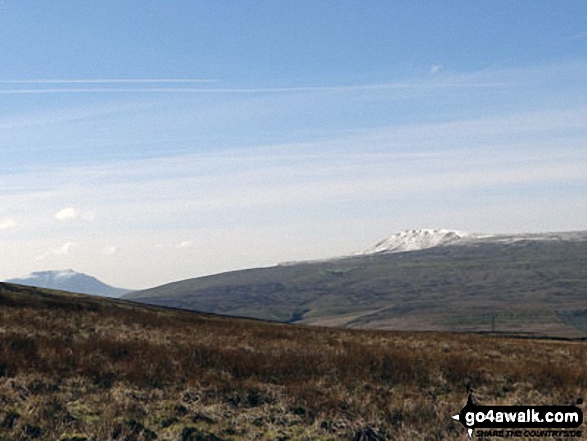
Snow on Whernside (left) and Pen-y-ghent from the path up Great Knoutberry Hill (Widdale Fell)

Curricks on Great Knoutberry Hill (Widdale Fell) with Ingleborough (centre) and Whernside (right) beyond
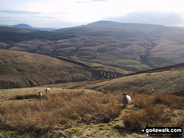
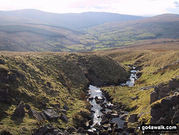
The Arten Gill Beck railway viaduct with Ingleborough (far left) and Whernside (centre) on the horizon from Great Knoutberry Hill (Widdale Fell)
Send us your photographs and pictures on, of, or from Great Knoutberry Hill (Widdale Fell)
If you would like to add your walk photographs and pictures to this page, please send them as email attachments (configured for any computer) along with your name to:
and we shall do our best to publish them.
(Guide Resolution = 300dpi. At least = 660pixels (wide) x 440 pixels (high).)

You can also submit photos via our Facebook Page.
NB. Please indicate where each photo was taken and whether you wish us to credit your photos with a Username or your First Name/Last Name.


