21 easy-to-follow walk, route maps of all grades on OS Landranger Map 41 Ben Nevis, Fort William & Glen Coe
Twenty-one easy-to-follow walk, route maps of all grades on OS Landranger Map 41 Ben Nevis, Fort William & Glen Coe in Walk Grade OrderTap/mouse over a coloured circle (1-3 easy walks, 4-6 moderate walks, 7-9 hard walks) and click to select.
You can use these checkboxes to show only the grades of walk you are interested in:-
Twenty-one easy-to-follow walk, route maps of all grades on OS Landranger Map 41 Ben Nevis, Fort William & Glen Coe in Walk Grade Order
Scroll down the list of walks below & click on each walk title (in blue) to locate it on the map above.
See this list of walks, routes & maps in:
Grade Order | Length Order | Time Order | Walk Number or Start Location Order
NB. To reverse (toggle) this order, click Grade Order again

   |
Vital Statistics:
| Length: | 10.25 miles (16.5 km) |
| Ascent: | 4,424ft (1,348m) |
| Time: | 8½ hrs |
| Grade: |  |

Route Summary:
Fort William - Achintee - Glen Nevis - The Ben Nevis Tourist Path - The Pony Track - Allt na H-Urchaire (Red Burn) - Lochan Meall an t-Suidhe - Coire Ghaimhnean (Five Finger Gully) - Ben Nevis - The Ben Nevis Tourist Path - Achintee - Fort William


|
Vital Statistics:
| Length: | 9.5 miles (15 km) |
| Ascent: | 6,173ft (1,881m) |
| Time: | 10 hrs |
| Grade: | |

Route Summary:
The Pass of Glencoe - The River Coe - Coire Nan Lochan - Stob Coire Nan Lochan (Bidean Nam Bian) - Bidean Nam Bian - Stob Coire Nam Beith (Bidean Nam Bian) - Bidean Nam Bian - Lost Valley Buttress - Bealach Dearg - Stob Coire Sgreamhach - Beinn Fhada (Stob Coire Sgreamhach) - Beinn Fhada (Stob Coire Sgreamhach) (North East Top) - Beinn Fhada (Stob Coire Sgreamhach) - Stob Coire Sgreamhach - Bealach Dearg - Coire Gabhail (The 'Lost Valley') - Allt Corrie Gabhail - The Pass of Glencoe

|
Vital Statistics:
| Length: | 6.5 miles (10.5 km) |
| Ascent: | 3,318ft (1,011m) |
| Time: | 6 hrs |
| Grade: |  |

Route Summary:
The Pass of Glencoe - Mam Buidhe - Stob Coire Raineach (Buachaille Etive Beag) - Buachaille Etive Beag (Stob Dubh) - Lairig Eilde - The Pass of Glencoe

|
Vital Statistics:
| Length: | 9.25 miles (14.5 km) |
| Ascent: | 2,194ft (669m) |
| Time: | 5½ hrs |
| Grade: | |


|
Vital Statistics:
| Length: | 7.75 miles (12.5 km) |
| Ascent: | 4,270ft (1,301m) |
| Time: | 7.25hrs |
| Grade: |  |
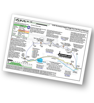
Route Summary:
The Pass of Glencoe - Allt-na-Reigh - Am Bodach (Aonach Eagach) - The Chancellor - Meall Dearg (Aonach Eagach) - Aonach Eagach Ridge - Stob Coire Leith (Aonach Eagach) - Sgorr Nam Fiannaidh (Aonach Eagach) - Clachaig Gully - Clachaig Inn - Loch Achtriochtan - The Pass of Glencoe

|
Vital Statistics:
| Length: | 10.25 miles (16.5 km) |
| Ascent: | 3,929ft (1,197m) |
| Time: | 7.75hrs |
| Grade: | |

Route Summary:
The Pass of Glencoe - The Kings House Hotel - Blackrock Cottage - Cam Ghleann - Stob a' Ghlais Choire (Creise) - Creise - Mam Coire Easain (Creise) - Clach Leathad (Creise) - Meall a' Bhuiridh - Allt Nan Giubhas - White Corries - Blackrock Cottage - The Kings House Hotel - The Pass of Glencoe

|
Vital Statistics:
| Length: | 5 miles (8 km) |
| Ascent: | 1,004ft (306m) |
| Time: | 3 hrs |
| Grade: |  |

Route Summary:
The Pass of Glencoe - Allt Corrie Gabhail - Coire Gabhail (The 'Lost Valley' of Glen Coe) - The Pass of Glencoe

|
Vital Statistics:
| Length: | 7.5 miles (12 km) |
| Ascent: | 3,016ft (919m) |
| Time: | 6½ hrs |
| Grade: | |
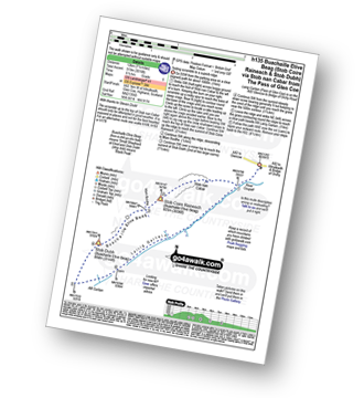
Route Summary:
The Pass of Glencoe - Stob Nan Cabar - Stob Coire Raineach (Buachaille Etive Beag) - Buachaille Etive Beag (Stob Dubh) - Lairig Gartain - The Pass of Glencoe

|
Vital Statistics:
| Length: | 12.25 miles (19.5 km) |
| Ascent: | 5,333ft (1,625m) |
| Time: | 10 hrs |
| Grade: |  |

Route Summary:
Fort William - Achintee - Glen Nevis - The Ben Nevis Tourist Path - The Pony Track - Allt na H-Urchaire (Red Burn) - Lochan Meall an t-Suidhe - Allt a' Mhuilinn - Carn Dearg Meadhonach (Carn Mor Dearg) - Carn Mor Dearg - Carn Mor Dearg Arete (CMD Arete) - Ben Nevis - Ben Nevis Tourist Path - Coire Ghaimhnean (Five Finger Gully) - Lochan Meall an t-Suidhe - Achintee - Fort William

|
Vital Statistics:
| Length: | 5.5 miles (9 km) |
| Ascent: | 2,501ft (762m) |
| Time: | 5.75hrs |
| Grade: |  |

Route Summary:
Glencoe Village - The Pass of Glencoe - Sgorr na Ciche (Pap of Glencoe) - Glencoe Village

|
Vital Statistics:
| Length: | 4.25 miles (6.5 km) |
| Ascent: | 2,491ft (759m) |
| Time: | 4 hrs |
| Grade: | |
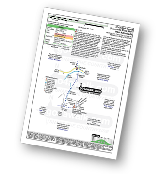
Route Summary:
Altnafeadh - The Pass of Glencoe - Lagangarbh Cottage - Allt Coire na Tulaich - Coire na Tulaich - Buachaille Etive Mor (Stob Dearg) - Coire na Tulaich - Allt Coire na Tulaich - Lagangarbh Cottage - The Pass of Glencoe - Altnafeadh.

|
Vital Statistics:
| Length: | 5 miles (8 km) |
| Ascent: | 2,983ft (909m) |
| Time: | 5 hrs |
| Grade: | |

Route Summary:
The Pass of Glencoe - Mam Buidhe - Stob Coire Raineach (Buachaille Etive Beag) - Buachaille Etive Beag (Stob Dubh) - Lairig Eilde - The Pass of Glencoe

|
Vital Statistics:
| Length: | 11.5 miles (18.5 km) |
| Ascent: | 3,919ft (1,194m) |
| Time: | 8½ hrs |
| Grade: | |

Route Summary:
The Nevis Range Mountain Gondola - Sgurr Finnisg-aig - Carn Beag Dearg (Carn Mor Dearg) - Carn Dearg Meadhonach (Carn Mor Dearg) - Carn Mor Dearg - Carn Mor Dearg Arete (CMD Arete) - Ben Nevis - Carn Dearg (Ben Nevis) (North West Top) - The Ben Nevis Tourist Path - Coire Ghaimhnean (Five Finger Gully) - Lochan Meall an t-Suidhe - Leanachan Forest - The Nevis Range Mountain Gondola

|
Vital Statistics:
| Length: | 6.5 miles (10.5 km) |
| Ascent: | 2,227ft (679m) |
| Time: | 4½ hrs |
| Grade: | |

Route Summary:
Altnafeadh - The Pass of Glen Coe - Stob Beinn a' Chrulaiste - Beinn a' Chrulaiste - The Kings House Hotel - The Old Military Road - The West Highland Way - Altnafeadh - The Pass of Glen Coe.

|
Vital Statistics:
| Length: | 9.75 miles (16.5 km) |
| Ascent: | 5,405ft (1,647m) |
| Time: | 9 hrs |
| Grade: | |

Route Summary:
The Pass of Glencoe - River Coe - Coire Nan Lochan - Aonach Dubh - Stob Coire Nan Lochan (Bidean Nam Bian) - Bidean Nam Bian - Stob Coire Nam Beith (Bidean Nam Bian) - Bidean Nam Bian - Lost Valley Buttress - Bealach Dearg - Stob Coire Sgreamhach - Beinn Fhada (Stob Coire Sgreamhach) - Beinn Fhada (Stob Coire Sgreamhach) (North East Top) - Beinn Fhada (Stob Coire Sgreamhach) (Far North East Top) - Lairig Eilde - Allt Lairig Eilde - The Pass of Glencoe

|
Vital Statistics:
| Length: | 8.75 miles (14 km) |
| Ascent: | 4,040ft (1,231m) |
| Time: | 7.25hrs |
| Grade: | |

Route Summary:
Glencoe Village - Sgorr na Ciche (Pap of Glencoe) - Sgorr Nam Fiannaidh (Aonach Eagach) - Clachaig Inn - Glencoe Village

|
Vital Statistics:
| Length: | 8.25 miles (13 km) |
| Ascent: | 3,814ft (1,162m) |
| Time: | 7 hrs |
| Grade: | |

Route Summary:
The Pass of Glencoe - A82 - Altnafeadh - Lagangarbh Cottage - Allt Coire na Tulaich - Coire na Tulaich - Buachaille Etive Mor (Stob Dearg) - Feadan Ban (Buachaille Etive Mor) - Stob na Doire (Buachaille Etive Mor) - Stob Coire Altruim (Buachaille Etive Mor) - Stob na Broige (Buachaille Etive Mor) - Lairig Gartain - A82 The Pass of Glencoe.

|
Vital Statistics:
| Length: | 8.25 miles (13 km) |
| Ascent: | 2,993ft (912m) |
| Time: | 6 hrs |
| Grade: | |
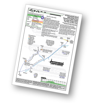
Route Summary:
The Pass of Glencoe - Stob Coire Raineach (Buachaille Etive Beag) - Buachaille Etive Beag (Stob Dubh) - Lairig Gartain - The Pass of Glencoe

|
Vital Statistics:
| Length: | 12.25 miles (19.5 km) |
| Ascent: | 4,322ft (1,317m) |
| Time: | 8.75hrs |
| Grade: | |

Route Summary:
A82 - Lochan na Stainge - Ba Cottage - Sron Nam Forsair - Clach Leathad (Creise) - Mam Coire Easain (Creise) - Creise - Stob a' Ghlais Choire (Creise) - Meall a' Bhuiridh - Ba Cottage - Lochan na Stainge - A82

|
Vital Statistics:
| Length: | 7.75 miles (12.5 km) |
| Ascent: | 4,391ft (1,338m) |
| Time: | 7.25hrs |
| Grade: | |

Route Summary:
The Pass of Glencoe - Coire Nan Lochan - Stob Coire Nan Lochan (Bidean Nam Bian) - Bidean Nam Bian - Stob Coire Nam Beith (Bidean Nam Bian) - Allt Coire Nam Beithach - A82 - Loch Achtriochtan - The Pass of Glencoe

|
Vital Statistics:
| Length: | 7.75 miles (12.5 km) |
| Ascent: | 4,175ft (1,272m) |
| Time: | 7.25hrs |
| Grade: | |

Route Summary:
South Ballachulish - Gleann a' Chaolais - Beinn a' Bheithir Ridge - Sgorr Dhearg (Beinn a' Bheithir) - Sgorr Dhonuill (Beinn a' Bheithir) - South Ballachulish - Glencoe.
See this list of walks, routes & maps in:
Grade Order | Length Order | Time Order | Walk Number or Start Location Order
NB. To reverse (toggle) this order, click Grade Order again