Wasdale Head with Pillar beyond from the lower slopes of Lingmell & Scafell Pike
The Southern Fells,
The Lake District National Park,
Cumbria, England

See views like this by using any of these 10 easy-to-follow circular walk route maps:

   |
Vital Statistics:
| Length: | 9 miles (14.5 km) |
| Ascent: | 2,402ft (732m) |
| Time: | 5.75hrs |
| Grade: |  |
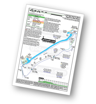
Route Summary:
Wasdale Head - (National Trust Campsite) - Wast Water - Lingmell Gill - Illgill Head - Whin Rigg - Greathall Gill - Wasdale Hall Youth Hostel - Wast Water - Wasdale Head


|
Vital Statistics:
| Length: | 7.5 miles (12 km) |
| Ascent: | 3,218ft (981m) |
| Time: | 6 hrs |
| Grade: | |

Route Summary:
Wasdale Head - Lingmell Gill - Brown Tongue - Hollow Stones - Mickledore - Scafell Pike - The Corridor Route - Sty Head - Lingmell Beck - Gable Beck Bridge - Wasdale Head - Wast Water.

|
Vital Statistics:
| Length: | 6.25 miles (10 km) |
| Ascent: | 3,187ft (971m) |
| Time: | 5½ hrs |
| Grade: | |

Route Summary:
Wasdale Head - Lingmell Gill - Brown Tongue - Hollow Stones - Mickledore - Scafell Pike - Mickledore - Lingmell Beck - Wasdale Head - Wast Water.

|
Vital Statistics:
| Length: | 11.25 miles (18 km) |
| Ascent: | 3,275ft (998m) |
| Time: | 7½ hrs |
| Grade: |  |

Route Summary:
Bowness Knott Car Park Ennerdale Water - Char Dub - Silver Cove Beck - Woundell Beck - Caw Fell - Little Gowder Crag - Haycock - Great Scoat Fell - Scoat Fell (Little Scoat Fell) - Steeple - Long Crag - Moss Dub - Lingmell Plantation - Bowness Knott Car Park Ennerdale Water.

|
Vital Statistics:
| Length: | 7.5 miles (12 km) |
| Ascent: | 4,195ft (1,279m) |
| Time: | 7 hrs |
| Grade: | |

Route Summary:
Wasdale Head - (National Trust Campsite) - Wast Water - Lingmell - Corridor Route - Scafell Pike - Mickledore - Foxes Tarn - Symonds Knott - Sca Fell - Lingmell Gill - Wasdale Head - Wast Water.

|
Vital Statistics:
| Length: | 9 miles (14.5 km) |
| Ascent: | 3,696ft (1,126m) |
| Time: | 7 hrs |
| Grade: | |

Route Summary:
Wasdale Head - Wast Water - Lingmell - Lingmell Col - Scafell Pike - Broad Crag - Ill Crag - Great End - Esk Hause - Sty Head - Lingmell Beck - Gable Beck Bridge - Wasdale Head - Wast Water.

|
Vital Statistics:
| Length: | 9.75 miles (15.5 km) |
| Ascent: | 5,140ft (1,567m) |
| Time: | 8.75hrs |
| Grade: |  |

Route Summary:
Wasdale Head - (National Trust Campsite) - Wast Water - Lingmell - Middleboot Knotts - Round How (Scafell) - Great End - Ill Crag - Broad Crag - Scafell Pike - Mickledore - Foxes Tarn - Symonds Knott - Sca Fell - Wast Water.

|
Vital Statistics:
| Length: | 11 miles (17.5 km) |
| Ascent: | 5,409ft (1,648m) |
| Time: | 9½ hrs |
| Grade: | |

Route Summary:
Wasdale Head - (National Trust Campsite) - Wast Water - Lingmell - Corridor Route - Great End - Ill Crag - Broad Crag - Scafell Pike - Mickledore - Foxes Tarn - Symonds Knott - Sca Fell - Slight Side - Broad Tongue - Hardrigg Gill - Wasdale Head - Wast Water.

|
Vital Statistics:
| Length: | 11.25 miles (18 km) |
| Ascent: | 5,819ft (1,773m) |
| Time: | 10 hrs |
| Grade: |  |

Route Summary:
Wasdale Head - Moses' Trod - Lingmell Beck - Gable Beck Bridge - Sty Head - Great Gable - Westmorland Cairn - Beck Head - Beckhead Tarn - Kirk Fell (East Top) - Kirk Fell - Black Sail Pass - Looking Stead (Pillar) - High Level Route - Robinson's Cairn - Pillar - Wind Gap - Black Crag (Pillar) - Scoat Fell (Little Scoat Fell) - Steeple - Red Pike (Wasdale) - Dore Head - Mosedale Beck - Wasdale Head - Wast Water.

|
Vital Statistics:
| Length: | 15.25 miles (24.5 km) |
| Ascent: | 4,841ft (1,475m) |
| Time: | 10½ hrs |
| Grade: | |

Route Summary:
Wasdale Head - (National Trust Campsite) - Wast Water - Lingmell Gill - Illgill Head - Whin Rigg - Greathall Gill - Low Wood - Lund Bridge - Woodhow Farm - Woodhow Tarn - Scale Farm - Tosh Tarn - Gill Farm - Gill Beck - Buckbarrow - Cold Well - Nether Wasdale Common - Seatallan - Windscale Hows - Middle Fell (Wasdale) - Greendale Farm - Nether Beck - Overbeck Bridge - Wasdale Head - Wast Water.
Send us your photographs and pictures of walks and hikes in the British countryside
If you would like to see your digital photographs as part of this collection, please send them as email attachments (configured for any computer) along with your name to:
and we shall do our best to publish them.
(Guide Resolution = 300dpi. At least = 587 pixels (wide) x 440 pixels (high).)

You can also submit photos via our Facebook Page.
NB. Please indicate where each photo was taken.
NB. To see photographs and pictures from a particular walk choose your walk from Walks or use our Walk Search facility.
To see photographs and pictures on, of or from a particular Mountain, Peak, Top or Hill select from Peaks & Mountains' or enter the Mountain, Peak, Top or Hill Name into our 'Photo Search facility.