Wainwright & Dewey Icon

Whin Rigg
535m (1756ft)

The Southern Fells, The Lake District, Cumbria, England


Tap/mouse over a coloured circle (1-3 easy walks, 4-6 moderate walks, 7-9 hard walks) and click to select.


Record Whin Rigg as Bagged, Climbed & Conquered


Wainwright Icon

Wainwright
(No. 156)

English Dewey Icon

English Dewey
103rd in England,
239th in England & Wales

Walk Whin Rigg walking UK Mountains in The Southern Fells The Lake District National Park Cumbria, England

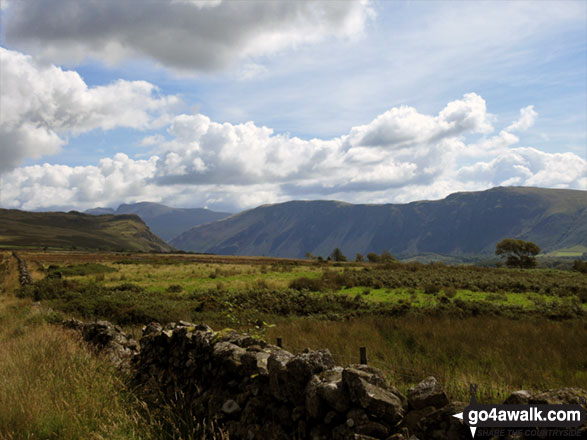
The view from the summit of Whin Rigg

Photo: Mick Fox

You can find Whin Rigg & all the walks that climb it on these unique free-to-access Interactive Walk Planning Maps: (click/TAP to select)

The Lake District National Park


1:25,000 scale OS Explorer Map (the ones with orange/yellow covers):

OL6 The English Lakes - South Western area


1:50,000 scale OS Landranger Map (the ones with pink/magenta covers):

89 West Cumbria, Cockermouth & Wast Water


See Whin Rigg and the surrounding tops on our free-to-access 'Google Style' Peak Bagging Maps:

See Whin Rigg and the surrounding tops on our downloadable PDF Peak Bagging Maps:

NB: Whether you print off a copy on to paper or download it to your phone, these PDF Peak Baggers Maps will prove incredibly useful when your are up there on the tops and you cannot get a phone signal!


You can walk to the top of Whin Rigg by using any of these 3 easy‑to‑follow route maps:
Walking Boot Print Icon

Walk c440 Whin Rigg, Illgill Head and Boat How from Miterdale Bridge

Superb views of Wast Water, the Scafell Massif and the southern fells

Walk GPS Icon
Walk GPX Icon
Walk PDF Icon

Vital Statistics:

Length: 8.75ml (14km)
Ascent:2,347ft (715m)
Time:5½ hrs
Grade:Walk Grade 6 Icon (Moderate)
Walking Boot Print Icon

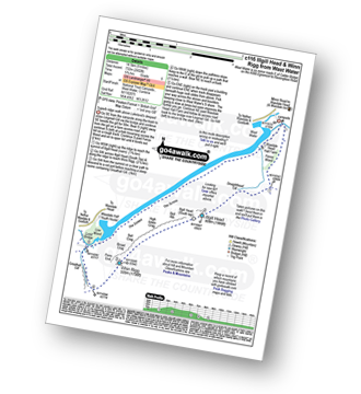
Walk c116 Illgill Head and Whin Rigg from Wasdale Head, Wast Water

Superb ridge walk above Lakeland's deepest lake

Walk GPS Icon
Walk GPX Icon
Walk PDF Icon

Vital Statistics:

Length: 9ml (14.5km)
Ascent:2,402ft (732m)
Time:5.75hrs
Grade:Walk Grade 6 Icon (Moderate)
Walking Boot Print Icon

Walk c423 The Wast Water Round from Wasdale Head, Wast Water

Testing hike around Lakeland's deepest lake

Walk GPS Icon
Walk GPX Icon
Walk PDF Icon

Vital Statistics:

Length: 15.25ml (24.5km)
Ascent:4,841ft (1,475m)
Time:10½ hrs
Grade:Walk Grade 9 Icon (Very Hard)

Other walkers who hiked, climbed, bagged and summited Whin Rigg Fellow go4awalkers who have already walked, climbed, summited & bagged Whin Rigg

Caroline Winter walked up Whin Rigg on October 13th, 2024 [from/via/route] Wasdale road, NT car park, Illgill head, Whinn Rigg, gill, river Irt, Wastwater [with] Solo [weather] Warm, wind 10mph, clear views over Soloway & Wasdale Fells - Change from yesterday of max 44 mph winds in Wasdale Head. Interesting to view mountain face walking along river Irt & nice walk through coppice. Dipped in Wastwater before driving off.

Geoff Hand climbed Whin Rigg on June 29th, 2024 [from/via/route] Walk C440 Whin Rigg, Illgill Head from Miterdale Bridge [with] Claire my daughter [weather] Cold claggy & wet - did the walk as part of the Wainwright Challenge 2024, which was to put someone on top of every Wainwright in one day. Unfortunately it was a wet & miserable day. We didn't get to see a thing. We missed our Boat How as it would have meant walking infront of Burnmoor Tarn which looked really wet & boggy.It is an outlying Wainwright in any case so wouldn't count.

Ian Ashton bagged Whin Rigg on March 29th, 2024 [with] Solo

Pete George hiked Whin Rigg on December 13th, 2023 [from/via/route] Wasdale [with] Roco [weather] Quite pleasant

James Hughes summited Whin Rigg on July 9th, 2023 [from/via/route] From Wasdale Head Inn through NT campsite over Illgill Head & Whinn Rigg, back up Miterdale. [with] Paul [weather] Beautiful day, some cloud to start with & that cleared & was warmer when dropped back into valley. - Couple of Ritson's & an underwhelming Pork Pie before a drive back over Hard Knott Pass - lovely weekend.

Christine Shepherd conquered Whin Rigg on August 18th, 2009 [from/via/route] Walked from Wasdale Head using walk c116 Climbed again from Eskdale on a glorious day on 20.07.2021 Climbed for a third time from Eskdale on a very hot, humid day. 12.6.23 [with] On my own [weather] Rainy & misty

Richard Marchant scaled Whin Rigg on September 29th, 2022 [from/via/route] Parked at a small car park at Porterthwaite in Miterdale. From here I took a NW route up through the forest onto Irton Fell & then I followed the ridge NE up to Whin Rigg. Then I carried on in a NE direction taking the nearest path to the tops of The Screes of Wast Water on to Illgill Head. from here I carried on in a NE direction to the pass then turn to a SW direction & on to Tongue Moor above Burnmoor Tarn & basically back down through Miterdale to the car. [with] On my Own [weather] Sunny clear day with no breeze.

Victoria Bates walked up Whin Rigg on June 1st, 2022 [from/via/route] Irton Fell car park with Whinn Rigg [with] Mark and Tabitha [weather] Cool, no wind or rain

Julie Clough climbed Whin Rigg on October 10th, 2021 [from/via/route] Wastwater shore loop, via Ilgill Head. [with] Myself & my healing broken toe [weather] Sunny but windy - Hard work with toe & lost fitness but stupendous views

Richard Annett bagged Whin Rigg on July 31st, 2021 [from/via/route] Porterthwaite little car park [with] Euan [weather] Cloudy & rainy - Bower House Inn, Akash & Premier Inn. Ludicrous hottie at pub.

To add (or remove) your name and experiences on this page - Log On and edit your Personal Mountain Bagging Record

. . . [see more walk reports]


More Photographs & Pictures of views from, on or of Whin Rigg

Whin Rigg summit cairn

Whin Rigg summit cairn

Photo: Christine Shepherd (916)

Red Pike (centre left), Pillar, Yewbarrow (centre), Kirk Fell & Great Gable (right) beyond Wast Water from Whin Rigg

Red Pike (centre left), Pillar, Yewbarrow (centre), Kirk Fell & Great Gable (right) beyond Wast Water from Whin Rigg

Photo: Ian Mansell (12)

The Wasdale Valley featuring Lingmell (left), Illgill Head and Whin Rigg (left of centre in the distance), Wast Water (centre) and Yewbarrow (right) from near Westmorland Cairn on the summit of Great Gable

The Wasdale Valley featuring Lingmell (left), Illgill Head and Whin Rigg (left of centre in the distance), Wast Water (centre) and Yewbarrow (right) from near Westmorland Cairn on the summit of Great Gable

Photo: Ian Mansell (14)

The Scafell Massif, Illgill Head, Whin Rigg and the Wast Water Screes from Buckbarrow

The Scafell Massif, Illgill Head, Whin Rigg and the Wast Water Screes from Buckbarrow

Photo: Alan Wainwright (63)

Whin Rigg (left) and Lund Bridge from Buckbarrow

Whin Rigg (left) and Lund Bridge from Buckbarrow

Photo: Chris Brankin (40)

The Wast Water Screes below Illgill Head and Whin Rigg

The Wast Water Screes below Illgill Head and Whin Rigg

Photo: Ian Mansell (13)

Greathall Gill between Irton Pike and Whin Rigg

Greathall Gill between Irton Pike and Whin Rigg

Photo: Steven Mostyn (2)

Irton Fell summit cairn with Whin Rigg in the background

Irton Fell summit cairn with Whin Rigg in the background

Photo: Steven Mostyn (1)

Wasdale featuring Lingmell (left), Illgill Head and Whin Rigg (left of centre in the distance), Wast Water (centre) and Yewbarrow (right) from Westmorland Cairn near the summit of Great Gable

Wasdale featuring Lingmell (left), Illgill Head and Whin Rigg (left of centre in the distance), Wast Water (centre) and Yewbarrow (right) from Westmorland Cairn near the summit of Great Gable

Photo: Karen Harding (5)

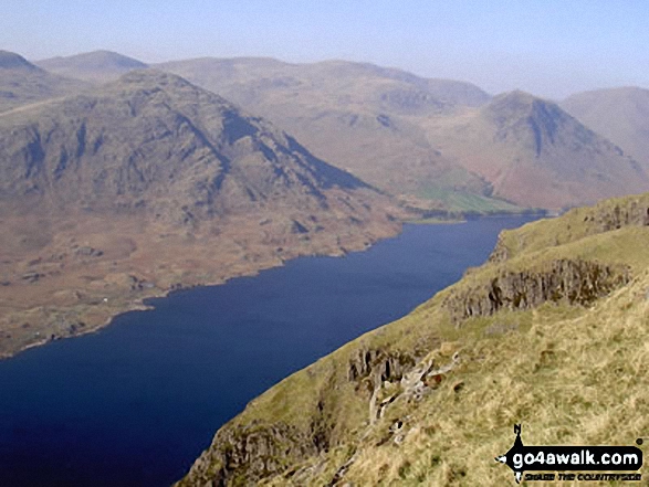
Illgill Head, Whin Rigg and Wast Water from Yewbarrow

Illgill Head, Whin Rigg and Wast Water from Yewbarrow

Photo: David Connolly (42)

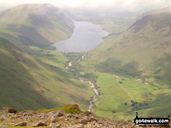
Wast Water from Whin Rigg summit

Wast Water from Whin Rigg summit

Photo: Steven Mostyn (4)

Yewbarrow, Wasdale Head, Wast Water, Lingmell, Scafell Pike, Mickledore and Sca Fell, Illgill Head and Whin Rigg from below Middle Fell (Wasdale)
Yewbarrow, Wasdale Head, Wast Water, Lingmell, Scafell Pike, Mickledore and Sca Fell, Illgill Head and Whin Rigg from below Middle Fell (Wasdale)

Photo: Alan Wainwright (72)

Wast Water with the Scafel Massive (far left- featuring Ling Mell, Great End, Broad Crag, Ill Crag, Scafell Pike, Symonds Knott and Sca Fell) and Illgill Head (centre) and Whin Rigg (centre right) above the Wast Water screes from Buckbarrow

Wast Water with the Scafel Massive (far left- featuring Ling Mell, Great End, Broad Crag, Ill Crag, Scafell Pike, Symonds Knott and Sca Fell) and Illgill Head (centre) and Whin Rigg (centre right) above the Wast Water screes from Buckbarrow

Photo: Chris Brankin (37)

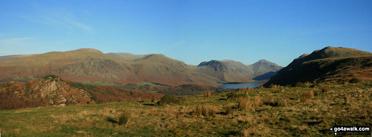
Seatallan, Great Scoat Fell, Little Scoat Fell, Red Pike (Wasdale), Yewbarrow, Kirk Fell, Great Gable and Whin Rigg from Irton Pike

Seatallan, Great Scoat Fell, Little Scoat Fell, Red Pike (Wasdale), Yewbarrow, Kirk Fell, Great Gable and Whin Rigg from Irton Pike

Photo: Andy Malcolm (179)

The Wasdale Screes below Illgill Head (centre) and Whin Rigg (right) from Ponsonby Fell

The Wasdale Screes below Illgill Head (centre) and Whin Rigg (right) from Ponsonby Fell

Photo: Christine Shepherd (623)

Burnmoor Tarn, Whin Rigg and Illgill Head from Sca Fell

Burnmoor Tarn, Whin Rigg and Illgill Head from Sca Fell

Photo: Gerry Ball (55)

Illgill Head and Whin Rigg (left) Wast Water and Yewbarrow and Middle Fell (right) from Westmorland Cairn, Great Gable

Illgill Head and Whin Rigg (left) Wast Water and Yewbarrow and Middle Fell (right) from Westmorland Cairn, Great Gable

Photo: Ian Mansell (2)

Whin Rigg and Wast Water from Middle Fell (Wasdale) summit cairn

Whin Rigg and Wast Water from Middle Fell (Wasdale) summit cairn

Photo: Alan Wainwright (70)

Illgill Head (left) and Whin Rigg (right) above the Wast Water screes from Buckbarrow

Illgill Head (left) and Whin Rigg (right) above the Wast Water screes from Buckbarrow

Photo: Chris Brankin (39)

Whin Rigg summit cairn

Whin Rigg summit cairn

Photo: Steven Mostyn (3)


. . . see all 23 walk photographs & pictures of views from, on or of Whin Rigg


Send us your photographs and pictures on, of, or from Whin Rigg

If you would like to add your walk photographs and pictures featuring views from, on or of Whin Rigg to this page, please send them as email attachments (configured for any computer) along with your name to:


and we shall do our best to publish them.

(Guide Resolution = 300dpi. At least = 660pixels (wide) x 440 pixels (high).)

Send us your photographs and pictures on, of, or from Whin Rigg via Facebook

You can also submit photos via our Facebook Page.

NB. Please indicate where each photo was taken.


Follow go4awalk.com on Twitter Follow go4awalk.com on Facebook


Home


Find new Friends to go walking with

Walk all 214 Wainwrights in just 59 Walks. Download GPS Waypoints - Great Walks you must not miss!

Walk The Yorkshire Three Peaks Challenge Walk - All the Latest Route Information, GPS Waypoints and Split Times to keep you on Schedule

Walk The British Three Peaks Challenge Walk - All the Latest Route Information and GPS Waypoints

See our pick of The Best Walks in The Lake District - Great Walks you must not miss!

Walk our pick of the Best Lake District Ridge Walks - Great Walks you must not miss!

Walk our pick of the Best Lake District Walks to do in the rain - Great Walks you must not miss!

Walk our pick of The Best Walks in Snowdonia - Great Walks you must not miss!

Walk our pick of The Best Ridge Walks in Wales - Walks you must not miss!

Walk our pick of The Best Walks in The Brecon Beacons - Great Walks you must not miss!

Walk our pick of The Best Walks in The Yorkshire Dales - Walks you must not miss!

Walk our pick of The Best Walks in The Peak District - Walks you must not miss!

Walk our pick of The Best Walks in The Forest of Bowland - Walks you must not miss!

Walk our pick of The Best Walks in Shropshire - Walks you must not miss!

Walk our pick of The Best Walks in Cheshire - Walks you must not miss!

Walk our pick of The Best Walks in Lancashire - Walks you must not miss!

Not sure where to walk next? Try Peak Bagging - Great Walks you must not miss!

Not sure where to walk next? Walk part of a National Trail - Great Walks you must not miss!

Walks with Downloadable and Uploadable GPS Waypoint Data

Walking Kit and Gear Tested by Walkers

Full Site Search
Do not miss our pick of the Best Walks in the UK