
![]()
Troutbeck Tongue
364m (1195ft)
The Far Eastern Fells, The Lake District, Cumbria, England

Not familiar with this top?
   |
|---|
Vital Statistics:
| Length: | 8.25ml (13km) |
|---|---|
| Ascent: | 1,421ft (433m) |
| Time: | 4½ hrs |
| Grade: |  (Moderate) (Moderate) |

Route Summary:
Troutbeck Bridge - Troutbeck - Limefitt Holiday Park - Long Green Head - Ing Bridge - Troutbeck Park - Park Fell Head - Trout Beck - Troutbeck Tongue - Hagg Gill - Lowther Brow - Long Green Head - Limefitt Holiday Park - Troutbeck - Troutbeck Bridge
|
|---|
Vital Statistics:
| Length: | 11ml (17.5km) |
|---|---|
| Ascent: | 3,410ft (1,039m) |
| Time: | 7½ hrs |
| Grade: |  (Hard) (Hard) |

Route Summary:
Troutbeck Bridge - Garburn Road - Backstone Barrow - Sour Howes - Sallows - Garburn Pass - Yoke - Ill Bell - Froswick - Wanfer Crag - Hagg Gill - Trout Beck - Troutbeck Tongue - Lowther Brow - Long Green Head - Limefitt Campsite - Troutbeck - Troutbeck Bridge
|
|---|
Vital Statistics:
| Length: | 12.25ml (19.5km) |
|---|---|
| Ascent: | 4,194ft (1,278m) |
| Time: | 8.75hrs |
| Grade: |  (Hard) (Hard) |
Route Summary:
Troutbeck Bridge - Garburn Pass - Yoke - Ill Bell - Froswick - Thornthwaite Crag - Stony Cove Pike (Caudale Moor) - Doup Crag - Trout Beck - Troutbeck Tongue - Hagg Gill - Lowther Brow - Long Green Head - Limefitt Campsite - Troutbeck - Troutbeck Bridge
See Troutbeck Tongue and the surrounding tops on our free-to-access 'Google Style' Peak Bagging Maps:
The Far Eastern Fells of The Lake District National Park
Less data - quicker to download
The Whole of The Lake District National Park
More data - might take a little longer to download
See Troutbeck Tongue and the surrounding tops on our downloadable Peak Bagging Maps in PDF format:

NB: Whether you print off a copy or download it to your phone, these PDF Peak Baggers' Maps might prove incredibly useful when your are up there on the tops and you cannot get a phone signal.
*This version is marked with the walk routes you need to follow to Walk all 214 Wainwrights in just 59 walks.
You can find Troutbeck Tongue & all the walks that climb it on these unique free-to-access Interactive Walk Planning Maps:
1:25,000 scale OS Explorer Map (orange/yellow covers):
1:50,000 scale OS Landranger Map (pink/magenta covers):
 Fellow go4awalkers who have already walked, climbed, summited & bagged Troutbeck Tongue
Martin Hartshorne walked up Troutbeck Tongue on January 20th, 2026 [from/via/route] Dubbs road [with] finley [weather] Mostly grey but skies but clear. Windy out of tje valley & cold
Mr M A Blanchard climbed it on December 12th, 2025 [with] The mutts
James Hughes bagged it on September 11th, 2024 [from/via/route] c332 The Hagg Gill Round from Troutbeck [weather] Mixed. Odd shower, warm in valleys, cold on tops. Clear visibility. - Stunning & reasonably straight forward easy to navigate walk. Beautiful vistas. Multiple jet fly-bys. Tongue boggy & tusoucky in places. Mortal Man for post walk pint.
Ian Ashton hiked Troutbeck Tongue on May 3rd, 2024 [with] Steve H - Ì
Paul Roddam summited on March 17th, 2024 [with] Barber [weather] Cloudy coming into sun
To add (or remove) your name and experiences on this page - Log On and edit your Personal Mountain Bagging Record
. . . [see more walk reports]
More Photographs & Pictures of views from, on or of Troutbeck Tongue

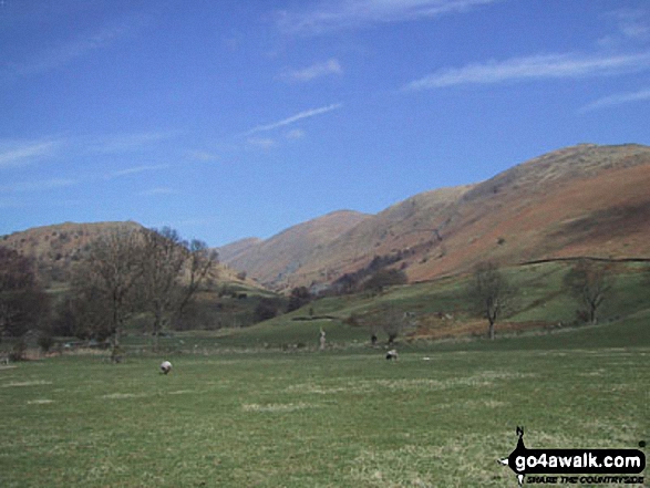
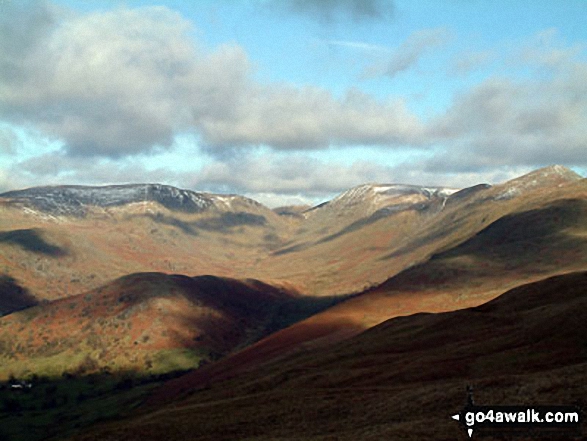
Stony Cove Pike (Caudale Moor) (left), Thresthwaite Mouth and Thornthwaite Crag (right) from the Northern end of Troutbeck Tongue

Troutbeck Tongue from Garburn Road with Stony Cove Pike and Thornthwaite Crag beyond covered in cloud

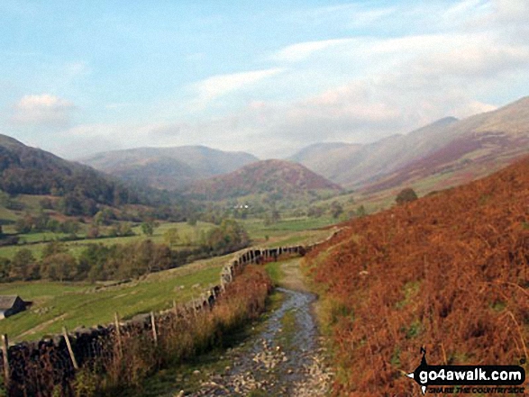
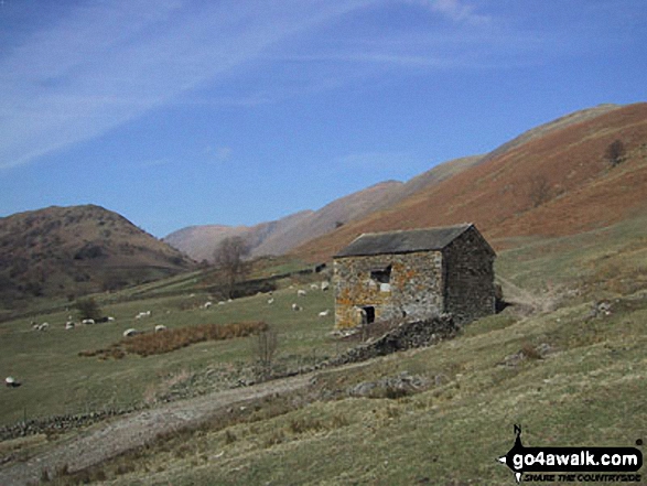
Troutbeck from the path beside Hagg Gill on the East side of Troutbeck Tongue
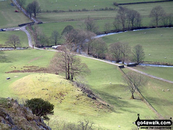


Looking South towards Troutbeck and Windermere from Troutbeck Tongue summit
. . . see just 10 walk photographs & pictures of views from, on or of Troutbeck Tongue
Send us your photographs and pictures on, of, or from Troutbeck Tongue
If you would like to add your walk photographs and pictures to this page, please send them as email attachments (configured for any computer) along with your name to:
and we shall do our best to publish them.
(Guide Resolution = 300dpi. At least = 660pixels (wide) x 440 pixels (high).)

You can also submit photos via our Facebook Page.
NB. Please indicate where each photo was taken and whether you wish us to credit your photos with a Username or your First Name/Last Name.


