The Wrekin
407m (1335ft)
The Shropshire Hills Area of Outstanding Natural Beauty, Shropshire, England
Tap/mouse over a coloured circle (1-3 easy walks, 4-6 moderate walks, 7-9 hard walks) and click to select.
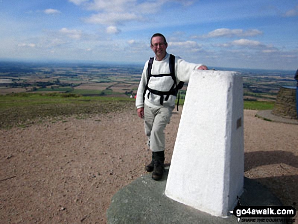
The summit of The Wrekin is marked by an Ordnance Survey Trig Point.
Not familiar with this top?
See The Wrekin and the surrounding tops on our free-to-access 'Google Style' Peak Bagging Map:
The Shropshire Hills
Less data - quicker to download
See The Wrekin and the surrounding tops on our downloadable Peak Bagging Map in PDF format:
NB: Whether you print off a copy or download it to your phone, this PDF Peak Baggers' Map might prove incredibly useful when your are up there on the tops and you cannot get a phone signal.
Free-to-access Interactive Walk Planning Maps:
1:25,000 scale OS Explorer Map (orange/yellow covers):
An Interactive Walk Planning Map for OS Explorer 242 Telford, Ironbridge & The Wrekin is not currently available
1:50,000 scale OS Landranger Map (pink/magenta covers):
An Interactive Walk Planning Map for OS Landranger 127 Stafford & Telford, Ironbridge is not currently available
 Fellow go4awalkers who have already walked, climbed, summited & bagged The Wrekin
Sue Bromley walked up The Wrekin on December 12th, 2021 [from/via/route] Round, up steep side back down main
Robert Lloyd climbed it on September 27th, 2018 [with] Imelda [weather] Sunny - Excellent walk & views.
Jennifer Beale bagged it on October 5th, 2013 [from/via/route] Main car park [with] Charlie [weather] T-shirt weather - Remembering grandad
Stephen Reader hiked The Wrekin on August 30th, 2015 [from/via/route] Circular walk including The Ercall ascent via Little Hill [with] Bev and Afia [weather] Light cloud & light rain
Marilyn Wadkin summited on January 19th, 2014 [from/via/route] Up Wrekin Trail, down & back through Wenlocks Woods [with] Rob, Nathan8, Alisha6 & Jack4 [weather] Cold & grey
Samantha Kimber conquered it on August 18th, 2013 [with] Hubby & Kids (aged 5, 4 and 1.5 yrs) [weather] Sunny & breezy...perfect! - One of many summits for me but the first for all three kids. My four year old daughter was especially pleased to make it to the top: "my whole body was aching & I thought I wouldn't make it...but I did!"
Kenneth Mellor scaled it during 2013 [from/via/route] Past Halfway House twice in 2 days [with] Sarah [weather] Excellent
Peter Bourne, Tracy Hudson , Mark Davidson and Roderick Devall have all walked, climbed & bagged The Wrekin.
To add (or remove) your name and experiences on this page - Log On and edit your Personal Mountain Bagging Record
More Photographs & Pictures of views from, on or of The Wrekin
. . . see all 10 walk photographs & pictures of views from, on or of The Wrekin
Send us your photographs and pictures on, of, or from The Wrekin
If you would like to add your walk photographs and pictures to this page, please send them as email attachments (configured for any computer) along with your name to:
and we shall do our best to publish them.
(Guide Resolution = 300dpi. At least = 660pixels (wide) x 440 pixels (high).)
You can also submit photos via our Facebook Page.
NB. Please indicate where each photo was taken and whether you wish us to credit your photos with a Username or your First Name/Last Name.

 (Easy)


