![]()
High Raise (Langdale)
762m (2501ft)
The Central Fells, The Lake District, Cumbria, England
Tap/mouse over a coloured circle (1-3 easy walks, 4-6 moderate walks, 7-9 hard walks) and click to select.
The summit of High Raise (Langdale) is marked by an Ordnance Survey Trig Point.

Not familiar with this top?
   |
|---|
Vital Statistics:
| Length: | 7.25ml (11.5km) |
|---|---|
| Ascent: | 3,046ft (928m) |
| Time: | 5.75hrs |
| Grade: |  (Moderate) (Moderate) |

Route Summary:
Great Langdale - The New Dungeon Ghyll - Stickle Ghyll - Whitegill Crag - Blea Rigg - Sergeant Man - High Raise (Langdale) - The Langdale Pikes - Thunacar Knott - Pavey Ark - Harrison Stickle - Pike of Stickle (Pike O' Stickle) - Loft Crag - Mark Gate - The New Dungeon Ghyll - Great Langdale
|
|---|
Vital Statistics:
| Length: | 9ml (14.5km) |
|---|---|
| Ascent: | 2,780ft (847m) |
| Time: | 6 hrs |
| Grade: | (Moderate) |
Route Summary:
Rosthwaite - Stonethwaite - Wainwright's Coast to Coast Walk - Stonethwaite Beck - Galleny Force - The Cumbria Way - Langstrath Beck - Eagle Crag - Sergeant's Crag - High Raise (Langdale) - Low White Stones - Greenup Edge - Lining Crag - Greenup Gill - Stonethwaite Beck - Stonethwaite - Rosthwaite
|
|---|
Vital Statistics:
| Length: | 10ml (16km) |
|---|---|
| Ascent: | 2,635ft (803m) |
| Time: | 6.25hrs |
| Grade: | (Moderate) |

Route Summary:
Dob Gill Car Park (Thirlmere) - Harrop Tarn - Standing Crag - Ullscarf - Greenup Edge - Low White Stones - High Raise (Langdale) - Sergeant Man - Codale Head - Broadstone Head - Mere Beck - Brownrigg Moss - Calf Crag - Wyth Burn - Stockhow Bridge - Thirlmere
|
|---|
Vital Statistics:
| Length: | 10.25ml (16.5km) |
|---|---|
| Ascent: | 3,128ft (953m) |
| Time: | 6.75hrs |
| Grade: |  (Hard) (Hard) |

Route Summary:
Grasmere - Goody Bridge - High Raven Crag - Helm Crag - The Lion and The Lamb - The Howitzer - Gibson Knott - Calf Crag - Brownrigg Moss - Greenup Edge - High Raise (Langdale) - Sergeant Man - Belles Knott - Coledale Tarn - Easedale Tarn - Sour Milk Gill - Easedale - Grasmere
|
|---|
Vital Statistics:
| Length: | 11.25ml (18km) |
|---|---|
| Ascent: | 3,371ft (1,027m) |
| Time: | 7½ hrs |
| Grade: | (Hard) |

Route Summary:
Rosthwaite - Stonethwaite - Wainwright's Coast to Coast Walk - Stonethwaite Beck - Galleny Force - The Cumbria Way - Langstrath Beck - Eagle Crag - Sergeant's Crag - High Raise (Langdale) - Low White Stones - Greenup Edge - Ullscarf - High Saddle (Coldbarrow Fell) - Low Saddle (Coldbarrow Fell) - Lord's How - Dock Tarn - Willygrass Gill - Great Crag - Rosthwaite
|
|---|
Vital Statistics:
| Length: | 12ml (19km) |
|---|---|
| Ascent: | 3,502ft (1,067m) |
| Time: | 7.75hrs |
| Grade: |  (Hard) (Hard) |

Route Summary:
Stonethwaite - Wainwright's Coast to Coast Walk - Stonethwaite Beck - Galleny Force - The Cumbria Way - Langstrath Beck - Stake Pass - Pike of Stickle (Pike O' Stickle) - Harrison Stickle - Thunacar Knott - High Raise (Langdale) - Low White Stones - Greenup Edge - Ullscarf - Low Saddle (Coldbarrow Fell) - Willygrass Gill - Dock Tarn.
|
|---|
Vital Statistics:
| Length: | 12.25ml (19.5km) |
|---|---|
| Ascent: | 3,781ft (1,152m) |
| Time: | 8½ hrs |
| Grade: | (Hard) |
Route Summary:
Rosthwaite - The Cumbria Way - Stonethwaite - Wainwright's Coast to Coast Walk - Stonethwaite Beck - Galleny Force - The Cumbria Way - Langstrath Beck - Eagle Crag - Sergeant's Crag - High Raise (Langdale) - Low White Stones - Greenup Edge - Ullscarf - Low Saddle (Coldbarrow Fell) - Lord's How - Dock Tarn - Great Crag - Puddingstone Bank - Jopplety How - Joppletyhow Moss - Grange Fell (Brund Fell) - King's How - Rosthwaite
|
|---|
Vital Statistics:
| Length: | 13.75ml (22km) |
|---|---|
| Ascent: | 3,991ft (1,216m) |
| Time: | 9 hrs |
| Grade: | (Hard) |

Route Summary:
Grasmere - Allan Bank - Wray Gill - Silver How - Lang How - Sinescar Pike - Little Castle How - Great Castle How - Blea Rigg - Sergeant Man - Thunacar Knott - Pavey Ark - Harrison Stickle - Loft Crag - Pike of Stickle (Pike O' Stickle) - High Raise (Langdale) - Codale Head - Tarn Crag (Easedale) - Far Easedale Gill - Sourmilk Falls - Far Easedale Beck - Goody Bridge - Grasmere
See High Raise (Langdale) and the surrounding tops on our free-to-access 'Google Style' Peak Bagging Maps:
The Central Fells of The Lake District National Park
Less data - quicker to download
The Whole of The Lake District National Park
More data - might take a little longer to download
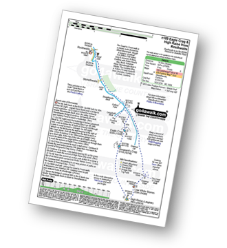
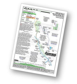
See High Raise (Langdale) and the surrounding tops on our downloadable Peak Bagging Maps in PDF format:

NB: Whether you print off a copy or download it to your phone, these PDF Peak Baggers' Maps might prove incredibly useful when your are up there on the tops and you cannot get a phone signal.
*This version is marked with the walk routes you need to follow to Walk all 214 Wainwrights in just 59 walks.
You can find High Raise (Langdale) & all the walks that climb it on these unique free-to-access Interactive Walk Planning Maps:
1:25,000 scale OS Explorer Maps (orange/yellow covers):
1:50,000 scale OS Landranger Maps (pink/magenta covers):
 Fellow go4awalkers who have already walked, climbed, summited & bagged High Raise (Langdale)
Iain Jones walked up High Raise (Langdale) on July 5th, 2014 [from/via/route] Great Langdale National Trust Campsite (Trail Run) - 01 January 2017 - walked from Rosthwaite; 29 July 2025 - walked from Great Langdale via Whitegill Crag
Neil Heywood climbed it on July 22nd, 2024 [from/via/route] Grasmere [with] logan Heywood, Mike Hills
James Hughes bagged it on March 9th, 2025 [from/via/route] c144 Sergeant Man from Grasmere [weather] Glorious warm, cloudless day with breeze on tops. - Missed turn to Tarn Crag on way up following Coast to Coast route. Ended up going to High Raise & High White Stones before heading for Sergeant Man. Returned down via Tarn Crag.
David Peebles hiked High Raise (Langdale) on June 2nd, 2024 [from/via/route] Langdale Campsite Carpark [with] Group [weather] Great Weather. Sun & not too cold or windy.
Tim Winn summited on March 24th, 2024 [with] Barry, Roger, Andy and Paul [weather] Sunny & clear.
To add (or remove) your name and experiences on this page - Log On and edit your Personal Mountain Bagging Record
. . . [see more walk reports]
More Photographs & Pictures of views from, on or of High Raise (Langdale)

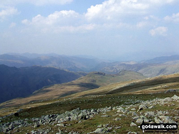
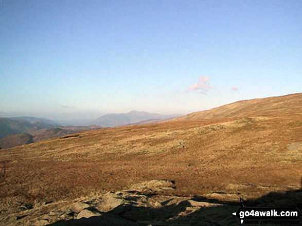
*Scafell Pike (far left back) and The Borrowdale Fells featuring Allen Crags, High House Tarn Top, Red Beck Top, Looking Stead, Glaramara, Comb Head, Comb Door Top, Dovenest Top and Rosthwaite Fell (Bessyboot) from High Raise (Langdale)


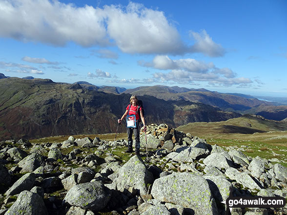


Harrison Stickle (left) and Pike of Stickle (centre right) with the Coniston Fells beyond from High Raise (Langdale)
. . . see all 19 walk photographs & pictures of views from, on or of High Raise (Langdale)
Send us your photographs and pictures on, of, or from High Raise (Langdale)
If you would like to add your walk photographs and pictures to this page, please send them as email attachments (configured for any computer) along with your name to:
and we shall do our best to publish them.
(Guide Resolution = 300dpi. At least = 660pixels (wide) x 440 pixels (high).)

You can also submit photos via our Facebook Page.
NB. Please indicate where each photo was taken and whether you wish us to credit your photos with a Username or your First Name/Last Name.