
![]()
Green Gable
801m (2629ft)
The Western Fells, The Lake District, Cumbria, England

Not familiar with this top?
You can walk/hike to the top of Green Gable by using any of these 8 easy‑to‑follow route maps:
Walk c442 Great Gable and Green Gable from Honister Hause
Easy to follow paths - a Lakeland classic
   |
|---|
Vital Statistics:
| Length: | 5.75ml (9km) |
|---|---|
| Ascent: | 2,340ft (731m) |
| Time: | 4½ hrs |
| Grade: |  (Moderate) (Moderate) |

Route Summary:
Honister Pass - Honister Hause - Grey Knotts - Brandreth - Green Gable - Windy Gap - Great Gable - Westmorland Cairn - Beck Head - Beckhead Tarn - Moses' Trod - Wainwright's Coast to Coast Walk - Honister Pass
Walk c118 Great Gable from Seathwaite (Borrowdale)
Clear paths & superb views on glorious gable
|
|---|
Vital Statistics:
| Length: | 6ml (9.5km) |
|---|---|
| Ascent: | 2,845ft (867m) |
| Time: | 5 hrs |
| Grade: |  (Moderate) (Moderate) |

Route Summary:
Seathwaite (Borrowdale) - Stockley Bridge - Styhead Tarn - Sty Head - Great Gable - Westmorland Cairn - Windy Gap - Green Gable - Mitchell Cove - Blackmoor Pols - Base Brown - Gillercomb - Sour Milk Gill (Borrowdale) - Seathwaite (Borrowdale)
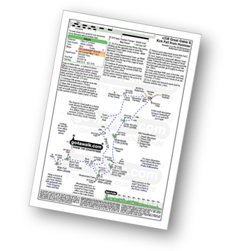
Walk c338 Great Gable and Kirk Fell from Honister Hause
Easy to follow paths - a Lakeland classic
|
|---|
Vital Statistics:
| Length: | 7.5ml (12km) |
|---|---|
| Ascent: | 3,289ft (1,002m) |
| Time: | 6 hrs |
| Grade: | (Moderate) |
Route Summary:
Honister Pass - Honister Hause - Grey Knotts - Brandreth - Green Gable - Windy Gap - Great Gable - Westmorland Cairn - Beck Head - Beckhead Tarn - Kirk Fell (East Top) - Kirk Fell - Moses' Trod - Wainwright's Coast to Coast Walk - Honister Pass
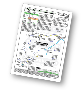
Walk c241 Great Gable and Honister Pass from Seatoller
Easy to follow paths - a Lakeland classic
|
|---|
Vital Statistics:
| Length: | 8.25ml (13km) |
|---|---|
| Ascent: | 3,016ft (919m) |
| Time: | 6 hrs |
| Grade: | (Moderate) |
Route Summary:
Seatoller - Seathwaite (Borrowdale) - Sourmilk Gill (Borrowdale) - Gillercomb - Blackmoor Pols - Mitchell Cove - Green Gable - Windy Gap - Great Gable - Westmorland Cairn - Beck Head - Beckhead Tarn - Moses' Trod - Honister Pass - Honister Hause - Wainwright's Coast to Coast Walk - Seatoller
Walk c151 Great Gable, Kirk Fell and Hay Stacks from Honister Hause
Good paths on rough ground
|
|---|
Vital Statistics:
| Length: | 8.5ml (13.5km) |
|---|---|
| Ascent: | 4,260ft (1,298m) |
| Time: | 7.25hrs |
| Grade: |  (Hard) (Hard) |

Route Summary:
Honister Pass - Honister Hause - Green Crag (Buttermere) - Black Beck - Blackbeck Tarn - Innominate Tarn - Hay Stacks (Haystacks) - Scarth Gap - Ennerdale - River Liza - Black Sail Hut (Youth Hostel) - Black Sail Path - Kirk Fell - Kirk Fell (East Top) - Beckhead Tarn - Beck Head - Great Gable - Westmorland Cairn - Windy Gap - Green Gable - Gillercomb Head - Brandreth - Grey Knotts - Honister Hause.
Walk c417 Base Brown, Great Gable and Kirk Fell from Honister Hause
Easy to follow paths with great views
|
|---|
Vital Statistics:
| Length: | 9ml (14.5km) |
|---|---|
| Ascent: | 3,965ft (1,208m) |
| Time: | 7½ hrs |
| Grade: | (Hard) |

Route Summary:
Honister Pass - Honister Hause - Grey Knotts - Brandreth - Blackmoor Pols - Base Brown - Mitchell Cove - Green Gable - Windy Gap - Great Gable - Westmorland Cairn - Beck Head - Beckhead Tarn - Kirk Fell (East Top) - Kirk Fell - Moses' Trod - Wainwright's Coast to Coast Walk - Honister Pass
Walk c174 Glaramara and Great Gable from Seatoller
Rough paths but generally easy to follow
|
|---|
Vital Statistics:
| Length: | 10.5ml (17km) |
|---|---|
| Ascent: | 4,693ft (1,430m) |
| Time: | 8½ hrs |
| Grade: |  (Hard) (Hard) |

Route Summary:
Seatoller - Strands Bridge - Borrowdale - The Combe - Thornythwaite Fell - Comb Head - Glaramara - Looking Steads (Glaramara) - Red Beck - Red Beck Top - Allen Gill - High House Tarn - High House Tarn Top - Allen Crags - Esk Hause - Ruddy Gill - Sprinkling Tarn - Sty Head - Great Gable - Westmorland Cairn - Windy Gap - Green Gable - Gillercomb Head - Brandreth - Grey Knotts - Honister Hause - Honister Pass - Wainwright's Coast to Coast Walk - Seatoller
Walk c120 The Ennerdale Horseshoe
Strenuous, high level route worth every step - if you have the energy!
|
|---|
Vital Statistics:
| Length: | 18.75ml (30km) |
|---|---|
| Ascent: | 7,309ft (2,408m) |
| Time: | 14.75hrs |
| Grade: |  (Very Hard) (Very Hard) |

Route Summary:
Bowness Knott Car Park Ennerdale - Low Gillerthwaite Field Centre - High Gillerthwaite Yourth Hostel - Red Pike (Buttermere) - High Stile - High Crag (Buttermere) - Seat (Buttermere) - Scarth Gap - Hay Stacks (Haystacks) - Innominate Tarn - Blackbeck Tarn - Black Beck - Green Crag (Buttermere) - Great Round How - Brandreth - Gillercomb Head - Green Gable - Windy Gap - Great Gable - Westmorland Cairn - Beck Head - Beckhead Tarn - Kirk Fell (East Top) - Kirk Fell - Black Sail Pass - Looking Stead (Pillar) - High Level Route - Robinson's Cairn - Pillar - Wind Gap - Black Crag (Pillar) - High Beck - Low Beck - Ennerdale.
See Green Gable and the surrounding tops on our free-to-access 'Google Style' Peak Bagging Maps:
The Western Fells of The Lake District National Park
Less data - quicker to download
The Whole of The Lake District National Park
More data - might take a little longer to download
See Green Gable and the surrounding tops on our unique, downloadable, PDF Peak Bagging Maps:

NB: Whether you print off a copy or download it to your phone, these PDF Peak Baggers' Maps might prove incredibly useful when your are up there on the tops and you cannot get a phone signal.
*This version is marked with the walk routes you need to follow to Walk all 214 Wainwrights in just 59 walks.
You can find Green Gable & all the walks that climb it on these unique free-to-access Interactive Walk Planning Maps:
1:25,000 scale OS Explorer Map (orange/yellow covers):
1:50,000 scale OS Landranger Maps (pink/magenta covers):
 Fellow go4awalkers who have already walked, climbed, scaled, summited, hiked & bagged Green Gable
James Hughes walked up Green Gable on August 10th, 2025 [from/via/route] c417 Base Brown, Great Gable & Kirk Fell from Honister [weather] Warmish, sometimes overcast, sometimes sunny. - Stomp up to Grey Knotts from Honister - didn't feel too bad as started at decent height. Easy yomp over to Brandreth before hitting the path to descend to Base Brown. Good views then steepish ascent back to Green Gable. Good vista of Great Gable & Moses Trod below. Hard trek up Great Gable on rocky terrain. Topped & then overshot after the memorial to return to path down to Kirk Fell. Took one of the false boulder paths cited by Wainwright which ended in scree Sunday. The error of my ways became more apparent looking back as the scree looks quite severe. Had actually ascended Great Gable before from Kirk Fell col which was easier, although easy to understand how it would be hard in the mist. Another there & back on Kirk Fell - big flat top. Return via Moses Trod back to tramway track. Pint of Wainwright Amber Ale at Borrowdale Hotel. Average.
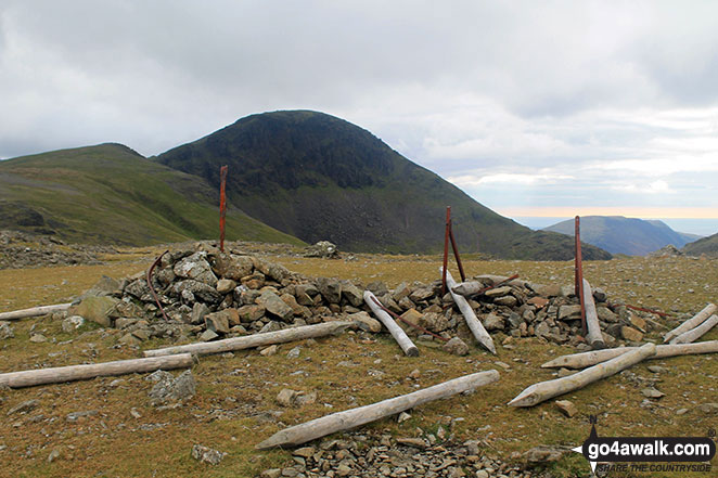
Andrew Gayne climbed it on May 15th, 2025 [from/via/route] From Honister Pass, Tin Slate Mine [with] Becky Gayne [weather] Really sunny & hot day. - Overnight stay at Ravenstone Manor near Bassenthwaite having walked Howtown to Glenridding the previous day, went up Grey Knotts then Brandreth before going up Green Gable & finally Grey Gable. Steepish scramble up & down Grey Gable. Visited Westmorland Cairn for amazing views
Tim Winn bagged it on October 27th, 2024 [from/via/route] Honister Slate Mine [with] Barry, Paul and Roger [weather] Dry.
Angeline Grieveson hiked Green Gable on October 5th, 2024 [with] Rick & Dotty
Geoff Hand summited on September 3rd, 2024 [from/via/route] Walk C417 Great Gable & Kirk Fell from Honister. Set off from Honister & climbed Grey Knotts, from there onto Glamara. We then climbed towards Green Gable but went South to pick up Brown Base. We retraced our steps, climbed green gable & onto Gt Gable. Leaving Gt Gable in cloud we found the path down to Beck Head. When reached there the cloud had lifted off Kirk fell so we went for it. Came back by Moses's trod & the dismantled tramway to Honister. [with] Tess, my Jack Russell [weather] Started off quite sunny, however cloud moved in & covered Gt Gable. A bit drisly towards the end. - A really tough walk, one I would think twice about in the future. Very pleased with my navigation of Gt Gable as it was spot on! According to my garmin I didn't quite hit the top of Grey Knots & Brandreth. I find this incredible as I did a lot of tramping around to make sure I hit the tops today. So I'm claiming them anyway. NB I've also done them both before.
To add (or remove) your name and experiences on this page - Log On and edit your Personal Mountain Bagging Record
. . . [see more walk reports]
More Photographs & Pictures of views from, on, or of, Green Gable

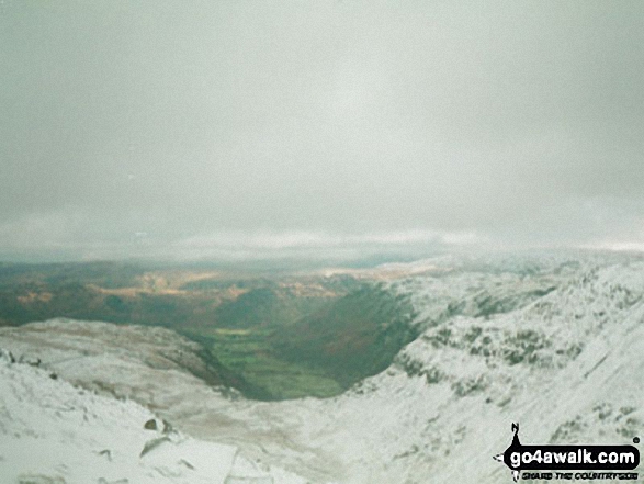
Kirk Fell, Looking Stead & Pillar, Ennerdale, High Stile, High Crag & Hay Stacks, Crummock Water & Buttermere and Grasmoor from Green Gable

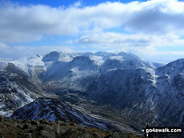
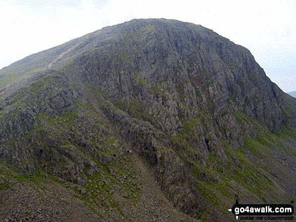
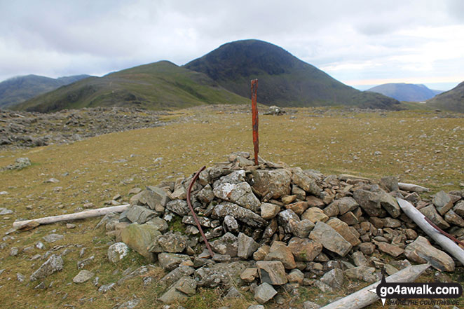
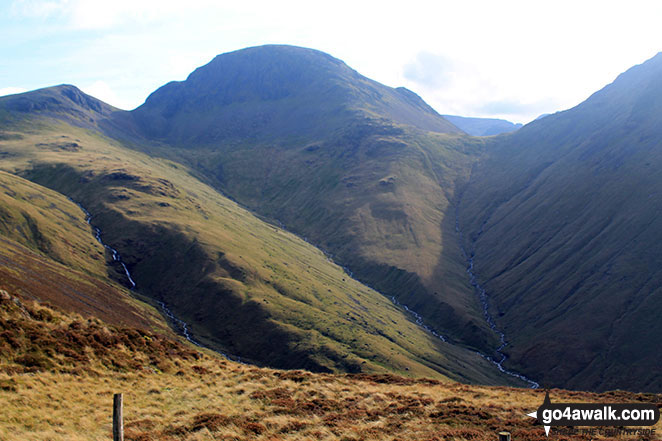
Brandreth summit cairn with Gillercomb Head leading up to Green Gable with Great Gable looking majestic in the background

Green Gable (left) Great Gable (centre left), Scafell Pike (centre distance) and Kirk Fell (centre right) from Hay Stacks (Haystacks)

Great view of Brandreth, Green Gable, Great Gable (the rounded dome), Kirk Fell, Pillar (the highest point), Black Crag and Steeple from Lingcomb Edge just below the summit of Red Pike (Buttermere)
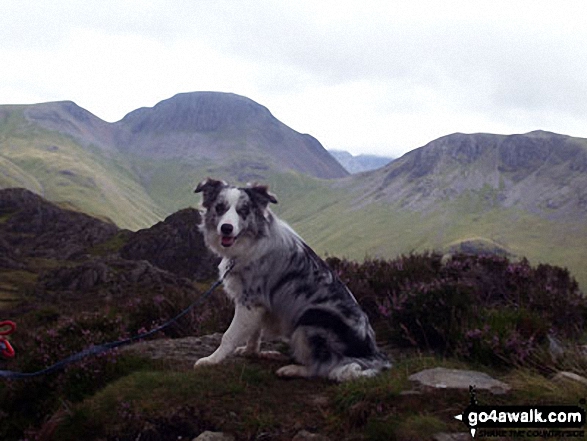
Our new addition Neela ( 1st time in the Lakes) on Hay Stacks (Haystacks) with Green Gable (left), Windy Gap, Great Gable and Kirk Fell (right) very clear in the background


*Pillar (left), High Stile (centre), Ennerdale, Hay Stacks, Crummock Water, Buttermere and Grasmoor (right) from Green Gable


360 degree panorama featuring Great Gable, Green Gable, Little Scoat Fell & Pillar (distance), Brandreth, Dale Head (Newlands), High Spy, Glaramara, Esk Pike, Great End and Scafell Pike from Base Brown
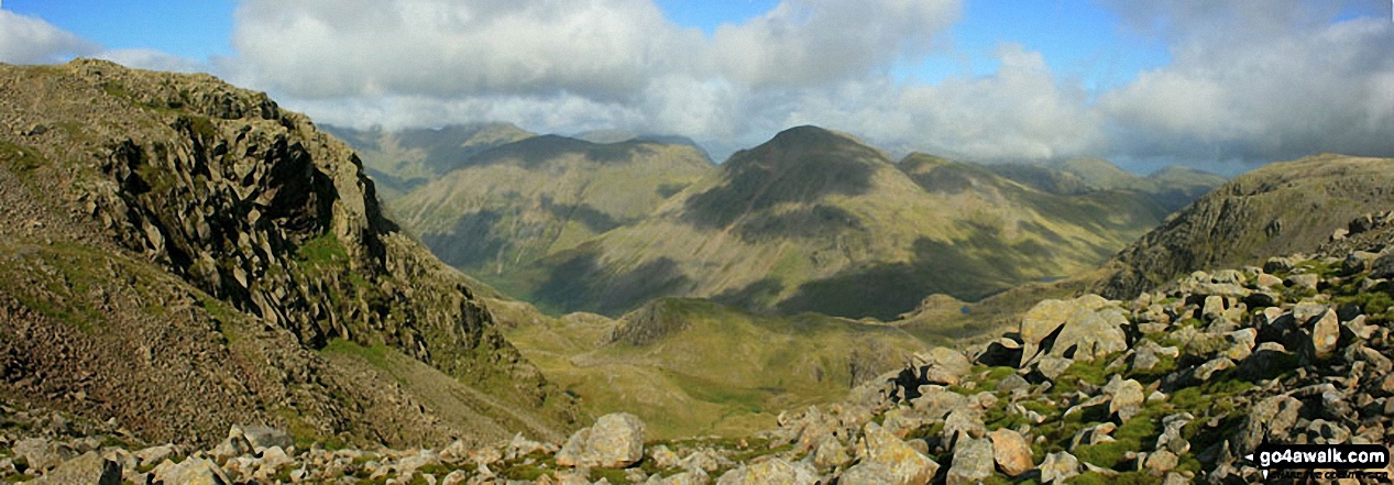
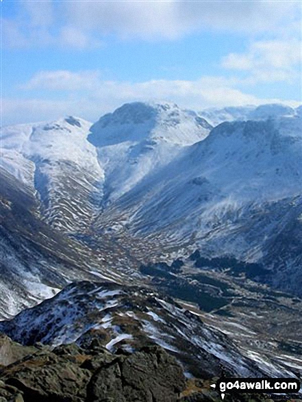
A grand view overlooking the valley of upper Wasdale from Esk Hause with Pillar, Kirk Fell, Great Gable and Green Gable taking centre stage

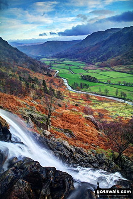
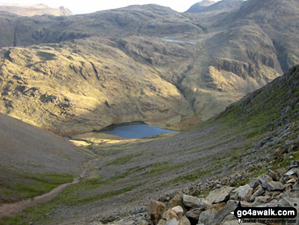
The Seathwaite Valley from half-way up Sourmilk Gill en-route to Gillercombe, Green Gable and Great Gable
Green Gable, Great Gable (left of centre), Kirk Fell (centre) and Pillar (right) with the Scafell Massif beyond (centre) from High Crag


High Stile, High Crag & Hay Stacks, Crummock Water & Buttermere and Grasmoor from the top of Green Gable
Green Gable left), Great Gable (centre) and Kirk Fell (right) with the Scafell Massif beyond (centre) from High Crag (Buttermere)

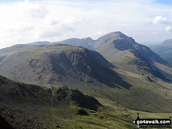
Green Gable (left) and Great Gable (centre left) and the shoulder of Kirk Fell from Loft Beck

Styhead Tarn, Great Gable and Green Gable from the path below Sprinkling Tarn


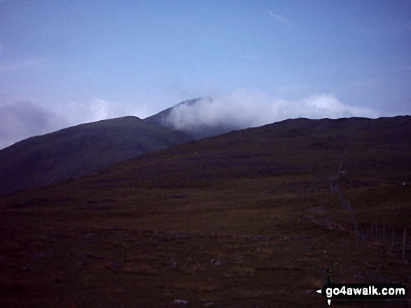
Harrison Stickle and Pike of Stickle (Pike o' Stickle) framed by cloud whilst ascending Green Gable

Innominate Tarn with Grey Knotts, Brandreth, Green Gable, Great Gable and Kirk Fell forming the backdrop
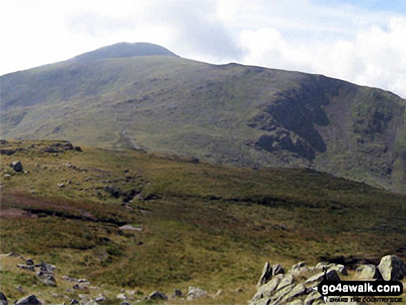
Green Gable (left) and Great Gable (centre left) from the summit of Brandreth
. . . see just 10 walk photographs & pictures of views from, on, or of, Green Gable
Send us your photographs and pictures on, of, or from Green Gable
If you would like to add your walk photographs and pictures to this page, please send them as email attachments (configured for any computer) along with your name to:
and we shall do our best to publish them.
(Guide Resolution = 300dpi. At least = 660pixels (wide) x 440 pixels (high).)

You can also submit photos via our Facebook Page.
NB. Please indicate where each photo was taken and whether you wish us to credit your photos with a Username or your First Name/Last Name.
