Dewey, Marilyn & OS Trig Point Icon

Black Hill (Soldier's Lump)
582m (1910ft)

The Dark Peak Area, The Peak District, West Yorkshire, England

Black Hill (Soldier's Lump) is the highest point in the county of West Yorkshire.


Tap/mouse over a coloured circle (1-3 easy walks, 4-6 moderate walks, 7-9 hard walks) and click to select.


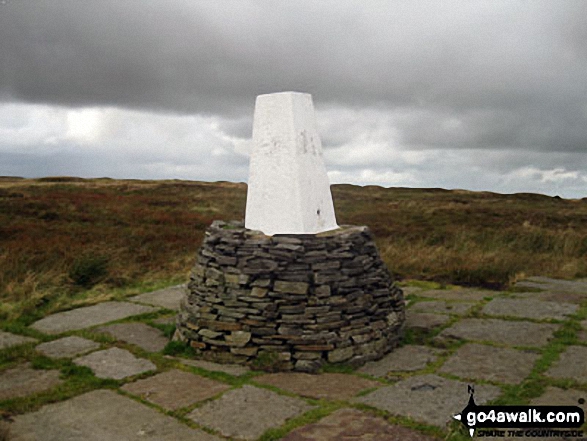
The summit of Black Hill (Soldier's Lump) is marked by an Ordnance Survey Trig Point.


Record Black Hill (Soldier's Lump) as Bagged, Climbed & Conquered


English Dewey Icon

English Dewey
28th in England,
66th in England & Wales

English Marilyn Icon

English Marilyn
55th highest in England,
795th highest in Great Britain

English Trig Point Icon


English Trig Point (Pillar)

Walk Black Hill (Soldier's Lump) walking UK Mountains in The Dark Peak Area The Peak District National Park West YorkshireDerbyshire, England

Black Hill (Soldier's Lump) Summit

Photo: Geoff Smithson

You can find Black Hill (Soldier's Lump) & all the walks that climb it on these unique free-to-access Interactive Walk Planning Maps: (click/TAP to select)

The Peak District National Park


1:25,000 scale OS Explorer Map (the ones with orange/yellow covers):

OL1 The Peak District - Dark Peak area


1:50,000 scale OS Landranger Map (the ones with pink/magenta covers):

110 Sheffield & Huddersfield, Glossop & Holmfirth


See Black Hill (Soldier's Lump) and the surrounding tops on our free-to-access 'Google Style' Peak Bagging Maps:

See Black Hill (Soldier's Lump) and the surrounding tops on our downloadable PDF Peak Bagging Map:


You can walk to the top of Black Hill (Soldier's Lump) by using either of these 2 easy‑to‑follow route maps:
Walking Boot Print Icon

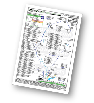
Walk d205 Black Chew Head (Laddow Rocks) and Black Hill (Soldier's Lump) from Crowden

Easy to follow paths across wild moorland

Walk GPS Icon
Walk GPX Icon
Walk PDF Icon

Vital Statistics:

Length: 9ml (14.5km)
Ascent:1,746ft (532m)
Time:5 hrs
Grade:Walk Grade 5 Icon (Moderate)
Walking Boot Print Icon

Walk wy176 Black Hill (Soldier's Lump) and Black Moss Reservior from Wessenden Head

The new & the old Pennine Way

Walk GPS Icon
Walk GPX Icon
Walk PDF Icon

Vital Statistics:

Length: 9.75ml (15.5km)
Ascent:1,902ft (580m)
Time:5½ hrs
Grade:Walk Grade 6 Icon (Moderate)

Other walkers who hiked, climbed, bagged and summited Black Hill (Soldier's Lump) Fellow go4awalkers who have already walked, climbed, summited & bagged Black Hill (Soldier's Lump)

Nina Adams walked up Black Hill (Soldier's Lump) on August 30th, 2021 [from/via/route] Holme - Kirklees way to Digby Reservoir - Greaves Head - Reap hill Clough - Black Dyke Head - Soldiers Lump - Black Hill - Holme Moss - Britland Edge Hill - Lad Clough - Brownhill Reservoir - Holme [with] Craig [weather] Cloudy, low cloud 12°C

Alison Tomlin climbed Black Hill (Soldier's Lump) on January 2nd, 2023 - Icy!

Patrick Molloy bagged Black Hill (Soldier's Lump) on May 5th, 2022 [from/via/route] Parked at Torside. Out & back [with] Nadia [weather] Cloudy, warm

Tony Halliday hiked Black Hill (Soldier's Lump) on April 3rd, 2021 [from/via/route] Croyden car park via black chew to black hill back over peat bogs [with] Sally Halliday Jimmy George and boo [weather] Started off very cool & windy up top but as we descended the sun came out & the layers came off - Steep start then levelled off first half of walk east to follow path over penine way second half took some navigating over peat bogs which would be fun in the winter !

Mark Pritchard summited Black Hill (Soldier's Lump) on September 25th, 2020 [from/via/route] Walk from Brownhill Resevoir, through Holme, over Digley Dam, up to Black Hill Trig Point, past Transmitter, over Twizle Head Moss to crossley Plantation & back to res [with] Tim Bailey [weather] Good sunny day but very windy on the high ground

Mike Walker conquered Black Hill (Soldier's Lump) on March 6th, 2003 [from/via/route] Walk d205 Black Chew Head (Laddow Rocks) & Black Hill (Soldier's Lump) from Crowden [with] T, AS [weather] OK

Christine Shepherd scaled Black Hill (Soldier's Lump) on January 5th, 2019 [from/via/route] Walked up via the Kirklees Way & down by the Pennine Way from Wessenden Head. [with] On my own [weather] Cold & quite dull but dry - I was going to walk wy176 but as the forecast was doubtful I climbed Black Fell first had my lunch in the car & then had a lovely walk down to the Reservoirs & back by the same route.

Margaret Richards walked up Black Hill (Soldier's Lump) on July 25th, 2011 [from/via/route] wy176 Black Hill & Black Moss Reservoir from Wessenden Head [with] Don [weather] Misty at times - boggy on old Pennine way part particularly

Louis Smith climbed Black Hill (Soldier's Lump) during July, 2016 [from/via/route] guessed date

Geoffrey Robertshaw bagged Black Hill (Soldier's Lump) on August 22nd, 2017 [from/via/route] A635 [weather] Nice - Great Views

To add (or remove) your name and experiences on this page - Log On and edit your Personal Mountain Bagging Record

. . . [see more walk reports]


More Photographs & Pictures of views from, on or of Black Hill (Soldier's Lump)

Black Hill (Soldier's Lump) from near Black Chew Head (Laddow Rocks)

Black Hill (Soldier's Lump) from near Black Chew Head (Laddow Rocks)

Photo: Geoff Smithson (7)

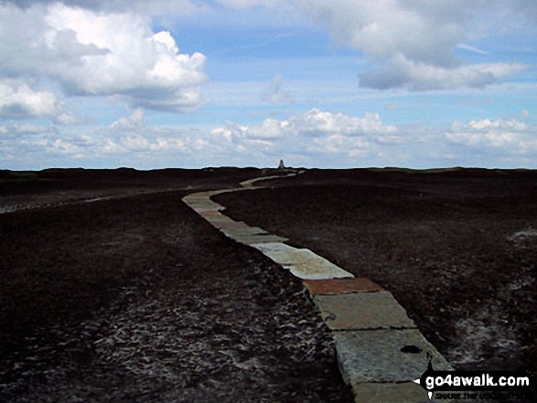
Approaching Black Hill (Soldier's Lump) summit

Approaching Black Hill (Soldier's Lump) summit

Photo: Geoff Smithson (13)

Black Hill (Soldier's Lump) Summit

Black Hill (Soldier's Lump) Summit

Photo: Pete Shapter (3)

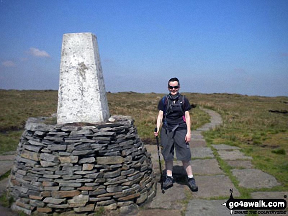
Black Hill (Soldier's Lump) summit trig point

Black Hill (Soldier's Lump) summit trig point

Photo: Simon Jacks (39)

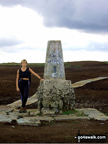
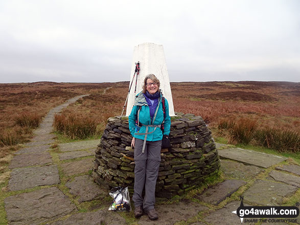
On the summit of Black Hill (Soldier's Lump)

On the summit of Black Hill (Soldier's Lump)

Photo: Christine Shepherd (715)

The Pennine Way on Black Hill (Soldier's Lump) about 150m from the summit

The Pennine Way on Black Hill (Soldier's Lump) about 150m from the summit

Photo: Simon Jacks (38)

On the summit of Black Hill (Soldier's Lump)

On the summit of Black Hill (Soldier's Lump)

Photo: Peter Cornforth (1)

Black Hill (Soldier's Lump) summit

Black Hill (Soldier's Lump) summit

Photo: Peter Ellis (7)

Me on the top of Black Hill (Soldier's Lump)

Me on the top of Black Hill (Soldier's Lump)

Photo: Debs Lyon (2)

Sunshine on The Pennine Way on Black Chew Head (Laddow Rocks) looking towards Black Hill (Soldier's Lump)

Sunshine on The Pennine Way on Black Chew Head (Laddow Rocks) looking towards Black Hill (Soldier's Lump)

Photo: Simon Jacks (30)

Laddow Rocks with Bleaklow Hill beyond from Black Hill (Soldier's Lump)

Laddow Rocks with Bleaklow Hill beyond from Black Hill (Soldier's Lump)

Photo: Mike Hart (4)

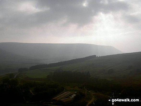
The view from the summit of Black Hill (Soldier's Lump)

The view from the summit of Black Hill (Soldier's Lump)

Photo: Christine Shepherd (716)

Black Hill (Soldier's Lump) from Black Chew Head (Laddow Rocks)

Black Hill (Soldier's Lump) from Black Chew Head (Laddow Rocks)

Photo: Pete Shapter (2)

On Black Hill (Soldier's Lump)

On Black Hill (Soldier's Lump)

Photo: Mike Hart (1)

On Black Hill (Soldier's Lump) sumit

On Black Hill (Soldier's Lump) sumit

Photo: Geoff Smithson (15)

The Pennine Way on Black Chew Head (Laddow Rocks) with Black Hill (Soldier's Lump) in the distance

The Pennine Way on Black Chew Head (Laddow Rocks) with Black Hill (Soldier's Lump) in the distance

Photo: Simon Jacks (28)

Black Hill (Soldier's Lump) from Royd Edge

Black Hill (Soldier's Lump) from Royd Edge

Photo: Gordon Leather (2)


Send us your photographs and pictures on, of, or from Black Hill (Soldier's Lump)

If you would like to add your walk photographs and pictures featuring views from, on or of Black Hill (Soldier's Lump) to this page, please send them as email attachments (configured for any computer) along with your name to:


and we shall do our best to publish them.

(Guide Resolution = 300dpi. At least = 660pixels (wide) x 440 pixels (high).)

Send us your photographs and pictures on, of, or from Black Hill (Soldier's Lump) via Facebook

You can also submit photos via our Facebook Page.

NB. Please indicate where each photo was taken.


Follow go4awalk.com on Twitter Follow go4awalk.com on Facebook


Home


Find new Friends to go walking with

Walk all 214 Wainwrights in just 59 Walks. Download GPS Waypoints - Great Walks you must not miss!

Walk The Yorkshire Three Peaks Challenge Walk - All the Latest Route Information, GPS Waypoints and Split Times to keep you on Schedule

Walk The British Three Peaks Challenge Walk - All the Latest Route Information and GPS Waypoints

See our pick of The Best Walks in The Lake District - Great Walks you must not miss!

Walk our pick of the Best Lake District Ridge Walks - Great Walks you must not miss!

Walk our pick of the Best Lake District Walks to do in the rain - Great Walks you must not miss!

Walk our pick of The Best Walks in Snowdonia - Great Walks you must not miss!

Walk our pick of The Best Ridge Walks in Wales - Walks you must not miss!

Walk our pick of The Best Walks in The Brecon Beacons - Great Walks you must not miss!

Walk our pick of The Best Walks in The Yorkshire Dales - Walks you must not miss!

Walk our pick of The Best Walks in The Peak District - Walks you must not miss!

Walk our pick of The Best Walks in The Forest of Bowland - Walks you must not miss!

Walk our pick of The Best Walks in Shropshire - Walks you must not miss!

Walk our pick of The Best Walks in Cheshire - Walks you must not miss!

Walk our pick of The Best Walks in Lancashire - Walks you must not miss!

Not sure where to walk next? Try Peak Bagging - Great Walks you must not miss!

Not sure where to walk next? Walk part of a National Trail - Great Walks you must not miss!

Walks with Downloadable and Uploadable GPS Waypoint Data

Walking Kit and Gear Tested by Walkers

Full Site Search